- Ives Estates, Florida
Infobox Settlement
official_name = Ives Estates, Florida
other_name =
native_name =
nickname =
settlement_type = CDP
motto =
imagesize =
image_caption =
flag_size =
image_
seal_size =
image_shield =
shield_size =
image_blank_emblem =
blank_emblem_type =
blank_emblem_size =
imagesize =
image_caption =
flag_size =
image_
seal_size =
image_shield =
shield_size =
image_blank_emblem =
blank_emblem_type =
blank_emblem_size =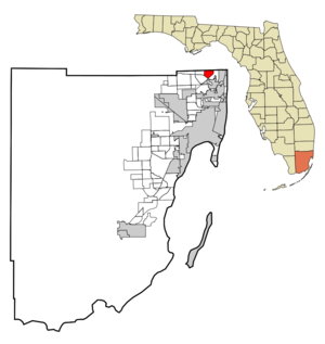
mapsize = 250x200px
map_caption = Location in Miami-Dade County and the state ofFlorida 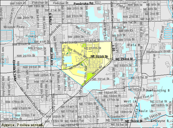
mapsize1 = 250x200px
map_caption1 = U.S. Census Bureau map showing CDP boundaries
image_dot_
dot_mapsize =
dot_map_caption =
dot_x =
dot_y =
pushpin_
pushpin_label_position =
pushpin_map_caption =
pushpin_mapsize =
subdivision_type = Country
subdivision_name = flag|United States
subdivision_type1 = State
subdivision_name1 = flag|Florida
subdivision_type2 = County
subdivision_name2 = noflag|Miami-Dade
subdivision_type3 =
subdivision_name3 =
subdivision_type4 =
subdivision_name4 =
government_footnotes =
government_type =
leader_title =
leader_name =
leader_title1 =
leader_name1 =
leader_title2 =
leader_name2 =
leader_title3 =
leader_name3 =
leader_title4 =
leader_name4 =
established_title =
established_date =
established_title2 =
established_date2 =
established_title3 =
established_date3 =
area_magnitude =
unit_pref = Imperial
area_footnotes =
area_total_km2 = 7.3
area_land_km2 = 6.9
area_water_km2 = 0.4
area_total_sq_mi = 2.8
area_land_sq_mi = 2.6
area_water_sq_mi = 0.2
area_water_percent =
area_urban_km2 =
area_urban_sq_mi =
area_metro_km2 =
area_metro_sq_mi =
area_blank1_title =
area_blank1_km2 =
area_blank1_sq_mi =
population_as_of = 2000
population_footnotes =
population_note =
population_total = 17586
population_density_km2 = 2409
population_density_sq_mi = 6280.7
population_metro =
population_density_metro_km2 =
population_density_metro_sq_mi =
population_urban =
population_density_urban_km2 =
population_density_urban_sq_mi =
population_blank1_title =
population_blank1 =
population_density_blank1_km2 =
population_density_blank1_sq_mi =
timezone = Eastern (EST)
utc_offset = -5
timezone_DST = EDT
utc_offset_DST = -4
latd = 25 |latm = 57 |lats = 47 |latNS = N
longd = 80 |longm = 10 |longs = 55 |longEW = W
elevation_footnotes =
elevation_m = 3
elevation_ft = 10
postal_code_type =
postal_code =
area_code =
blank_name = FIPS code
blank_info = 12-34400GR|2
blank1_name = GNIS feature ID
blank1_info = 0284640GR|3
website =
footnotes =Ives Estates is a
census-designated place (CDP) in Miami-Dade County,Florida ,United States . The population was 17,586 at the 2000 census.Geography
Ives Estates is located at coor dms|25|57|47|N|80|10|55|W|city (25.963070, -80.181968)GR|1.
According to the
United States Census Bureau , the CDP has a total area of 2.8square mile s (7.3km² ), of which, 2.7 square miles (6.9 km²) of it is land and 0.2 square miles (0.4 km²) of it (5.36%) is water.Demographics
As of the
census GR|2 of 2000, there were 17,586 people, 6,923 households, and 4,506 families residing in the CDP. Thepopulation density was 6,645.9 people per square mile (2,562.3/km²). There were 7,449 housing units at an average density of 2,815.0/sq mi (1,085.3/km²). The racial makeup of the CDP was 51.10% White (33.3% were Non-Hispanic White,) [cite web |url=http://www.muninetguide.com/states/florida/municipality/Ives_Estates.php |title=Demographics of Ives Estates, FL |publisher=MuniNetGuide.com |accessdate=2007-11-06] 35.11% African American, 0.17% Native American, 4.63% Asian, 0.05% Pacific Islander, 3.76% from other races, and 5.17% from two or more races. Hispanic or Latino of any race were 24.08% of the population.There were 6,923 households out of which 32.7% had children under the age of 18 living with them, 40.8% were married couples living together, 19.2% had a female householder with no husband present, and 34.9% were non-families. 28.3% of all households were made up of individuals and 9.1% had someone living alone who was 65 years of age or older. The average household size was 2.54 and the average family size was 3.13.
In the CDP the population was spread out with 24.8% under the age of 18, 8.6% from 18 to 24, 33.6% from 25 to 44, 20.6% from 45 to 64, and 12.4% who were 65 years of age or older. The median age was 35 years. For every 100 females there were 83.8 males. For every 100 females age 18 and over, there were 79.3 males.
The median income for a household in the CDP was $40,717, and the median income for a family was $43,370. Males had a median income of $29,512 versus $27,544 for females. The
per capita income for the CDP was $19,118. About 7.0% of families and 8.6% of the population were below thepoverty line , including 8.4% of those under age 18 and 8.8% of those age 65 or over.As of 2000, speakers of English as a
first language accounted for 54.25% of residents, while Spanish made up 24.45%, French Creole was at 11.65%, French was at 2.35%, Urdu at 1.23%, Portuguese 1.11%, and Arabic was 1.08% of the population. Hebrew made up 0.73% of speakers, Russian made up 0.69%, and both Chinese and Tagalog was themother tongue of 0.57% of the population. [cite web |url=http://www.mla.org/map_data_results&state_id=12&county_id=&mode=place&zip=&place_id=34400&cty_id=&ll=&a=&ea=&order=r |title=MLA Data Center Results of Ives Estates, FL |publisher=Modern Language Association |accessdate=2007-11-06]As of 2000, Ives Estates had the seventh highest percentage of Haitian residents in the US, with 13.90% of the populace. [cite web |url=http://www.epodunk.com/ancestry/Haitian.html |title=Ancestry Map of Haitian Communities |publisher=Epodunk.com |accessdate=2007-11-06] It had the twentieth highest percentage of Jamaican residents in the US, at 5.70% of the population (tied with Golden Glades, East Orange, NJ and Gordon Heights, NY.) [cite web |url=http://www.epodunk.com/ancestry/Jamaican.html |title=Ancestry Map of Jamaican Communities |publisher=Epodunk.com |accessdate=2007-11-06] It also had the eighty-second highest percentage of Cuban residents in the US, at 3.51%, [cite web |url=http://www.epodunk.com/ancestry/Cuban.html |title=Ancestry Map of Cuban Communities |publisher=Epodunk.com |accessdate=2007-11-06] while it had the forty-ninth highest percentage of Colombians in the US, at 2.76% of all residents. [cite web |url=http://www.epodunk.com/ancestry/Colombian.html |title=Ancestry Map of Colombian Communities |publisher=Epodunk.com |accessdate=2007-11-06] It's also home to the 105th highest percentage of Dominican residents in the US, at 1.53% of the population (tied with Tamiami,
Adelphi, Maryland and Dover, NJ,) [cite web |url=http://www.epodunk.com/ancestry/Dominican-Republic.html |title=Ancestry Map of Dominican Communities |publisher=Epodunk.com |accessdate=2007-11-06] as well as being home to the forty-second highest percentage of Peruvians in the US, at 1.31% of all residents. [cite web |url=http://www.epodunk.com/ancestry/Peruvian.html |title=Ancestry Map of Peruvian Communities |publisher=Epodunk.com |accessdate=2007-11-06]chools
*
Dr. Michael M. Krop High School
*Madie Ives Elementary School References
External links
Wikimedia Foundation. 2010.