- Tamiami, Florida
Infobox Settlement
official_name = Tamiami, Florida
other_name =
native_name =
nickname =
settlement_type = CDP
motto =
imagesize =
image_caption =
flag_size =
image_
seal_size =
image_shield =
shield_size =
image_blank_emblem =
blank_emblem_type =
blank_emblem_size =
imagesize =
image_caption =
flag_size =
image_
seal_size =
image_shield =
shield_size =
image_blank_emblem =
blank_emblem_type =
blank_emblem_size =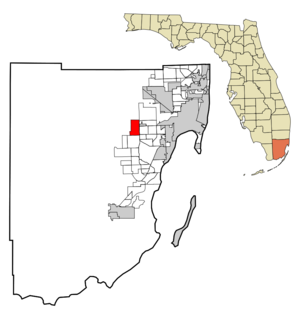
mapsize = 250x200px
map_caption = Location in Miami-Dade County and the state ofFlorida 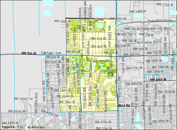
mapsize1 = 250x200px
map_caption1 = U.S. Census Bureau map showing CDP boundaries
image_dot_
dot_mapsize =
dot_map_caption =
dot_x =
dot_y =
pushpin_
pushpin_label_position =
pushpin_map_caption =
pushpin_mapsize =
subdivision_type = Country
subdivision_name = flag|United States
subdivision_type1 = State
subdivision_name1 = flag|Florida
subdivision_type2 = County
subdivision_name2 = noflag|Miami-Dade
subdivision_type3 =
subdivision_name3 =
subdivision_type4 =
subdivision_name4 =
government_footnotes =
government_type =
leader_title =
leader_name =
leader_title1 =
leader_name1 =
leader_title2 =
leader_name2 =
leader_title3 =
leader_name3 =
leader_title4 =
leader_name4 =
established_title =
established_date =
established_title2 =
established_date2 =
established_title3 =
established_date3 =
area_magnitude =
unit_pref = Imperial
area_footnotes =
area_total_km2 = 19.6
area_land_km2 = 19
area_water_km2 = 0.6
area_total_sq_mi = 7.5
area_land_sq_mi = 7.3
area_water_sq_mi = 0.2
area_water_percent =
area_urban_km2 =
area_urban_sq_mi =
area_metro_km2 =
area_metro_sq_mi =
area_blank1_title =
area_blank1_km2 =
area_blank1_sq_mi =
population_as_of = 2000
population_footnotes =
population_note =
population_total = 54788
population_density_km2 = 2795.3
population_density_sq_mi = 7305.1
population_metro =
population_density_metro_km2 =
population_density_metro_sq_mi =
population_urban =
population_density_urban_km2 =
population_density_urban_sq_mi =
population_blank1_title =
population_blank1 =
population_density_blank1_km2 =
population_density_blank1_sq_mi =
timezone = Eastern (EST)
utc_offset = -5
timezone_DST = EDT
utc_offset_DST = -4
latd = 25 |latm = 45 |lats = 18 |latNS = N
longd = 80 |longm = 24 |longs = 13 |longEW = W
elevation_footnotes =
elevation_m = 1
elevation_ft = 3
postal_code_type =
postal_code =
area_code =
blank_name = FIPS code
blank_info = 12-70700GR|2
blank1_name = GNIS feature ID
blank1_info = 1867216GR|3
website =
footnotes =Tamiami is a
census-designated place (CDP) in Miami-Dade County,Florida ,United States . The population was 54,788 at the 2000 census. Tamiami is a combination of the words "Tampa" and "Miami". TheTamiami Trail , a roadway that connects the two cities, was the reason for this unique combination. Even though it is aportmanteau of both city names, it is pronounced "Tammee-Ammy," not "Tam-My-Ammy."Geography
Tamiami is located at coor dms|25|45|18|N|80|24|13|W|city (25.754945, -80.403611)GR|1.
According to the
United States Census Bureau , the CDP has a total area of 7.6square mile s (19.6km² ), of which, 7.3 square miles (19.0 km²) of it is land and 0.2 square miles (0.6 km²) of it (3.04%) is water.Demographics
As of the
census GR|2 of 2000, there were 54,788 people, 16,285 households, and 14,233 families residing in the CDP. Thepopulation density was 7,461.3 people per square mile (2,882.0/km²). There were 16,707 housing units at an average density of 2,275.3/sq mi (878.8/km²). The racial makeup of the CDP was 90.57% White (11.8% were Non-Hispanic White,) [cite web |url=http://www.muninetguide.com/states/florida/municipality/Tamiami.php |title=Demographics of Tamiami, FL |publisher=MuniNetGuide.com |accessdate=2007-11-10] 0.89% African American, 0.10% Native American, 0.59% Asian, 0.02% Pacific Islander, 4.85% from other races, and 2.99% from two or more races. Hispanic or Latino of any race were 86.98% of the population.There were 16,285 households out of which 42.1% had children under the age of 18 living with them, 66.0% were married couples living together, 16.2% had a female householder with no husband present, and 12.6% were non-families. 9.4% of all households were made up of individuals and 3.5% had someone living alone who was 65 years of age or older. The average household size was 3.33 and the average family size was 3.50.
In the CDP the population was spread out with 24.4% under the age of 18, 8.7% from 18 to 24, 30.0% from 25 to 44, 24.1% from 45 to 64, and 12.9% who were 65 years of age or older. The median age was 37 years. For every 100 females there were 90.4 males. For every 100 females age 18 and over, there were 85.4 males.
The median income for a household in the CDP was $47,503, and the median income for a family was $49,763. Males had a median income of $30,716 versus $26,426 for females. The
per capita income for the CDP was $17,601. About 7.6% of families and 9.4% of the population were below thepoverty line , including 12.0% of those under age 18 and 9.7% of those age 65 or over.As of 2000, speakers of Spanish as a
first language accounted for 92.39% of residents, while English was themother tongue of 6.99% of the population. [cite web |url=http://www.mla.org/map_data_results&state_id=12&county_id=&mode=place&zip=&place_id=70700&cty_id=&ll=&a=&ea=&order=r |title=MLA Data Center Results of Tamiami, FL |publisher=Modern Language Association |accessdate=2007-11-10]As of 2000, Tamiami had the seventh highest percentage of
Cuba n residents in the US, with 56.63% of the populace. [cite web |url=http://www.epodunk.com/ancestry/Cuban.html |title=Ancestry Map of Cuban Communities |publisher=Epodunk.com |accessdate=2007-11-10]Nicaragua ns made up the fifth highest percentage, at 4.66% of Tamiami residents. [cite web |url=http://www.epodunk.com/ancestry/Nicaraguan.html |title=Ancestry Map of Nicaraguan Communities |publisher=Epodunk.com |accessdate=2007-12-05] It had the thirty-second highest percentage ofColombia n residents in the US, at 3.94% of the population, [cite web |url=http://www.epodunk.com/ancestry/Colombian.html |title=Ancestry Map of Colombian Communities |publisher=Epodunk.com |accessdate=2007-11-10] and the 105th highest percentage of Dominican residents in the US, at 1.53% of its population (tied with Ives Estates, FL,Adelphi, Maryland and Dover, NJ.) [cite web |url=http://www.epodunk.com/ancestry/Dominican-Republic.html |title=Ancestry Map of Dominican Communities |publisher=Epodunk.com |accessdate=2007-11-10] It also had the eighteenth mostVenezuela ns in the US, at 1.06% of the population (tied with Miami Lakes.) [cite web |url=http://www.epodunk.com/ancestry/Venezuelan.html |title=Ancestry Map of Venezuelan Communities |publisher=Epodunk.com |accessdate=2007-11-10]References
External links
Wikimedia Foundation. 2010.