- Miami Beach, Florida
-
Miami Beach
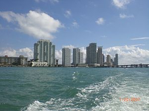
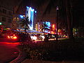
City of Miami Beach— City — Southern portion of Miami Beach with downtown Miami in background
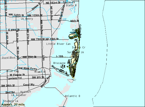
SealNickname(s): The Beach Location in Miami-Dade County and the state of Florida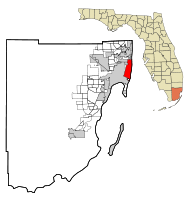 U.S. Census Bureau map showing city limits
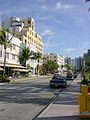
Coordinates: 25°48′46.89″N 80°8′2.63″W / 25.813025°N 80.1340639°WCoordinates: 25°48′46.89″N 80°8′2.63″W / 25.813025°N 80.1340639°W Country United States State Florida County Miami-Dade Incorporated March 26, 1915 Government - Mayor Matti Herrera Bower Area - City 18.7 sq mi (48.5 km2) - Land 7.0 sq mi (18.2 km2) - Water 11.7 sq mi (30.2 km2) 62.37% Elevation[1] 4 ft (1.2 m) Population (2010) - City 87,779 - Density 12,539.8/sq mi (4,841.6/km2) - Metro 5,564,635 Time zone EST (UTC-5) - Summer (DST) EDT (UTC-4) Zip 33109, 33139, 33140, 33141. Area code(s) 305, 786 FIPS code 12-45025[2] GNIS feature ID 0286750[3] Website www.miamibeachfl.gov Miami Beach is a coastal resort city in Miami-Dade County, Florida, United States, incorporated on March 26, 1915.[4] The municipality is located on a barrier island between the Atlantic Ocean and Biscayne Bay, the latter which separates the Beach from Miami city proper. The neighborhood of South Beach, comprising the southernmost 2.5 square miles (6.5 km2) of Miami Beach, along with Downtown Miami and the port collectively form the commercial center of South Florida.[5] As of the 2010 census, the city had a total population of 87,779. Miami Beach has been one of America's pre-eminent beach resorts since the early 20th century.
Description
In 1979 Miami Beach's Art Deco Historic District was listed on the National Register of Historic Places. The Art Deco District is the largest collection of Art Deco architecture in the world[6] and comprises hundreds of hotels, apartments and other structures erected between 1923 and 1943. Mediterranean, Streamline Moderne and Art Deco are all represented in the District. The Historic District is bounded by the Atlantic Ocean on the East, Lenox Court on the West, 6th Street on the South and Dade Boulevard along the Collins Canal to the North. The movement to preserve the Art Deco District's architectural heritage was led by former interior designer Barbara Capitman, who now has a street in the District named in her honor.
Government
Miami Beach is governed by a mayor and six commissioners. The mayor runs commission meetings and the mayor and all commissioners have equal voting power. The mayor serves for terms of two years with a term limit of three terms and commissioners serve for terms of four years and are limited to two terms. Commissioners are voted for by region and every two years three commission seats are voted upon. A city manager is responsible for administering governmental operations.
As of November 2009 the mayor is Matti Herrera Bower. The commissioners are Michael Gongora, Jerry Libbin, Jorge Exposito, Nathan Garg, Ed Tobin, Deede Weithorn, and Jonah Wolfson.
As of November 2010 the mayor is still Matti Herrera Bower. She won with 59.47% of the vote. The commissioners are Deede Weithorn, Wilfredo "Willy" Gort, and Marc Sanoff. [4]
History
Early history
Pre-history
Prior the establishment of the state of Florida and the Spanish colony, the first inhabitants of the area now known as Miami Beach were American Indians. At the time of Spanish discovery, the Tequesta Indians, who were related to the Arawak Indians of the Caribbean, had displaced a previous primitive Indian tribe known principally for their bead and shell craftsmanship. However, these Indians suffered the same fate as their relatives on the other West Indian islands who fell prey to the conquering nation of the Arawak Indians. Locally known as the Tequesta, these Indians were a far more aggressive, warlike tribe, known for their ferocity and cannibalism and easily overwhelmed the beach dwellers.
Spanish history
Miami Beach became known to Europeans primarily through the adventures of Álvar Núñez Cabeza de Vaca who is believed to have been shipwrecked nearby, and taken as a slave to well known powerful Indian sorcerer who was descended of the tribe living along the Miami Beach area prior to the Tequesta. During his captivity, Cabaza de Vaca spoke of the areas’ tempestuous beauty, stark blue seas, and tranquility interspaced by violent hurricanes. But aside from his remarks and a few tales of European sailors, the area was wholly unknown to the wider world, thereby leaving the Tequesta Indians in their own world of raid, counter-raid, and periodic cannibalism which kept almost all other outsiders from the area.
Although the Spaniards continued to visit the area and established small temporary trading, fishing, and coast watch settlements, they never succeeded in creating a permanent colonial settlement due to their limited resources and the violence of the local Indians. However, Dutch, English, and French settlers fleeing Spanish genocide of their colonies in Northern Florida, the Carolinas, and the West Indies, did manage to create relations with the local Tequesta as fellow persecuted nationals of the Spanish, thereby succeeding in creating small settlements in the area over the next centuries which became centered upon Coconut Grove. In turn, with the rise of the English, Dutch, and French Buccaneers who were sent to circumnavigate Spanish control of the Americas, Miami Beach soon became a small secret refuge for various privateers. Nonetheless, the area remained a mostly unexplored backwater of Spanish and European colonial policy.
Buccaneering history
Early refugees
Starting in the late 17th century, the Brethren of the Coasts established a small but permanent harbor and ship repair facility in the area, whilst the local Tequesta, decimated by disease, intermarried with various European and black refugees of the area and assimilated with other larger Indian tribes to the north and south. Thus, Miami Beach became a covert encampment for the Piracy and Privateering activities. Henceforth, the areas numerous inlets, small harbors, temporary portages, and swampland became a place of wild buccaneering, Indian trading posts, and general outlawry, governed by its own local codes of conduct.
Smuggling era and Coconut Grove
While the buccaneering days of the West Indies mostly came to an end by the late 1700s, minor pirates, European and American adventurers, black Maroon terrorists, and a small but surviving group of mixed European and Indian farmers and tradesman put the place on the maps of European colonialists as Coconut Grove. However, with the slow decline of the Spanish Empire, and the all pervasive might of the British Navy, and more commercially safe developments in the British colonies to the north, the areas principal standing as a smuggler and pirate center stagnated, causing much of the small town to slowly retreated into nature. But for the use of St. Augustine to the north, and the continued growth of shipping commerce and subsequent wrecks the area would’ve disappeared back into swampland, but instead enterprising British sailors and traders from the Bahamas came to South Florida and the Florida Keys in the early 19th Century, to hunt for the remains of an international array of ill-fated ships that crashed onto the treacherous Great Florida reef or to trade with the local small and mixed group of Indians and Europeans. Yet even with this new arrival of commerce the future was grim for the area.
However, this slow decline into swamp was checked and reversed with the final end to the Spanish Empire and its replacement with a new English Republic, the United States. Following centuries of savage warfare by black Maroons and Spanish backed Indians upon the British settlers and their American descendents, a new nation had arisen in northern Florida coalesced around Anglophobic and anti-American hostile Indians and escaped Black slaves, but also including Spaniards and enslaved British women and children. Together, these people and their descendents, became known as the Seminoles. In turn, backed by Spanish Armies and arms, this mixed nation of Seminoles, Black maroons, and Spaniards would pour from St. Augustine to raid, rape, and pillage advancing American settlements in Georgia, Alabama and South Carolina. British and subsequently, American diplomats and war leaders had checked the Spanish raids until a low level cold war had existed on the border of Spanish Florida and the State of Georgia thereby fixing Spanish gaze from polyglot and mostly subversive community of Coconut Grove and Miami Beach northward toward the Americans. Thus, Miami remained a stagnate but convenient way station where both sides could trade, negotiate, and commerce in secret. Yet, with the independence of America, a new more aggressive policy was implemented as covert raids, Filibuster missions, and strong diplomacy finally forced the Spanish to relinquish Florida in its entirety. In 1821, the Spanish flag was lowered and the Stars and Stripes raised over Florida. (Florida became a U.S.Territory in 1821, but did not become a State until 1845.)
Early American history
This caused a new and rapid change in the area of present day Miami, one from a small mostly covert settlement of mixed mostly Anglo-American settlers and Indians to a larger more American town. But before this occurred came a generation of warfare which almost led to the final genocide of the small community. With the exclusionary barriers raised by Spanish imperial policy eliminated and with Spanish Arms departing, the Seminoles lost their key support and centuries of righteous hatred toward them by the Americans was unleashed. Several wars, campaigns, and unrelenting advancement quickly pushed the Seminoles and their allies out of northern Florida and southward toward the barrier island (actually still a peninsula) that would become Miami Beach in 1915. Until then, however, the first structure to be built on this uninhabited oceanfront was the Biscayne House of Refuge, constructed in 1876 by the U.S. Lifesaving Service at approximately 72nd Street. Its purpose was to provide food, water, and a return to civilization for people who were shipwrecked. The next step in the development of the future Miami Beach was the planting of a coconut plantation along the shore here in the 1880s by New Jersey entrepreneurs Ezra Osborn and Elnathan Field, but this was a failed venture. One of the investors in the project was agriculturist John S. Collins, who achieved success by buying out other partners and planting different crops, notably avocadoes, on the land that would later become Miami Beach. Meanwhile, across Biscayne Bay, the City of Miami was established in 1896 with the arrival of the railroad, and developed further as a port when the shipping channel of Government Cut was created in 1905, cutting off Fisher Island from the south end of the Miami Beach peninsula. Collins' family members saw the potential in developing the beach here as a resort. This effort got underway in the early years of the 20th century by the Collins/Pancoast family, the Lummus brothers (bankers from Miami), and Indianapolis entrepreneur Carl G. Fisher. Until then, the beach here was only the destination for day-trips by ferry from Miami, across the bay. There were bath houses and food stands here, but no hotel until Brown's Hotel was built in 1915 (still standing, at 112 Ocean Drive). Much of the interior land mass here at that time was a tangled jungle of mangroves, and clearing it was a herculean effort. The Town of Miami Beach was chartered on March 26, 1915; it grew to become a City in 1917. Carl Fisher was the main promoter of Miami Beach's development in the 1920s as the site for wealthy industrialists from the north and midwest to build their winter homes here. In addition, Fisher built five hotels here (none still surviving). In the 1920s, Fisher and others literally created much of Miami Beach as landfill by dredging Biscayne Bay; this manmade territory includes Star, Palm, and Hibiscus Islands, the Sunset Islands, much of Normandy Isle, and all of the Venetian Islands except Belle Isle. The Miami Beach peninsula became an island in April 1925 when Haulover Cut was opened, connecting the ocean to the bay, north of present-day Bal Harbour. The great hurricane of Sept. 17-18, 1926, put an end to this prosperous era of the Florida Boom, but in the 1930s, Miami Beach still attracted tourists, and investors constructed the mostly small-scale, stucco hotels and rooming houses, for seasonal rental, that comprise much of the present "Art Deco" historic district.
This community, long sympathetic toward first the British and then the Americans, quickly called for help, and the United States Marine Corps and navy vessels were dispatched to aid the hard pressed community. After several years, the United States Navy and Marines had pushed the Seminoles out of the coastal areas of Florida and Miami Beach, whilst the earlier community which had been spread out along the beach and inner harbor, had congregated around Miami Beach and the safety of American arms and the sea. Finally, in 1836, the United States Army backed by Marines launched a series of offensives which finally drove the Seminole and their Black and Indian allies out of Miami, permanently securing the countryside with the establishment of Fort Dallas. For the next twenty years, American soldiers, marines, and seaman fought the Seminoles to secure and protect what remained of the community. At war's end, what remained of the Tequesta and their intermixed descendents had either joined with the Seminoles and remained in the Everglades or had been incorporated into the American protected community of Coconut Grove. In turn, these troops brought with them various families and camp followers which brought added numbers to the Coconut Grove community thereby advancing the boundaries of the small settlement with their newer neighborhood. Thus, by 1850, Miami was a collection of old Anglo-Dutch-French refugees and Buccaneers, Tequesta Indians, Anglo-Bahamians, and American adventurers and soldiers. However, the areas’ notoriety as a long Buccaneer, Pirate, and Smugglers haunt became little more than a colorful past as the American Army’s new Fort Dallas and troops as well as its new Navy port, and Marines quickly put an end to all but the most harmless smuggling.Tranquil era and early expansion
For the next few generations, protected from the Seminole Indians by the Everglades and the fort, and by foreign powers by the sea and the US Navy, Miami Beach settled into a more tranquil and peaceful era of quiet but colorful small shopkeepers, merchants, and a few enterprising ship captains, while the remainder moved to the countryside or other parts of Florida and the United States. Nonetheless, with the Seminole threat still existent, periodic petty piracy still occasional, and the geopolitical location of importance, Miami Beach periodically entered the national narrative with swamp rangers, small night-raids, a few daring smuggling operations, and eccentric American plantation owners and notables. Yet, aside from a few minor raids during the War Between the States, the area enjoyed one of its few periods of peace throughout its centuries of Buccaneer campaigns, Spanish-Indian wars, Seminole-Indian raids, and general lawlessness. Thus, with the arrival of the Americans and the State of Florida, Miami Beach had left its earlier period of frontier town and pirate haunt to a more tranquil time of peace and general prosperous small town. Indeed, by the late 1800s, the peacefulness of the area resulted in the abandonment of Fort Dallas and the break-up of much of the Navy port. Thankfully, the next era of change was peaceful enough that these military losses were not too far felt.
The area's next greatest change came thanks to a visionary Cleveland widow and noted Gilded Era socialite, named Julia Tuttle, who purchased 640 acres of a former Confederate plantation on the north bank of the Miami River in 1891, moving her family into the abandoned Fort Dallas buildings. Within four years, Tuttle—the "mother of Miami"—convinced fellow friend and Standard Oil co-founder Henry Flagler to extend his railroad to Miami, build a luxury hotel, and lay out a new town. The railroad arrived in 1896. The City of Miami was incorporated on July 28 that same year.
Middle American history
Coconut Grove golden era
The railroad, advertising by Tuttle’s robber-baron businesses, and general boosterism, brought in a new group of people to the newly established city. Much like other Southern coastal areas such Mobile, Alabama, Jacksonville, Florida, and New Orleans, Louisiana, Miami had a previous history of rowdy even outlawed behavior by a group of adventurers of mixed European and Indian nationality which had only been quieted and integrated with wider American and Southern culture in the middle 19th century. This new group was to reverse those gains as large numbers of Irish and German Catholics as well as typical Northern Yankee Americans arrived. The old Southern establishment already long crippled by the Civil War was quickly brushed aside, with the election of Miami's first mayor who also was an Irish Catholic. However, most of the early merchants remained Southern or of old Judeo-American background so Southern they became notorious in later years for their disdain and discrimination toward Jews from New York City. Additionally, the old Coconut Grove community of mixed American, Black, Indian, Anglo-Bahamians remained in politics controlling one-third of the city's incorporators. Backed by real estate boosterism, Greater Miami never lacked for forward thinkers, including John Collins (a New Jersey Quaker) and Prest-O-Lite king Carl Fisher, who together in 1913 embarked on an agriculture venture on a spit of oceanfront beach and started a bridge across the bay.
Great Depression and the new immigrant elite
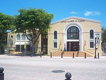 Beth Jacob Social Hall and Congregation
During the Depression, Pan American Airways launched the era of modern aviation with "Flying Clippers" from Miami's Dinner Key. Even then, Pan Am advertised Miami as the "Gateway to the Americas." However, much as elsewhere the Depression significantly hit the fortunes of the North-Eastern elite and just as quickly as Miami Beach’s high-flying escapades made for movies on the silver screens so did it depart. Although the native elite of Coconut Grove and Miami Beach had certainly lost on much of the wealth creation of the Northern elite, the native Miami Beach establishment had been fairly integrated into the development and expansion of Miami Beach. Thus, whilst the loss of the money and elegance provided by the Northern elite was felt economically, Miami Beach still retained its old ways and community.
However, in the destitute period of the Great Depression, Miami Beach attracted a new group, who found its numerous vacant vacation homes and elegant hotels, and still extant working class world and old line but almost decrepit families tracing back centuries, almost impossible to resist. Thus, did the North-East’s immigrant communities of Italians, Irish and predominantly Jews, come to Miami Beach and take-over and sub-divide its large hotels and mansions into smaller hotels and town homes and finally force most of the remaining old line families to sell out their ancestral land and homes. In turn, with land so cheap, the new Jewish and Italian businessmen, bought most of the remaining farmland and beach front portages for small craft dating from the buccaneers and which dotted the inner harbor of Miami, and in turn paved them over with buildings of stark modern lines along lower Collins Avenue and Ocean Drive to create Miami Beach‘s world famous Art Deco district.
With this came the final end of old Coconut Grove, which from the 1500’s had been a haunt of shipwrecked adventurers, notorious pirates, famous buccaneers, imperviously strong refugees and survivors of the Counter-Reformation and the Seminole Indian wars. Public Houses which claimed descent as Privateer dens were torn down, piers which had repaired many a sole surviving ship of a fleet destroyed by storm, and almost ancient plantation houses, all were destroyed and its former citizens thrown to the wind. Although, the changes are seen as a travesty today and a huge loss of Miami Beach‘s culture, the building boom helped bring the area out of the Depression and forty years later would become the world-famous Art Deco District, which includes the internationally renowned South Beach area.
Post World War American history
Suburbanization
With this new modern era also came new waves of Americans. Both World War I and World War II brought the geopolitical importance of Miami Beach back into the mindset of America’s leadership and new military facilities were established. In turn, this brought in another 100,000 people to Greater Miami and the Beaches when the Army Air Corps and the navy established major training centers. Many of these servicemen made the area their permanent home after the war. By the end of the 1950s, South Florida had doubled its pre-war population.
Cuban refugees
When Fidel Castro took over Cuba in 1959, no one dreamed that the revolution would change Miami as much as Cuba. The Cuban exiles who were just beginning to pour into the area were bringing the next change to Miami with them. Although most of the Cuban exiles in the early 1960s did come in significant numbers, their make-up as mostly upper-class and middle class Cubans of principally European descent, mostly only encouraged Miami’s American citizens to move for houses on the outskirts for reasons of better housing rather than out of fear of foreign manners and crime. However, starting in the 1970s, school integration, new arrivals of Black Americans and Caribbeans brought in a new crime wave and fear of children’s lives leading to a wave of white-flight of what remained of Miami Beach’s American community.
Thus, after thirty years of change starting with the great buy-out of the Coconut Grove elite during the Great Depression, most of Miami Beach had become principally a Jewish and black enclave. But even this period would quickly end as the Mariel Boat Lift brought in hundreds of thousands of a new class of Cubans, many of whom were professional criminals. In total, starting in the 1960s more than half a million Cuban exiles fled to Miami to start a new life, adding onto the hundreds of thousands of Americans suburban settlers, and the hundreds of thousands of early immigrants from the North East, resulting in the permanent change of Miami Beach from an exclusive community of wealthy North Eastern Americans and old South Florida natives to a large, heavily suburbanized metropolis of Americans from across the country and naturalized Americans from across old Europe, Cuba, and the West Indies.
Modern American history
Miami Vice
In contrast to the early era of silver screen representations of Miami Beach, with its breezy lifestyle of patrician wealth mixed with haunted memories of honorable buccaneering days and plantation lifestyle, this new era of human vacuous life, stark neighborhood lifestyle, media glamour, criminal racketeering, felonies, smuggling, and vice, became typified in numerous movies and television shows. Starting in the 1930s with the displacement of the Coconut Grove Elite, onto the new suburbs of Miami during the post-war era, and into the 1960s and 1980s of Cuban and Caribbean immigration, Miami Beach had suffered mind-boggling change to become what many call the "Capital of the Americas." Once an elegant place of plantation houses, beachfront hotels served by seaplanes, interspaced with open land, small farms, and quaint seafaring communities, Miami and Miami Beach had descended into a area of poverty and stark modernity. However, the 1980s and early 1990s brought a multi-billion dollar infusion of investment capital that produced a beautiful new Miami downtown skyline, a reborn Miami Beach, a modernized transportation infrastructure and a new way of life that features betters aspects of modern art, culture, sports and entertainment, all with a mostly international Latin accent. Although it has changed almost beyond recognition, Miami Beach has thrived amidst change and overcome many difficulties. Today, Greater Miami airport has overtaken New York's JFK airport as the nation's leading gateway for international arrivals with 5.1 million international travelers arriving in the U.S. through Miami in 1994. Thus, Greater Miami and the City of Miami Beach continue to be an international Mecca for travel, business and to establish a home.
Culture
Image and cultural depictions
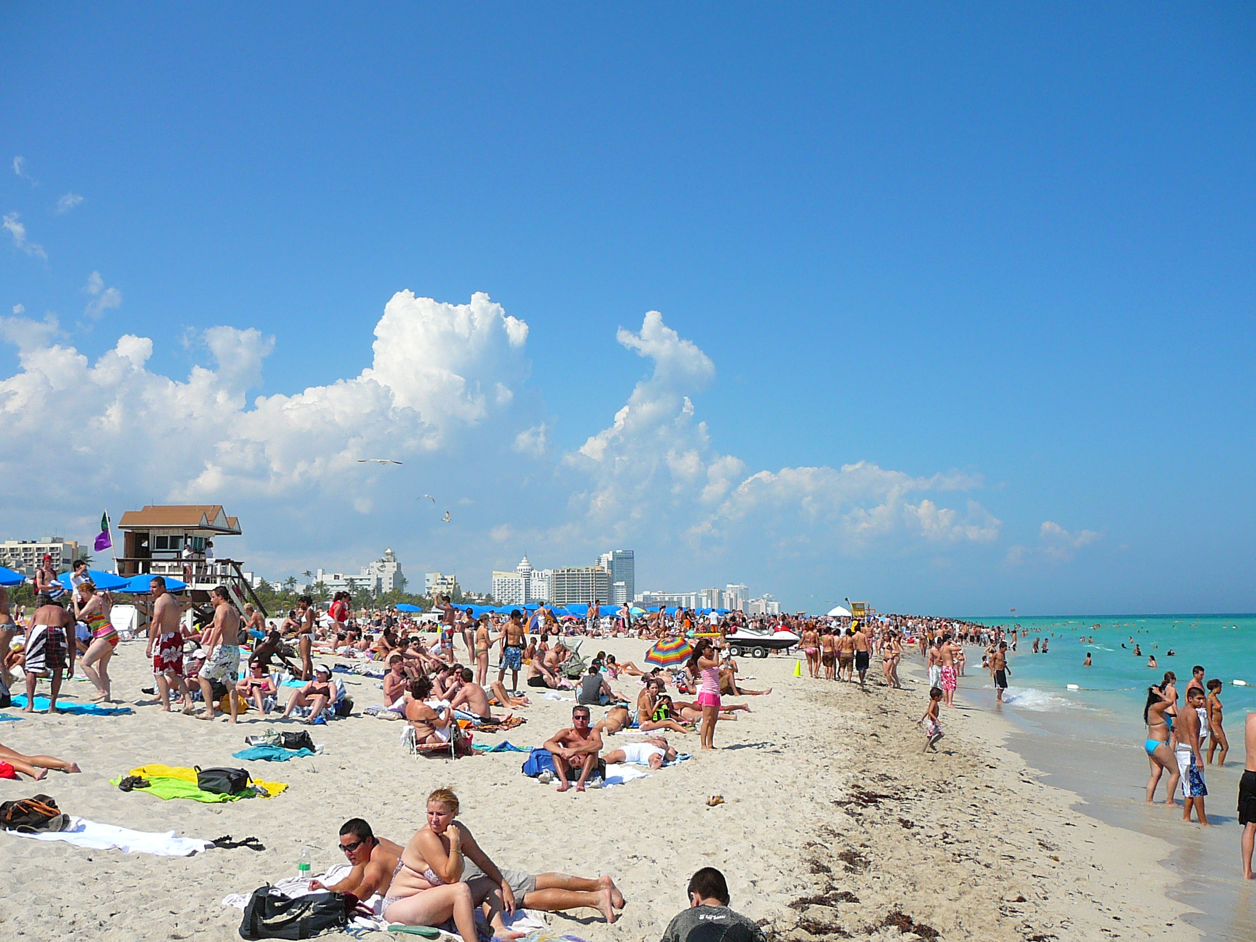
South Beach (also known as SoBe, or simply The Beach, the area from 1st street to about 25th street) is one of the more popular areas of Miami Beach. Topless sunbathing is legal on certain designated areas of the beach. Before the TV show Miami Vice helped make the area popular, SoBe was under urban blight, with vacant buildings and a high crime rate. Today, it is considered one of the richest commercial areas on the beach, yet poverty and crime still remain in some places near the area.[7]
Miami Beach, particularly Ocean Drive of what is now the Art Deco District, was also featured prominently in the 1983 feature film Scarface and the 1996 comedy The Birdcage.
The New World Symphony Orchestra is based in Miami Beach, under the direction of Michael Tilson Thomas.
Lincoln Road, running east-west between 16th and 17th Streets, is a nationally known spot for outdoor dining, bicycling, rollerblading and shopping and features and galleries of well known designers, artists and photographers such as Romero Britto, Peter Lik, and Jonathan Adler.[citation needed]
Jewish population
Miami Beach is home to a number of Orthodox Jewish communities with a network of well-established synagogues and yeshivas, the first of which being the Landow Yeshiva, a Chabad institution in operation for over 30 years. In addition, there is also a liberal Jewish community containing such famous synagogues as Temple Emanu-El (Miami Beach, Florida) and Cuban Hebrew Congregation. It is also a magnet for Jewish families, retirees, and particularly snowbirds when the cold winter sets in to the north. They range from the Modern Orthodox to the Haredi and Hasidic – including many rebbes who vacation there during the North American winter.
There are a number of kosher restaurants and even kollels for post-graduate Talmudic scholars, such as the Miami Beach Community Kollel. Miami Beach had roughly 60,000 people in Jewish households, 62 percent of the total population, in 1982, but only 16,500, or 19 percent of the population, in 2004, said Ira Sheskin, a demographer at the University of Miami who conducts surveys once a decade.[citation needed]
Miami Beach is home to the Holocaust Memorial on Miami Beach.
LGBT community
After decades of economic and social decline, an influx of gay men and lesbians moving to South Beach in the late-1980s to mid-1990s helped contribute to Miami Beach's revitalization. The newcomers purchased and restored dilapidated Art Deco hotels and clubs, started numerous businesses, and built political power in city and county government.[8] As South Beach became more popular as a national and international tourist destination, there have been occasional clashes between cultures and disputes about whether South Beach is as "gay friendly" as it once was.[9]
Miami Beach is home to numerous gay bars and gay-specific events, and five service and resource organizations. The passage of progressive civil rights laws,[8] election of outspokenly pro-gay Miami Beach Mayor Matti Bower, and the introduction of Miami Beach's Gay Pride Celebration, have reinvigorated the local LGBT community in recent years, which some argued had experienced a decline in the late 2000s.[10] A handful of anti-gay attacks[citation needed] and some instances of Miami Beach Police brutality against gay men[11] have been at odds with Miami Beach's longstanding image as a welcoming place for gay people.[12]
Miami Beach is home to some of the country's largest fundraisers that benefit both local and national LGBT nonprofits. As of 2011, some of the largest LGBT events in Miami Beach are:
- The Winter Party
- The White Party
- The Miami Recognition Dinner
- The Miami Gay & Lesbian Film Festival
- Aqua Girl
In 2008, the new Miami Beach Mayor Matti Bower created a Gay Business Development Ad Hoc Committee, with a mission to bring recommendations to the Mayor and City Commission on initiatives to be implemented and supported by the City regarding a variety of issues to ensure the welfare and future of the Miami Beach LGBT community.
While being a gay mecca of the 1980s and 1990s, Miami Beach never had a city sanctioned Gay Pride Parade until April 2009.[13] With strong support from the newly elected mayor Matti Bower.,[14] Miami Beach had its first Gay Pride Festival in April 2009.[15] It is now an annual event. The 2010 Pride drew tens of thousands of people.[16]
In 2009, the American Civil Liberties Union (ACLU) began looking into instances of Miami Beach Police Department (MBPD) targeting gay men for harassment.[17] In February 2010, the ACLU announced that it will sue the City of Miami Beach for an ongoing targeting and arrests of gay men in public.[18] According to the ACLU, Miami Beach police have a history of arresting gay men for simply looking “too gay”.[19]
The incidents between gay men and MBPD resulted in negative publicity for the city.[20] At the meeting with the local gay leaders, Miami Beach Police Chief Carlos Noriega claimed that the incidents were isolated, and promised increased diversity training for police officers. He also announced that captain, who is a lesbian, would soon be reassigned to internal affairs to handle complaints about cops accused of harassing gays. Some members of the committee were skeptical of Noriega's assertion that the recent case wasn't indicative of a larger problem in the MBPD, and provided examples of other cases.[21]
In January 2010, Miami Beach passed a revised Human Rights Ordinance that strengthens enforcement of already existing human rights laws and adds protections for transgendered people,[22] making Miami Beach’s human rights laws some of the most progressive in the state.[8] Both residents of, and visitors to, Miami Beach have been able to register as domestic partners since 2004;[23] in 2008 this benefit was extended to all of Miami-Dade County.[24]
In 2010, the Miami-Dade Gay & Lesbian Chamber of Commerce, with support from the City of Miami Beach, opened an LGBT Visitor Center at Miami Beach's Old City Hall.
The arts
Each December, the City of Miami Beach hosts Art Basel Miami Beach, one of the largest art shows in the United States. Art Basel Miami Beach, the sister event to the Art Basel event held each June in Basel, Switzerland, combines an international selection of top galleries with a program of special exhibitions, parties and crossover events featuring music, film, architecture and design. Exhibition sites are located in the city's Art Deco District, and ancillary events are scattered throughout the greater Miami metropolitan area.
Miami Beach is home to the New World Symphony, established in 1987 under the artistic direction of Michael Tilson Thomas. In January 2011, the New World Symphony made a highly publicized move into a new building designed by Canadian American Pritzker Prize-winning architect Frank Gehry. Gehry is famous for his design of the Guggenheim Museum in Bilbao, Spain, and the Walt Disney Concert Hall in Los Angeles, California. The new Gehry building offers Live Wallcasts™, which allow visitors to experience select events throughout the season at the half-acre, outdoor Miami Beach SoundScape through the use of visual and audio technology on a 7,000-square-foot (650 m2) projection wall.
The Miami City Ballet, a ballet company founded in 1985, which is housed in a 63,000-square-foot (5,900 m2) building near Miami Beach's Bass Museum of Art.
The Miami Beach Festival of the Arts is an annual outdoor art festival that was begun in 1974.
In November 2007 and 2009, a multi-media art festival ("Sleepless Night") was held based on Nuit Blanche.[25][26] The festival returns on November 5, 2011.[5]
Geography
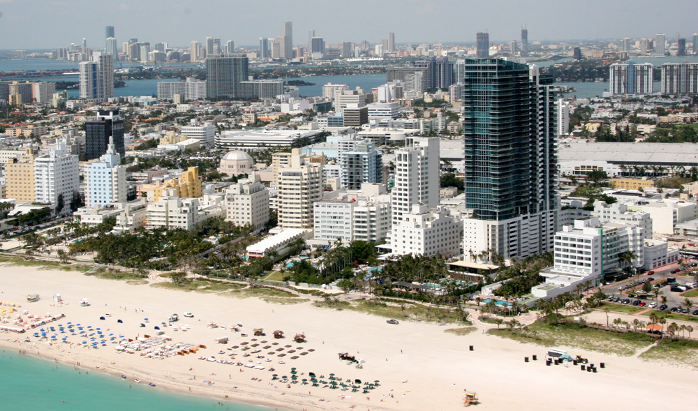
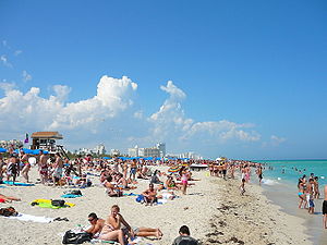 South Beach in March 2008
Miami Beach is located at 25°48′47″N 80°08′03″W / 25.813025°N 80.134065°W (25.813025, −80.134065).[27]
According to the United States Census Bureau, the city has a total area of 18.7 square miles (48.5 km2), of which 7.0 square miles (18.2 km2) is land and 11.7 square miles (30.2 km2) (62.37%) is water.
Climate
It has a Tropical monsoon climate (Köppen Am),[28] with hot humid summers and warm winters. There is a marked wet season during the summer months, with dry winters that feature much lower humidity. Miami Beach is one of only a handful of U.S. locales that has never recorded snow or snow flurries in its weather history.
Miami Beach's location on the Atlantic Ocean, near its confluence with the Gulf of Mexico, make it extraordinarily vulnerable to hurricanes and tropical storms. It has experienced two direct hits from major hurricanes in recorded weather history; the 1926 Miami hurricane and Hurricane Cleo in 1964. The area has seen indirect contact from hurricanes Betsy (1965), Andrew (1992), Irene (1999), Michelle (2001), Katrina (2005), and Wilma (2005).
Climate data for Miami Beach, FL Month Jan Feb Mar Apr May Jun Jul Aug Sep Oct Nov Dec Year Record high °F (°C) 87
(31)88
(31)92
(33)94
(34)98
(37)97
(36)98
(37)98
(37)96
(36)95
(35)92
(33)86
(30)98
(37)Average high °F (°C) 73
(23)73
(23)75
(24)79
(26)82
(28)86
(30)87
(31)87
(31)86
(30)83
(28)78
(26)75
(24)80 Average low °F (°C) 63
(17)63
(17)66
(19)70
(21)74
(23)77
(25)78
(26)78
(26)78
(26)75
(24)70
(21)65
(18)71 Record low °F (°C) 32
(0)37
(3)32
(0)46
(8)58
(14)65
(18)66
(19)67
(19)67
(19)54
(12)39
(4)32
(0)32
(0)Precipitation inches (mm) 2.4
(61)2.1
(53)2.2
(56)2.8
(71)4.9
(124)6.9
(175)3.6
(91)5.4
(137)6.3
(160)4.5
(114)3.3
(84)2.0
(51)46.4
(1,179)Source: The Weather Channel[29] Water temperature
This chart shows the average coastal water temperature for the Atlantic Ocean by month in degrees Fahrenheit for Miami Beach based on historical measurements.[30]
January February March April 1–15 April 16–30 May 1–15 May 16–31 June 1–15 June 16–30 July 1–15 July 16–31 August 1–15 August 16–31 September 1–15 September 16–30 October 1–15 October 16–31 November December 71 73 75 78 78 80 81 84 85 86 86 86 84 84 83 83 79 76 73 Surrounding areas
Surrounding areas of Miami Beach 
Biscayne Bay Indian Creek, Surfside Atlantic Ocean Biscayne Bay, North Bay Village, Miami, Fisher Island 
Atlantic Ocean  Miami Beach

Fisher Island Government Cut, Fisher Island Atlantic Ocean Demographics
Miami Beach Demographics 2010 Census Miami Beach Miami-Dade County Florida Total population 87,779 2,496,435 18,801,310 Population, percent change, 2000 to 2010 -0.2% +10.8% +17.6% Population density 11,511.1/sq mi 1,315.5/sq mi 350.6/sq mi White or Caucasian (including White Hispanic) 87.4% 73.8% 75.0% (Non-Hispanic White or Caucasian) 40.5% 15.4% 57.9% Black or African-American 4.4% 18.9% 16.0% Hispanic or Latino (of any race) 53.0% 65.0% 22.5% Asian 1.9% 1.5% 2.4% Native American or Native Alaskan 0.3% 0.2% 0.4% Pacific Islander or Native Hawaiian 0.1% 0.0% 0.1% Two or more races (Multiracial) 2.7% 2.4% 2.5% Some Other Race 3.2% 3.2% 3.6% As of 2000, there were 46,194 households out of which 14.0% had children under the age of 18 living with them, 27.4% were married couples living together, 8.5% had a female householder with no husband present, and 60.3% were non-families. 48.7% of all households were made up of individuals and 14.8% had someone living alone who was sixty-five years of age or older. The average household size was 1.87 and the average family size was 2.76.
Historical populations Census Pop. %± 1920 644 — 1930 6,494 908.4% 1940 28,012 331.4% 1950 46,282 65.2% 1960 63,145 36.4% 1970 87,072 37.9% 1980 96,298 10.6% 1990 92,639 −3.8% 2000 87,933 −5.1% 2010 87,779 −0.2% In the city the population was spread out with 13.4% under the age of 18, 7.8% from 18 to 24, 38.2% from 25 to 44, 21.3% from 45 to 64, and 19.2% who were sixty-five years of age or older. The median age was thirty-nine years. For every 100 females there were 105.0 males. For every 100 females age eighteen and over, there were 105.4 males.
The median income for a household in the city was $27,322, and the median income for a family was $33,440. Males had a median income of $33,964 versus $27,094 for females. The per capita income for the city was $27,853. About 17.0% of families and 21.8% of the population were below the poverty line, including 25.2% of those under age 18 and 24.5% of those age sixty-five or over.
As of 2000, speakers of Spanish as a first language accounted for 55% of residents, while English made up 33%, Portuguese was at 3.4%, French was at 1.7%, German at 1.1%, Italian 1%, and Russian was 0.85% of the population. Due to the large Jewish community, Yiddish was spoken at the home of 0.81% of the population, and Hebrew was the mother tongue of 0.74%.[31]
As of 2000, Miami Beach had the 22nd highest concentration of Cuban residents in the United States, at 20.5% of the population.[32] It had the 28th highest percentage of Colombian residents, at 4.4% of the city's population,[33] and the 14th highest percentage of Brazilian residents, at 2.2% of the its population (tied with Hillside, New Jersey and Hudson, Massachusetts.)[34] It also had the 27th largest concentration of Peruvian ancestry, at 1.85%,[35] and the 27th highest percentage of people of Venezuelan heritage, at 1.79%.[36] Miami Beach also has the 33rd highest concentration of Honduran ancestry (1.03%)[37] and the 41st-highest percentage of Nicaraguan residents, which made up 1% of the population.[38]
Transportation
See also: Transportation in MiamiPublic Transportation in Miami Beach is operated by Miami-Dade Transit (MDT). Along with neighborhoods such as Downtown and Brickell, public transit is heavily used in Miami Beach, and is a vital part of city life. Although Miami Beach has no direct Metrorail stations, numerous Metrobus lines, connect to Downtown Miami and Metrorail (i.e., the 'S' bus line). The 'South Beach Local' or 'SBL' is one of the most heavily-used lines in Miami, and connects all major points of South Beach to other major bus lines in the city. Metrobus ridership in Miami Beach is high, with some of the routes, such as the L and S alone being the busiest Metrobus routes.[39]
The Airport-Beach Express (Route 150), operated by MDT, is a direct-service bus line that connects Miami International Airport to major points in South Beach. The ride costs $2.35, and runs every 30 minutes from 6:00 a.m. to 11:00 p.m. seven days a week.[40]
Bicycling
In recent years, bicycling has grown in popular in Miami Beach. Due to its dense, urban nature, and pedestrian-friendly streets, many Miami Beach residents get around by bicycle.
In March 2011 a public bike sharing program named Decobike was launched, one of only a handful of such programs in the United States. The program is operated by a private corporation, Decobike, LLC, but is partnered with the City of Miami Beach in a revenue sharing model.[41] Once fully implemented, the program hopes to have around 1000 bikes accessible from 100 stations throughout Miami Beach, from around 85th Street on the north side of Miami Beach all the way south to South Pointe Park.[42]
Education
Miami-Dade County Public Schools serves Miami Beach.
- North Beach Elementary
- South Pointe Elementary
- Biscayne Elementary
- Feinberg/Fisher K - 8 Center
- Treasure Island Elementary in nearby North Bay Village
- Ruth K. Broad/ Bay Harbor Elementary in nearby Bay Harbor Islands
- Nautilus Middle School (which is the only Public middle school for the Miami Beach area)
- Miami Beach Senior High School (which is the only Public high school for the Miami Beach area)
Private schools include Alexander S. Gross Hebrew Academy, St. Patrick Catholic School, Landow Yeshiva – Lubavitch Educational Center (Klurman Mesivta High School for Boys and Beis Chana Middle and High School for Girls), and Mechina High School.
Colleges and universities
The Florida International University School of Architecture has a sister campus at 420 Lincoln Road in South Beach, with classroom spaces for FIU architecture, art, music and theater graduate students[43]
Neighborhoods
 A portion of the southern part of the South Beach skyline as seen from Biscayne Bay. Photo: Marc Averette
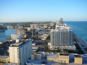
- Bayshore
- Sunset Islands I & II
- Sunset Islands III & IV
- Sunset Harbour
- Biscayne Point
- Stillwater Drive Neighborhood
- City Center
- Fisher Island (A small portion of the island)
- Flamingo/Lummus
- Flamingo Park
- Flamingo Park West
- North Ocean Drive Area
- South Beach
- La Gorce
- Allison Island
- Aqua Allison Island
- La Gorce Island
- La Gorce Pine Tree
- Lower North Bay Road Neighborhood
- Middle North Bay Road Neighborhood
- Nautilus
- Alton Road Neighborhood
- Lakeview/Surprise Lake
- Orchard Park
- North Shore
- Little Buenos Aires
- Normandy Fountain
- Park View Island
- Normandy Isles
- Normandie Sud
- Normandy Shores
- Oceanfront
- South Pointe
- SoFi (South of Fifth)
- Star Island, Palm Island, & Hibiscus Island
- Venetian Islands, including Belle Isle
- Biscayne Island
- Di Lido Island
- Rivo Alto Island
- San Marco Island
- San Marino Island
- West Avenue/Bay Road
- Lincoln West
Points of interest
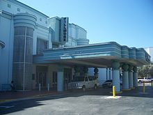 The Fillmore
- Fillmore Miami Beach at the Jackie Gleason Theatre
- Eden Roc (hotel)
- Flagler Monument Island
- Fontainebleau Hotel
- Versace Mansion (Casa Casuarina)
- Holocaust Memorial
- Lincoln Road
- Miami Beach Architectural District
- Miami Beach Botanical Garden
- Ocean Drive
- South Beach
- Wolfsonian-FIU Museum
Notable residents
Historical
- George Ade, writer
- Moses Annenberg, newspaper publisher
- Desi Arnaz, entertainer
- John Jacob Astor, businessman
- Walter Briggs, Sr., entrepreneur, owner of The Detroit Tigers
- Al Capone, mobster
- John S. Collins, horticulturist
- Kent Cooper, Associated Press
- James M. Cox, Governor of Ohio and presidential candidate
- Harvey Firestone, Firestone Tires
- Carl Graham Fisher, developer of Miami Beach
- Frank Gannett, Gannett Media Corporation
- Jackie Gleason, comedian and actor
- Gabriel Heatter, radio commentator
- John D. Hertz, Hertz Rental Cars
- Howard Hughes, businessman
- S.S. Kresge, retailer
- Albert Lasker, businessman
- Nunnally Johnson, film director
- Ring Lardner, writer
- Bernarr MacFadden, bodybuilder, owner of the Deauville Hotel
- James Cash Penney, department store magnate
- Irving Jacob Reuter, General Motors
- Grantland Rice, sportswriter
- Knute Rockne, football player and coach
- Damon Runyon, newspaperman and writer
- Nicholas Schenck, MGM studios
- Dutch Schultz, mobster
- Albert Warner, Warner Brothers studio founder
- Walter Winchell, columnist
- Garfield Wood, inventor
Post-World War II
- Ellen Barkin, actress
- Edna Buchanan, journalist
- Luther Campbell, rap performer
- Frank Costello, mobster
- Terry Cousin, football player, The Miami Dolphins
- Frank Erickson, bookmaker
- Gloria Estefan, entertainer
- Joan Field, concert violinist
- Roy Firestone, sportscaster and entertainer
- Andy Garcia, actor
- Barry Gibb and Maurice Gibb, singers, members of The Bee Gees
- Mitch Glazer, writer and producer
- Thomas Harris, writer
- Maida Heatter, chef and author
- Kim Hunter, actress
- Dan Gelber, judge and Florida state senator
- Chubby Jackson, jazz musician
- Larry King, television host
- Gerald Kogan, Chief Justice, Florida Supreme Court
- Morris Lapidus, architect
- Meyer Lansky, mobster
- William Lehman, U.S. Representative
- Jennifer Lopez, entertainer
- Sheila MacRae, actress
- Mark Medoff, playwright, screenwriter and director
- Bob Mover, jazz musician
- Murph the Surf, surfer and criminal
- Chad Ochocinco, football player, The Cincinnati Bengals
- Brett Ratner, film director
- Martha Raye, entertainer, night club owner
- Samari Rolle, football player, The Baltimore Ravens
- Elliot Roosevelt, Miami Beach mayor, son of Franklin Delano Roosevelt
- Stephen M. Ross, real estate developer, owner of The Miami Dolphins
- Mickey Rourke, actor
- Robert Rubin, former United States Secretary of the Treasury
- Porfirio Rubirosa, diplomat
- Duane Starks, football player, The Baltimore Ravens
- Daniel Taradash, screenwriter
- Dave Thomas, football player, The Dallas Cowboys
- Michael Tilson Thomas, conductor
- Neal Walk, NBA basketball player
- Barbara Walters, television journalist
- Louis Wolfson, financier, racehorse owner
- Mitchell Wolfson, Jr., businessman, philanthropist
- Mana Zucca, composer
Sister cities
Miami Beach has 11 sister cities[44]
 Brampton, Canada[45]
 Almonte, Spain
- Marbella, Spain
 Fortaleza, Brazil
 Santa Marta, Colombia
 Ceský Krumlov, Czech Republic
 Nahariya, Israel
 Pescara, Italy
 Fujisawa, Japan
 Cozumel, Mexico
 Ica, Peru
See also
- Neighborhoods of Miami Beach, Florida
- List of upscale shopping districts
- South Florida
- Miami-Dade County
- Miami Beach Police Department
- Miami Modern Architecture
- John S. Collins
- Carl G. Fisher
- Collins Bridge
- Rosie the Elephant
- A Hole in the Head (1959 film)
- The Bellboy (1960 film)
- Fair Game (1995 film)
- Doral Hotel
- Ocean Drive
- Julia Tuttle Causeway
- Macarthur Causeway
- Venetian Causeway
- Spring Break
- 8th & Ocean
References
- ^ City-Data.com
- ^ "American FactFinder". United States Census Bureau. http://factfinder.census.gov. Retrieved 2008-01-31.
- ^ "US Board on Geographic Names". United States Geological Survey. 2007-10-25. http://geonames.usgs.gov. Retrieved 2008-01-31.
- ^ Ruby Leach Carson. 40 Years of Miami Beach. p. 13. http://www.miamibeachfl.gov/weblink/DocView.aspx?id=49088.
- ^ Andersson, Åke E.; David E. Andersson (2000). Gateways to the Global Economy. Edward Elgar Publishing. p. 124. ISBN 978-1840643893.
- ^ Miami Art Deco District – Official Art Deco District Visitors Guide
- ^ MSNBC: South Beach: Life imitates art, quite vicely
- ^ a b c Miami Beach by the numbers - Miami Beach - MiamiHerald.com
- ^ Questioning South Beach’s Status as a Gay Mecca? :: EDGE Miami
- ^ Gays leave unfriendly South Beach for Fort Lauderdale - Page 1 - News - Miami - Miami New Times
- ^ Miami Beach Police face charges of anti-gay harassment :: EDGE Miami
- ^ Gay Miami Beach Travel Guide, Gay South Beach Guide
- ^ The Inaugural Miami Beach Gay Pride 2009 - Miami - Slideshows
- ^ Celebrate Pride on Miami Beach!
- ^ miamibeachgaypride.com
- ^ Steve Rothaus' Gay South Florida
- ^ Steve Rothaus' Gay South Florida
- ^ ACLU Gives Notice Of Intent To Sue Miami Beach For Unlawful Arrest Of Gay Men And Individuals Who Report Police Misconduct | American Civil Liberties Union
- ^ ACLU To Sue Miami Beach For Targeting Gay Men | On Top Magazine :: Gay & Lesbian News, Entertainment, Commentary & Travel
- ^ Steve Rothaus' Gay South Florida
- ^ Police Chief Carlos Noriega Meets With Miami Beach's Gay Leaders Over ACLU Suit, Promises Changes - Miami News - Riptide 2.0
- ^ Breaking News - Two New Local Ordinances Support Equality For Gay Residents Of Miami Beach And South Miami | Save Dade
- ^ City Clerk @ City of Miami Beach
- ^ Miami-Dade County - Consumer Services - Domestic Partnerships
- ^ [1][2]
- ^ [3]
- ^ "US Gazetteer files: 2010, 2000, and 1990". United States Census Bureau. 2011-02-12. http://www.census.gov/geo/www/gazetteer/gazette.html. Retrieved 2011-04-23.
- ^ "Köppen Climate Map Aw=tropical". .johnabbott.qc.ca. http://www2.johnabbott.qc.ca/webpages/departments/geoscience/intro/Koppen/KoppenMap.htm. Retrieved 2009-04-21.
- ^ "Monthly Averages for Miami Beach, Fla.". The Weather Channel. 2009. http://www.weather.com/weather/wxclimatology/monthly/graph/33140?from=36hr_bottomnav_undeclared. Retrieved 2009-11-07.
- ^ US NODC Coastal Water Temperature Guide
- ^ "MLA Data Center Results of Miami Beach, Fla.". Modern Language Association. http://www.mla.org/map_data_results&state_id=12&county_id=&mode=&zip=&place_id=45025&cty_id=&ll=&a=&ea=&order=r. Retrieved 2007-11-01.
- ^ "Ancestry Map of Cuban Communities". Epodunk.com. http://www.epodunk.com/ancestry/Cuban.html. Retrieved 2007-11-01.
- ^ "Ancestry Map of Colombian Communities". Epodunk.com. http://www.epodunk.com/ancestry/Colombian.html. Retrieved 2007-11-01.
- ^ "Ancestry Map of Brazilian Communities". Epodunk.com. http://www.epodunk.com/ancestry/Brazilian.html. Retrieved 2007-11-01.
- ^ "Ancestry Map of Peruvian Communities". Epodunk.com. http://www.epodunk.com/ancestry/Peruvian.html. Retrieved 2007-11-01.
- ^ "Ancestry Map of Venezuelan Communities". Epodunk.com. http://www.epodunk.com/ancestry/Venezuelan.html. Retrieved 2007-11-01.
- ^ "Ancestry Map of Honduran Communities". Epodunk.com. http://www.epodunk.com/ancestry/Honduran.html. Retrieved 2007-11-01.
- ^ "Ancestry Map of Nicaraguan Communities". Epodunk.com. http://www.epodunk.com/ancestry/Nicaraguan.html. Retrieved 2007-11-01.
- ^ 2011-02_Ridership_Technical_Report.pdf
- ^ miamiherald.com
- ^ http://www.decobike.com/decofaq.php#where-revenues-go
- ^ http://www.transitmiami.com/bicycle-sharing/deco-bikes-south-florida-bikeshare-debut
- ^ FIU College of Architecture + The Arts to open new home on Lincoln Road
- ^ "Miami Beach Sister Cities Program". Miamibeachsistercities.com. http://miamibeachsistercities.com/. Retrieved 2009-04-21.
- ^ "Historic Sister City Agreemtn Between Brampton and Miami Beach, Florida" (PDF). City of Brampton, Canada. 2008-10-03. http://www.brampton.ca/media-releases/08-054.pdf. Retrieved 2008-10-05.
Further reading
- Kennedy, Patricia, Miami Beach, Arcadia Publishing, Images of America series, 2006
- Lavender, Abraham D., Miami Beach in 1920: The Making of a Winter Resort, Arcadia Publishing, The Making of America Series, 2002
Gallery
-
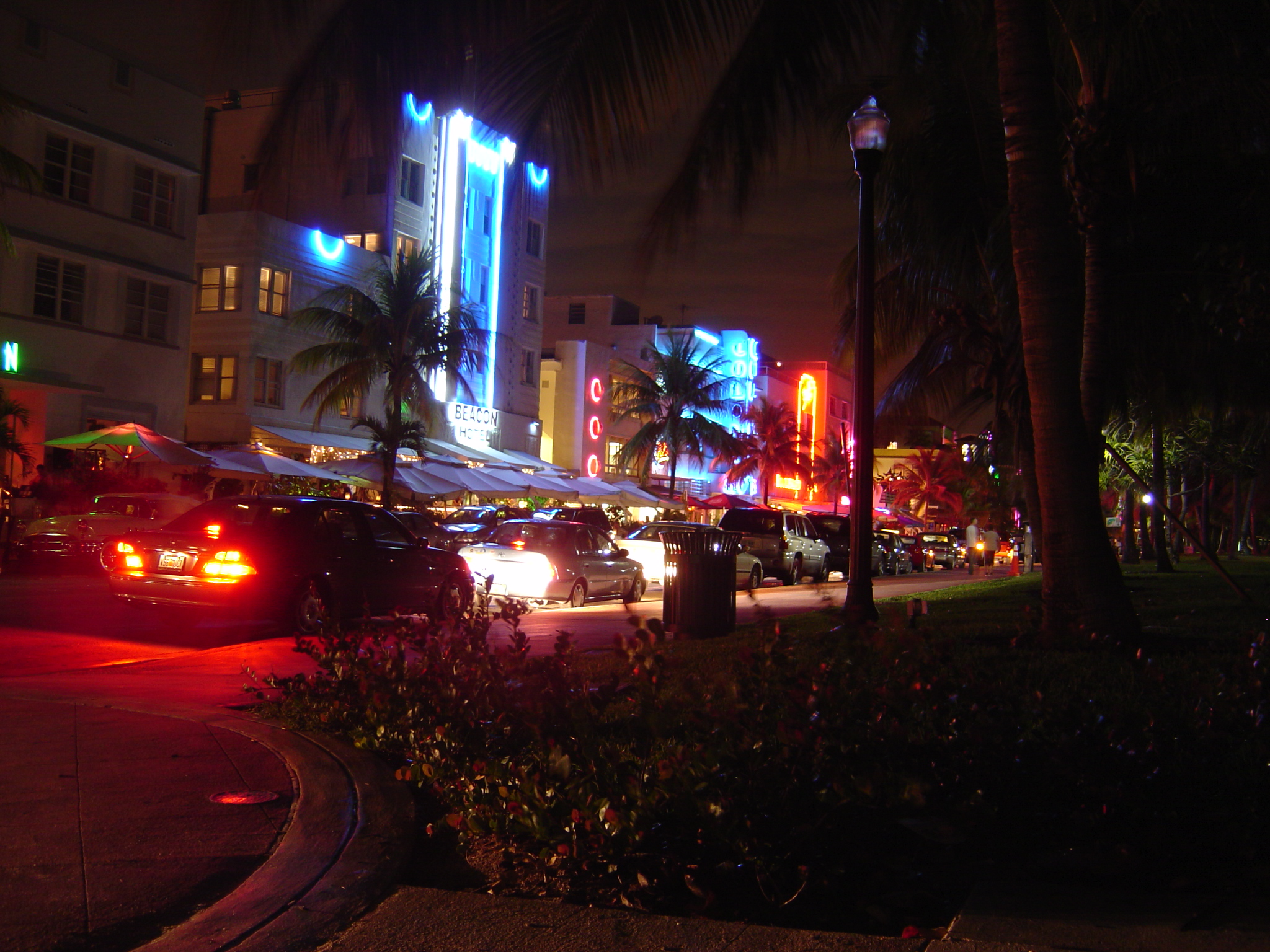
The historical Art Deco District at South Beach during the night.
-
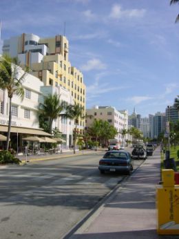
The Art Deco District at South Beach during the day.
-

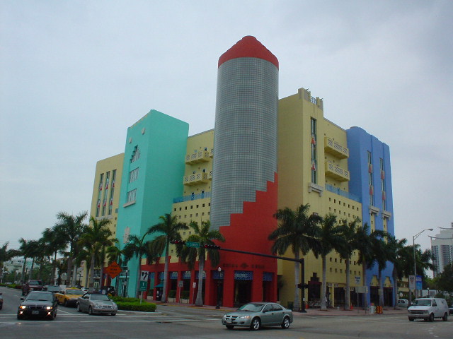
Colorful new building blends in with the historic Art Deco
External links
Official sites
Photos
- Miami Beach Architecture Photos
- The lifeguard towers of Miami Beach
- Photographs of Miami Beach From the State Library & Archives of Florida
- Photos of Miami Beach, Miami and surrounding areas
Other
- Miami Design Preservation League – Non-profit Organization for the preservation of Miami Beach Architectural History
- Miami's Southeast Coast – Biscayne Bay Watershed – Florida DEP
Greater Miami CBD Urban centers Major thoroughfares North 36th Street · North 79th Street · North 103rd Street · North 125th Street · West 7th Avenue · West 27th Avenue · West 107th Avenue · Allapattah Road · Alton Road · Bird Road · Biscayne Boulevard · Collins Avenue · Coral Reef Drive · Coral Way · County Line Road · Flagler Street · Galloway Road · Gratigny · Ives Dairy Road · Julia Tuttle Causeway · Kendall Drive · Killian · Krome Avenue · William H. Lehman Causeway · LeJeune Road · Ludlam Road · MacArthur Causeway · Miami Avenue · Miami Gardens Drive · Milam Dairy Road · Miracle Mile · Ocean Drive · Okeechobee Road · Old Cutler Road · Port Boulevard · Red Road · Rickenbacker Causeway · South Dixie Highway · Sunset Drive · Tamiami Trail · Venetian CausewayColleges and universities Parks and recreation Amelia Earhart Park · Arch Creek · The Barnacle Historic State Park · Bayfront Park · Bicentennial Park · Big Cypress National Preserve · Bill Baggs Cape Florida State Park · Biscayne National Park · Chapman Field Park · Crandon Park · Dinner Key · Everglades National Park · Fairchild Tropical Botanic Garden · Fort Dallas · Fruit and Spice Park · Greynolds Park · Haulover Park · The Kampong · Matheson Hammock Park · Oleta River State Park · Peacock Park · Shark Valley · South Pointe Park · Tamiami Park · Tropical Park · Virginia Key · Zoo MiamiMajor districts and attractions Adrienne Arsht Center for the Performing Arts · American Airlines Arena · Boca Chita Key Historic District · Coral Castle · Design District · Downtown Miami Historic District · Jungle Island · Lummus Park · Homestead Historic Downtown District · MacFarlane Homestead District · Miami Art Deco District · Miami Seaquarium · Monkey Jungle · Normandy Isles Historic District · North Shore Historic District · Miami Riverwalk · South Beach · Villa VizcayaMajor shopping centers Aventura Mall · Bal Harbour Shops · Bayside Marketplace · CocoWalk · Dadeland Mall · Dadeland Station · Dolphin Mall · The Falls · Lincoln Road Mall · The Mall at 163rd Street · Mall of the Americas · Mary Brickell Village · Metrofare Shops & Cafe · Miami International Mall · Miracle Marketplace · The Shops at Sunset Place · Southland Mall · Village of Merrick Park · Westland MallPrimary modes of transport South Florida metropolitan area Largest city Counties
(by population)Cities and towns
100k-250kCities and towns
25k-99kAventura • Boca Raton • Boynton Beach • Coconut Creek • Cooper City • Coral Gables • Dania Beach • Davie • Deerfield Beach • Delray Beach • Doral • Greenacres • Hallandale Beach • Homestead • Jupiter • Lake Worth • Lauderdale Lakes • Lauderhill • Margate • Miami Beach • North Lauderdale • North Miami • North Miami Beach • Oakland Park • Palm Beach Gardens • Plantation • Riviera Beach • Sunrise • Tamarac • West Park • Weston • Wilton ManorsCities and towns
10k-25kCategories:- Cities in Miami-Dade County, Florida
- Miami Beach, Florida
- Islands of Miami-Dade County, Florida
- Barrier islands of Florida
- United States places with Orthodox Jewish communities
- Beaches of Miami-Dade County, Florida
- Populated places in Florida with Hispanic majority populations
- Seaside resorts in Florida


Wikimedia Foundation. 2010.