- Richmond Heights, Florida
Infobox Settlement
official_name = Richmond Heights, Florida
other_name =
native_name =
nickname =
settlement_type = CDP
motto =
imagesize =
image_caption =
flag_size =
image_
seal_size =
image_shield =
shield_size =
image_blank_emblem =
blank_emblem_type =
blank_emblem_size =
imagesize =
image_caption =
flag_size =
image_
seal_size =
image_shield =
shield_size =
image_blank_emblem =
blank_emblem_type =
blank_emblem_size =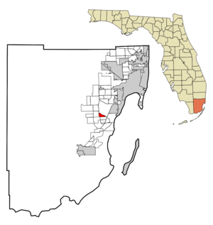
mapsize = 250x200px
map_caption = Location in Miami-Dade County and the state ofFlorida 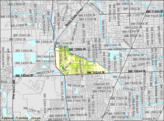
mapsize1 = 250x200px
map_caption1 = U.S. Census Bureau map showing CDP boundaries
image_dot_
dot_mapsize =
dot_map_caption =
dot_x =
dot_y =
pushpin_
pushpin_label_position =
pushpin_map_caption =
pushpin_mapsize =
subdivision_type = Country
subdivision_name = flag|United States
subdivision_type1 = State
subdivision_name1 = flag|Florida
subdivision_type2 = County
subdivision_name2 = noflag|Miami-Dade
subdivision_type3 =
subdivision_name3 =
subdivision_type4 =
subdivision_name4 =
government_footnotes =
government_type =
leader_title =
leader_name =
leader_title1 =
leader_name1 =
leader_title2 =
leader_name2 =
leader_title3 =
leader_name3 =
leader_title4 =
leader_name4 =
established_title =
established_date =
established_title2 =
established_date2 =
established_title3 =
established_date3 =
area_magnitude =
unit_pref = Imperial
area_footnotes =
area_total_km2 = 4.3
area_land_km2 = 4.3
area_water_km2 = 0
area_total_sq_mi = 1.7
area_land_sq_mi = 1.7
area_water_sq_mi = 0
area_water_percent =
area_urban_km2 =
area_urban_sq_mi =
area_metro_km2 =
area_metro_sq_mi =
area_blank1_title =
area_blank1_km2 =
area_blank1_sq_mi =
population_as_of = 2000
population_footnotes =
population_note =
population_total = 8479
population_density_km2 = 1971.9
population_density_sq_mi = 4987.6
population_metro =
population_density_metro_km2 =
population_density_metro_sq_mi =
population_urban =
population_density_urban_km2 =
population_density_urban_sq_mi =
population_blank1_title =
population_blank1 =
population_density_blank1_km2 =
population_density_blank1_sq_mi =
timezone = Eastern (EST)
utc_offset = -5
timezone_DST = EDT
utc_offset_DST = -4
latd = 25 |latm = 38 |lats = 0 |latNS = N
longd = 80 |longm = 22 |longs = 21 |longEW = W
elevation_footnotes =
elevation_m = 3
elevation_ft = 10
postal_code_type =ZIP code s
postal_code = 33156, 33158, 33176
area_code = 305
blank_name = FIPS code
blank_info = 12-60225GR|2
blank1_name = GNIS feature ID
blank1_info = 0289685GR|3
website =
footnotes =Richmond Heights is a
census-designated place (CDP) in Miami-Dade County,Florida ,United States . The population was 8,479 at the 2000 census.Geography
Richmond Heights is located at coor dms|25|38|0|N|80|22|21|W|city (25.633415, -80.372362)GR|1.
According to the
United States Census Bureau , the CDP has a total area of 1.6square mile s (4.3km² ), all of it land.Demographics
As of the
census GR|2 of 2000, there were 8,479 people, 2,653 households, and 2,101 families residing in the CDP. Thepopulation density was 5,124.3 people per square mile (1,984.1/km²). There were 2,771 housing units at an average density of 1,674.7/sq mi (648.4/km²). The racial makeup of the CDP was 12.45% White (of which 3.4% were Non-Hispanic White,) [cite web |url=http://www.muninetguide.com/states/florida/municipality/Richmond_Heights.php |title=Demographics of Richmond Heights, FL |publisher=MuniNetGuide.com |accessdate=2007-11-08] 82.83% African American, 0.22% Native American, 0.83% Asian, 0.01% Pacific Islander, 2.00% from other races, and 1.65% from two or more races. Hispanic or Latino of any race were 12.47% of the population.There were 2,653 households out of which 32.5% had children under the age of 18 living with them, 42.4% were married couples living together, 30.1% had a female householder with no husband present, and 20.8% were non-families. 17.9% of all households were made up of individuals and 8.3% had someone living alone who was 65 years of age or older. The average household size was 3.16 and the average family size was 3.55.
In the CDP the population was spread out with 29.0% under the age of 18, 9.0% from 18 to 24, 26.3% from 25 to 44, 21.8% from 45 to 64, and 14.0% who were 65 years of age or older. The median age was 35 years. For every 100 females there were 83.8 males. For every 100 females age 18 and over, there were 77.9 males.
The median income for a household in the CDP was $38,191, and the median income for a family was $44,095. Males had a median income of $31,286 versus $27,882 for females. The
per capita income for the CDP was $15,824. About 14.0% of families and 15.1% of the population were below thepoverty line , including 23.0% of those under age 18 and 14.8% of those age 65 or over.As of 2000, speakers of English as a
first language accounted for 87.29% of residents, while Spanish as amother tongue made up 12.70% of the population. [cite web |url=http://www.mla.org/map_data_results&state_id=12&county_id=&mode=&zip=&place_id=60225&cty_id=&ll=&a=&ea=&order=r |title=MLA Data Center Results of Richmond Heights, FL |publisher=Modern Language Association |accessdate=2007-11-08]As of 2000, Richmond Heights had the sixtieth highest percentage of African-American and black residents in the US, with 82.80% of the populace. [cite web |url=http://www.epodunk.com/ancestry/African-American.html |title=Ancestry Map of African-American Communities |publisher=Epodunk.com |accessdate=2007-11-08] It had the fifth highest percentage of Bahamian residents in the US, at 1.30% of the population, [cite web |url=http://www.epodunk.com/ancestry/Bahamian.html |title=Ancestry Map of Bahamian Communities |publisher=Epodunk.com |accessdate=2007-11-08] and the ninety-seventh highest percentage of Cuban residents in the US, at 2.54% of its population (tied with Malone, FL.) [cite web |url=http://www.epodunk.com/ancestry/Cuban.html |title=Ancestry Map of Cuban Communities |publisher=Epodunk.com |accessdate=2007-11-08] It also had the fortieth most Nicaraguans in the US, at 1.04% of all residents (tied with South Miami and Lake Butler, FL.) [cite web |url=http://www.epodunk.com/ancestry/Nicaraguan.html |title=Ancestry Map of Nicaraguan Communities |publisher=Epodunk.com |accessdate=2007-11-08]
References
External links
Wikimedia Foundation. 2010.