- Coral Terrace, Florida
-
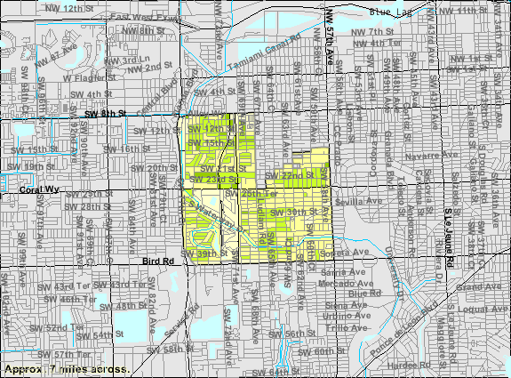
Coral Terrace, Florida — CDP — Location in Miami-Dade County and the state of Florida U.S. Census Bureau map showing CDP boundaries
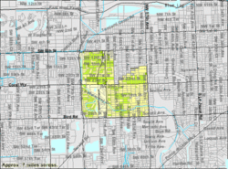
Coordinates: 25°44′48″N 80°18′16″W / 25.74667°N 80.30444°WCoordinates: 25°44′48″N 80°18′16″W / 25.74667°N 80.30444°W Country  United States
State  Florida
County Miami-Dade Area – Total 3.4 sq mi (8.9 km2) – Land 3.4 sq mi (8.9 km2) – Water 0 sq mi (0 km2) Elevation 3 ft (1 m) Population (2000) – Total 24,380 – Density 7,170.6/sq mi (2,739.3/km2) Time zone Eastern (EST) (UTC-5) – Summer (DST) EDT (UTC-4) FIPS code 12-14412[1] GNIS feature ID 1867127[2] Coral Terrace is an unincorporated suburban community and census-designated place in Miami-Dade County, Florida, United States. The population was 24,376 at the 2010 census.
Geography
Coral Terrace is located at 25°44′48″N 80°18′16″W / 25.74667°N 80.30444°W (25.746778, -80.304551)[3].
According to the United States Census Bureau, the CDP has a total area of 3.5 square miles (9.1 km2), of which, 3.4 square miles (8.8 km2) of it is land and 0.04 square miles (0.10 km2) of it (0.58%) is water.
Demographics
Historical populations Census Pop. %± 1980 22,702 — 1990 23,255 2.4% 2000 24,380 4.8% 2010 24,376 0% source: [4] As of the census[1] of 2000, there were 24,380 people, 7,744 households, and 6,171 families residing in the CDP. The population density was 7,110.0 people per square mile (2,744.4/km²). There were 7,955 housing units at an average density of 2,319.9/sq mi (895.5/km²). The racial makeup of the CDP was 93.06% White (16.5% were Non-Hispanic White,)[5] 1.15% African American, 0.10% Native American, 0.53% Asian, 0.01% Pacific Islander, 2.84% from other races, and 2.31% from two or more races. Hispanic or Latino of any race were 82.10% of the population.
There were 7,744 households out of which 29.3% had children under the age of 18 living with them, 58.3% were married couples living together, 15.6% had a female householder with no husband present, and 20.3% were non-families. 15.4% of all households were made up of individuals and 8.1% had someone living alone who was 65 years of age or older. The average household size was 3.07 and the average family size was 3.30.
In the CDP the population was spread out with 20.3% under the age of 18, 6.7% from 18 to 24, 27.8% from 25 to 44, 24.6% from 45 to 64, and 20.6% who were 65 years of age or older. The median age was 41 years. For every 100 females there were 89.6 males. For every 100 females age 18 and over, there were 85.2 males.
The median income for a household in the CDP was $38,523, and the median income for a family was $39,624. Males had a median income of $26,846 versus $23,190 for females. The per capita income for the CDP was $15,291. About 8.6% of families and 11.2% of the population were below the poverty line, including 9.1% of those under age 18 and 12.8% of those age 65 or over.
As of 2000, 85.18% spoke Spanish as a first language, while 14.11% spoke English as their mother tongue.[6]
As of 2000, Coral Terrace had the third highest percentage of Cuban residents in the US, with 61.87% of the populace.[7] It had the seventeenth highest percentage of Nicaraguan residents in the US, at 2.27% of the population,[8] and the ninety-seventh highest percentage of Colombian residents in the US, at 1.70% of its population.[9]
References
- ^ a b "American FactFinder". United States Census Bureau. http://factfinder.census.gov. Retrieved 2008-01-31.
- ^ "US Board on Geographic Names". United States Geological Survey. 2007-10-25. http://geonames.usgs.gov. Retrieved 2008-01-31.
- ^ "US Gazetteer files: 2010, 2000, and 1990". United States Census Bureau. 2011-02-12. http://www.census.gov/geo/www/gazetteer/gazette.html. Retrieved 2011-04-23.
- ^ "CENSUS OF POPULATION AND HOUSING (1790-2000)". U.S. Census Bureau. http://www.census.gov/prod/www/abs/decennial/index.html. Retrieved 2010-07-17.
- ^ "Demographics of Coral Terrace, FL". MuniNetGuide.com. http://www.muninetguide.com/states/florida/municipality/Coral_Terrace.php. Retrieved 2007-11-05.
- ^ "MLA Data Center Results of Coral Terrace, FL". Modern Language Association. http://www.mla.org/map_data_results&state_id=12&county_id=&mode=place&zip=&place_id=14412&cty_id=&ll=&a=&ea=&order=r. Retrieved 2007-11-05.
- ^ "Ancestry Map of Cuban Communities". Epodunk.com. http://www.epodunk.com/ancestry/Cuban.html. Retrieved 2007-11-05.
- ^ "Ancestry Map of Nicaraguan Communities". Epodunk.com. http://www.epodunk.com/ancestry/Nicaraguan.html. Retrieved 2007-11-05.
- ^ "Ancestry Map of Colombian Communities". Epodunk.com. http://www.epodunk.com/ancestry/Colombian.html. Retrieved 2007-11-05.
South Florida metropolitan area Largest city Counties
(by population)Cities and towns
100k-250kCities and towns
25k-99kAventura • Boca Raton • Boynton Beach • Coconut Creek • Cooper City • Coral Gables • Dania Beach • Davie • Deerfield Beach • Delray Beach • Doral • Greenacres • Hallandale Beach • Homestead • Jupiter • Lake Worth • Lauderdale Lakes • Lauderhill • Margate • Miami Beach • North Lauderdale • North Miami • North Miami Beach • Oakland Park • Palm Beach Gardens • Plantation • Riviera Beach • Sunrise • Tamarac • West Park • Weston • Wilton ManorsCities and towns
10k-25k State of Florida
Topics - Delegations
- Environment
- Floridians
- Geography
- Government
- History
- State Parks
- Transportation
- Visitor Attractions
Society - Culture
- Crime
- Demographics
- Economy
- Education
- Politics
Regions Metro areas - Miami–Fort Lauderdale–Pompano Beach (Miami-Dade, Broward, Palm Beach)
- Tampa-St. Petersburg-Clearwater (Hernando, Hillsborough, Pasco, Pinellas)
- Orlando-Kissimmee-Sanford (Lake, Orange, Osceola, Seminole)
- Jacksonville (Duval, Clay, St. Johns, Nassau, Baker)
- North Port–Bradenton–Sarasota (Manatee, Sarasota)
- Cape Coral-Fort Myers (Lee)
- Lakeland-Winter Haven (Polk)
- Palm Bay-Melbourne-Titusville (Brevard)
- Deltona-Daytona Beach-Ormond Beach (Volusia)
- Pensacola-Ferry Pass-Brent (Escambia, Santa Rosa)
- Port St. Lucie (St. Lucie, Martin)
- Tallahassee (Gadsden, Jefferson, Leon, Wakulla)
- Ocala (Marion)
- Naples-Marco Island (Collier)
- Gainesville (Alachua, Gilchrist)
- Fort Walton Beach-Crestview-Destin (Okaloosa)
- Panama City-Lynn Haven-Panama City Beach (Bay)
- Punta Gorda (Charlotte)
- Sebastian-Vero Beach (Indian River)
- Palm Coast (Flagler)
Largest cities Counties - Alachua
- Baker
- Bay
- Bradford
- Brevard
- Broward
- Calhoun
- Charlotte
- Citrus
- Clay
- Collier
- Columbia
- DeSoto
- Dixie
- Duval
- Escambia
- Flagler
- Franklin
- Gadsden
- Gilchrist
- Glades
- Gulf
- Hamilton
- Hardee
- Hendry
- Hernando
- Highlands
- Hillsborough
- Holmes
- Indian River
- Jackson
- Jefferson
- Lafayette
- Lake
- Lee
- Leon
- Levy
- Liberty
- Madison
- Manatee
- Marion
- Martin
- Miami‑Dade
- Monroe
- Nassau
- Okaloosa
- Okeechobee
- Orange
- Osceola
- Palm Beach
- Pasco
- Pinellas
- Polk
- Putnam
- Santa Rosa
- Sarasota
- Seminole
- St. Johns
- St. Lucie
- Sumter
- Suwannee
- Taylor
- Union
- Volusia
- Wakulla
- Walton
- Washington
Categories:- Unincorporated communities in Miami-Dade County, Florida
- Census-designated places in Miami-Dade County, Florida
- Populated places in Florida with Hispanic majority populations


Wikimedia Foundation. 2010.