- Jackson County, Florida
-
Jackson County, Florida 
Seal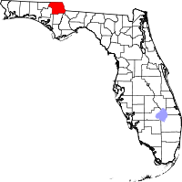
Location in the state of Florida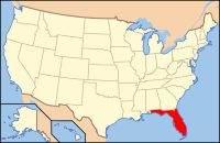
Florida's location in the U.S.Founded 12 August 1822 Seat Marianna Area
- Total
- Land
- Water
954.58 sq mi (2,472 km²)
915.64 sq mi (2,371 km²)
38.94 sq mi (101 km²), 4.08%Population
- (2010)
- Density
49,746
54/sq mi (20.98/km²)Website www.jacksoncountyfl.com Jackson County is a county located in the U.S. state of Florida. The population as of the 2000 census was 46,755. As of 2005, the population was estimated to be 48,985 [1]. Its county seat is Marianna, Florida[1].
Contents
History
Jackson County was created by the Florida Territorial Council in 1822 out of Escambia County, along with Duval County out of St. Johns County, making them the third and fourth counties in the Territory. The county was named for Andrew Jackson, who had served as Florida's first military governor for six months in 1821. Jackson County originally extended from the Choctawhatchee River on the west to the Suwannee River on the east. The county had been reduced close to its present boundaries by 1840 through the creation of new counties from its original territory. Minor adjustments to the county boundaries continued through most of the 19th century, however.[2][3][4]
There were no towns in Jackson County when it was formed. The first county court met at what was called "Robinson's Big Spring" (later called Blue Springs) in 1822 and then at the "Big Spring of the Choctawhatchee" in 1823. The following year the county court met at "Chipola Settlement" which is also known as Waddell's Mill Pond.[citation needed]
Marianna became the county seat, but not without controversy. It was founded by Robert Beveridge, a native of Scotland, in September 1827. The first town established in Jackson County was Webbville in January 1827. Webbville, a community of land squatters, was located 9 miles (14 km) northwest of present day Marianna and was designated as the county seat. Webbville thrived until 1828 when Beveridge and other Marianna settlers went to Tallahassee and enticed the Florida Legislature with free land, construction of a courthouse, a public square and $500 to purchase a quarter section of land to be sold at public auction as a way to finance the new government, if the county seat was moved to Marianna.[citation needed]
Beveridge and his supporters succeeded and Marianna became the county seat of the county justice and civil authority, even though it was never officially proclaimed the county seat. Marianna began to grow and prosper when the county government moved into the new courthouse in 1829. Webbville's prominent citizens moved to Marianna and the L&N Railroad decided to bypass the town. Webbville does not exist today.[citation needed]
From 1869-71, Jackson County was the center of a low-level guerrilla war known as the Jackson County War. Members of the Ku Klux Klan consisting of Confederate Army veterans assassinated over 150 Republican Party officials and prominent African-Americans as part of a successful campaign to retain white Democratic power.[5]
Geography
According to the 2000 census, the county has a total area of 954.58 square miles (2,472.4 km2), of which 915.64 square miles (2,371.5 km2) (or 95.92%) is land and 38.94 square miles (100.9 km2) (or 4.08%) is water.[6] Jackson County is the only county in Florida that borders both Georgia and Alabama. Jackson County is in the Central Standard Time Zone. Its eastern border with Gadsden County forms the boundary in this area between the Central Standard and Eastern Standard Time Zones.
Adjacent Counties
- Seminole County, Georgia - east
- Gadsden County, Florida - southeast
- Liberty County, Florida - southeast
- Calhoun County, Florida - south
- Washington County, Florida - southwest
- Bay County, Florida - southwest
- Holmes County, Florida - west
- Geneva County, Alabama - northwest
- Houston County, Alabama - north
Demographics
Historical populations Census Pop. %± 1840 4,681 — 1850 6,639 41.8% 1860 10,209 53.8% 1870 9,528 −6.7% 1880 14,372 50.8% 1890 17,544 22.1% 1900 23,377 33.2% 1910 29,821 27.6% 1920 31,224 4.7% 1930 31,969 2.4% 1940 34,428 7.7% 1950 34,645 0.6% 1960 36,208 4.5% 1970 34,434 −4.9% 1980 39,154 13.7% 1990 41,375 5.7% 2000 46,755 13.0% 2010 49,746 6.4% [7][8][9] As of the census[10] of 2000, there were 46,755 people, 16,620 households, and 11,600 families residing in the county. The population density was 51 people per square mile (20/km²). There were 19,490 housing units at an average density of 21 per square mile (8/km²). The racial makeup of the county was 70.18% White, 26.56% Black or African American, 0.67% Native American, 0.36% Asian, 0.03% Pacific Islander, 0.81% from other races, and 1.40% from two or more races. 2.91% of the population were Hispanic or Latino of any race.
There were 16,620 households out of which 30.90% had children under the age of 18 living with them, 51.50% were married couples living together, 14.40% had a female householder with no husband present, and 30.20% were non-families. 27.00% of all households were made up of individuals and 12.80% had someone living alone who was 65 years of age or older. The average household size was 2.44 and the average family size was 2.95.
In the county the population was spread out with 22.30% under the age of 18, 9.70% from 18 to 24, 29.60% from 25 to 44, 23.80% from 45 to 64, and 14.60% who were 65 years of age or older. The median age was 38 years. For every 100 females there were 110.40 males. For every 100 females age 18 and over, there were 111.20 males.
The median income for a household in the county was $29,744, and the median income for a family was $36,404. Males had a median income of $27,138 versus $21,180 for females. The per capita income for the county was $13,905. About 12.80% of families and 17.20% of the population were below the poverty line, including 23.70% of those under age 18 and 21.00% of those age 65 or over.
Municipalities
Incorporated
- Town of Alford
- Town of Bascom
- Town of Campbellton
- Town of Cottondale
- City of Graceville
- Town of Grand Ridge
- Town of Greenwood
- City of Jacob City
- Town of Malone
- City of Marianna
- Town of Sneads
Unincorporated
- Cypress, Florida
- Two Egg, Florida
- Round Lake, Florida
Politics
Presidential elections results Year Republican Democratic Other 2008 63.5% 35.5% 1.0% 2004 61.2% 38.1% 0.7% 2000 56.1% 42.1% 1.8% Government and infrastructure
The Florida Department of Corrections operates Region I - Correctional Facility Office in an unincorporated area in Jackson County.[11]
See also
References
- ^ "Find a County". National Association of Counties. http://www.naco.org/Counties/Pages/FindACounty.aspx. Retrieved 2011-06-07.
- ^ Jackson County Information - accessed February 10, 2008
- ^ Encyclopedia Americana - Jackson, Andrew - accessed February 10, 2008
- ^ Fernald, Edward A. (1981) Atlas of Florida. The Florida State University Foundation, Inc. ISBN 0-9606708-0-7
- ^ Weitz, Seth. "Defending the Old South: The Myth of the Lost Cause and Political Immorality in Florida, 1885-1968." In The Historian, Vol. 71, No. 1 (Spring 2009), pg. 83.
- ^ "Census 2000 U.S. Gazetteer Files: Counties". United States Census. http://www.census.gov/tiger/tms/gazetteer/county2k.txt. Retrieved 2011-02-13.
- ^ http://www.census.gov/population/www/censusdata/cencounts/files/fl190090.txt
- ^ http://factfinder2.census.gov/faces/tableservices/jsf/pages/productview.xhtml?pid=DEC_10_PL_QTPL&prodType=table
- ^ http://mapserver.lib.virginia.edu/
- ^ "American FactFinder". United States Census Bureau. http://factfinder.census.gov. Retrieved 2008-01-31.
- ^ "Region I - Correctional Facility Office." Florida Department of Corrections. Retrieved on January 8, 2010.
External links
Government links/Constitutional offices
- Jackson County Board of County Commissioners
- Jackson County Supervisor of Elections
- Jackson County Property Appraiser
- Jackson County Sheriff's Office
- Jackson County Tax Collector
Special districts
Judicial branch
- Jackson County Clerk of Courts
- Circuit and County Court for the 14th Judicial Circuit of Florida serving Bay, Calhoun, Gulf, Holmes, Jackson and Washington counties
Tourism links

Geneva County, Alabama Houston County, Alabama Holmes County 
Seminole County, Georgia  Jackson County, Florida

Bay County and Washington County Calhoun County Gadsden County and Liberty County Municipalities and communities of Jackson County, Florida Cities 
Towns Alford | Bascom | Campbellton | Cottondale | Grand Ridge | Greenwood | Malone | Sneads
Unincorporated
communitiesCategories:- Florida counties
- Jackson County, Florida
- 1822 establishments in the United States
- Populated places established in 1822


Wikimedia Foundation. 2010.