- Lee County, Florida
Infobox U.S. County
county = Lee County
state = Florida

founded = 12 May1887
seat = Fort Myers | area_total_sq_mi =1212
area_land_sq_mi =804
area_water_sq_mi =408
area percentage = 33.69%
census yr = 2000
pop = 440888
density_km2 =212
web = http://www.lee-county.com/
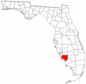
|Lee County is a
county located in theU.S. state ofFlorida . The county makes up the entirety of theCape Coral-Fort Myers, Florida Metropolitan Statistical Area , and is the most populous county inSouthwest Florida .According to the U.S. Census Bureau, as of 2000, the population of Lee County was 440,888. The population estimate for 2008 was 623,725. [ [http://www.news-press.com/apps/pbcs.dll/article?AID=/20080822/NEWS01/808220395/1075] ]
Between 2000 and 2004, Lee County had the fastest growth rate in
Hispanic population in the country. [http://www.news-press.com/apps/pbcs.dll/article?AID=/20060309/NEWS01/603090396/1075]Its
county seat is Fort MyersGR|6, and its largest city is Cape Coral.History
Lee County was created in 1887 from Monroe County. It was named for
Robert E. Lee , Confederate general in theAmerican Civil War .Incorporated in 1886, Fort Myers is the center of a popular tourist area in Southwest Florida and the seat of Lee County. It is located about 120 miles south of Tampa at the meeting point of the Gulf of Mexico and the Caloosahatchee River. Fort Myers was the frequent winter home of
Thomas Edison , as well asHenry Ford . Lee County has been the host to severalMajor League Baseball teams forSpring Training , over the past several decades. Currently, it is the spring home of theBoston Red Sox , as well as theMinnesota Twins .Fort Myers, built in 1850 as a military fort to fend off Seminole Indians that were massacring the area’s few settlers, was named after Col. Abraham C. Myers, who was stationed in Florida for seven years and was the son-in-law of the fort’s establisher and commander. In 1858, after years of elusive battle, chief Billy Bowlegs and his warriors were persuaded to surrender and move west, and the fort was abandoned. Billy’s Creek, which flows into the Caloosahatchee River and runs between The Beau Rivage Condominiums and Alta Mar, was named after a temporary camp where Billy Bowlegs and his men awaited ships to take them west.
The fort was abandoned until 1863 when a small number of Federal troops re-occupied the fort during the Civil War. In 1865 the fort was attacked unsuccessfully by a very small group of Confederates. After the war, the fort was again deserted.
The first settlers arrived in 1866, but it wasn’t until 1882 when the city experienced a significant influx of settlers. By 1885, when Fort Myers was incorporated, it was the second largest city only to Tampa on Florida’s west coast south of Cedar Key, even larger than Clearwater and Sarasota, also growing cities at the time.
Fort Myers first became a nationally known winter resort with the building of The Royal Palm Hotel in 1898. But what really sparked the city’s growth was the construction of the Tamiami Trail Bridge built across the Caloosahatchee River in 1924. After the bridge’s construction, the city experienced its first real estate boom and many subdivisions sprouted around the city.
In 1923, Collier and Hendry Counties were created by splitting these areas from Lee County. As recently as 2004, discussion had taken place surrounding the possibility of the city of Cape Coral becoming its own county, citing in particular a perceived lack of infrastructure support from the Lee County government. However a new county has not as of yet been created.
In
August 2004 , the county was hit hard byHurricane Charley , particularly on the northwesternisland s of Captiva, Gasparilla andNorth Captiva .Geography
According to the U.S. Census Bureau, the county has a total area of 1,212
square mile s (3,139km² ), of which, 804 square miles (2,081 km²) of it is land and 408 square miles (1,057 km²) of it (33.69%) is water.Lee County is located on the southwest coast of
Florida . It is approximately 125 miles south of Tampa and 115 miles west of Fort Lauderdale viaInterstate 75 ; and approximately 125 miles west-northwest of Miami viaU.S. Highway 41 .Lee County is the sole county in the Cape Coral-Fort Myers Metropolitan Statistical Area.
Adjacent counties
*
Charlotte County, Florida (north)
*Glades County, Florida - (northeast)
*Collier County, Florida (southeast)
*Hendry County, Florida (east)National
protected area s*
Caloosahatchee National Wildlife Refuge
*J.N. "Ding" Darling National Wildlife Refuge
*Matlacha Pass National Wildlife Refuge
*Pine Island National Wildlife Refuge Demographics
As of the
census GR|2 of 2000, there were 440,888 people, 188,599 households, and 127,681 families residing in the county. Thepopulation density was 549 people per square mile (212/km²). There were 245,405 housing units at an average density of 305 per square mile (118/km²). The racial makeup of the county was 87.69% White, 6.59% Black or African American, 0.28% Native American, 0.77% Asian, 0.05% Pacific Islander, 3.07% from other races, and 1.55% from two or more races. 9.54% of the population were Hispanic or Latino of any race. 86.7% spoke English, 8.7% Spanish and 1.1% German as their first language.In 2005 the population was 76.6% non-Hispanic white, 14.3% Latino, 7.5% African-American and 1.1% Asian. (Source=http://quickfacts.census.gov/qfd/states/12/12071.html)
There were 188,599 households out of which 22.40% had children under the age of 18 living with them, 55.50% were married couples living together, 8.70% had a female householder with no husband present, and 32.30% were non-families. 25.80% of all households were made up of individuals and 13.10% had someone living alone who was 65 years of age or older. The average household size was 2.31 and the average family size was 2.73.
In the county the population was spread out with 19.60% under the age of 18, 6.20% from 18 to 24, 24.00% from 25 to 44, 24.80% from 45 to 64, and 25.40% who were 65 years of age or older. The median age was 45.2 years. For every 100 females there were 95.60 males. For every 100 females age 18 and over, there were 93.10 males.
The median income for a household in the county was $40,319, and the median income for a family was $46,430. Males had a median income of $31,247 versus $24,380 for females. The
per capita income for the county was $24,542. About 6.70% of families and 9.70% of the population were below thepoverty line , including 15.20% of those under age 18 and 5.60% of those age 65 or over.Law enforcement
: "See:
Lee County Sheriff's Office "chool district
:"See: Lee County School District"
Municipalities
Incorporated
* City of Bonita Springs Population 43,518
* City of Cape Coral Population 154, 499
* City of Fort Myers Population 65, 729
* Town of Fort Myers Beach Population 6,874
* City of Sanibel Population 6,321Unincorporated
*Alva
*Boca Grande
*Bokeelia
*Buckingham
*Burnt Store Marina
*Captiva
*Charleston Park
*Cypress Lake
*East Dunbar
*Estero
*Fort Myers Shores
*Gateway
*Harlem Heights
*Iona
*Lehigh Acres
*Lochmoor Waterway Estates
*Matlacha (on Matlacha Island)
*Matlacha Isles-Matlacha Shores
*McGregor
*North Fort Myers
*Olga
*Page Park
*Palmona Park
*Pine Island Center
*Pine Manor
*Pineland (on Pine Island)
*Punta Rassa
*San Carlos Park
*South Fort Myers
*St. James City
*Suncoast Estates
*Three Oaks
*Tice
*Villas
*Whiskey CreekIslands
*Big Hickory Island (
Lovers Key / Carl E. Johnson State Park )
*Cabbage Key
*Captiva Island
*Cayo Costa (Cayo Costa State Park )
*Estero Island (Town of Fort Myers Beach)
*Gasparilla Island (community of Boca Grande)
*Little Hickory Island (Beaches of Bonita Springs)
*Matlacha Island
*North Captiva Island
*Pine Island
*San Carlos Island
*Sanibel Island (Town of Sanibel)
*Useppa Island Transportation
Airports
:*
Southwest Florida International Airport , inSouth Fort Myers , serves over 7.6 million passengers annually. Currently, the airport offers non-stop flights to two cities inGermany (Munich andDusseldorf ) and two inCanada (Montreal andToronto ), in addition to 35 domestic non-stop destinations. 21 airlines operate scheduled service to and from the airport, withDelta Air Lines serving aplurality of the airport's passengers. On September 9, 2005, the airport opened a new terminal.:*
Page Field , also inSouth Fort Myers , just south of the incorporated limits of the City of Fort Myers, is the county's general aviation airport. Prior to the opening of Southwest Florida Regional Airport in 1983 (nowSouthwest Florida International Airport ), Page Field was the county's commercial airport.Seaports and marine transport
A small
port operation continues in Boca Grande, being used as a way-point for oil distribution. However, Port Boca Grande has been in decline for many years as the shipping industry has moved north, especially to thePort of Tampa .In addition, a private enterprise operates a high-speed passenger-only
ferry service between Fort Myers Beach From San Carlos Island and Key West. Another ferry service is offered from Fort Myers to Key WestMajor highways
The
Southwest Florida Expressway Authority is an 8-person body including transportation officials from Lee and Collier Counties, the role of which is to raise toll revenue to widen and improve major arteries throughout both counties. Of particular priority is the needed revenue to widen the I-75 freeway beyond the 6-lane expansion due to begin in March 2007.:*"', coordinated by the Southwest Florida Expressway Authority. [http://www.i75mobility.com]
:*"'.
:*"'.
:*"'.
:*"'. After it intersects with State Road 82, it is called Lee Blvd.
Bi-county transportation corridor
In March 2005, Lee County and Charlotte County concluded a transportation study on creating a circumferential freeway that would bypass downtown Fort Myers, running through downtown Cape Coral and
South Fort Myers .The
freeway is being designed as an 8- to 10-lane structure, including minor frontage roads. It is to begin at the Jones Loop Road interchange withInterstate 75 south of Punta Gorda in Charlotte County, and end at an upgraded Colonial Boulevard interchange withInterstate 75 near Lehigh Acres. [http://www.bicountystudy.com/]Major road bridges
:*
Caloosahatchee Bridge (U.S. Highway 41 ): 4-travel-lane single-span bridge connects North Fort Myers with Fort Myers, over theCaloosahatchee River .:*
Cape Coral Bridge (College Parkway/Cape Coral Parkway): Two 2-travel-lane spans (one eastbound, one westbound) connect Cape Coral withSouth Fort Myers , over theCaloosahatchee River .:*Edison Bridge (State Road 739): Two 3-travel-lane spans (one northbound, one southbound) connect North Fort Myers with Fort Myers, over the
Caloosahatchee River .:*Interstate 75: Two 2-travel-lane spans (one northbound, one southbound) between the State Road 78 ("Bayshore Road") and State Road 80 ("Palm Beach Boulevard") interchanges, over the
Caloosahatchee River .:*
Matanzas Pass Bridge (State Road 865): 3-travel-lane single-span bridge crosses Hurricane Bay and Matanzas Pass within the incorporated limits of the Town of Fort Myers Beach, connecting the mainland to the barrier islands.:*
Matlacha Bridge (State Road 78): a small single-leaf drawbridge connecting Cape Coral to Matlacha and Pine Island:*
Midpoint Memorial Bridge (State Road 884): 4-lane single span bridge that connects Cape Coral with Fort Myers, over theCaloosahatchee River . The Midpoint Bridge will be part of the future Bi-County Transportation Corridor.:*
Sanibel Causeway (State Road 867): series of three 2-travel-lane single-span bridges and two 3-travel-lane islandcauseway s crossing the mouth of theCaloosahatchee River at theGulf of Mexico . The causeway connectsSouth Fort Myers with Sanibel.:*
Wilson Pigott Bridge (State Road 31): 2-travel-lane single-span drawbridge between State Road 78 ("Bayshore Road") and State Road 80, over theCaloosahatchee River .Mass transportation
Fixed-route bus service is provided by the Lee County Transit Department, operated as "LeeTran". Several routes extend outward from the Downtown Intermodal Transfer Center; in addition, suburb-to-suburb routes are operated, as well as park-and-ride service to and from both Fort Myers Beach and
Southwest Florida International Airport .The Downtown Intermodal Transfer Center also serves as an intermediate stop on
Greyhound Lines bus service.Media
Newspapers
Lee County's daily newspaper is the
Fort Myers News-Press .Lee County's weekly paper is Florida Weekly. ( [http://www.floridaweekly.com Web site] )
In addition, Breeze Newspapers ( [http://www.breezenewspapers.com Web site] ), the
Naples Daily News ( [http://www.naplesdailynews.com Web site] ) (circulation 56,981) publishes a "Bonita Daily News" edition ( [http://www.bonitanews.com Web site] ), which serves Bonita Springs in southern Lee County. The Daily News is owned by the Ohio-based E. W. Scripps Company.Radio
Arbitron Standard Radio Market: Ft Myers-Naples-Marco Island. [http://www.arbitron.com/radio_stations/mm001050.asp]With an Arbitron-assigned 783,100 listening area population, the metropolitan area ranks 62/299 for the fall of 2006.
The metropolitan area is home to 32
radio station s.Television
Nielsen Media Research Designated Market Area (DMA): Ft. Myers-Naples. [http://www.nielsenmedia.com/nc/portal/site/Public/menuitem.3437240b94cacebc3a81e810d8a062a0/?vgnextoid=130547f8b5264010VgnVCM100000880a260aRCRD]Number of TV homes: 479,130
2006-2007 U.S. rank: 64/210
*WBBH -
NBC Affiliate [http://www.nbc-2.com NBC-2]
*WFTX - Fox Affiliate [http://www.fox4florida.com FOX 4]
*WGCU -PBS Member Station [http://www.wgcu.org WGCU Public Media]
*WINK -CBS Affiliate [http://www.winktv.com WINK TV]
*WXCW - CW Television Newtork Affiliate [http://www.cw6tv.com/ CW 6]
*WZVN - ABC Affiliate [http://www.abc-7.com ABC-7]
*WNFM -MyNetworkTV [http://www.mytv8.com My TV 8]
*WTPH -Azteca America [http://www.dlatinos.tv 14]Professional sports
*"It has been [http://www.news-press.com/apps/pbcs.dll/article?AID=/20060509/SPORTS/60509003/1010 announced] that the Florida Flame will not return for the 2007-2008 season."
References
External links
* [http://maps.google.com/maps?q=33901&ll=26.535094,-81.910629&spn=0.374670,0.705803&hl=en Google map of Lee County]
Government links/constitutional offices
* [http://www.lee-county.com/ Lee County Government / Board of County Commissioners]
* [http://www.leeelections.com/intro.htm Lee County Supervisor of Elections]
* [http://www.leepa.org/ Lee County Property Appraiser]
* [http://www.sheriffleefl.org/ Lee County Sheriff's Office]pecial districts
* [http://www.lee.k12.fl.us/ Lee County Public Schools]
* [http://www.swfrpc.org/mpo.htm Lee County Metropolitan Planning Organization]
* [http://www.sfwmd.gov South Florida Water Management District]
* [http://www.swfrpc.org/ Southwest Florida Regional Planning Council]
* [http://www.floridafirejobs.org// Lee County Fire Chief's Association]Judicial branch
* [http://www.leeclerk.org/index.asp Lee County Clerk of Courts]
* [http://publicdefender.cjis20.org/ Public Defender, 20th Judicial Circuit] serving Charlotte, Collier, Glades, Hendry and Lee Counties
* [http://sao.cjis20.org/ Office of the State Attorney, 20th Judicial Circuit]
* [http://www.ca.cjis20.org/ Circuit and County Court for the 20th Judicial Circuit of Florida]Internet sites
* [http://leecountychat.com/ Lee County Chat] Online Discussion Forum.
Wikimedia Foundation. 2010.