- Sanibel, Florida
Infobox Settlement
official_name = Sanibel
nickname =
settlement_type =City
motto =
imagesize =
image_caption =
flag_size =
image_
seal_size =
image_blank_emblem =
blank_emblem_type =
blank_emblem_size =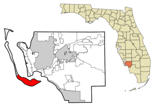
mapsize = 250x200px
map_caption = Location in Lee County and the state ofFlorida
subdivision_type = Country
subdivision_name = flag|United States
subdivision_type1 = State
subdivision_name1 = flag|Florida
subdivision_type2 = County
subdivision_name2 = noflag|Lee
government_footnotes =
government_type =Council-Manager
leader_title = Mayor
leader_name = Mick Denham
leader_title1 = City Manager
leader_name1 = Judie Zimomra
established_title = Settled
established_date = 1884
established_title2 =
established_date2 =
established_title3 = Incorporated (city)
established_date3 = 1974
area_magnitude =
unit_pref = Imperial
area_footnotes = cite web |url=http://factfinder.census.gov/servlet/GCTTable?_bm=y&-geo_id=04000US12&-_box_head_nbr=GCT-PH1&-ds_name=DEC_2000_SF1_U&-format=ST-7 |title=Florida by Place. Population, Housing, Area, and Density: 2000 |publisher-US Census Bureau |accessdate=2007-07-21]
area_total_sq_mi = 33.16
area_land_sq_mi = 17.21
area_water_sq_mi = 15.96
area_water_percent = 48.13
area_metro_sq_mi =
population_as_of =1 July 2006
population_footnotes = cite web |url=http://www.census.gov/popest/cities/tables/SUB-EST2006-04-12.xls |title=Annual Estimates of the population for the Incorporated Places of Florida |publisher=US Census Bureau |accessdate=2007-11-20 |format=XLS]
population_note = Census Bureau estimate
population_total = 6066
population_density_sq_mi = 182.7
population_metro =
population_density_metro_sq_mi =
timezone = Eastern (EST)
utc_offset = -5
timezone_DST = EDT
utc_offset_DST = -4
latd = 26 |latm = 26 |lats = 23 |latNS = N
longd = 82 |longm = 4 |longs = 50 |longEW = W
elevation_footnotes =
elevation_ft = 3
postal_code_type =ZIP code
postal_code = 33957
area_code = 239
blank_name = FIPS code
blank_info = 12-63700GR|2
blank1_name = GNIS feature ID
blank1_info = 0290637GR|3
website = http://www.mysanibel.com
footnotes =Sanibel is a
city in Lee County,Florida ,United States , onSanibel Island . As of 2008, the estimated population is 6,374. [ [http://www.news-press.com/apps/pbcs.dll/article?AID=/20080822/NEWS01/808220395/1075] ]The main town is at the eastern end of the island, while the community of Santiva (a
portmanteau of Sanibel and Captiva) is at the northwestern end. The city was formed in 1974 as a direct result of the main causeway being built in 1963 to replace theferry , and the rampantconstruction and development that occurred afterward. Developers sued over the new restrictions, but the city and citizens prevailed in their quest to protect the island. The only buildings above two to three stories now on thebarrier island were built during that period.The city is on Sanibel Island on the Gulf coast of
Southwest Florida , and is linked to the mainland by theSanibel Causeway . A shortbridge overBlind Pass links Sanibel to the unincorporated town of Captiva onCaptiva Island . More than half of the two islands is preserved in its natural state as wildlife refuges. You can drive, walk, bike, or kayak through theJ. N. "Ding" Darling National Wildlife Refuge . [http://www.fws.gov/dingdarling/] The island's most famous landmark, the Sanibel Lighthouse, is located at the eastern end of the island, adjacent to the fishing pier. The main thoroughfare, Periwinkle Way, is where the majority of stores and restaurants are located, while the Gulf Drives (East, Middle and West) play host to most of the accommodations.The Sanibel-Captiva Conservation Foundation, a not-for-profit organization, has also been a key player in helping to curb uncontrolled commercial growth and development on the island. Since 1967, SCCF has been dedicated to the preservation of natural resources on and around Sanibel and Captiva and has led efforts to acquire and preserve environmentally sensitive land on the islands including critical wildlife habitats, rare and unique subtropical plant communities, tidal wetlands, and freshwater wetlands along the Sanibel River.
The most serious
hurricane damage in 44 years (sinceHurricane Donna in 1960) occurred in August 2004 whenHurricane Charley struck to the north. Thanks to the city's very strictbuilding code s, very fewbuilding s were seriously damaged, and none were destroyed. Residents who left before theAugust 13 storm were not allowed back by the citygovernment untilAugust 18 , due to hundreds of downed non-nativeAustralian pine tree s and power lines, and the lack of potable water andsanitary sewer . A temporary city hall for Sanibel was set up on themainland in a Fort Myershotel , untilutilities andtransport could be restored to the island.A new three-part causeway bridge to Sanibel was completed during the Summer of 2007, and the high-span section replaced the original drawbridge.
The city's most well-known resident is former
CIA DirectorPorter Goss , who spearheaded the island's incorporation, became its first mayor, and represented the area in Congress from 1989 until his appointment as CIA Director in 2004.Geography
Sanibel is located at coor dms|26|26|23|N|82|4|50|W|city (26.439608, -82.080456)GR|1. According to the
United States Census Bureau , the city has a total area of convert|33.16|sqmi|km2|1. convert|17.21|sqmi|km2|1 of it is land and convert|15.96|sqmi|km2|1 of it (48.13%) is water.Demographics
As of the
census GR|2 of 2000, there were 6,064 people, 3,049 households, and 2,125 families residing in the city. Thepopulation density was 352.4/mi² (136.0/km²). There were 7,075 housing units at an average density of 411.2/mi² (158.7/km²). The racial makeup of the city was 97.99% White, 0.94% African American, 0.08% Native American, 0.33% Asian, 0.05% Pacific Islander, 0.12% from other races, and 0.49% from two or more races. Hispanic or Latino of any race were 1.39% of the population.There were 3,049 households out of which 10.7% had children under the age of 18 living with them, 65.3% were married couples living together, 3.2% had a female householder with no husband present, and 30.3% were non-families. 25.9% of all households were made up of individuals and 14.7% had someone living alone who was 65 years of age or older. The average household size was 1.99 and the average family size was 2.33.
In the city the population was spread out with 10.1% under the age of 18, 1.7% from 18 to 24, 12.4% from 25 to 44, 35.8% from 45 to 64, and 40.0% who were 65 years of age or older. The median age was 60 years. For every 100 females there were 90.6 males. For every 100 females age 18 and over, there were 88.9 males.
The median income for a household in the city was $79,044, and the median income for a family was $92,455. Males had a median income of $40,641 versus $27,481 for females. The
per capita income for the city was $66,912. About 2.0% of families and 3.2% of the population were below thepoverty line , including 2.8% of those under age 18 and 1.5% of those age 65 or over.See also
*
Bailey-Matthews Shell Museum References
External links
* [http://www.mysanibel.com City of Sanibel] official site

Wikimedia Foundation. 2010.