- Matlacha, Florida
-
Matlacha, Florida — CDP — Location in Lee County and the state of Florida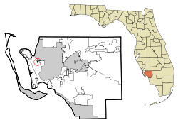
Coordinates: 26°37′49″N 82°4′24″W / 26.63028°N 82.07333°WCoordinates: 26°37′49″N 82°4′24″W / 26.63028°N 82.07333°W Country  United States
State  Florida
County Lee Area – Total 0.2 sq mi (0.4 km2) – Land 0.2 sq mi (0.4 km2) – Water 0 sq mi (0 km2) Elevation 0 ft (0 m) Population (2000) – Total 735 – Density 3,675/sq mi (1,837.5/km2) Time zone Eastern (EST) (UTC-5) – Summer (DST) EDT (UTC-4) ZIP code 33993 Area code(s) 239 FIPS code 12-43475[1] GNIS feature ID 0286522[2] Matlacha (pronounced "MAT-la-shay") is a census-designated place (CDP) in Lee County, Florida, United States. As of the 2000 census, the CDP had a total population of 735. It is part of the Cape Coral–Fort Myers Metropolitan Statistical Area. The community's name comes from a Caloosa word meaning "water to the chin."
Matlacha is one of five communities on Pine Island, although technically, it is located on a smaller island in Matlacha Pass, east of Pine Island. It is an "Old Florida" fishing village home to many brightly-colored art galleries, island boutiques, seafood restaurants, and traditional Florida cottages.[3]
Contents
Geography
Matlacha is located at 26°37′49″N 82°4′24″W / 26.63028°N 82.07333°W (26.630339, -82.073412)[4].
According to the United States Census Bureau, the CDP has a total area of 0.2 square miles (0.52 km2), all of it land.
Demographics
As of the census[1] of 2000, there were 735 people, 409 households, and 213 families residing in the CDP. The population density was 4,878.7 people per square mile (1,891.9/km²). There were 579 housing units at an average density of 3,843.3/sq mi (1,490.4/km²). The racial makeup of the CDP was 98.23% White, 0.27% Native American, 0.27% Asian, 0.68% from other races, and 0.54% from two or more races. Hispanic or Latino of any race were 1.36% of the population.
There were 409 households out of which 6.4% had children under the age of 18 living with them, 46.9% were married couples living together, 3.9% had a female householder with no husband present, and 47.7% were non-families. 39.4% of all households were made up of individuals and 19.3% had someone living alone who was 65 years of age or older. The average household size was 1.80 and the average family size was 2.33.
In the CDP the population was spread out with 7.3% under the age of 18, 2.4% from 18 to 24, 17.4% from 25 to 44, 34.7% from 45 to 64, and 38.1% who were 65 years of age or older. The median age was 58 years. For every 100 females there were 105.9 males. For every 100 females age 18 and over, there were 106.4 males.
The median income for a household in the CDP was $36,417, and the median income for a family was $50,000. Males had a median income of $28,056 versus $28,750 for females. The per capita income for the CDP was $24,371. About 7.4% of families and 9.2% of the population were below the poverty line, including 23.9% of those under age 18 and 2.8% of those age 65 or over.
References
- ^ a b "American FactFinder". United States Census Bureau. http://factfinder.census.gov. Retrieved 2008-01-31.
- ^ "US Board on Geographic Names". United States Geological Survey. 2007-10-25. http://geonames.usgs.gov. Retrieved 2008-01-31.
- ^ Tedd C. Lincoln (2005-09-19). "Discover Pine Island". http://www.pineislandfl.com/. Retrieved 29 December 2008.
- ^ "US Gazetteer files: 2010, 2000, and 1990". United States Census Bureau. 2011-02-12. http://www.census.gov/geo/www/gazetteer/gazette.html. Retrieved 2011-04-23.
External links
Municipalities and communities of Lee County, Florida Cities 
Town CDPs Alva | Bokeelia | Buckingham | Burnt Store Marina | Captiva | Charleston Park | Cypress Lake | Estero | Fort Myers Shores | Gateway | Harlem Heights | Iona | Lehigh Acres | Lochmoor Waterway Estates | Matlacha | Matlacha Isles-Matlacha Shores | McGregor | North Fort Myers | Olga | Page Park | Palmona Park | Pine Island Center | Pine Manor | Pineland | Punta Rassa | San Carlos Park | St. James City | Suncoast Estates | Three Oaks | Tice | Villas | Whiskey Creek
Unincorporated
communityCategories:- Census-designated places in Lee County, Florida


Wikimedia Foundation. 2010.