- Clay County, Florida
-
Clay County, Florida 
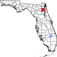
Location in the state of Florida
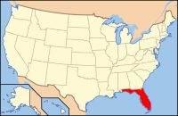
Florida's location in the U.S.Founded December 31, 1858 Seat Green Cove Springs Area
- Total
- Land
- Water
643.69 sq mi (1,667 km²)
601.11 sq mi (1,557 km²)
42.59 sq mi (110 km²), 6.62%Population
- (2010)
- Density
190,865
317/sq mi (122.58/km²)Website www.claycountygov.com Clay County is a county located in the U.S. state of Florida. As of 2010, the population was 190,895. Its county seat is Green Cove Springs, Florida[1]. Clay County is part of the Greater Jacksonville Metropolitan area.
Contents
History
Clay County was created on December 31, 1858, from a section of Duval County. Its name is in honor of Henry Clay, a famous American statesman, member of the United States Senate from Kentucky, and United States Secretary of State in the 19th century.
Clay County was once a popular destination for tourists visiting from the northern states. The therapeutic, warm springs and mild climate were major draws for visitors. Steamboats brought them to various hotels in Green Cove Springs - the St. Elmo, Clarendon and the Oakland. President Grover Cleveland was the most prominent of such tourists; he had spring water shipped to the White House. Clay County's popularity among tourists peaked during the last three decades of the 19th century. It was later eclipsed by Henry Flagler's extension of the Florida East Coast Railway to points south such as Palm Beach and Miami.
The military has also played an important role in Clay County history. In 1939, Camp Blanding opened on Kingsley Lake in central Clay County. The Florida National Guard developed this 28,000 acres (110 km2) complex. During World War II, it trained over 90,000 troops and became the fourth largest 'city' in the state. In Green Cove Springs, Lee Field was a flight training center. After World War II, Lee Field became a base for the mothball fleet. Although Lee Field closed in the early 1960s, Camp Blanding continues to operate today. Clay County is also a popular choice of residence for military personnel who are stationed on bases in nearby Duval County (NAS Jacksonville, NS Mayport).
Geography
According to the 2000 census, the county has a total area of 643.69 square miles (1,667.1 km2), of which 601.11 square miles (1,556.9 km2) (or 93.39%) is land and 42.59 square miles (110.3 km2) (or 6.62%) is water.[2]
Adjacent counties
- Duval County, Florida - north
- St. Johns County, Florida - east
- Putnam County, Florida - south
- Bradford County, Florida - west
- Baker County, Florida - northwest
Demographics
Historical populations Census Pop. %± 1860 1,914 — 1870 2,098 9.6% 1880 2,838 35.3% 1890 5,154 81.6% 1900 5,635 9.3% 1910 6,116 8.5% 1920 5,621 −8.1% 1930 6,859 22.0% 1940 6,468 −5.7% 1950 14,323 121.4% 1960 19,535 36.4% 1970 32,059 64.1% 1980 67,052 109.2% 1990 105,986 58.1% 2000 140,814 32.9% 2010 190,865 35.5% [3][4][5] As of the census[6] of 2010, there were 190,865 people, 65,356 households, and 39,390 families residing in the county. The population density was 234 people per square mile (90/km²). There were 73,208 housing units at an average density of 89 per square mile (35/km²). The racial makeup of the county was 81.8% White, 9.9% Black or African American, 0.5% Native American, 2.9% Asian, 0.1% Pacific Islander, 1.1% from other races, and 2.9% from two or more races. 7.7% of the population were Hispanic or Latino, with Puerto Ricans being the majority of the population.
There were 50,243 households out of which 39.60% had children under the age of 18 living with them, 63.80% were married couples living together, 10.70% had a female householder with no husband present, and 21.60% were non-families. 16.90% of all households were made up of individuals and 5.50% had someone living alone who was 65 years of age or older. The average household size was 2.77 and the average family size was 3.11.
In the county the population was spread out with 28.00% under the age of 18, 7.90% from 18 to 24, 30.30% from 25 to 44, 24.00% from 45 to 64, and 9.80% who were 65 years of age or older. The median age was 36 years. For every 100 females there were 97.00 males. For every 100 females age 18 and over, there were 94.20 males.
The median income for a household in the county was $48,854, and the median income for a family was $53,814. Males had a median income of $36,683 versus $25,488 for females. The per capita income for the county was $20,868. About 5.10% of families and 6.80% of the population were below the poverty line, including 8.90% of those under age 18 and 7.40% of those age 65 or over.
According to the Florida Times-Union, in October 2004, there were 106,114 registered voters in Clay County.
Cities and towns
Incorporated municipalities
- City of Green Cove Springs
- Town of Keystone Heights
- Town of Orange Park
- Town of Penney Farms
Unincorporated Communities
- Lake Asbury
- Bellair-Meadowbrook Terrace
- Belmore
- Clay Hill
- Doctors Inlet
- Fleming Island
- Hibernia
- Lake Geneva
- Lakeside
- McRae
- Middleburg
- Oakleaf
- Virginia Village
Politics
Clay County is one of the most reliably Republican counties in the state during presidential elections outside of the Panhandle, although it often supports Conservative Democrats for local and state offices.
Presidential elections results [7] Year Republican Democratic Other 2008 70.9% 28.2% 0.9% 2004 76.2% 23.3% 0.5% 2000 72.8% 25.5% 1.7% 1996 64.5% 28.2% 7.4% 1992 58.0% 23.3% 18.7% 1988 76.7% 23.0% 0.3% Museums
- Clay County Historical and Railroad Museum, Green Cove Springs.
- Middleburg Historical Museum, Middleburg.
- Black Heritage Museum, Middleburg.
- Camp Blanding Museum, Camp Blanding.
See also
References
- ^ "Find a County". National Association of Counties. http://www.naco.org/Counties/Pages/FindACounty.aspx. Retrieved 2011-06-07.
- ^ "Census 2000 U.S. Gazetteer Files: Counties". United States Census. http://www.census.gov/tiger/tms/gazetteer/county2k.txt. Retrieved 2011-02-13.
- ^ http://www.census.gov/population/www/censusdata/cencounts/files/fl190090.txt
- ^ http://factfinder2.census.gov/faces/tableservices/jsf/pages/productview.xhtml?pid=DEC_10_PL_QTPL&prodType=table
- ^ http://mapserver.lib.virginia.edu/
- ^ "American FactFinder". United States Census Bureau. http://factfinder.census.gov. Retrieved 2008-01-31.
- ^ http://www.clayelections.com/ElectionHistory2008.html
External links
- Relocate in Clay Clay County Economic Development
- The Clay Today and The Clay County Crescent newspapers for Clay County, Florida are available in full-text with images in Florida Digital Newspaper Library
- Camp Blanding Museum
- Clay County Historical Society
- Clay County Government

Baker County Duval County 
Bradford County 
St. Johns County  Clay County, Florida

Putnam County Municipalities and communities of Clay County, Florida Cities Towns CDPs Unincorporated
communitiesFootnotes ‡This populated place also has portions in an adjacent county or counties
Categories:- Florida counties
- Clay County, Florida
- 1858 establishments in the United States
- Greater Jacksonville
- Charter counties in Florida
Wikimedia Foundation. 2010.

