- Cottondale, Florida
-
Cottondale, Florida — Town — Location in Jackson County and the state of Florida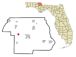
Coordinates: 30°47′49″N 85°22′34″W / 30.79694°N 85.37611°WCoordinates: 30°47′49″N 85°22′34″W / 30.79694°N 85.37611°W Country  United States
State  Florida
County Jackson Area - Total 1.7 sq mi (4.4 km2) - Land 1.5 sq mi (3.9 km2) - Water 0.2 sq mi (0.5 km2) Elevation 131 ft (40 m) Population (2000) - Total 869 - Density 511.2/sq mi (197.5/km2) Time zone Central (CST) (UTC-6) - Summer (DST) CDT (UTC-5) ZIP code 32431 Area code(s) 850 FIPS code 12-14850[1] GNIS feature ID 0280886[2] Cottondale is a town in Jackson County, Florida, United States. The population was 869 at the 2000 census. As of 2004, the population recorded by the U.S. Census Bureau is 865 [1].
Geography
Cottondale is located at 30°47′49″N 85°22′34″W / 30.79694°N 85.37611°W (30.796810, -85.376031)[3].
According to the United States Census Bureau, the town has a total area of 1.7 square miles (4.4 km2). 1.5 square miles (3.9 km2) of it is land and 0.2 square miles (0.52 km2) of it (10.65%) is water.
Demographics
As of the census[1] of 2000, there were 869 people, 376 households, and 239 families residing in the town. The population density was 573.2 inhabitants per square mile (220.7/km²). There were 445 housing units at an average density of 293.5 per square mile (113.0/km²). The racial makeup of the town was 76.41% White, 18.64% African American, 0.35% Native American, 0.58% Asian, 0.58% from other races, and 3.45% from two or more races. Hispanic or Latino of any race were 4.14% of the population.
There were 376 households out of which 31.1% had children under the age of 18 living with them, 41.0% were married couples living together, 19.4% had a female householder with no husband present, and 36.2% were non-families. 34.6% of all households were made up of individuals and 17.3% had someone living alone who was 65 years of age or older. The average household size was 2.31 and the average family size was 2.94.
In the town the population was spread out with 27.7% under the age of 18, 9.8% from 18 to 24, 24.3% from 25 to 44, 22.8% from 45 to 64, and 15.4% who were 65 years of age or older. The median age was 36 years. For every 100 females there were 83.7 males. For every 100 females age 18 and over, there were 78.9 males.
The median income for a household in the town was $20,509, and the median income for a family was $26,667. Males had a median income of $24,545 versus $18,571 for females. The per capita income for the town was $11,266. About 24.8% of families and 27.4% of the population were below the poverty line, including 34.3% of those under age 18 and 23.6% of those age 65 or over. This town is known as a "speed trap" with tickets averaging $180 (this is due to a high flow of out of state motorists that do not obey posted speed limits.)
References
- ^ a b "American FactFinder". United States Census Bureau. http://factfinder.census.gov. Retrieved 2008-01-31.
- ^ "US Board on Geographic Names". United States Geological Survey. 2007-10-25. http://geonames.usgs.gov. Retrieved 2008-01-31.
- ^ "US Gazetteer files: 2010, 2000, and 1990". United States Census Bureau. 2011-02-12. http://www.census.gov/geo/www/gazetteer/gazette.html. Retrieved 2011-04-23.
Municipalities and communities of Jackson County, Florida County seat: Marianna Cities 
Towns Alford | Bascom | Campbellton | Cottondale | Grand Ridge | Greenwood | Malone | Sneads
Unincorporated
communitiesCategories:- Towns in Jackson County, Florida


Wikimedia Foundation. 2010.