- Kendall, Florida
Infobox Settlement
official_name = Kendall, Florida
other_name =
native_name =
nickname =
settlement_type = CDP
motto =
imagesize = 250x200px
image_caption = Skyline ofDadeland , Kendall'scentral business district
flag_size =
image_
seal_size =
image_shield =
shield_size =
image_blank_emblem =
blank_emblem_type =
blank_emblem_size =
flag_size =
image_
seal_size =
image_shield =
shield_size =
image_blank_emblem =
blank_emblem_type =
blank_emblem_size =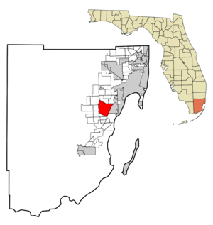
mapsize = 250x200px
map_caption = Location in Miami-Dade County and the state ofFlorida 
mapsize1 = 250x200px
map_caption1 = U.S. Census Bureau map of Kendal CDP showing boundaries
image_dot_
dot_mapsize =
dot_map_caption =
dot_x =
dot_y =
pushpin_
pushpin_label_position =
pushpin_map_caption =
pushpin_mapsize =
subdivision_type = Country
subdivision_name = flag|United States
subdivision_type1 = State
subdivision_name1 = flag|Florida
subdivision_type2 = County
subdivision_name2 = noflag|Miami-Dade
subdivision_type3 =
subdivision_name3 =
subdivision_type4 =
subdivision_name4 =
government_footnotes =
government_type =
leader_title =
leader_name =
leader_title1 =
leader_name1 =
leader_title2 =
leader_name2 =
leader_title3 =
leader_name3 =
leader_title4 =
leader_name4 =
established_title =
established_date =
established_title2 =
established_date2 =
established_title3 =
established_date3 =
area_magnitude =
unit_pref = Imperial
area_footnotes =
area_total_km2 = 42.4
area_land_km2 = 41.8
area_water_km2 = 0.6
area_total_sq_mi = 16.3
area_land_sq_mi = 16.1
area_water_sq_mi = 0.2
area_water_percent =
area_urban_km2 =
area_urban_sq_mi =
area_metro_km2 =
area_metro_sq_mi =
area_blank1_title =
area_blank1_km2 =
area_blank1_sq_mi =
population_as_of = 2000
population_footnotes =
population_note =
population_total = 75226
population_density_km2 = 1774.2
population_density_sq_mi = 4615.1
population_metro =
population_density_metro_km2 =
population_density_metro_sq_mi =
population_urban =
population_density_urban_km2 =
population_density_urban_sq_mi =
population_blank1_title =
population_blank1 =
population_density_blank1_km2 =
population_density_blank1_sq_mi =
timezone = Eastern (EST)
utc_offset = -5
timezone_DST = EDT
utc_offset_DST = -4
latd = 25 |latm = 40 |lats = 0 |latNS = N
longd = 80 |longm = 21 |longs = 24 |longEW = W
elevation_footnotes =
elevation_m = 4
elevation_ft = 13
area_code = 305,786
blank_name = FIPS code
blank_info = 12-36100GR|2
blank1_name = GNIS feature ID
blank1_info = 0285050GR|3
website =
footnotes =Kendall is a
census-designated place and an unincorporated suburban community in Miami-Dade County,Florida , southwest of Miami. As of the 2000 census, the area had a total population of 75,226. The Kendall area is home to one of Miami'sgeneral aviation airports, theKendall-Tamiami Executive Airport .The Kendall area is also home to one of the largest
Colombian American populations in the State ofFlorida . Over 11,000 Colombians live in the area, mostly concentrated in the western fringes (West of theFlorida Turnpike ), in the census-designated places of The Hammocks, Country Walk, The Crossings, Kendale Lakes, Kendall West and Three Lakes, where they make up over 60 percent of the population in certain neighborhoods (West Kendall , Royal Palms on 134th Ave. and the Hammocks).History
Much of what is now Kendall was purchased from the State of Florida in 1883 by the Florida Land and Mortgage Company. It is named after Henry John Broughton Kendall, a director of the company who moved to the area in the 1900s to manage the company's land. As the land was not open to homesteading, development was slow well into the 20th century. A post office opened in 1914, and the first school opened in 1929. After the end of the land boom in 1926, some residents left. Two
Seminole camps were in the Kendall area, and Seminoles continued to live there into the 1940s. [Taylor, Jean. (1986) "Villages of South Dade". St. Petersburg, Florida: Byron Kennedy and Company. ISBN 0-041072-12-6 Pp. 39-49.]Geography
Kendall is located at coor dms|25|40|0|N|80|21|24|W|city (25.666781, -80.356533)GR|1.
According to the
United States Census Bureau , the Kendall region has an approximate total area of 42.3km² (16.3 mi²). 41.8 km² (16.1 mi²) of it is land and 0.6 km² (0.2 mi²) of it (1.35%) is water.Demographics
As of the
census GR|2 of 2000, there were 75,226 people, 28,482 households, and 19,652 families residing in the CDP. Thepopulation density was 1,800.7/km² (4,664.8/mi²). There were 29,669 housing units at an average density of 710.2/km² (1,839.8/mi²). The racial makeup of the CDP was 86.48% White (of which 41.6% were Non-Hispanic Whites,) [cite web |url=http://www.muninetguide.com/states/florida/municipality/Kendall.php |title=Demographics of Kendall, Florida |publisher=MuniNetGuide.com |accessdate=2007-11-06] 4.45% African American, 0.14% Native American, 2.99% Asian, 0.03% Pacific Islander, 2.81% from other races, and 3.10% from two or more races. Hispanic or Latino of any race were 49.91% of the population.There were 28,482 households out of which 33.4% had children under the age of 18 living with them, 51.0% were married couples living together, 13.8% had a female householder with no husband present, and 31.0% were non-families. 24.4% of all households were made up of individuals and 7.3% had someone living alone who was 65 years of age or older. The average household size was 2.61 and the average family size was 3.14.
In the region the population was spread out with 23.3% under the age of 18, 8.6% from 18 to 24, 31.8% from 25 to 44, 24.9% from 45 to 64, and 11.5% who were 65 years of age or older. The median age was 37 years. For every 100 females there were 88.5 males. For every 100 females age 18 and over, there were 83.4 males.
The median income for a household in the area was $51,330, and the median income for a family was $61,241. Males had a median income of $42,875 versus $31,416 for females. The
per capita income for the area was $27,914. About 5.7% of families and 8.6% of the population were below thepoverty line , including 8.0% of those under age 18 and 10.9% of those age 65 or over.As of 2000, speakers of Spanish as a
first language accounted for 52.46% of all residents, while English speakers comprised 40.38%, Portuguese was 1.49%, French at 1.12%, and French Creole made up 0.95% of the population. [cite web |url=http://www.mla.org/map_data_results&state_id=12&county_id=&mode=&zip=&place_id=36100&cty_id=&ll=&a=&ea=&order=r |title=MLA Data Center Results of Kendall, FL |publisher=Modern Language Association |accessdate=2007-11-06]As of 2000, Kendall had the twenty-first highest percentage of
Cuba n residents in the US, with 21.31% of the populace. [cite web |url=http://www.epodunk.com/ancestry/Cuban.html |title=Ancestry Map of Cuban Communities |publisher=Epodunk.com |accessdate=2007-11-06] It had the twenty-fifth highest percentage ofColombia n residents in the US, at 4.56% of the population, [cite web |url=http://www.epodunk.com/ancestry/Colombian.html |title=Ancestry Map of Colombian Communities |publisher=Epodunk.com |accessdate=2007-11-06] and the sixteenth highest percentage ofNicaragua n residents in the US, at 2.48% of its population. [cite web |url=http://www.epodunk.com/ancestry/Nicaraguan.html |title=Ancestry Map of Nicaraguan Communities |publisher=Epodunk.com |accessdate=2007-11-06] It also had the twenty-fifth mostPeru vians in the US, at 2.01% (tied withCarteret, New Jersey ,) [cite web |url=http://www.epodunk.com/ancestry/Peruvian.html |title=Ancestry Map of Peruvian Communities |publisher=Epodunk.com |accessdate=2007-11-06] while it had the tenth highest percentage ofVenezuela n residents in the US, at 1.47% of the population. [cite web |url=http://www.epodunk.com/ancestry/Venezuelan.html |title=Ancestry Map of Venezuelan Communities |publisher=Epodunk.com |accessdate=2007-11-06] As a result of the city's large French community, the French American School of Miami is located in Kendall. It is the only French American school in the southern United States.Fact|date=January 2008Media
West Kendall is served by the Miami market for local and . Kendall has its own newspaper, "The Kendall Gazette", which is published twice monthly and is part of
Miami's Community Newspapers , the "Voice of the Community".Notable Residents
*
Janet Reno
*OJ Simpson moved from Los Angeles to Kendall in the 1990s .Education
Primary and secondary schools
Public schools
The first public school in Kendall was Kendall School, now renamed Kenwood K-8 Center. Kenwood is the site of the Kenwoods Hammock, a native forest planting which has become a world-renowned stop for bird watchers.
Miami-Dade County Public Schools serves Kendall.Elementary schools
*
Bent Tree Elementary School
*Calusa Elementary School
*Claude Pepper Elementary
*Dante B. Fascell
*Devon Aire Elementary
*Gilbert L. Porter Elementary
*Kendale Lakes Elementary
*Kendale Elementary
*Kenwood Elementary
*Leewood Elementary School
*Oliver Hoover Elementary
*Sunset Park Elementary School
*Westminster Christian School
*Westwood Christian School
*Winston Park K-8 Center High schools
*
G. Holmes Braddock High School
*Felix Varela High School
*John A. Ferguson High School
*Miami Killian High School
*Miami Sunset High School Private schools
*
Florida Christian School
*Gateway Christian School
*St. Kevin Catholic School
*Westwood Christian School Colleges and universities
*
Miami-Dade College (Kendall Campus)
*Nova Southeastern University (Miami Student Educational Center)
*Kaplan University (Support center)References
External links
Wikimedia Foundation. 2010.