- Merrimack County, New Hampshire
-
Merrimack County, New Hampshire 
Location in the state of New Hampshire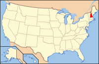
New Hampshire's location in the U.S.Founded 1823 Seat Concord Largest city Concord Area
- Total
- Land
- Water
956.60 sq mi (2,478 km²)
934.43 sq mi (2,420 km²)
22.17 sq mi (57 km²), 2.31%Population
- (2010)
- Density
146,445
158/sq mi (61/km²)Website www.merrimackcounty.net/ Merrimack County is a county in the U.S. state of New Hampshire. In 2010 the population was 146,445.[1] Its county seat is Concord, the state capital. The center of population of New Hampshire is located in Merrimack County, in the town of Pembroke.[2]
Merrimack County was organized at Concord in 1823, and is named for the Merrimack River.[3] It was formed by removing towns from northern Hillsborough and Rockingham counties. In 1841 its original scope was somewhat reduced by the creation of Belknap County.[4]
Contents
Geography
According to the U.S. Census Bureau, the county has a total area of 956 square miles (2,476 km2), of which 934 sq mi (2,419 km2) is land and 22 sq mi (57 km2) (2.31%) is water.
Adjacent counties
- Belknap County (northeast)
- Strafford County (east)
- Rockingham County (southeast)
- Hillsborough County (south)
- Sullivan County (west)
- Grafton County (northwest)

Grafton County Belknap County Sullivan County 
Strafford County  Merrimack County, New Hampshire

Hillsborough County Rockingham County National protected area
- John Hay National Wildlife Refuge
Demographics
Historical populations Census Pop. %± 1830 34,614 — 1840 36,253 4.7% 1850 40,337 11.3% 1860 41,408 2.7% 1870 42,151 1.8% 1880 46,300 9.8% 1890 49,435 6.8% 1900 52,430 6.1% 1910 53,335 1.7% 1920 51,770 −2.9% 1930 56,152 8.5% 1940 60,710 8.1% 1950 63,022 3.8% 1960 67,785 7.6% 1970 80,925 19.4% 1980 98,302 21.5% 1990 120,005 22.1% 2000 136,225 13.5% 2010 146,445 7.5% [5][6][7] As of the census[8] of 2000, there were 136,225 people, 51,843 households, and 35,460 families residing in the county. The population density was 146 people per square mile (56/km²). There were 56,244 housing units at an average density of 60 per square mile (23/km²). The racial makeup of the county was 97.08% White, 0.54% Black or African American, 0.23% Native American, 0.86% Asian, 0.02% Pacific Islander, 0.23% from other races, and 1.04% from two or more races. 1.00% of the population were Hispanic or Latino of any race. 16.5% were of English, 13.4% Irish, 12.7% French, 11.0% French Canadian, 8.4% American, 6.4% German and 6.0% Italian ancestry according to Census 2000. 94.2% spoke English, 2.9% French and 1.1% Spanish as their first language.
There were 51,843 households out of which 33.90% had children under the age of 18 living with them, 54.90% were married couples living together, 9.80% had a female householder with no husband present, and 31.60% were non-families. 24.60% of all households were made up of individuals and 9.00% had someone living alone who was 65 years of age or older. The average household size was 2.51 and the average family size was 3.00.
In the county the population was spread out with 24.90% under the age of 18, 8.10% from 18 to 24, 30.60% from 25 to 44, 24.00% from 45 to 64, and 12.40% who were 65 years of age or older. The median age was 38 years. For every 100 females there were 97.00 males. For every 100 females age 18 and over, there were 93.70 males.
The median income for a household in the county was $48,522, and the median income for a family was $56,842. Males had a median income of $37,722 versus $27,207 for females. The per capita income for the county was $23,208. About 4.10% of families and 5.90% of the population were below the poverty line, including 6.60% of those under age 18 and 5.70% of those age 65 or over.
Politics
Presidential election results[9] Year Democrat Republican 2008 56.3% 45,078 42.5% 34,010 2004 52.2% 39,975 47.1% 36,060 2000 48.1% 30,622 47.1% 30,028 Cities, towns, and villages
- Allenstown
- Andover
- Boscawen
- Bow
- Bradford
- Canterbury
- Chichester
- Concord
- Penacook (a village of Concord)
- Danbury
- Dunbarton
- Epsom
- Franklin
- Henniker
- Hill
- Hooksett
- South Hooksett (a village of Hooksett)
- Hopkinton
- Contoocook (a village of Hopkinton)
- Loudon
- New London
- Elkins (a village of New London)
- Newbury
- Northfield
- Tilton-Northfield, New Hampshire, a census-designated place spanning the centers of both towns
- Pembroke
- Suncook (a village of Pembroke)
- Pittsfield
- Salisbury
- Sutton
- Warner
- Webster
- Wilmot
* Villages are named settlements that have no separate corporate existence from the towns they are in.
See also
References
- ^ United States Census Bureau, American FactFinder, 2010 Census figures. Retrieved March 23, 2011.
- ^ http://www.census.gov/geo/www/cenpop/statecenters.txt
- ^ http://home.att.net/~local_history/NH-Merrimack_Co.htm
- ^ http://home.att.net/~local_history/NH-Belknap_Co.htm
- ^ http://www.census.gov/population/www/censusdata/cencounts/files/nh190090.txt
- ^ http://factfinder2.census.gov/faces/tableservices/jsf/pages/productview.xhtml?pid=DEC_10_PL_QTPL&prodType=table
- ^ http://mapserver.lib.virginia.edu/
- ^ "American FactFinder". United States Census Bureau. http://factfinder.census.gov. Retrieved 2008-01-31.
- ^ "Dave Leip's Atlas of U.S. Presidential Elections". http://uselectionatlas.org/RESULTS/. Retrieved 2011-06-11.
External links
Municipalities and communities of Merrimack County, New Hampshire Cities 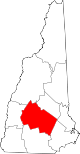
Towns Allenstown | Andover | Boscawen | Bow | Bradford | Canterbury | Chichester | Danbury | Dunbarton | Epsom | Henniker | Hill | Hooksett | Hopkinton | Loudon | New London | Newbury | Northfield | Pembroke | Pittsfield | Salisbury | Sutton | Warner | Webster | Wilmot
Villages Blodgett Landing | Contoocook | East Andover | Elkins | Penacook | South Hooksett | Suncook | Tilton-Northfield‡
Footnotes ‡This populated place also has portions in an adjacent county or counties
Categories:- New Hampshire counties
- Merrimack County, New Hampshire


Wikimedia Foundation. 2010.