- Sandwich, New Hampshire
Infobox Settlement
official_name = Sandwich, New Hampshire
nickname =
motto =
image_
imagesize =
image_caption =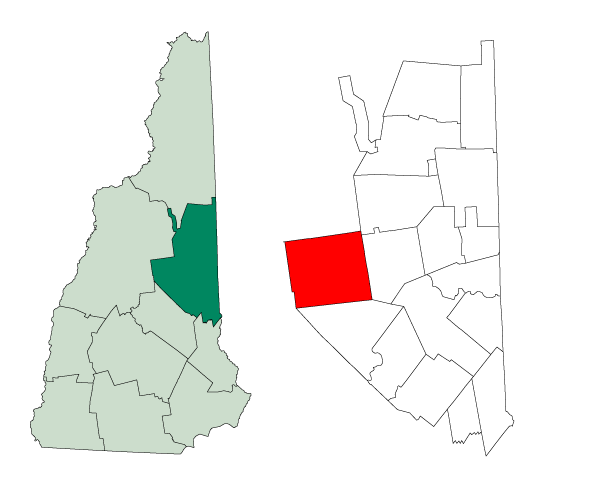
mapsize = 250px
map_caption = Location in Carroll County,New Hampshire
settlement_type = Town
mapsize1 =
map_caption1 =
subdivision_type = Country
subdivision_name =United States
subdivision_type1 = State
subdivision_name1 =New Hampshire
subdivision_type2 = County
subdivision_name2 = Carroll
government_type =
leader_title =
leader_name =
established_title = Incorporated
established_date = 1763
area_magnitude = 1 E8
area_total_km2 = 223.7
area_total_sq_mi = 86.4
area_land_km2 = 222.0
area_land_sq_mi = 85.8
area_water_km2 = 1.8
area_water_sq_mi = 0.6
area_water_percent = 3.08
population_as_of = 2000
population_note =
population_total = 1286
population_density_km2 = 5.1
population_density_sq_mi = 14.0
timezone = Eastern
utc_offset = -5
timezone_DST = Eastern
utc_offset_DST = -4
latd = 43 |latm = 47 |lats = 27 |latNS = N
longd = 71 |longm = 24 |longs = 40 |longEW = W
elevation_m = 243
elevation_ft = 797
website = http://town.sandwich.nh.us
postal_code_type =ZIP code
postal_code = 03227
area_code = 603
blank_name = FIPS code
blank_info = 33-67780
blank1_name = GNIS feature ID
blank1_info = 0873717
footnotes =Sandwich is a town in Carroll County,
New Hampshire ,United States . The population was 1,286 at the 2000 census. Sandwich includes the villages of Center Sandwich and North Sandwich. Part of theWhite Mountain National Forest is in the north. Part ofSquam Lake is in the southwestern corner of the town.History
Chartered in 1763 by Colonial Governor
Benning Wentworth , the land was considered so inaccessible that the grant was enlarged, making Sandwich one of the largest towns in the state. It was named in honor of John Montagu, fourthEarl of Sandwich . The earl is said to be the inventor of thesandwich , requesting from his servant a thin slab of meat placed between two slices of bread, which he consumed while intent upon the gaming table.The earliest European settlers arrived in 1767. By 1830 Sandwich had grown to a population of 2700, which is higher than the current population. At this time the town contained farms, stores, mills, churches, schools, carpenters, blacksmiths, and wheelwrights.
By the end of the 1800s much of the population had left Sandwich to live in cities to the west. Sandwich began to be an attraction for visitors, summer residents, and artists which continues to this day. [ [http://www.discoversandwich.com Lamb, Janina, "Discover SANDWICH New Hampshire", The Sandwich Business Group] ]
The New Hampshire League of Arts & Crafts began in Sandwich in 1920, and continues today. Each fall the town hosts the
Sandwich Fair . There is acovered bridge in the east.Notable inhabitants
* Philip Simmons, author
Geography
According to the
United States Census Bureau , the town has a total area of convert|93.5|sqmi|km2, of which convert|90.6|sqmi|km2|abbr=on is land and convert|2.9|sqmi|km2|abbr=on is water, comprising 3.08% of the town. Sandwich is drained to the east by the Bearcamp and Cold rivers, to the northwest by theBeebe River , to the southwest bySquam Lake , and to the south by theRed Hill River . Mount Israel, elevation convert|2630|ft|m|sigfig=3 abovesea level , is at the center. Part of the Squam Mountains is in the west. Part of theSandwich Range is in the north, includingSandwich Mountain (also known as Sandwich Dome), the highest point in town at convert|3993|ft|m abovesea level .Demographics
As of the
census GR|2 of 2000, there were 1,286 people, 564 households, and 390 families residing in the town. Thepopulation density was 14.2 people per square mile (5.5/km²). There were 965 housing units at an average density of 10.7/sq mi (4.1/km²). The racial makeup of the town was 97.82% White, 0.62% African American, 0.31% Native American, 0.31% Asian, and 0.93% from two or more races. Hispanic or Latino of any race were 0.47% of the population.There were 564 households out of which 26.1% had children under the age of 18 living with them, 59.8% were married couples living together, 6.4% had a female householder with no husband present, and 30.7% were non-families. 26.8% of all households were made up of individuals and 13.7% had someone living alone who was 65 years of age or older. The average household size was 2.28 and the average family size was 2.72.
In the town the population was spread out with 22.0% under the age of 18, 3.3% from 18 to 24, 20.2% from 25 to 44, 30.6% from 45 to 64, and 24.0% who were 65 years of age or older. The median age was 47 years. For every 100 females there were 87.7 males. For every 100 females age 18 and over, there were 87.1 males.
The median income for a household in the town was $47,292, and the median income for a family was $55,417. Males had a median income of $35,060 versus $25,769 for females. The
per capita income for the town was $23,714. About 3.5% of families and 6.1% of the population were below thepoverty line , including 8.1% of those under age 18 and 5.3% of those age 65 or over.Education
* [http://www.interlakes.org/scs Sandwich Central School]
Sites of interest
* [http://www.sandwichhistorical.org/ Sandwich Historical Society Museum]
* [http://www.thesandwichfair.com/ Sandwich Fair]References
External links
* [http://town.sandwich.nh.us Town website]
* [http://www.nh.gov/nhes/elmi/htmlprofiles/sandwich.html New Hampshire Economic and Labor Market Information Bureau Profile]
Wikimedia Foundation. 2010.