- Columbia, New Hampshire
-
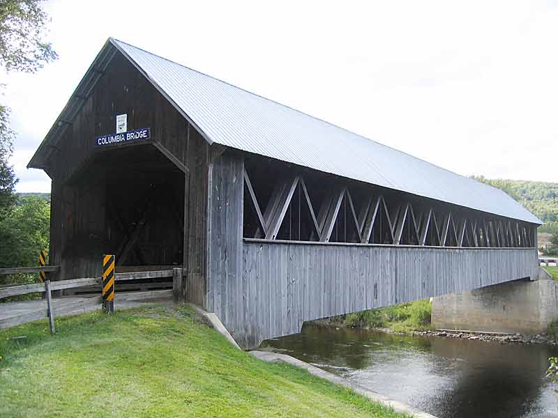
Columbia, New Hampshire — Town — Columbia Covered Bridge, built in 1912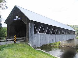 Location in Coos County, New Hampshire
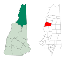
Coordinates: 44°52′40″N 71°30′51″W / 44.87778°N 71.51417°WCoordinates: 44°52′40″N 71°30′51″W / 44.87778°N 71.51417°W Country United States State New Hampshire County Coos Incorporated 1797 Government – Board of Selectmen Area – Total 60.6 sq mi (157.0 km2) – Land 60.3 sq mi (156.1 km2) – Water 0.3 sq mi (0.9 km2) 0.55% Elevation 1,024 ft (312 m) Population (2010) – Total 757 – Density 12.5/sq mi (4.8/km2) Time zone Eastern (UTC-5) – Summer (DST) Eastern (UTC-4) ZIP codes 03576, 03590 Area code(s) 603 FIPS code 33-13940 GNIS feature ID 0873568 Website http://www.columbianh.org/ Columbia is a town in Coos County, New Hampshire, United States. The population was 757 at the 2010 census.[1] It is part of the Berlin, NH–VT micropolitan statistical area.
Contents
History
The township was originally chartered in 1762 and named Preston, after Richard Graham, 1st Viscount Preston of Scotland. Settlers failed to meet the terms of the original grant, so the plantation was transferred in 1770 to grantees including Sir James Cockburn, 8th Baronet, after which it was named Cockburn Town, incorporated in 1797. In 1811, in the lead-up to the War of 1812, Governor John Langdon changed the name to Columbia.[2]
Although the surface is uneven and mountainous, the soil was of good quality. Maple sugar became an important product, and lumber was cut and transported on rafts down the Connecticut River to markets. By 1859, when the population was 762, Columbia had four sawmills, three gristmills, two clapboard machines, and a starch mill.[3]
Geography
According to the United States Census Bureau, the town has a total area of 60.6 square miles (157 km2), of which 60.3 square miles (156 km2) is land and 0.3 square miles (0.78 km2) is water, comprising 0.55% of the town.[4] It is drained by the east and west branches of Simms Stream. The highest point is the summit of Blue Mountain, at 3,720 feet (1,130 m) above sea level. Columbia lies fully within the Connecticut River watershed.[5]
The town is served by U.S. Route 3.
Demographics
As of the census[6] of 2000, there were 750 people, 300 households, and 218 families residing in the town. The population density was 12.3 people per square mile (4.8/km²). There were 449 housing units at an average density of 7.4 per square mile (2.8/km²). The racial makeup of the town was 97.60% White, 0.13% African American, 0.27% Native American, 0.27% Asian, and 1.73% from two or more races. Hispanic or Latino of any race were 0.67% of the population.
There were 300 households out of which 31.7% had children under the age of 18 living with them, 60.0% were married couples living together, 7.7% had a female householder with no husband present, and 27.3% were non-families. 21.3% of all households were made up of individuals and 8.0% had someone living alone who was 65 years of age or older. The average household size was 2.49 and the average family size was 2.82.
In the town the population was spread out with 24.8% under the age of 18, 4.4% from 18 to 24, 26.5% from 25 to 44, 29.1% from 45 to 64, and 15.2% who were 65 years of age or older. The median age was 42 years. For every 100 females there were 113.7 males. For every 100 females age 18 and over, there were 101.4 males.
The median income for a household in the town was $36,964, and the median income for a family was $42,143. Males had a median income of $27,604 versus $19,732 for females. The per capita income for the town was $16,859. About 4.0% of families and 7.3% of the population were below the poverty line, including 6.8% of those under age 18 and 10.1% of those age 65 or over.
See also
- Wallace Farm
References
- ^ United States Census Bureau, American FactFinder, 2010 Census figures. Retrieved March 23, 2011.
- ^ History of Columbia, Coos County, New Hampshire
- ^ Coolidge, Austin J.; John B. Mansfield (1859). A History and Description of New England. Boston, Massachusetts. pp. 448–449. http://books.google.com/books?id=OcoMAAAAYAAJ&lpg=PA9&dq=coolidge%20mansfield%20history%20description%20new%20england%201859&pg=PA448#v=onepage&q&f=false.
- ^ "Geographic Identifiers: 2010 Demographic Profile Data (G001) - Columbia town, New Hampshire". U.S. Census Bureau American Factfinder. http://factfinder2.census.gov. Retrieved November 8, 2011.
- ^ Foster, Debra H.; Batorfalvy, Tatianna N.; and Medalie, Laura (1995). Water Use in New Hampshire: An Activities Guide for Teachers. U.S. Department of the Interior and U.S. Geological Survey. http://nh.water.usgs.gov/Publications/nh.intro.html.
- ^ "American FactFinder". United States Census Bureau. http://factfinder.census.gov. Retrieved 2008-01-31.
External links
Municipalities and communities of Coös County, New Hampshire City 
Towns Carroll | Clarksville | Colebrook | Columbia | Dalton | Dummer | Errol | Gorham | Jefferson | Lancaster | Milan | Northumberland | Pittsburg | Randolph | Shelburne | Stark | Stewartstown | Stratford | Whitefield
Townships Atkinson and Gilmanton Academy Grant | Bean's Grant | Bean's Purchase | Cambridge | Chandler's Purchase | Crawford's Purchase | Cutt's Grant | Dix's Grant | Dixville | Erving's Location | Green's Grant | Hadley's Purchase | Kilkenny | Low and Burbank's Grant | Martin's Location | Millsfield | Odell | Pinkham's Grant | Sargent's Purchase | Second College Grant | Success | Thompson and Meserve's Purchase | Wentworth's Location
Villages Bretton Woods | Cascade | Dixville Notch | Groveton | Twin Mountain | West Stewartstown
Categories:- Towns in Coos County, New Hampshire
- Berlin micropolitan area
- Populated places on the Connecticut River


Wikimedia Foundation. 2010.