- Northumberland, New Hampshire
-
Northumberland, New Hampshire — Town — Covered bridge over the Upper Ammonoosuc River Location in Coos County, New Hampshire
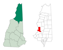
Coordinates: 44°33′48″N 71°33′31″W / 44.56333°N 71.55861°WCoordinates: 44°33′48″N 71°33′31″W / 44.56333°N 71.55861°W Country United States State New Hampshire County Coos Incorporated 1779 Government – Board of Selectmen Area – Total 36.5 sq mi (94.5 km2) – Land 35.7 sq mi (92.5 km2) – Water 0.8 sq mi (2.0 km2) 2.13% Elevation 860 ft (262 m) Population (2010) – Total 2,288 – Density 62.7/sq mi (24.2/km2) Time zone Eastern (UTC-5) – Summer (DST) Eastern (UTC-4) ZIP codes 03582, 03583 Area code(s) 603 FIPS code 33-56100 GNIS feature ID 0873688 Northumberland is a town located in southwestern Coos County, New Hampshire, U.S., north of Lancaster. It is part of the Berlin, NH–VT micropolitan statistical area. As of the 2010 census, the town population was 2,288,[1] a large portion in the village of Groveton.
Contents
History
North of the mountain ridge known as Cape Horn, near the Connecticut River, are the remains of Fort Wentworth, built by the New Hampshire Militia in 1755 during the French and Indian War. The town was granted as Stonington in 1761 to John Hogg and others by Governor Benning Wentworth, and first settled in 1767 by Thomas Burnside and Daniel Spaulding. It was regranted by Governor John Wentworth in 1771 as Northumberland, the name derived from Northumberland in England. The town was incorporated November 16, 1779.[2]
Groveton is the northern terminus of a railroad track owned by the New Hampshire & Vermont Railroad, where it intersects the St. Lawrence & Atlantic Railroad. This was formerly the junction of the Grand Trunk Railway and the Boston, Concord & Montreal Railroad -- a major point of access for the northern White Mountains.[3]
The area was once known for its large corn and potato crop, starch mills, and manufacturing (leather, shoe pegs). More recently, the town economy centered on the lumber industry. That changed in 2007, however, when the Wausau Paper Mill closed, eliminating 300 jobs.[4]
Geography
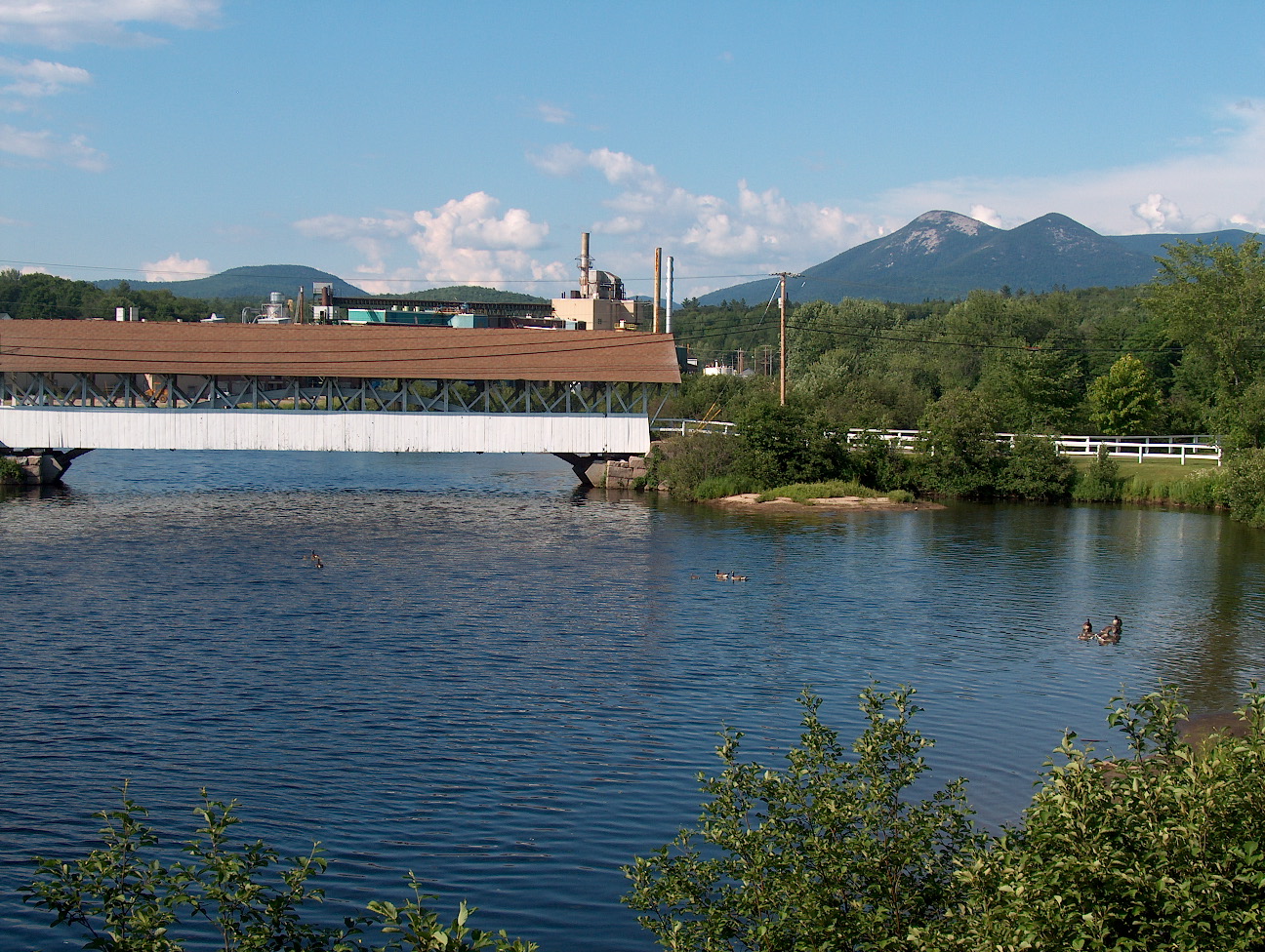
According to the United States Census Bureau, the town has a total area of 36.5 square miles (95 km2), of which 35.7 square miles (92 km2) is land and 0.8 square miles (2.1 km2) is water, comprising 2.13% of the town.[5] The Connecticut River, which forms the New Hampshire–Vermont border, runs along the western edge of town. The Upper Ammonoosuc River runs through town in a southwesterly direction to the Connecticut and is crossed by a covered bridge at Groveton.
There are several mountains in town, including Morse Mountain (1,880 feet (570 m) above sea level), Cape Horn (2,040 ft (620 m)), Moore Mountain (1,522 ft (464 m)), and Spaulding Hill (1,220 ft (370 m)). The town's highest point is 2,860 ft (870 m) above sea level on a spur of the Pilot Range on the town's eastern boundary.
Cape Horn State Forest is located in the central portion of the town boundaries.
The nucleus of Northumberland (outside of Groveton) is arranged along US 3, which runs along the Connecticut River. Route 110 intersects US 3 in Northumberland and runs east toward adjacent Stark.
Demographics
As of the census[6] of 2000, there were 2,438 people, 989 households, and 666 families residing in the town. The population density was 67.4 people per square mile (26.0/km²). There were 1,112 housing units at an average density of 30.7 per square mile (11.9/km²). The racial makeup of the town was 98.44% White, 0.25% Native American, 0.33% Asian, and 0.98% from two or more races. Hispanic or Latino of any race were 0.53% of the population.
There were 989 households out of which 32.3% had children under the age of 18 living with them, 51.3% were married couples living together, 10.1% had a female householder with no husband present, and 32.6% were non-families. 26.7% of all households were made up of individuals and 13.5% had someone living alone who was 65 years of age or older. The average household size was 2.47 and the average family size was 2.91.
In the town the population was spread out with 26.2% under the age of 18, 6.8% from 18 to 24, 27.6% from 25 to 44, 23.5% from 45 to 64, and 15.8% who were 65 years of age or older. The median age was 38 years. For every 100 females there were 98.5 males. For every 100 females age 18 and over, there were 95.1 males.
The median income for a household in the town was $31,570, and the median income for a family was $34,444. Males had a median income of $33,281 versus $19,464 for females. The per capita income for the town was $15,101. About 9.4% of families and 11.4% of the population were below the poverty line, including 13.4% of those under age 18 and 10.1% of those age 65 or over.
Site of interest
Notable residents
- Fred N. Cummings, congressman
- William E. Holyoke, boatswain's mate
References
- ^ United States Census Bureau, American FactFinder, 2010 Census figures. Retrieved March 23, 2011.
- ^ Coolidge, Austin J.; John B. Mansfield (1859). A History and Description of New England. Boston, Massachusetts. pp. 605–606. http://books.google.com/books?id=OcoMAAAAYAAJ&lpg=PA9&ots=cUndZkVSIF&dq=coolidge%20mansfield%20history%20description%20new%20england%201859&pg=PA605#v=onepage&q&f=false.
- ^ History of Northumberland, Coos County, New Hampshire
- ^ "Groveton paper mill to close, 300 jobs lost". Associated Press. 2007-10-23. http://www.boston.com/news/local/new_hampshire/articles/2007/10/23/groveton_paper_mill_to_close_300_jobs_lost/. Retrieved 2008-05-09.[dead link]
- ^ "Geographic Identifiers: 2010 Demographic Profile Data (G001) - Northumberland town, New Hampshire". U.S. Census Bureau American Factfinder. http://factfinder2.census.gov. Retrieved November 8, 2011.
- ^ "American FactFinder". United States Census Bureau. http://factfinder.census.gov. Retrieved 2008-01-31.
External links
Municipalities and communities of Coös County, New Hampshire City 
Towns Townships Atkinson and Gilmanton Academy Grant | Bean's Grant | Bean's Purchase | Cambridge | Chandler's Purchase | Crawford's Purchase | Cutt's Grant | Dix's Grant | Dixville | Erving's Location | Green's Grant | Hadley's Purchase | Kilkenny | Low and Burbank's Grant | Martin's Location | Millsfield | Odell | Pinkham's Grant | Sargent's Purchase | Second College Grant | Success | Thompson and Meserve's Purchase | Wentworth's Location
Villages Bretton Woods | Cascade | Dixville Notch | Groveton | Twin Mountain | West Stewartstown
Categories:- Towns in Coos County, New Hampshire
- Populated places established in 1767
- Berlin micropolitan area
- Populated places on the Connecticut River


Wikimedia Foundation. 2010.