- Groveton, New Hampshire
Infobox Settlement
official_name = Groveton, New Hampshire
settlement_type = CDP
nickname =
motto =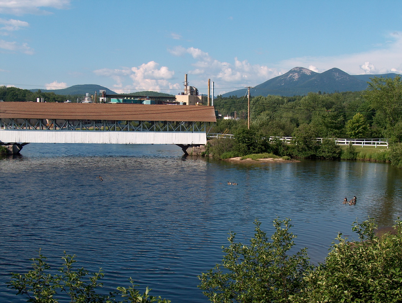
imagesize =
image_caption = Covered bridge over theUpper Ammonoosuc River in front of former paper mill in Groveton. The Percy Peaks are in the distance.
image_|pushpin_
pushpin_label_position =left
pushpin_map_caption =Location within the state of New Hampshire
pushpin_mapsize =
|mapsize =
map_caption =
mapsize1 =
map_caption1 =subdivision_type = Country
subdivision_name =United States
subdivision_type1 = State
subdivision_name1 =New Hampshire
subdivision_type2 = County
subdivision_name2 = Coos
government_footnotes =
government_type =
leader_title =
leader_name =
leader_title1 =
leader_name1 =
established_title =
established_date =unit_pref = Imperial
area_footnotes =
area_magnitude =
area_total_km2 = 5.6
area_land_km2 = 5.6
area_water_km2 = 0.0
area_total_sq_mi = 2.2
area_land_sq_mi = 2.2
area_water_sq_mi = 0.0population_as_of = 2000
population_footnotes =
population_total = 1197
population_density_km2 = 212.6
population_density_sq_mi = 550.6timezone = Eastern (EST)
utc_offset = -5
timezone_DST = EDT
utc_offset_DST = -4
elevation_footnotes =
elevation_m = 269
elevation_ft = 883
latd = 44 |latm = 35 |lats = 56 |latNS = N
longd = 71 |longm = 30 |longs = 52 |longEW = Wpostal_code_type =
ZIP code
postal_code = 03582
area_code = 603
blank_name = FIPS code
blank_info = 33-32260
blank1_name = GNIS feature ID
blank1_info = 0867268
website =
footnotes =Groveton is a
census-designated place (CDP) in the town of Northumberland in Coos County,New Hampshire ,United States . The population was 1,197 at the 2000 census. It is the location of a large paper mill at the intersection ofU.S. Route 3 and NH-110.The paper mill, which was the primary employer in Groveton, was closed by Wausau Papers in 2008.
Groveton is part of the Berlin, NH–VT Micropolitan Statistical Area.
Geography
Groveton is located at coor dms|44|36|3|N|71|30|49|W|city (44.600868, -71.513525).GR|1
According to the
United States Census Bureau , the CDP has a total area of convert|2.2|sqmi|km2, all of it land.Demographics
As of the
census GR|2 of 2000, there were 1,197 people, 514 households, and 323 families residing in the CDP. Thepopulation density was 550.6 people per square mile (213.0/km²). There were 558 housing units at an average density of 256.7/sq mi (99.3/km²). The racial makeup of the CDP was 98.75% White, 0.17% Native American, 0.25% Asian, and 0.84% from two or more races. Hispanic or Latino of any race were 0.33% of the population.There were 514 households out of which 30.7% had children under the age of 18 living with them, 45.9% were married couples living together, 12.1% had a female householder with no husband present, and 37.0% were non-families. 32.3% of all households were made up of individuals and 18.7% had someone living alone who was 65 years of age or older. The average household size was 2.33 and the average family size was 2.90.
In the CDP the population was spread out with 25.0% under the age of 18, 6.9% from 18 to 24, 27.3% from 25 to 44, 21.4% from 45 to 64, and 19.5% who were 65 years of age or older. The median age was 39 years. For every 100 females there were 91.2 males. For every 100 females age 18 and over, there were 85.9 males.
The median income for a household in the CDP was $26,801, and the median income for a family was $30,938. Males had a median income of $29,028 versus $18,828 for females. The
per capita income for the CDP was $13,516. About 11.7% of families and 14.5% of the population were below thepoverty line , including 17.7% of those under age 18 and 13.0% of those age 65 or over.References
External links

Wikimedia Foundation. 2010.