- Orford, New Hampshire
-
Orford, New Hampshire — Town — The Mall Location in Grafton County, New Hampshire
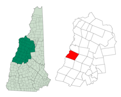
Coordinates: 43°54′18″N 72°08′15″W / 43.905°N 72.1375°WCoordinates: 43°54′18″N 72°08′15″W / 43.905°N 72.1375°W Country United States State New Hampshire County Grafton Incorporated 1761 Government – Board of Selectmen John Bouzoun, Chairman
Paul Dalton
Thomas SteketeeArea – Total 48.0 sq mi (124.4 km2) – Land 46.7 sq mi (120.9 km2) – Water 1.4 sq mi (3.5 km2) 2.81% Elevation 407 ft (124 m) Population (2010) – Total 1,237 – Density 25.8/sq mi (10/km2) Time zone Eastern (UTC-5) – Summer (DST) Eastern (UTC-4) ZIP code 03777 Area code(s) 603 FIPS code 33-58500 GNIS feature ID 0873693 Website www.orfordnh.us Orford is a town in Grafton County, New Hampshire, United States. The population was 1,237 at the 2010 census.[1] The Appalachian Trail crosses in the east.
Contents
History
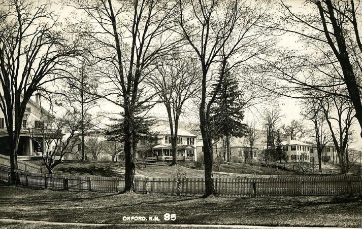
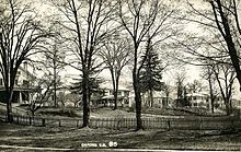 The Ridge c. 1912
First called Number Seven in a line of Connecticut River fort towns, Orford was incorporated in 1761 by Governor Benning Wentworth and named for Robert Walpole, Earl of Orford, who was England's first prime minister. It was settled in 1765 by Daniel Cross and wife from Lebanon, Connecticut.[2] By 1859, it had 1,406 inhabitants, most involved in agriculture. There was a large tannery, chair factory, 10 sawmills, a starch factory, a gristmill, a sash, blind and door factory, and 2 boot and shoe factories.[2]
An original grantee was General Israel Morey, whose son Samuel Morey discovered a way to separate hydrogen from oxygen in water, making possible the first marine steam engine. He recognized the potential of steam power after working at his father's ferry. In 1793, on the river at Orford, he was first to demonstrate the use of a paddlewheel to propel a steam boat.
Author Washington Irving visited Orford in 1832 and is quoted as saying, "In all my travels in this country and in Europe, I have seen no village more beautiful than this. It is a charming place -- nature has done her utmost here."[3] Of the famous sequence of seven early homes built on The Ridge, Dartmouth Professor of Architecture Hugh Morrison said, "As a row and counting the setting, this is the finest group of Federal-style houses in the United States."[4] Built between 1773 and 1839, the dwellings show the influence of architect Asher Benjamin.
Geography
According to the United States Census Bureau, the town has a total area of 48.0 square miles (124.3 km2), of which 46.7 sq mi (121.0 km2) is land and 1.3 sq mi (3.4 km2) is water, comprising 2.81% of the town. The Connecticut River, which serves as the boundary between New Hampshire and Vermont, forms the western edge of the town. Most of Orford is drained by Jacob's Brook and other small tributaries of the Connecticut. The northeastern corner of the town, around Upper and Lower Baker Ponds, drains via the Baker River and Pemigewasset River into the Merrimack River.
The town has two population centers. The main village of Orford, with the town's schools and post office, is located on New Hampshire Route 10 along the banks of the Connecticut River. The town hall, however, is located in the smaller village of Orfordville, on New Hampshire Route 25A several miles east of the river.
The highest point in Orford is the summit of Mount Cube, at 2,909 feet (887 m) above sea level, in the eastern part of town. The northern slopes of Smarts Mountain, whose 3,240-foot (990 m) summit lies in the neighboring town of Lyme, occupy the southeast corner of town.
Camps Merriwood and Moosilauke are situated on Upper Baker Pond in Orford.
Demographics
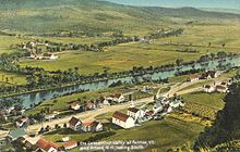
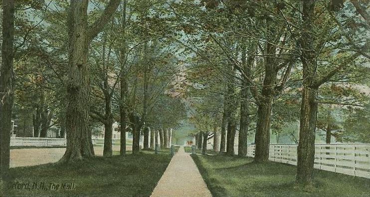
 The Mall c. 1905
As of the census[5] of 2000, there were 1,091 people, 470 households, and 308 families residing in the town. The population density was 23.4 people per square mile (9.0/km²). There were 561 housing units at an average density of 12.0 per square mile (4.6/km²). The racial makeup of the town was 96.98% White, 0.09% African American, 0.27% Native American, 0.64% Asian, 1.10% from other races, and 0.92% from two or more races. Hispanic or Latino of any race were 0.92% of the population.
There were 470 households out of which 26.6% had children under the age of 18 living with them, 55.5% were married couples living together, 7.0% had a female householder with no husband present, and 34.3% were non-families. 27.4% of all households were made up of individuals and 9.1% had someone living alone who was 65 years of age or older. The average household size was 2.32 and the average family size was 2.84.
In the town the population was spread out with 21.9% under the age of 18, 6.3% from 18 to 24, 29.8% from 25 to 44, 29.0% from 45 to 64, and 13.0% who were 65 years of age or older. The median age was 40 years. For every 100 females there were 95.2 males. For every 100 females age 18 and over, there were 94.5 males.
The median income for a household in the town was $46,250, and the median income for a family was $50,577. Males had a median income of $27,500 versus $25,833 for females. The per capita income for the town was $24,196. About 3.1% of families and 5.5% of the population were below the poverty line, including 7.4% of those under age 18 and 4.1% of those age 65 or over.
Crime
In the winter of 2011, Orford experienced a rash of street sign theft, at one point leaving the town with only six signs remaining. With an addition of a new police officer, 66 of the signs were recovered and two of the thieves confessed.[6]
Notable inhabitants
- Daniel Doan, hiking enthusiast and writer
- Milton Friedman, economist
- Charles R. Jackson, writer
- Gilman Marston, politician and general
- Samuel Morey, inventor
- Jameson Parker, actor
- Meldrim Thomson, Jr., governor
- Jeduthun Wilcox, congressman
- Leonard Wilcox, senator
References
- ^ United States Census Bureau, American FactFinder, 2010 Census figures. Retrieved March 23, 2011.
- ^ a b A. J. Coolidge & J. B. Mansfield, A History and Description of New England; Boston, Massachusetts 1859
- ^ The White Mountains: A Handbook for Travellers; James R. Osgood & Company, Boston 1880
- ^ Alice Doan Hodgson, Orford Street Historic District -- National Register Nomination Information 1976
- ^ "American FactFinder". United States Census Bureau. http://factfinder.census.gov. Retrieved 2008-01-31.
- ^ Rachel Kent (Mar 22, 2011). "66 Road Signs Stolen in Orford, New Hampshire". Fox 44 News. http://www.fox44now.com/story/14259101/66-road-signs-stolen-in-orford-new-hampshire. Retrieved July 27, 2011.
External links
- Town website
- History of Orford, New Hampshire
- New Hampshire Economic and Labor Market Information Bureau Profile
Municipalities and communities of Grafton County, New Hampshire City 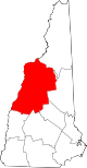
Towns Alexandria | Ashland | Bath | Benton | Bethlehem | Bridgewater | Bristol | Campton | Canaan | Dorchester | Easton | Ellsworth | Enfield | Franconia | Grafton | Groton | Hanover | Haverhill | Hebron | Holderness | Landaff | Lincoln | Lisbon | Littleton | Lyman | Lyme | Monroe | Orange | Orford | Piermont | Plymouth | Rumney | Sugar Hill | Thornton | Warren | Waterville Valley | Wentworth | Woodstock
Township Villages East Hebron | Enfield Center | Etna | Glencliff | Lyme Center | Montcalm | Mountain Lakes | North Woodstock | Pike | West Lebanon | Woodsville
Categories:- Towns in Grafton County, New Hampshire
- Populated places on the Connecticut River


Wikimedia Foundation. 2010.