- North Woodstock, New Hampshire
-
Coordinates: 44°01′49″N 71°41′09″W / 44.03028°N 71.68583°W North Woodstock is a census-designated place in the town of Woodstock in Grafton County, New Hampshire. It had a population of 528 at the 2010 census.[1]
It is located along the northern boundary of the town of Woodstock, adjacent to Lincoln, New Hampshire. The village is centered around the intersection of U.S. Route 3 and New Hampshire Route 112. Interstate 93 passes through the east portion of the village. The Pemigewasset River flows past the center of North Woodstock, joined by the East Branch of the Pemigewasset and Moosilauke Brook at the southern limits of the village.
References
- ^ United States Census Bureau, American FactFinder, 2010 Census figures. Retrieved March 23, 2011.
Municipalities and communities of Grafton County, New Hampshire City 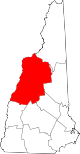
Towns Alexandria | Ashland | Bath | Benton | Bethlehem | Bridgewater | Bristol | Campton | Canaan | Dorchester | Easton | Ellsworth | Enfield | Franconia | Grafton | Groton | Hanover | Haverhill | Hebron | Holderness | Landaff | Lincoln | Lisbon | Littleton | Lyman | Lyme | Monroe | Orange | Orford | Piermont | Plymouth | Rumney | Sugar Hill | Thornton | Warren | Waterville Valley | Wentworth | Woodstock
Township Villages East Hebron | Enfield Center | Etna | Glencliff | Lyme Center | Montcalm | Mountain Lakes | North Woodstock | Pike | West Lebanon | Woodsville
Categories:- New Hampshire geography stubs
- Census-designated places in New Hampshire
- Unincorporated communities in New Hampshire
- Populated places in Grafton County, New Hampshire

Wikimedia Foundation. 2010.