- Canaan, New Hampshire
Infobox Settlement
official_name = Canaan, New Hampshire
nickname =
motto =
image_
imagesize =
image_caption =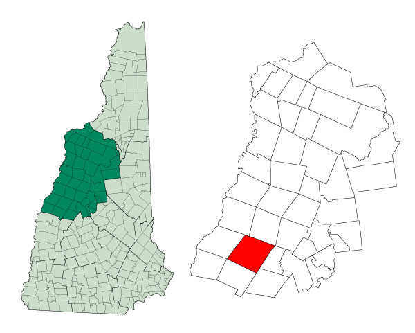
mapsize = 250px
map_caption = Location in Grafton County,New Hampshire
settlement_type = Town
mapsize1 =
map_caption1 =
subdivision_type = Country
subdivision_name =United States
subdivision_type1 = State
subdivision_name1 =New Hampshire
subdivision_type2 = County
subdivision_name2 = Grafton
government_type =
leader_title =Board of Selectmen
leader_name = Scott Borthwick
Tim Lewis
Robert Reagan
established_title = Incorporated
established_date = 1761
area_magnitude = 1 E8
area_total_km2 = 142.5
area_total_sq_mi = 55.0
area_land_km2 = 137.8
area_land_sq_mi = 53.2
area_water_km2 = 4.7
area_water_sq_mi = 1.8
area_water_percent = 3.31
population_as_of = 2000
population_note =
population_total = 3319
population_density_km2 = 24.1
population_density_sq_mi = 62.4
timezone = Eastern
utc_offset = -5
timezone_DST = Eastern
utc_offset_DST = -4
latd = 43 |latm = 38 |lats = 48 |latNS = N
longd = 72 |longm = 00 |longs = 37 |longEW = W
elevation_m = 288
elevation_ft = 945
website = [http://www.townofcanaannh.us/ www.townofcanaannh.us]
postal_code_type =ZIP code
postal_code = 03741
area_code = 603
blank_name = FIPS code
blank_info = 33-08980
blank1_name = GNIS feature ID
blank1_info = 0873557
footnotes =Canaan is a town in Grafton County,
New Hampshire ,United States . The population was 3,319 at the 2000 census. It is the location of Mascoma State Forest. Canaan is home to theCardigan Mountain School , the town's largest employer.History
Chartered in 1761 by Colonial Governor
Benning Wentworth , the town probably took its name from the hometown of early settlers from Canaan,Connecticut , which was named for the Biblical land ofCanaan . Settled in 1766, it would be incorporated in 1770 by Governor John Wentworth. The town was once astagecoach stop.In March 1835, 28 white students and 14 black students commenced classes at the newly established
Noyes Academy . OnAugust 10 ,1835 , white residents of Canaan, with the help of neighboring towns and "nearly 100 yoke ofoxen ," forcibly removed Noyes Academy from its foundation. Later, the community would be a stop on theUnderground Railroad .Canaan was the site of a famous
train wreck onSeptember 15 ,1907 . Four miles north of Canaan Station, the southbound Quebec to Boston express, heavily loaded with passengers returning from the Sherbrooke Fair, collided head-on with a northbound Boston & Mainefreight train . Twenty-five people perished, and an equal number were seriously injured. Cause of the accident was "due to a mistake in train dispatcher's orders."Geography
According to the
United States Census Bureau , the town has a total area of convert|55.0|sqmi|km2, of which convert|53.2|sqmi|km2|abbr=on is land and convert|1.8|sqmi|km2|abbr=on is water, comprising 3.31% of the town. Canaan is drained by theMascoma River .Canaan Street Lake is in the center, andGoose Pond is in the northwest.The town center lies in the valley of the Indian River (a tributary of the Mascoma) at the base of
Mount Cardigan , which lies to the east in the neighboring town of Orange. A mountain road leads from Canaan to a trailhead in Cardigan Mountain State Forest, where hiking trails on the west slope of the mountain lead to the bare-rock summit. The highest point in Canaan is the top of an unnamed ridge (approximately convert|2270|ft|m abovesea level ) in the northeast corner of town, overlooking Derby Pond.Canaan lies almost fully within the
Connecticut River watershed except for a tiny part of the northeast of the town, which is in theMerrimack River watershed.cite book |title=Water Use in New Hampshire: An Activities Guide for Teachers |url=http://nh.water.usgs.gov/Publications/nh.intro.html |last=Foster |first=Debra H. |coauthors=Batorfalvy, Tatianna N.; and Medalie, Laura |publisher=U.S. Department of the Interior and U.S. Geological Survey |year=1995]Demographics
As of the
census GR|2 of 2000, there were 3,319 people, 1,279 households, and 929 families residing in the town. Thepopulation density was 62.4 people per square mile (24.1/km²). There were 1,588 housing units at an average density of 29.8/sq mi (11.5/km²). The racial makeup of the town was 98.13% White, 0.12% African American, 0.12% Native American, 0.36% Asian, 0.21% from other races, and 1.05% from two or more races. Hispanic or Latino of any race were 0.51% of the population.There were 1,279 households out of which 36.4% had children under the age of 18 living with them, 60.2% were married couples living together, 8.4% had a female householder with no husband present, and 27.3% were non-families. 21.0% of all households were made up of individuals and 7.5% had someone living alone who was 65 years of age or older. The average household size was 2.59 and the average family size was 3.00.
In the town the population was spread out with 27.0% under the age of 18, 5.9% from 18 to 24, 31.3% from 25 to 44, 26.1% from 45 to 64, and 9.7% who were 65 years of age or older. The median age was 38 years. For every 100 females there were 96.0 males. For every 100 females age 18 and over, there were 93.8 males.
The median income for a household in the town was $43,220, and the median income for a family was $46,339. Males had a median income of $32,946 versus $25,000 for females. The
per capita income for the town was $20,515. About 2.9% of families and 6.0% of the population were below thepoverty line , including 4.6% of those under age 18 and 12.4% of those age 65 or over.Sites of interest
* [http://www.rootsweb.com/~nhchs/Museum.html Canaan Historical Museum]
References
External links
* [http://www.townofcanaannh.us Town website]
* [http://www.rootsweb.com/~nhchs/ Canaan Historical Society]
* [http://www.cardigan.org/ Cardigan Mountain School]
* [http://www.canaanlibrary.org/ Canaan Town Library]
* [http://www.nh.gov/nhes/elmi/htmlprofiles/canaan.html New Hampshire Economic and Labor Market Information Bureau Profile]
* [http://www.rootsweb.com/~nhchs/Reporter/20Sep1907.html Canaan, NH Train Wreck of 1907]
Wikimedia Foundation. 2010.