- Bridgewater, New Hampshire
Infobox Settlement
official_name = Bridgewater, New Hampshire
nickname =
motto =
image_
imagesize =
image_caption =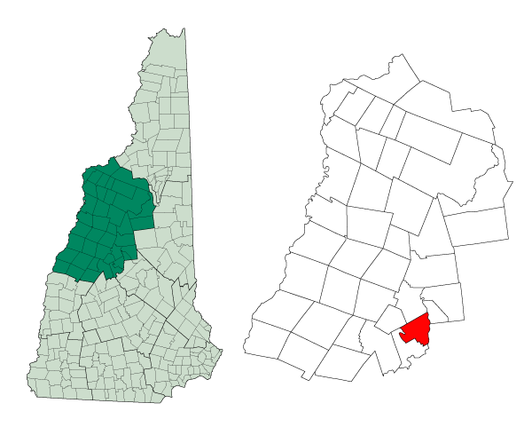
mapsize = 250px
map_caption = Location in Grafton County,New Hampshire
settlement_type = Town
mapsize1 =
map_caption1 =
subdivision_type = Country
subdivision_name =United States
subdivision_type1 = State
subdivision_name1 =New Hampshire
subdivision_type2 = County
subdivision_name2 = Grafton
government_type =
leader_title =Board of Selectmen
leader_name =
established_title = Incorporated
established_date = 1788
area_magnitude = 1 E8
area_total_km2 = 55.6
area_total_sq_mi = 21.5
area_land_km2 = 55.1
area_land_sq_mi = 21.3
area_water_km2 = 0.5
area_water_sq_mi = 0.2
area_water_percent = 0.84
population_as_of = 2000
population_note =
population_total = 974
population_density_km2 = 17.7
population_density_sq_mi = 45.8
timezone = Eastern
utc_offset = -5
timezone_DST = Eastern
utc_offset_DST = -4
latd = 43 |latm = 38 |lats = 16 |latNS = N
longd = 71 |longm = 44 |longs = 10 |longEW = W
elevation_m = 195
elevation_ft = 640
website = http://www.bridgewater-nh.com/
postal_code_type =
postal_code =
area_code = 603
blank_name = FIPS code
blank_info = 33-07540
blank1_name = GNIS feature ID
blank1_info = 0873551
footnotes =Bridgewater is a town in Grafton County,
New Hampshire ,United States . The population was 974 at the 2000 census.History
The land comprising Bridgewater was originally part of a town known as New Chester, which was separated into Bridgewater, Bristol, Hill, Danbury, and Wilmot. The town name was chosen because many of the settlers were from Bridgewater,
Massachusetts .Geography
According to the
United States Census Bureau , the town has a total area of convert|21.5|sqmi|km2, of which convert|21.3|sqmi|km2|abbr=on is land and convert|0.2|sqmi|km2|abbr=on is water, comprising 0.84% of the town. The highest point in Bridgewater is Peaked Hill, at convert|1905|ft|m abovesea level . Bridgewater lies fully within theMerrimack River watershed.cite book |title=Water Use in New Hampshire: An Activities Guide for Teachers |url=http://nh.water.usgs.gov/Publications/nh.intro.html |last=Foster |first=Debra H. |coauthors=Batorfalvy, Tatianna N.; and Medalie, Laura |publisher=U.S. Department of the Interior and U.S. Geological Survey |year=1995]Demographics
As of the
census GR|2 of 2000, there were 974 people, 414 households, and 289 families residing in the town. Thepopulation density was 45.8 people per square mile (17.7/km²). There were 850 housing units at an average density of 40.0/sq mi (15.4/km²). The racial makeup of the town was 99.08% White, 0.10% Native American, 0.51% Asian, 0.21% from other races, and 0.10% from two or more races. Hispanic or Latino of any race were 0.62% of the population.There were 414 households out of which 24.9% had children under the age of 18 living with them, 61.6% were married couples living together, 6.5% had a female householder with no husband present, and 30.0% were non-families. 23.9% of all households were made up of individuals and 12.3% had someone living alone who was 65 years of age or older. The average household size was 2.35 and the average family size was 2.78.
In the town the population was spread out with 19.7% under the age of 18, 4.5% from 18 to 24, 25.2% from 25 to 44, 31.3% from 45 to 64, and 19.3% who were 65 years of age or older. The median age was 45 years. For every 100 females there were 96.8 males. For every 100 females age 18 and over, there were 89.8 males.
The median income for a household in the town was $50,662, and the median income for a family was $54,722. Males had a median income of $33,250 versus $26,250 for females. The
per capita income for the town was $28,600. About 6.1% of families and 6.9% of the population were below thepoverty line , including 5.4% of those under age 18 and 4.9% of those age 65 or over.References
External links
* [http://www.bridgewater-nh.com Official town website]
* [http://www.nh.gov/nhes/elmi/htmlprofiles/bridgewater.html New Hampshire Economic and Labor Market Information Bureau Profile]
Wikimedia Foundation. 2010.