- Ellsworth, New Hampshire
Infobox Settlement
official_name = Ellsworth, New Hampshire
nickname =
motto =
image_
imagesize =
image_caption =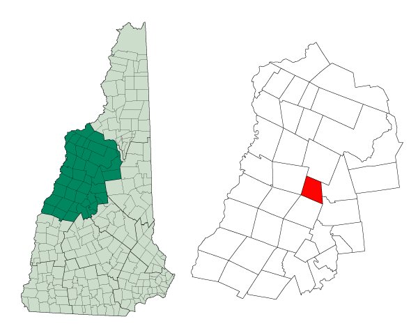
mapsize = 250px
map_caption = Location in Grafton County,New Hampshire
settlement_type = Town
mapsize1 =
map_caption1 =
subdivision_type = Country
subdivision_name =United States
subdivision_type1 = State
subdivision_name1 =New Hampshire
subdivision_type2 = County
subdivision_name2 = Grafton
government_type =
leader_title =Board of Selectmen
leader_name =
established_title = Incorporated
established_date = 1769
area_magnitude = 1 E8
area_total_km2 = 55.6
area_total_sq_mi = 21.5
area_land_km2 = 55.4
area_land_sq_mi = 21.4
area_water_km2 = 0.3
area_water_sq_mi = 0.1
area_water_percent = 0.47
population_as_of = 2000
population_note =
population_total = 87
population_density_km2 = 1.6
population_density_sq_mi = 4.1
timezone = Eastern
utc_offset = -5
timezone_DST = Eastern
utc_offset_DST = -4
latd = 43 |latm = 52 |lats = 26 |latNS = N
longd = 71 |longm = 44 |longs = 14 |longEW = W
elevation_m = 358
elevation_ft = 1174
website =
postal_code_type =ZIP code
postal_code = 03223
area_code = 603
blank_name = FIPS code
blank_info = 33-23860
blank1_name = GNIS feature ID
blank1_info = 0873589
footnotes =Ellsworth is a town in Grafton County,
New Hampshire ,United States . The population was 87 at the 2000 census.History
Originally known as Trecothick, after Barlow Trecothick, a Bostonian who moved to
London . He was anAlderman and MP and aLord Mayor of the City of London . He had a country estate at Addington,London , which is now calledAddington Palace .The name of the town was changed to Ellsworth in 1802, in honor of Chief Justice
Oliver Ellsworth .The first census of the town, in 1880, reported 47 residents.
Geography
According to the
United States Census Bureau , the town has a total area of convert|21.5|sqmi|km2|sigfig=3, of which convert|21.4|sqmi|km2|abbr=on|sigfig=3 is land and convert|0.1|sqmi|km2|abbr=on|sigfig=1 is water, comprising 0.47% of the town. The highest point in Ellsworth is the summit of Mount Kineo, at convert|3313|ft|m abovesea level . Ellsworth lies fully within theMerrimack River watershed.cite book |title=Water Use in New Hampshire: An Activities Guide for Teachers |url=http://nh.water.usgs.gov/Publications/nh.intro.html |last=Foster |first=Debra H. |coauthors=Batorfalvy, Tatianna N.; and Medalie, Laura |publisher=U.S. Department of the Interior and U.S. Geological Survey |year=1995]Demographics
As of the
census GR|2 of 2000, there were 87 people, 32 households, and 19 families residing in the town. Thepopulation density was 4.1 people per square mile (1.6/km²). There were 72 housing units at an average density of 3.4/sq mi (1.3/km²). The racial makeup of the town was 96.55% White, and 3.45% Native American.There were 32 households out of which 34.4% had children under the age of 18 living with them, 53.1% were married couples living together, none have a female householder with no husband present, and 40.6% were non-families. 18.8% of all households were made up of individuals and 12.5% had someone living alone who was 65 years of age or older. The average household size was 2.72 and the average family size was 3.37.
In the town the population was spread out with 29.9% under the age of 18, 3.4% from 18 to 24, 23.0% from 25 to 44, 28.7% from 45 to 64, and 14.9% who were 65 years of age or older. The median age was 41 years. For every 100 females there were 102.3 males. For every 100 females age 18 and over, there were 110.3 males.
The median income for a household in the town was $33,750, and the median income for a family was $34,750. Males had a median income of $26,500 versus $21,250 for females. The
per capita income for the town was $22,705. None of the population and none of the families were below thepoverty line .References
External links
* [http://www.nh.gov/nhes/elmi/htmlprofiles/ellsworth.html New Hampshire Economic and Labor Market Information Bureau Profile]
Wikimedia Foundation. 2010.