- Wentworth, New Hampshire
Infobox Settlement
official_name = Wentworth, New Hampshire
nickname =
motto =
image_
imagesize =
image_caption = Wentworth Town Common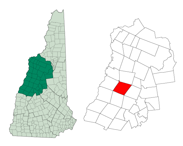
mapsize = 250px
map_caption = Location in Grafton County,New Hampshire
settlement_type = Town
mapsize1 =
map_caption1 =
subdivision_type = Country
subdivision_name =United States
subdivision_type1 = State
subdivision_name1 =New Hampshire
subdivision_type2 = County
subdivision_name2 = Grafton
government_type =
leader_title =Board of Selectmen
leader_name = Palmer W. Koelb
Francis Muzzey
Randy Morrison
established_title = Incorporated
established_date = 1766
area_magnitude = 1 E8
area_total_km2 = 108.6
area_total_sq_mi = 41.9
area_land_km2 = 107.9
area_land_sq_mi = 41.7
area_water_km2 = 0.7
area_water_sq_mi = 0.3
area_water_percent = 0.67
population_as_of = 2000
population_note =
population_total = 798
population_density_km2 = 7.4
population_density_sq_mi = 19.2
timezone = Eastern
utc_offset = -5
timezone_DST = Eastern
utc_offset_DST = -4
latd = 43 |latm = 52 |lats = 08 |latNS = N
longd = 71 |longm = 54 |longs = 36 |longEW = W
elevation_m = 192
elevation_ft = 630
website = [http://www.wentworth-nh.org/ www.wentworth-nh.org]
postal_code_type =ZIP code
postal_code = 03282
area_code = 603
blank_name = FIPS code
blank_info = 33-80500
blank1_name = GNIS feature ID
blank1_info = 0873752
footnotes =Wentworth is a town in Grafton County,
New Hampshire ,United States . The population was 798 at the 2000 census. Plummer's Ledge Natural Area is on the north boundary. Part of theWhite Mountain National Forest is in the northeast. The town has a picturesque common, presided over by a Federal style church and bordered by antique homes.History
First chartered in 1766, this town was originally reserved for the private use of Colonial Governor
Benning Wentworth . When John Wentworth succeeded his uncle as governor, one of his first acts was to grant the tract to a group of settlers, naming it "Wentworth" in his uncle's honor. Most of the new colonists came from Salisbury,Massachusetts .Geography
According to the
United States Census Bureau , the town has a total area of convert|41.9|sqmi|km2|lk=on, of which convert|41.7|sqmi|km2|abbr=on is land and convert|0.3|sqmi|km2|abbr=on (0.67%) is water. The town is drained by the Baker River and its south branch. The highest point in Wentworth is Carr Mountain, at convert|3453|ft|m|lk=on abovesea level .Demographics
of any race were 0.38% of the population.
There were 310 households out of which 31.9% had children under the age of 18 living with them, 60.0% were married couples living together, 7.4% had a female householder with no husband present, and 29.0% were non-families. 21.3% of all households were made up of individuals and 8.4% had someone living alone who was 65 years of age or older. The average household size was 2.57 and the average family size was 3.04.
In the town the population was spread out with 25.8% under the age of 18, 5.8% from 18 to 24, 29.6% from 25 to 44, 24.7% from 45 to 64, and 14.2% who were 65 years of age or older. The median age was 40 years. For every 100 females there were 100.4 males. For every 100 females age 18 and over, there were 101.4 males.
The median income for a household in the town was $44,219, and the median income for a family was $47,917. Males had a median income of $31,250 versus $24,500 for females. The
per capita income for the town was $18,258. About 6.1% of families and 7.9% of the population were below thepoverty line , including 9.7% of those under age 18 and 2.6% of those age 65 or over.Government
(D).
Climate
Infobox Weather
single_line=yes
location = Wentworth, New Hampshire
Jan_Hi_°F = 26.8
Feb_Hi_°F = 29.6
Mar_Hi_°F = 39.6
Apr_Hi_°F = 52.1
May_Hi_°F = 65.7
Jun_Hi_°F = 73.6
Jul_Hi_°F = 78
Aug_Hi_°F = 75.4
Sep_Hi_°F = 67.2
Oct_Hi_°F = 56.6
Nov_Hi_°F = 43
Dec_Hi_°F = 30.7
Year_Hi_°F = 53.2
Jan_Lo_°F = 6.9
Feb_Lo_°F = 8.7
Mar_Lo_°F = 19.8
Apr_Lo_°F = 30.8
May_Lo_°F = 41.5
Jun_Lo_°F = 50.1
Jul_Lo_°F = 54.5
Aug_Lo_°F = 52.8
Sep_Lo_°F = 45.3
Oct_Lo_°F = 36.1
Nov_Lo_°F = 26.9
Dec_Lo_°F = 13.2
Year_Lo_°F = 32.2
Jan_Precip_inch = 2.1
Feb_Precip_inch = 2.2
Mar_Precip_inch = 2.4
Apr_Precip_inch = 2.7
May_Precip_inch = 3.4
Jun_Precip_inch = 3.8
Jul_Precip_inch = 3.5
Aug_Precip_inch = 4.0
Sep_Precip_inch = 3.2
Oct_Precip_inch = 3.3
Nov_Precip_inch = 3.5
Dec_Precip_inch = 2.8
Year_Precip_inch = 36.8
source= Weatherbasecite web
url=http://www.weatherbase.com/weather/weather.php3?refer=&s=186072 |title=Weatherbase |accessdate=2008-04-17 ]
accessdate = 2008-04-17Photo Gallery
References
External links
* [http://www.wentworth-nh.org Town website]
* [http://www.nh.gov/nhes/elmi/htmlprofiles/wentworth.html New Hampshire Economic and Labor Market Information Bureau Profile]
* [http://www.wentworth.sau48.k12.nh.us/ Wentworth Elementary School]
Wikimedia Foundation. 2010.