- Freedom, New Hampshire
Infobox Settlement
official_name = Freedom, New Hampshire
nickname =
motto =
image_
imagesize =
image_caption =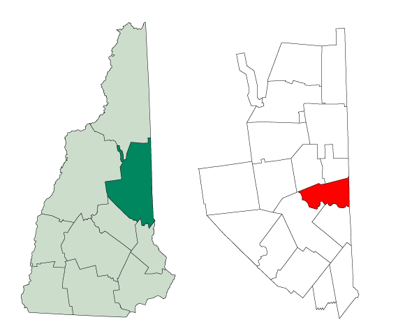
mapsize = 250px
map_caption = Location inCarroll County, New Hampshire
settlement_type = Town
mapsize1 =
map_caption1 =
subdivision_type = Country
subdivision_name =United States
subdivision_type1 = State
subdivision_name1 =New Hampshire
subdivision_type2 = County
subdivision_name2 = Carroll
government_type =
leader_title =
leader_name =
established_title = Incorporated
established_date = 1831
area_magnitude = 1 E8
area_total_km2 = 98.3
area_total_sq_mi = 38.0
area_land_km2 = 89.7
area_land_sq_mi = 34.7
area_water_km2 = 8.6
area_water_sq_mi = 3.3
area_water_percent = 8.75
population_as_of = 2000
population_note =
population_total = 1303
population_density_km2 = 14.5
population_density_sq_mi = 37.6
timezone = Eastern
utc_offset = -5
timezone_DST = Eastern
utc_offset_DST = -4
latd = 43 |latm = 48 |lats = 49 |latNS = N
longd = 71 |longm = 02 |longs = 11 |longEW = W
elevation_m = 134
elevation_ft = 439
website = http://www.townoffreedom.net/
postal_code_type =ZIP code
postal_code = 03836
area_code = 603
blank_name = FIPS code
blank_info = 33-27700
blank1_name = GNIS feature ID
blank1_info = 0873601
footnotes =Freedom is a town located in Carroll County,
New Hampshire ,United States . The population was 1,303 at the 2000 census. The New Hampshire Office of Energy and Planning estimated its 2007 population at 1,410. [cite web| url=http://www.nh.gov/oep/programs/DataCenter/Population/documents/2007_population_estimates.pdf| title="2007 Population Estimates of New Hampshire Cities and Towns"| date=June 2008| publisher=NH Office of Energy and Planning| accessdate=2008-06-09] The town's eastern boundary runs along theMaine state border.Ossipee Lake , with a resort and camps, is in the southwest of the town.History
The town was once a part of Effingham called "North Effingham". Following an influx of new settlers from Maine, there was a conflict of
culture andreligion between them and people from theNew Hampshire seacoast area who already populated Effingham. As a result, North Effingham separated into a town of its own. The community, incorporated in 1831, was appropriately named "Freedom".The town has been the setting for a couple of stories, including the children's
fantasy book called "The Enormous Egg", first published in 1956 but reissued years later (ISBN 0-316-11920-2). Freedom was also the setting for a 2001 broadcast of "This American Life ", entitled "The House at Loon Lake". That [http://www.wbez.org/ta/199.rm episode] depicted an abandoned house explored by young boys, in town forsummer camp at Loon Lake.Notable Residents
*
Frank S. Black , governor ofNew York (summer resident)Geography
Freedom is situated between the Lakes Region and the White Mountains. According to the
United States Census Bureau , the town has a total area of convert|38.0|sqmi|km2, of which convert|34.7|sqmi|km2|abbr=on is land and convert|3.3|sqmi|km2|abbr=on is water, comprising 8.75% of the town. The highest point in the town is the summit of Cragged Mountain, at convert|1806|ft|m abovesea level . Freedom is drained by theOssipee River and lies fully within theSaco River watershed.cite book |title=Water Use in New Hampshire: An Activities Guide for Teachers |url=http://nh.water.usgs.gov/Publications/nh.intro.html |last=Foster |first=Debra H. |coauthors=Batorfalvy, Tatianna N.; and Medalie, Laura |publisher=U.S. Department of the Interior and U.S. Geological Survey |year=1995]Freedom is one of several sites for
Nature's Classroom . It is also home to one of the permanent campsites of theLuethi-Peterson Camps and toCragged Mountain Farm , a co-ed summer camp on Cragged Mountain started by Dr. Henry Utter in 1927, and still owned by the Utter family.Demographics
As of the
census GR|2 of 2000, there were 1,303 people, 602 households, and 402 families residing in the town. Thepopulation density was 37.6 people per square mile (14.5/km²). There were 1,406 housing units at an average density of 40.6/sq mi (15.7/km²). The racial makeup of the town was 99.16% White, 0.15% African American, 0.08% Asian, and 0.61% from two or more races.There were 602 households out of which 19.6% had children under the age of 18 living with them, 59.1% were married couples living together, 4.8% had a female householder with no husband present, and 33.2% were non-families. 28.1% of all households were made up of individuals and 12.1% had someone living alone who was 65 years of age or older. The average household size was 2.15 and the average family size was 2.60.
In the town the population was spread out with 16.8% under the age of 18, 3.1% from 18 to 24, 24.0% from 25 to 44, 32.1% from 45 to 64, and 24.0% who were 65 years of age or older. The median age was 49 years. For every 100 females there were 95.1 males. For every 100 females age 18 and over, there were 96.0 males.
The median income for a household in the town was $40,188, and the median income for a family was $49,167. Males had a median income of $32,150 versus $26,000 for females. The
per capita income for the town was $23,036. About 4.6% of families and 6.8% of the population were below thepoverty line , including 4.7% of those under the age of 18 and 8.1% of those 65 and older.Sites of interest
* Allard House & Works Museum, Freedom Historical Society
References
External links
* [http://www.townoffreedom.net Town website]
* [http://www.nh.gov/nhes/elmi/htmlprofiles/freedom.html New Hampshire Economic and Labor Market Information Bureau Profile]
* [http://www.nh.gov/dot/transportationplanning/traffic/trafficweb/DetailSheets/freedom.htm Traffic volume report, New Hampshire Department of Transportation]
* [http://docs.unh.edu/NH/ossp58se.jpg1958 USGS area map (JPEG), University of New Hampshire Library]
* [http://www.freedompubliclibrary.org Freedom Public Library]
* [http://www.freedomoldhomeweek.org Freedom Old Home Week]
Wikimedia Foundation. 2010.