- Henniker, New Hampshire
Infobox Settlement
official_name = Henniker, New Hampshire
nickname =
motto = The Only Henniker on Earth
image_
imagesize =
image_caption =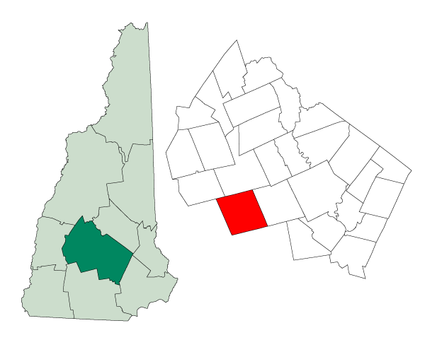
mapsize = 250px
map_caption = Location inMerrimack County, New Hampshire
settlement_type = Town
mapsize1 =
map_caption1 =
subdivision_type = Country
subdivision_name =United States
subdivision_type1 = State
subdivision_name1 =New Hampshire
subdivision_type2 = County
subdivision_name2 = Merrimack
government_type =
leader_title =Board of Selectmen
leader_name = Roderick Pimentel
Cordell Johnston
Thomas Watman
Cheryl Morse
Joseph Damour
established_title = Incorporated
established_date = 1768
area_magnitude = 1 E8
area_total_km2 = 116.1
area_total_sq_mi = 44.8
area_land_km2 = 114.3
area_land_sq_mi = 44.1
area_water_km2 = 1.8
area_water_sq_mi = 0.7
area_water_percent = 1.52
population_as_of = 2000
population_note =
population_total = 4433
population_density_km2 = 38.8
population_density_sq_mi = 100.5
timezone = Eastern
utc_offset = -5
timezone_DST = Eastern
utc_offset_DST = -4
latd = 43 |latm = 10 |lats = 47 |latNS = N
longd = 71 |longm = 49 |longs = 20 |longEW = W
elevation_m = 133
elevation_ft = 436
website = [http://www.henniker.org/ www.henniker.org]
postal_code_type =ZIP code
postal_code = 03242
area_code = 603
blank_name = FIPS code
blank_info = 33-35540
blank1_name = GNIS feature ID
blank1_info = 0873623
footnotes =Henniker is a town in Merrimack County,
New Hampshire ,United States . As of the 2000 census, the town had a total population of 4,433. Henniker is home toNew England College , as well as Ames State Forest and Craney Hill State Forest. The town's motto is "The Only Henniker on Earth."The primary settlement in Henniker, where over 36% of the population resides, is defined as the Henniker
census-designated place (CDP). It encompasses the area around the crossing of theContoocook River byNew Hampshire Route 114 .History
Henniker was first known as "Number Six," part of a line of settlements running between the Merrimack and Connecticut rivers. In 1752, the land was granted by Colonial Governor
Benning Wentworth to Andrew Todd, who named it "Todd's Town." In 1763, the first frame house was built. The area would be settled by families fromMarlborough, Massachusetts , who named it "New Marlborough." Governor John Wentworth would incorporate the town in 1768 as "Henniker," after Sir John Henniker, aLondon merchant of leather and furs, who had shipping interests in Boston and Portsmouth prior to the Revolution.Water power ed mills operated on theContoocook River in Henniker until 1959 when they were closed by the Hopkinton-Everett Lakes Flood Control Project. The Edna Dean Proctor Bridge, a double-arch stone bridge spanning the Contoocook, was built in 1835. Beginning in the late 1800s, the river's scenic beauty attracted tourism. Henniker today remains a resort area, featuring bothskiing and white-waterkayak ing.Notable inhabitants
*
Amy Beach , pianist
*Ocean Born Mary , legendary figure of early New England
*James W. Patterson , educator
*Edna Dean Proctor , poetess citation |url=http://seacoastnh.com/The_Arts/For_Better_or_Verse/Take_Heart/ |title=Take Heart |periodical=SeacoastNH.com |accessdate=2007-10-08 ]
*Ted Williams , baseball player [ [http://www.hennikerhistory.org/thistory.htm Henniker Historical Society, "Introduction to the History of Henniker"] ]Geography
According to the
United States Census Bureau , the town has a total area of convert|116.1|km2|sqmi. convert|114.3|km2|sqmi|abbr=on of it is land and convert|1.8|km2|sqmi|abbr=on of it is water, comprising 1.52% of the town. The village of Henniker, orcensus-designated place (CDP), has a total area of convert|3.6|km2|sqmi|abbr=on, all of it land.Craney Hill, elevation convert|1402|ft|m above
sea level and home ofPat's Peak ski area, is in the south. The highest point in Henniker is an unnamed summit near the town's northwest corner, with an elevation of convert|1552|ft|m|abbr=on. Henniker is drained by the Contoocook River and Amey Brook; the town lies fully within theMerrimack River watershed.cite book |title=Water Use in New Hampshire: An Activities Guide for Teachers |url=http://nh.water.usgs.gov/Publications/nh.intro.html |last=Foster |first=Debra H. |coauthors=Batorfalvy, Tatianna N.; and Medalie, Laura |publisher=U.S. Department of the Interior and U.S. Geological Survey |year=1995]Demographics
At the
census of 2000 there were 4,433 people, 1,585 households, and 1,019 families residing in the town. The population density was 38.8/square kilometer (100.5/square mile). There were 1,679 housing units at an average density of 14.7 persons/square kilometer (38.0 persons/square mile). The racial makeup of the town was 96.64% White, 0.45%African American , 0.18% Native American, 0.99%Asia n, 0.02% Pacific Islander, 0.38% from other races, and 1.33% from two or more races. 0.83% of the population wereHispanic orLatino of any race.There were 1,585 households, of which 37.3% had children under the age of 18 living with them, 50.3% were married couples living together, 9.1% had a woman whose husband does not live with her, and 35.7% were non-families. 26.2% of all households were made up of individuals and 8.9% had someone living alone who was 65 years of age or older. The average household size was 2.53 and the average family size was 3.09.
24.9% of the population were under the age of 18, 16.8% from 18 to 24, 28.9% from 25 to 44, 21.5% from 45 to 64, and 7.9% who were 65 years of age or older. The median age was 33 years. For every 100 females there were 103.3 males. For every 100 females age 18 and over, there were 100.2 males.
The median income for a household in the town was $50,288, and the median income for a family was $59,527. Males had a median income of $39,583 versus $27,243 for females. The per capita income for the town was $24,530. 7.0% of the population and 2.0% of families were below the poverty line. Of the people living in poverty, 2.1% were under the age of 18 and 10.3% were 65 or older.
Town center
As of the
census of 2000, there were 1,627 people, 541 households, and 292 families residing in the central village of Henniker, orcensus-designated place (CDP). Thepopulation density was 1,164.1 people per square mile (448.7/km²). There were 558 housing units at an average density of 153.9 persons/km² (399.3 persons/sq mi). The racial makeup of the town was 95.02% White, 0.98%African American , 0.18% Native American, 1.78%Asia n, 0.55% from other races, and 1.48% from two or more races. 1.35% of the population wereHispanic orLatino of any race.There were 541 households out of which 30.7% had children under the age of 18 living with them, 40.1% were married couples living together, 10.4% have a woman whose husband does not live with her, and 46.0% were non-families. 34.8% of all households were made up of individuals and 13.7% had someone living alone who was 65 years of age or older. The average household size was 2.23 and the average family size was 2.91.
In the CDP the population was spread out with 18.0% under the age of 18, 32.9% from 18 to 24, 23.9% from 25 to 44, 17.2% from 45 to 64, and 8.0% who were 65 years of age or older. The median age was 24 years. For every 100 females there were 97.5 males. For every 100 females age 18 and over, there were 95.9 males.
The median income for a household is $40,000, and the median income for a family was $48,563. Males had a median income of $31,771 versus $26,667 for females. The
per capita income for the town was $16,808. 10.4% of the population and 2.2% of families were below the poverty line. Out of the total people living in poverty, 3.2% are under the age of 18 and 4.3% are 65 or older.Education
Henniker is part of [http://www.sau24.org New Hampshire School Administrative Unit #24] , which also includes Weare and
Stoddard, New Hampshire .Kindergarten andprimary school students attend [http://www.henniker.k12.nh.us Henniker Community School] , while secondary level students attendJohn Stark Regional High School in Weare. Henniker is also home toNew England College , a four-year privateliberal arts college . Henniker has a free library for residents, two community centers, and aParent-Teacher Association .Culture
Religion
Henniker has a
Congregational Church , aRoman Catholic Church and a Quaker Meeting House.References
External links
* [http://www.henniker.org Town website]
* [http://www.hennikerhistory.org/ Henniker Historical Society]
* [http://www.nec.edu/ New England College]
* [http://www.nae.usace.army.mil/recreati/hel/helhome.htm Hopkinton-Everett Lake]
* [http://www.nh.gov/nhes/elmi/htmlprofiles/henniker.html New Hampshire Economic and Labor Market Information Bureau Profile]
* [http://www.hollowhill.com/nh/oceanborn1.htm Ocean-Born Mary] - Fact and fiction about Henniker's famous ghost
Wikimedia Foundation. 2010.