- New London, New Hampshire
-
New London, New Hampshire — Town — 
SealLocation in Merrimack County, New Hampshire
Coordinates: 43°24′50″N 71°59′07″W / 43.41389°N 71.98528°WCoordinates: 43°24′50″N 71°59′07″W / 43.41389°N 71.98528°W Country United States State New Hampshire County Merrimack Incorporated 1779 Government – Board of Selectmen Tina Helm, Chair
Mark Kaplan
Peter BianchiArea – Total 25.6 sq mi (66.3 km2) – Land 22.5 sq mi (58.3 km2) – Water 3.1 sq mi (8.0 km2) 12.04% Elevation 1,291 ft (394 m) Population (2010) – Total 4,397 – Density 171.8/sq mi (66.3/km2) Time zone Eastern (UTC-5) – Summer (DST) Eastern (UTC-4) ZIP code 03257 Area code(s) 603 FIPS code 33-52100 GNIS feature ID 0873682 Website www.nl-nh.com New London is a town in Merrimack County, New Hampshire, United States. The population was 4,397 at the 2010 census.[1]
The town center, where 1,415 people resided at the 2010 census,[1] is defined as the New London census-designated place (CDP), and is located on a hilltop along New Hampshire Route 114 north of Route 11 and Interstate 89.
Contents
History
In 1753, the Masonian Proprietors of Portsmouth, New Hampshire, granted the area now called New London as "Heidelberg". Although it appears on some New Hampshire maps, the township was never settled, and the 1753 grant lapsed into default.
In 1773, roughly the same area was awarded as the "Alexandria Addition" to a new group of speculators, who had previously been granted the adjacent township of Alexandria. These proprietors were led by Jonas Minot of Concord, Massachusetts, but the others were Scotch-Irish immigrants living in Londonderry, New Hampshire. None built dwellings in the Alexandria Addition. Instead they recruited settlers to build roads, mills, schools, and a church—all increasing the value of their land holdings. Nearly all of the original settlers came from Massachusetts, either from the Amesbury area of the north shore or from the Attleboro area in the southeast. The township proprietors soon began a long, systematic process of subdividing and selling their properties at great profit.
By 1779, there were sixteen families recorded within the bounds of the Alexandria Addition, and they petitioned the General Court to incorporate as the town of "New London" -- officially named after London, England, but perhaps also an acknowledgement of the Londonderry-based proprietors. The first town meeting was held on August 3, 1779.
In 1807, the northern half of New London was annexed, merged with an area called "Kearsarge Gore", and then incorporated as the town of Wilmot, New Hampshire. In the early 19th century, there were three small additions to New London, including the village of Otterville in 1817.
Geography
According to the United States Census Bureau, the town has a total area of 25.6 square miles (66 km2), of which 22.5 sq mi (58 km2) is land and 3.1 sq mi (8.0 km2) is water, comprising 12.04% of the town. The highest point in town is Morgan Hill, approximately 1,770 feet (540 m) above sea level.
The town is crossed by Interstate 89, which serves New London with two exits, by New Hampshire Route 11, and by New Hampshire Route 114.
Demographics
As of the census[2] of 2000, there were 4,116 people, 1,574 households, and 1,051 families residing in the town. The population density was 182.9 people per square mile (70.6/km²). There were 2,085 housing units at an average density of 92.6 per square mile (35.8/km²). The racial makeup of the town was 98.35% White, 0.22% African American, 0.05% Native American, 0.73% Asian, 0.02% Pacific Islander, 0.19% from other races, and 0.44% from two or more races. Hispanic or Latino of any race were 0.63% of the population.
There were 1,574 households out of which 19.3% had children under the age of 18 living with them, 60.6% were married couples living together, 5.0% had a female householder with no husband present, and 33.2% were non-families. 29.4% of all households were made up of individuals and 18.7% had someone living alone who was 65 years of age or older. The average household size was 2.16 and the average family size was 2.63.
In the town the population was spread out with 14.3% under the age of 18, 18.4% from 18 to 24, 14.5% from 25 to 44, 23.0% from 45 to 64, and 29.8% who were 65 years of age or older. The median age was 47 years. For every 100 females there were 78.3 males. For every 100 females age 18 and over, there were 73.7 males.
The median income for a household in the town was $61,520, and the median income for a family was $82,201. Males had a median income of $51,506 versus $33,984 for females. The per capita income for the town was $37,556. About 1.5% of families and 2.4% of the population were below the poverty line, including 2.4% of those under age 18 and 1.5% of those age 65 or over.
Sites of interest
- Colby-Sawyer College:
A small liberal arts school that includes a gym open to the public. - New London Outing Club:
The NLOC is a non-profit run and funded by volunteers. The park includes multiple outdoor tennis courts, a basketball court, soccer fields, youth baseball fields, and a bocce court. There is also a slide and some other diversions for young children. - Mountainside Racquet and Fitness Center:
This facility has a workout center and three indoor tennis courts. - Twin Lake Villa Golf Course:
A nine hole par 27 course. The complex also includes some residences to rent and other tourist attractions like lake access. - Lake Sunapee Country Club:
An 18 hole golf course. - Little Lake Sunapee:
A clean, small lake with public and private beaches. Bucklin Beach allows parking in its lot only by town residents. - Pleasant Lake:
Features public beach access from Elkins Beach. Fireworks on the Fourth of July. - Mount Kearsarge:
The mountain occupies the towns of Warner and Wilmot, both close to New London. The Wilmot trailhead is a 15 minute drive away, and the trip from the park to the summit is about 1 mile. - Mount Sunapee:
Also located in the surrounding towns. The King Ridge Ski Area went out of business in 1995. Mount Sunapee Resort is about 20 minutes from town and provides skiing and riding in the winter. - Sunapee-Ragged-Kearsarge Greenway:
This 75-mile "green necklace" hiking trail crosses the summits of the region's three primary peaks while circling through 10 towns, three state parks, three state forests and many scenic vistas and lowlands. - Shopping:
There is a Hannaford supermarket in town and a variety of smaller stores including Morgan Hill Book store, clothing stores, Colonial Pharmacy, and Spring Ledge Farm. - Park and Ride:
Located just off of I-89 (exit 12 heading northbound) is a free lot that provides carpool possibilities. Dartmouth Coach makes regular stops here on its route to Boston. - New London Town Green:
Friday nights during the summer there are free concerts here. The first weekend in August is Hospital Day, featuring a small carnival, a parade, and a triathlon to help raise money for the local hospital. - New London Barn Playhouse:
Showing plays and musicals, a summer stock theatre. - New London Historical Society:
Guided tours of its carriage and sleigh museum and its 19th century village depicting rural New England life. - WFK Ice House:
An extensive collection of antique cars and New London memorabilia gathered by William F. Kidder and now on public display at The Ice House. - Other:
New London Hospital has an emergency room and an ambulance. There are two gas stations in town with the hours generally running from 6 AM to 10 PM.
References
- ^ a b United States Census Bureau, American FactFinder, 2010 Census figures. Retrieved March 23, 2011.
- ^ "American FactFinder". United States Census Bureau. http://factfinder.census.gov. Retrieved 2008-01-31.
External links
- Town website
- New Hampshire Economic and Labor Market Information Bureau Profile
- Sunapee-Ragged-Kearsarge Greenway Coalition
- NHLiving New London New Hampshire
Municipalities and communities of Merrimack County, New Hampshire Cities 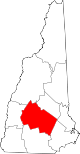
Towns Allenstown | Andover | Boscawen | Bow | Bradford | Canterbury | Chichester | Danbury | Dunbarton | Epsom | Henniker | Hill | Hooksett | Hopkinton | Loudon | New London | Newbury | Northfield | Pembroke | Pittsfield | Salisbury | Sutton | Warner | Webster | Wilmot
Villages Blodgett Landing | Contoocook | East Andover | Elkins | Penacook | South Hooksett | Suncook | Tilton-Northfield‡
Footnotes ‡This populated place also has portions in an adjacent county or counties
Categories:- Towns in Merrimack County, New Hampshire
- Populated places established in 1779
- Colby-Sawyer College:


Wikimedia Foundation. 2010.