- Andover, New Hampshire
Infobox Settlement
official_name = Andover, New Hampshire
nickname =
motto =
image_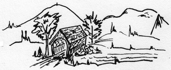
imagesize =
image_caption =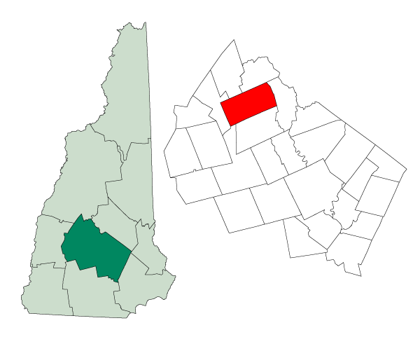
mapsize = 250px
map_caption = Location in Merrimack County,New Hampshire
settlement_type = Town
mapsize1 =
map_caption1 =
subdivision_type = Country
subdivision_name =United States
subdivision_type1 = State
subdivision_name1 =New Hampshire
subdivision_type2 = County
subdivision_name2 = Merrimack
government_type =
leader_title =Board of Selectmen
leader_name =
established_title = Incorporated
established_date =
area_magnitude = 1 E8
area_total_km2 = 107.0
area_total_sq_mi = 41.3
area_land_km2 = 104.8
area_land_sq_mi = 40.5
area_water_km2 = 2.3
area_water_sq_mi = 0.9
area_water_percent = 2.11
population_as_of = 2000
population_note =
population_total = 2109
population_density_km2 = 20.1
population_density_sq_mi = 52.1
timezone = Eastern
utc_offset = -5
timezone_DST = Eastern
utc_offset_DST = -4
latd = 43 |latm = 26 |lats = 11 |latNS = N
longd = 71 |longm = 49 |longs = 24 |longEW = W
elevation_m = 198
elevation_ft = 648
website = [http://www.andovernh.us/ www.andovernh.us]
postal_code_type =ZIP code
postal_code = 03216
area_code = 603
blank_name = FIPS code
blank_info = 33-01460
blank1_name = GNIS feature ID
blank1_info = 0873532
footnotes =Andover is a town in Merrimack County,
New Hampshire ,United States . The population was 2,109 at the 2000 census. Andover includes the villages of Cilleyville, Potter Place, and East Andover, a resort on Highland Lake. The town is home to Ragged Mountain State Forest andProctor Academy , a private coeducational preparatory school.History
Settled in 1761, the town was originally named "New Breton," having been granted primarily to soldiers who had taken part in the 1745 capture of Cape Breton during hostilities with the French in
Canada . Among those soldiers was their regimental surgeon, Dr. Anthony Emery, a friend ofSamuel Phillips, Jr. , who in 1778 founded thePhillips Andover Academy in Andover,Massachusetts . "New Breton" would be incorporated as "Andover" in 1779, the year Phillips Andover was completed.In 1822, an academy was established in Andover, although it would close in 1828. Another school was founded in 1848 that would become Proctor Academy, the prestigious institution around which the town's economy is based. Andover is noted for its antique shops,
Greek Revival architecture , and twocovered bridge s. Potter Place Railroad Station, built in 1874 by the Northern Railroad, is listed on theNational Register of Historic Places , and today serves as a museum for the Andover Historical Society.Notable Inhabitants
*
Nahum Josiah Bachelder (1854-1934), governor of New Hampshire from 1903-1905.
*Jacob Bailey Moore (1797-1853), editor of "New Hampshire Patriot" and the "New York Daily Whig", founder and first librarian of New Hampshire Historical Society. cite book | title = Who Was Who in America, Historical Volume, 1607-1896 | publisher = Marquis Who's Who | location=Chicago | date = 1963]
*John Weeks Moore (1807-1886), publisher of the "Androscoggin Free Press" and editor of the "Bellows Falls Gazette".Geography
According to the
United States Census Bureau , the town has a total area of convert|41.3|sqmi|km2, of which convert|40.5|sqmi|km2|abbr=on is land and convert|0.9|sqmi|km2|abbr=on is water, comprising 2.11% of the town. Andover is drained by the Blackwater River. Bradley Lake is in the south. Ragged Mountain, elevation convert|2286|ft|m abovesea level , is on the northern boundary. The northern slopes of Mount Kearsarge occupy the southernmost part of town and contain the town's highest point, convert|2460|ft|m|abbr=on above sea level. Andover lies fully within theMerrimack River watershed.cite book |title=Water Use in New Hampshire: An Activities Guide for Teachers |url=http://nh.water.usgs.gov/Publications/nh.intro.html |last=Foster |first=Debra H. |coauthors=Batorfalvy, Tatianna N.; and Medalie, Laura |publisher=U.S. Department of the Interior and U.S. Geological Survey |year=1995]Demographics
As of the
census GR|2 of 2000, there were 2,109 people, 823 households, and 609 families residing in the town. Thepopulation density was 52.1 people per square mile (20.1/km²). There were 1,038 housing units at an average density of 25.7/sq mi (9.9/km²). The racial makeup of the town was 98.20% White, 0.38% African American, 0.14% Native American, 0.05% Asian, 0.05% Pacific Islander, 0.05% from other races, and 1.14% from two or more races. Hispanic or Latino of any race were 0.19% of the population.There were 823 households out of which 33.7% had children under the age of 18 living with them, 61.7% were married couples living together, 7.7% had a female householder with no husband present, and 26.0% were non-families. 20.5% of all households were made up of individuals and 7.4% had someone living alone who was 65 years of age or older. The average household size was 2.55 and the average family size was 2.90.
In the town the population was spread out with 24.3% under the age of 18, 6.2% from 18 to 24, 28.2% from 25 to 44, 28.6% from 45 to 64, and 12.7% who were 65 years of age or older. The median age was 40 years. For every 100 females there were 100.5 males. For every 100 females age 18 and over, there were 98.8 males.
The median income for a household in the town was $47,093, and the median income for a family was $52,212. Males had a median income of $33,074 versus $25,927 for females. The
per capita income for the town was $21,627. About 4.5% of families and 5.7% of the population were below thepoverty line , including 7.6% of those under age 18 and 6.3% of those age 65 or over.Sites of Interest
* Andover Historical Society Museum
References
External links
* [http://www.andovernh.us/ Town website]
* [http://www.andoverhistory.org/ Andover Historical Society]
* [http://www.andover.k12.nh.us/townlib.htm Andover Town Library]
* [http://www.nh.gov/nhes/elmi/htmlprofiles/andover.html New Hampshire Economic and Labor Market Information Bureau Profile]
* [http://www.srkg.com Sunapee-Ragged-Kearsarge Greenway Coalition]
Wikimedia Foundation. 2010.