- Greenville, New Hampshire
:otherplaces3|GreenvilleInfobox Settlement
official_name = Greenville, New Hampshire
nickname =
motto =
image_
imagesize =
image_caption =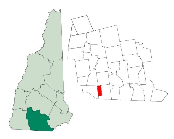
mapsize = 250px
map_caption = Location inHillsborough County, New Hampshire
settlement_type = Town
mapsize1 =
map_caption1 =
subdivision_type = Country
subdivision_name =United States
subdivision_type1 = State
subdivision_name1 =New Hampshire
subdivision_type2 = County
subdivision_name2 = Hillsborough
government_type =
leader_title =Board of Selectmen
leader_name = Michael D. Lamarre, Chairman
Debbie Bouley
David Dow
established_title = Incorporated
established_date = 1872
area_magnitude = 1 E8
area_total_km2 = 17.8
area_total_sq_mi = 6.9
area_land_km2 = 17.8
area_land_sq_mi = 6.9
area_water_km2 = 0.0
area_water_sq_mi = 0.0
area_water_percent =
population_as_of = 2000
population_note =
population_total = 2224
population_density_km2 = 125.0
population_density_sq_mi = 323.8
timezone = Eastern
utc_offset = -5
timezone_DST = Eastern
utc_offset_DST = -4
latd = 42 |latm = 46 |lats = 02 |latNS = N
longd = 71 |longm = 48 |longs = 44 |longEW = W
elevation_m = 253
elevation_ft = 830
website = [http://www.greenvillenh.org/ www.greenvillenh.org]
postal_code_type =ZIP code
postal_code = 03048
area_code = 603
blank_name = FIPS code
blank_info = 33-31940
blank1_name = GNIS feature ID
blank1_info = 0873613
footnotes =Greenville is a town in Hillsborough County,
New Hampshire ,United States . The population was 2,224 at the 2000 census.The primary settlement in Greenville, where over 50% of the population resides, is defined as a
census-designated place (CDP) and is located at the junction of New Hampshire Routes 31, 45, and 123.History
Once a part of Mason called "Mason Village", Greenville is one of the state's newest and smallest towns, incorporated in 1872. It is located at the "High Falls" on the
Souhegan River , whose plentifulwater power provided themill town with the state's first industries, makingcotton andwoolen goods. Because of the falls, Greenville was always a manufacturing center. The Columbian Manufacturing Company was established in 1826 to maketextiles in both Greenville and New Ipswich. The Columbian is long gone, but its fine brick buildings still dominate the village, kept company byQueen Anne style houses on side streets. The mills are now used for other businesses and storage.Greenville once had a Boston & Maine
Railroad trestle which was visible from every part of town. Before it was dismantled for safety reasons, local residents turned out one cool, wet morning to watch Bronson Potter, Mason resident and inventor, fly a private airplane underneath the span on a wager. It is widely rumored that he had to "remove a foot from one wing, and bend the other one up a little bit" to fit through. The railroad depot, which still stands, was once an importantlandmark that literally put the tiny towns of Mason and Greenville "on the map" in New Hampshire. The depot has since been turned into a Chinese restaurant and lounge.Notable inhabitants
*
Brian Viglione ofThe Dresden Dolls Geography
According to the
United States Census Bureau , the town has a total area of convert|6.9|sqmi|km2. The town center, or CDP, has an area of convert|3.4|sqmi|km2|abbr=on.Greenville's highest point is Barrett Hill, with an elevation of convert|1270|ft|m above
sea level . The town is drained by the Souhegan River. Greenville lies fully within theMerrimack River watershed.cite book |title=Water Use in New Hampshire: An Activities Guide for Teachers |url=http://nh.water.usgs.gov/Publications/nh.intro.html |last=Foster |first=Debra H. |coauthors=Batorfalvy, Tatianna N.; and Medalie, Laura |publisher=U.S. Department of the Interior and U.S. Geological Survey |year=1995]Roadways
Three state highways traverse Greenville. NH Route 31 enters the state in Mason from
Ashby, Massachusetts , on MA Route 31. NH 31 intersects NH 124 before entering Greenville. NH 31 runs north-south for the entire length of the town before entering Wilton to the north. The highway shares a right-of-way with NH Route 123 which intersects it and runs north to Pleasant Street. Pleasant Street is the main access road to downtown Greenville from NH 31, aside from Mill Street, Old Mason Center Road, and Old Wilton Road. NH 123 continues on a left turn in downtown Greenville and runs south to New Ipswich and NH 124. Further down Main Street in Greenville is the beginning of NH Route 45, which runs northwest to Temple, ending at NH Route 101.Demographics
As of the
census of 2000, there were 2,224 people, 879 households, and 556 families residing in the town. Thepopulation density was 323.8 people per square mile (125.0/km²). There were 918 housing units at an average density of 51.6 persons/km² (133.6 persons/sq mi). The racial makeup of the town was 97.84% White, 0.27%African American , 0.18% Native American, 0.36%Asia n, 0.04% Pacific Islander, 0.13% from other races, and 1.17% from two or more races. 0.63% of the population wereHispanic orLatino of any race.There were 879 households out of which 32.9% had children under the age of 18 living with them, 49.1% were married couples living together, 9.6% have a woman whose husband does not live with her, and 36.7% were non-families. 29.4% of all households were made up of individuals and 10.7% had someone living alone who was 65 years of age or older. The average household size was 2.53 and the average family size was 3.16.
In the town the population was spread out with 27.4% under the age of 18, 6.7% from 18 to 24, 32.1% from 25 to 44, 22.8% from 45 to 64, and 11.1% who were 65 years of age or older. The median age was 36 years. For every 100 females there were 102.0 males. For every 100 females age 18 and over, there were 104.6 males.
The median income for a household in the town was $39,545, and the median income for a family was $48,750. Males had a median income of $34,792 versus $26,295 for females. The
per capita income for the town was $17,901. 7.4% of the population and 2.9% of families were below the poverty line. Out of the total people living in poverty, 5.7% are under the age of 18 and 18.5% are 65 or older.Town center
As of the
census of 2000, there were 1,131 people, 465 households, and 279 families residing in the central settlement (CDP). Thepopulation density was 333.7 people per square mile (128.8/km²). There were 487 housing units at an average density of 55.5 persons/km² (143.7 persons/sq mi). The racial makeup of the town was 98.14% White, 0.27%African American , 0.27% Native American, 0.35%Asia n, 0.09% Pacific Islander, 0.09% from other races, and 0.80% from two or more races. 0.35% of the population wereHispanic orLatino of any race.There were 465 households out of which 31.6% had children under the age of 18 living with them, 47.3% were married couples living together, 8.8% have a woman whose husband does not live with her, and 39.8% were non-families. 34.2% of all households were made up of individuals and 15.9% had someone living alone who was 65 years of age or older. The average household size was 2.43 and the average family size was 3.15.
In the CDP the population was spread out with 26.1% under the age of 18, 7.4% from 18 to 24, 31.2% from 25 to 44, 21.0% from 45 to 64, and 14.2% who were 65 years of age or older. The median age was 37 years. For every 100 females there were 98.1 males. For every 100 females age 18 and over, there were 101.4 males.
The median income for a household is $42,917, and the median income for a family was $48,889. Males had a median income of $38,875 versus $23,472 for females. The
per capita income for the town was $17,850. 5.0% of the population and 1.4% of families were below the poverty line. Out of the total people living in poverty, 3.4% are under the age of 18 and 17.7% are 65 or older.References
External links
* [http://www.greenvillenh.org Town website]
* [http://www.chamberlinlibrary.org Chamberlin Free Public Library website]
* [http://www.nh.gov/nhes/elmi/htmlprofiles/greenville.html New Hampshire Economic and Labor Market Information Bureau Profile]
Wikimedia Foundation. 2010.