- Wilton, New Hampshire
Infobox Settlement
official_name = Wilton, New Hampshire
nickname =
motto =
image_
imagesize =
image_caption =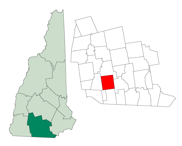
mapsize = 250px
map_caption = Location in Hillsborough County,New Hampshire
settlement_type = Town
mapsize1 =
map_caption1 =
subdivision_type = Country
subdivision_name =United States
subdivision_type1 = State
subdivision_name1 =New Hampshire
subdivision_type2 = County
subdivision_name2 = Hillsborough
government_type =
leader_title =Board of Selectmen
leader_name = Daniel E. Donovan III, Chair
Jerry W. Greene
Richard D. Rockwood
established_title = Incorporated
established_date = 1762
area_magnitude = 1 E8
area_total_km2 = 67.0
area_total_sq_mi = 25.9
area_land_km2 = 66.7
area_land_sq_mi = 25.8
area_water_km2 = 0.2
area_water_sq_mi = 0.1
area_water_percent = 0.35
population_as_of = 2000
population_note =
population_total = 3,743
population_density_km2 = 56.1
population_density_sq_mi = 145.3
timezone = Eastern
utc_offset = -5
timezone_DST = Eastern
utc_offset_DST = -4
latd = 42 |latm = 50 |lats = 36 |latNS = N
longd = 71 |longm = 44 |longs = 06 |longEW = W
elevation_m = 117
elevation_ft = 384
website = [http://www.ci.wilton.nh.us/ www.ci.wilton.nh.us]
postal_code_type =ZIP code
postal_code = 03086
area_code = 603
blank_name = FIPS code
blank_info = 33-85220
blank1_name = GNIS feature ID
blank1_info = 0873756
footnotes =Wilton is a town in Hillsborough County,
New Hampshire ,United States . The population was 3,743 at the 2000 census. Like many smallNew England towns it grew up around water-powered textile mills, but is now a ruralbedroom community with some manufacturing and service employment.The compact town center, where over 33% of the population resides, is defined by the U.S. Census Bureau as the Wilton
census-designated place and is located near the junction of New Hampshire Routes 31 and 101, at the confluence of Stony Brook with theSouhegan River .History
The town was first part of a township chartered as "Salem-Canada" in 1735 by Colonial Governor Jonathan Belcher of
Massachusetts , which then held authority overNew Hampshire . It was granted to soldiers from Salem,Massachusetts , who had served in 1690 under SirWilliam Phips in the war againstCanada . "Salem-Canada" was one of the towns on the state's borders intended to provide protection against Indian attack.It would be regranted in 1749 by Governor
Benning Wentworth as "Number Two", before being incorporated in 1762 as "Wilton". It was either named for Wilton, England, or for SirJoseph Wilton , a famous English sculptor. Sir Wilton's coach design for King George III'scoronation was later used as a model for the Concord coach.The
Souhegan River originally providedwater power for mills. Today, Wilton is a rural town withorchards , farms and woodlands.Geography
According to the
United States Census Bureau , the town has a total area of convert|25.9|sqmi|km2|lk=on, of which convert|25.8|sqmi|km2|abbr=on is land and convert|0.1|sqmi|km2|abbr=on (0.35%) is water. Wilton is drained by the Souhegan River, and Stony and Blood brooks. The town's highest point is convert|1140|ft|m|lk=on abovesea level , where the east slope of Fisk Hill touches the town's western border.The town center, defined as a
census-designated place , has a total area of convert|1.9|sqmi|km2|lk=on.Demographics
As of the
census GR|2 of 2000, there were 3,743 people, 1,410 households, and 1,023 families residing in the town. Thepopulation density was 145.3 people per square mile (56.1/km²). There were 1,451 housing units at an average density of 56.3/sq mi (21.7/km²). The racial makeup of the town was 97.57% White, 0.35% Black or African American, 0.13% Native American, 0.51% Asian, 0.45% from other races, and 0.99% from two or more races. Hispanic or Latino of any race were 0.77% of the population.There were 1,410 households out of which 36.7% had children under the age of 18 living with them, 59.6% were married couples living together, 8.9% had a female householder with no husband present, and 27.4% were non-families. 19.7% of all households were made up of individuals and 8.2% had someone living alone who was 65 years of age or older. The average household size was 2.65 and the average family size was 3.06.
In the town the population was spread out with 26.9% under the age of 18, 6.3% from 18 to 24, 30.8% from 25 to 44, 25.2% from 45 to 64, and 10.8% who were 65 years of age or older. The median age was 37 years. For every 100 females there were 94.7 males. For every 100 females age 18 and over, there were 95.9 males.
The median income for a household in the town was $54,276, and the median income for a family was $61,311. Males had a median income of $39,830 versus $28,714 for females. The
per capita income for the town was $26,618. About 3.1% of families and 4.2% of the population were below thepoverty line , including 3.8% of those under age 18 and 9.2% of those age 65 or over.Town center
As of the
census GR|2 of 2000, there were 1,236 people, 503 households, and 320 families residing in the CDP, the main village settlement of the town. Thepopulation density was 637.4 people per square mile (246.0/km²). There were 520 housing units at an average density of 268.1/sq mi (103.5/km²). The racial makeup of the CDP was 97.82% White, 0.08% Black or African American, 0.08% Native American, 0.65% Asian, 0.32% from other races, and 1.05% from two or more races. Hispanic or Latino of any race were 0.97% of the population.There were 503 households out of which 31.2% had children under the age of 18 living with them, 47.5% were married couples living together, 10.5% had a female householder with no husband present, and 36.2% were non-families. 26.2% of all households were made up of individuals and 11.9% had someone living alone who was 65 years of age or older. The average household size was 2.46 and the average family size was 2.96.
In the CDP the population was spread out with 24.8% under the age of 18, 8.6% from 18 to 24, 33.3% from 25 to 44, 21.0% from 45 to 64, and 12.3% who were 65 years of age or older. The median age was 36 years. For every 100 females there were 92.2 males. For every 100 females age 18 and over, there were 90.8 males.
The median income for a household in the CDP was $39,345, and the median income for a family was $47,330. Males had a median income of $38,661 versus $23,281 for females. The
per capita income for the CDP was $21,349. About 3.5% of families and 5.2% of the population were below thepoverty line , including none of those under age 18 and 14.5% of those age 65 or over.Sites of interest
* Wilton is home to part of the Russell-Abbott State Forest.
* [http://www.andyssummerplayhouse.org/ Andy's Summer Playhouse] is a children's theatre that attracts visitors throughout the region.
* The [http://www.wiltontownhalltheatre.com/ Wilton Town Hall Theatre] is a private art-house movie theater which screens films in the Town Hall's auditorium and in a former dressing room forvaudeville troupes which once played the auditorium.References
External links
* [http://www.ci.wilton.nh.us Town website]
* [http://www.nh.gov/nhes/elmi/htmlprofiles/wilton.html New Hampshire Economic and Labor Market Information Bureau Profile]
Wikimedia Foundation. 2010.