- Tuftonboro, New Hampshire
Infobox Settlement
official_name = Tuftonboro, New Hampshire
nickname =
motto = The Diamond in the Heart of New Hampshire
image_
imagesize =
image_caption =
image_
imagesize =
image_caption =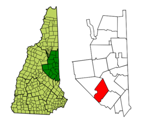
mapsize = 250px
map_caption = Location in Carroll County,New Hampshire
settlement_type = Town
mapsize1 =
map_caption1 =
subdivision_type = Country
subdivision_name =United States
subdivision_type1 = State
subdivision_name1 =New Hampshire
subdivision_type2 = County
subdivision_name2 = Carroll
government_type =
leader_title =Board of Selectmen
leader_name = Sue Weeks, Chairman
Bill Stockman
Dan Duffy
established_title = Incorporated
established_date = 1795
area_magnitude = 1 E8
area_total_km2 = 129.7
area_total_sq_mi = 50.1
area_land_km2 = 106.5
area_land_sq_mi = 41.1
area_water_km2 = 23.2
area_water_sq_mi = 8.9
area_water_percent = 17.85
population_as_of = 2000
population_note =
population_total = 2148
population_density_km2 = 20.2
population_density_sq_mi = 52.2
timezone = Eastern
utc_offset = -5
timezone_DST = Eastern
utc_offset_DST = -4
latd = 43 |latm = 41 |lats = 46 |latNS = N
longd = 71 |longm = 13 |longs = 21 |longEW = W
elevation_m = 301
elevation_ft = 988
website = [http://www.tuftonboro.org/ www.tuftonboro.org]
postal_code_type =ZIP code s
postal_code = 03816, 03850, 03853, 03894
area_code = 603
blank_name = FIPS code
blank_info = 33-77620
blank1_name = GNIS feature ID
blank1_info = 0873741
footnotes =Tuftonboro is a town in Carroll County,
New Hampshire ,United States . The population was 2,148 at the 2000 census. Bounded on the southwest byLake Winnipesaukee , Tuftonboro includes the villages of Tuftonboro Corner, Center Tuftonboro, Melvin Corner, Melvin Village and Mirror Lake.History
Tuftonboro was the only incorporated place in
New Hampshire owned by just one man, John Tufton Mason, for whom the town was named. Mason was heir to the Masonian Claim, the undivided lands of northern New Hampshire, which he sold in 1746 to a group of Portsmouth merchants, thereafter known as the Masonian Proprietors. They disposed of the land via grants to prospective settlers prior to theAmerican Revolution . The town would be granted in 1750 by Colonial GovernorBenning Wentworth , and incorporated in 1795.Geography
According to the
United States Census Bureau , the town has a total area of convert|50.1|sqmi|km2|lk=on, of which convert|41.1|sqmi|km2|abbr=on is land and convert|8.9|sqmi|km2|abbr=on is water, comprising 17.85% of the town. Tuftonboro is drained by the Melvin and Beech rivers. Mirror Lake is in the south, andDan Hole Pond is in the north. The highest point in Tuftonboro is the south peak ofMount Shaw , elevation convert|2930|ft|m|lk=on abovesea level , on the town's northwest boundary.Tuftonboro has miles of winding back roads, rolling fields, old homesteads and beautiful scenic views of the
Ossipee Mountains to the northeast.Melvin Village, a village of Tuftonboro, is a summer vacation spot on Melvin Bay of
Lake Winnipesaukee . It has a marina and many lakeside homes and cottages that are for rent. It is also a popular spot for antique shopping. Running through the village isNew Hampshire Route 109 . Melvin Village is in the southwestern part of Tuftonboro, near the town of Moultonborough.Demographics
As of the
census GR|2 of 2000, there were 2,148 people, 926 households, and 665 families residing in the town. Thepopulation density was 52.2 people per square mile (20.2/km²). There were 2,019 housing units at an average density of 49.1/sq mi (19.0/km²). The racial makeup of the town was 98.32% White, 0.23% Native American, 0.23% Asian, 0.05% from other races, and 1.16% from two or more races. Hispanic or Latino of any race were 0.42% of the population.There were 926 households out of which 23.9% had children under the age of 18 living with them, 62.9% were married couples living together, 5.3% had a female householder with no husband present, and 28.1% were non-families. 22.9% of all households were made up of individuals and 9.6% had someone living alone who was 65 years of age or older. The average household size was 2.32 and the average family size was 2.68.
In the town the population was spread out with 19.8% under the age of 18, 3.8% from 18 to 24, 22.5% from 25 to 44, 31.8% from 45 to 64, and 22.1% who were 65 years of age or older. The median age was 48 years. For every 100 females there were 97.2 males. For every 100 females age 18 and over, there were 97.4 males.
The median income for a household in the town was $45,729, and the median income for a family was $51,875. Males had a median income of $36,181 versus $27,109 for females. The
per capita income for the town was $25,070. About 4.4% of families and 6.4% of the population were below thepoverty line , including 7.1% of those under age 18 and 6.1% of those age 65 or over.Emergency services
Tuftonboro Police Department (24 hour Full Time)
PO Box 98
Center Tuftonboro, NH 03816
(603)569-8695 - Dispatched by Carroll County Sheriff's OfficeTuftonboro Fire/Rescue Department (24 hour Full Time/Volunteer)
Tuftonboro, NH 03816
(603)539-2261 - Dispatched by Carroll County Sheriff's OfficeSites of interest
* Tuftonboro Historical Society Museum
References
External links
* [http://www.tuftonboro.org Town website]
* [http://www.lwhs.us/ Lake Winnipesaukee Historical Society]
* [http://www.nh.gov/nhes/elmi/htmlprofiles/tuftonboro.html New Hampshire Economic and Labor Market Information Bureau Profile]
Wikimedia Foundation. 2010.