- Rollinsford, New Hampshire
Infobox Settlement
official_name = Town of Rollinsford
nickname =
motto =
imagesize =
image_caption =
image_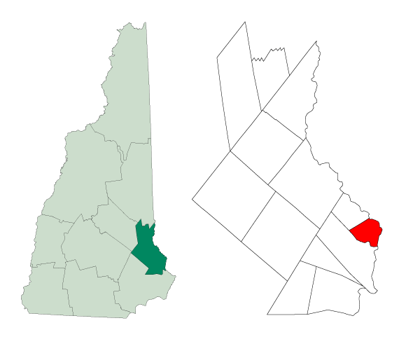
mapsize = 250px
map_caption = Location withinStrafford County ,New Hampshire
settlement_type = Town
mapsize1 =
map_caption1 =
subdivision_type = Country
subdivision_type1 = State
subdivision_type2 = County
subdivision_name =United States
subdivision_name1 =New Hampshire
subdivision_name2 = Strafford
government_type =
leader_title =
leader_name =
established_title = Settled
established_title2 = Incorporated
established_date = 1630s
established_date2 = 1754
area_magnitude =
area_total_sq_mi = 7.5
area_total_km2 = 19.5
area_land_sq_mi = 7.3
area_land_km2 = 18.9
area_water_sq_mi = 0.2
area_water_km2 = 0.6
area_urban_sq_mi =
area_urban_km2 =
area_metro_sq_mi =
area_metro_km2 =
population_as_of = 2007
population_note =
population_total = 2,642
population_metro =
population_urban =
population_density_km2 = 139.8
population_density_sq_mi = 361.9
timezone = EST
utc_offset = -5
timezone_DST = EDT
utc_offset_DST = -4
latd = 43 |latm = 14 |lats = 10 |latNS = N
longd = 70 |longm = 49 |longs = 08 |longEW = W
elevation_m = 21
elevation_ft = 70
website = http://www.rollinsford.nh.us/
postal_code_type =ZIP code s
postal_code = 03805, 03869
area_code = 603
blank_name = FIPS code
blank_info = 33-65540
blank1_name = GNIS feature ID
blank1_info = 0873709
footnotes = Rollinsford is a town in Strafford County,New Hampshire ,United States . The population was 2,648 at the 2000 census. Rollinsford includes Salmon Falls Village.History
The area was once within the domain of the Newichawannock Indians, an
Abenaki sub-tribe which took its name from the Newichawannock River, meaning "river with many falls," now theSalmon Falls River . Their village was located at what is today Salmon Falls Village. They fished at the falls, stretching nets across the river to catch migratingsalmon and other species swimming upriver to spawn. Butwar anddisease , probablysmallpox brought from abroad, decimated the native population.Subsequently settled by about 1630, the land was part of Dover, one of the original townships of New Hampshire. The area was first called Sligo after
Sligo inIreland , and the name survives on a town road. It would be established in 1729 as aparish called Summersworth, meaning summer town, because the ministers preached here during the summer. In 1754, it would be set off and incorporated as a town by Colonial GovernorBenning Wentworth , although thereafter spelled Somersworth due to a clerical error. Since the pioneers' arrival, small communities had developed near varioussawmill s andgristmill s along the Salmon Falls River, but the center of "Summersworth" was located at Rollinsford Junction.Beginning in the early 1820s,
water power edtextile mills were established at the larger falls, and the town would divide between them -- Great Falls became Somersworth, and Salmon Falls became Rollinsford, incorporated in 1849. It was named forEdward H. Rollins , a prominent businessman, banker and politician.Notable Inhabitants
*
Bill Staines , Americanfolk singer /songwriter Salmon Falls Village
According to the Old Berwick Historical Society's 2005 exhibit, "This Promising Little Place: The Village of Salmon Falls," the town began as "a planned utopian industrial community" deliberately laid out in an easy-to-navigate grid plan and made of brick to withstand fires. Designed with worker houses aligned to two adjoining brick mill buildings, the brick village of Salmon Falls was founded in 1823 by a group of local investors led by James Rundlet of Portsmouth, who on
June 17 ,1822 incorporated the Salmon Falls Manufacturing Company to manufacture woolen cloth using the power of the Salmon Falls River, aPiscataqua River tributary. The town thrived into the first decades of the 20th century and eventually became home to many immigrant families whose forebears came to work in the mills. Ironically, though the town planners originally forbade the mill workers to drink alcohol and required that they attend church on Sunday, duringprohibition , its proximity to temperateMaine and the Boston railroad line led to the establishment of numerous bars and a relatively short-lived but racy reputation for free-flowing liquor.The
New England cotton industry would fade in the early to mid-20th century, but would leave the brick town intact. Today, the mills have been reborn as low-cost studio space for more than 100 artists and artisans who use the converted studios for everything from painting, sculpting and crafting handmade furniture to teaching and practicing yoga and dance.Geography
According to the
United States Census Bureau , the town has a total area of convert|7.5|sqmi|km2|1, of which convert|7.3|sqmi|km2|abbr=on|1 is land and convert|0.2|sqmi|km2|abbr=on|1 is water, comprising 3.32% of the town. Rollinsford is bounded on the east by the Salmon Falls River, but most of the town is drained by Rollins and Twombly brooks, which flow south to theCochecho River in neighboring Dover. The highest point in town is an unnamed convert|300|ft|m|adj=on summit near the border with Somersworth. Garrison Hill, convert|290|ft|m abovesea level , occupies the town's border with Dover to the west.Demographics
As of the
census GR|2 of 2000, there were 2,648 people, 1,033 households, and 721 families residing in the town. Thepopulation density was 363.0 people per square mile (140.2/km²). There were 1,060 housing units at an average density of 145.3/sq mi (56.1/km²). The racial makeup of the town was 97.77% White, 0.68% African American, 0.08% Native American, 0.53% Asian, 0.08% from other races, and 0.87% from two or more races. Hispanic or Latino of any race were 0.60% of the population.There were 1,033 households out of which 34.1% had children under the age of 18 living with them, 58.4% were married couples living together, 7.6% had a female householder with no husband present, and 30.2% were non-families. 22.3% of all households were made up of individuals and 8.4% had someone living alone who was 65 years of age or older. The average household size was 2.56 and the average family size was 3.03.
In the town the population was spread out with 25.2% under the age of 18, 6.9% from 18 to 24, 33.0% from 25 to 44, 22.5% from 45 to 64, and 12.3% who were 65 years of age or older. The median age was 37 years. For every 100 females there were 97.8 males. For every 100 females age 18 and over, there were 95.1 males.
The median income for a household in the town was $48,588, and the median income for a family was $60,625. Males had a median income of $37,750 versus $26,068 for females. The
per capita income for the town was $24,444. About 2.6% of families and 3.7% of the population were below thepoverty line , including 5.2% of those under age 18 and 3.4% of those age 65 or over.References
External links
* [http://www.rollinsford.nh.us Town website]
* [http://www.nh.gov/nhes/elmi/htmlprofiles/rollinsford.html New Hampshire Economic and Labor Market Information Bureau Profile]
Wikimedia Foundation. 2010.