- Charlestown, New Hampshire
-
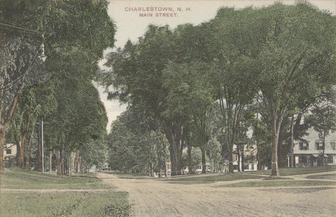
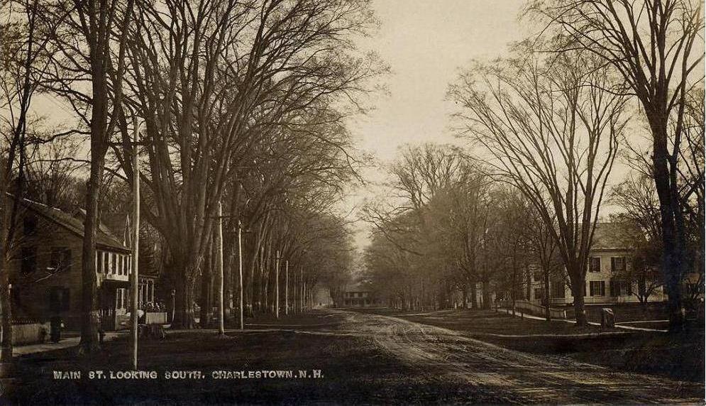
Charlestown, New Hampshire — Town — Main Street in 1910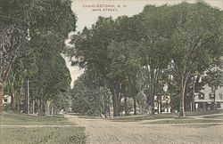
SealLocation in Sullivan County, New Hampshire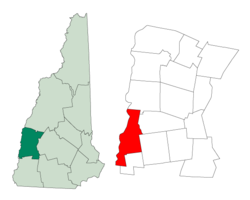
Coordinates: 43°14′04″N 72°25′28″W / 43.23444°N 72.42444°WCoordinates: 43°14′04″N 72°25′28″W / 43.23444°N 72.42444°W Country United States State New Hampshire County Sullivan Incorporated 1783 Government - Board of Selectmen Brenda Ferland, Chair
Steven A. Neill
Douglas RingArea - Total 38.0 sq mi (98.3 km2) - Land 35.8 sq mi (92.7 km2) - Water 2.2 sq mi (5.6 km2) 5.66% Elevation 384 ft (117 m) Population (2010) - Total 5,114 - Density 134.6/sq mi (52/km2) Time zone Eastern (UTC-5) - Summer (DST) Eastern (UTC-4) ZIP code 03603 Area code(s) 603 FIPS code 33-11380 GNIS feature ID 0873562 Website www.charlestown-nh.gov Charlestown is a town in Sullivan County, New Hampshire, United States. The population was 5,114 at the 2010 census.[1] The town is home to Hubbard State Forest and the headquarters of the Student Conservation Association.
The primary settlement in town, where 1,152 people resided at the 2010 census,[1] is defined as the Charlestown census-designated place (CDP) and is located along New Hampshire Route 12. The town also includes the villages of North Charlestown, South Charlestown and Hemlock Center.[2]
Contents
History
The area was first granted in 1735 by Colonial Governor Jonathan Belcher of Massachusetts as Plantation No. 4, the fourth in a line of forts on the Connecticut River border established as trading posts. Settled in 1740, Number Four was the northernmost township, and its 1744 log fort became a strategic military site throughout the French and Indian Wars. Several settlers were ambushed and captured by the Indians, and in 1747 the fort was besieged for three days by a force of 400 French and Indians. Captain Phineas Stevens and 31 soldiers, stationed at the fort, repelled the attack. Their success became well-known, and the fort was never attacked again.
In 1753, the town was regranted as Charlestown by Governor Benning Wentworth, after Admiral Charles Knowles of the British navy, then governor of Jamaica. Admiral Knowles, in port at Boston during the 1747 siege, sent Captain Stevens a sword to acknowledge his valor. The town responded by naming itself in his honor. In 1781, Charlestown briefly joined Vermont because of dissatisfaction with treatment by the New Hampshire government. Returning at the insistence of George Washington, it was incorporated in 1783. [3]
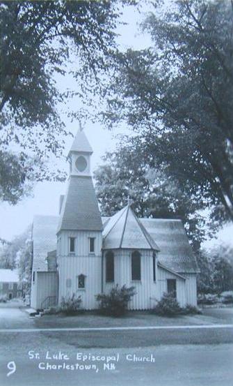
The community developed into a center for law and lawyers, second regionally only to Boston. Its prosperity would be expressed in fine architecture. Sixty-three buildings on Charlestown's Main Street are now listed on the National Register of Historic Places. They include the Gothic Revival South Parish Church erected by master-builder Stephen Hassam in 1842, St. Luke's Church designed by Richard Upjohn in 1863, and the Italianate Town Hall designed in 1872 by Edward Dow, New Hampshire's most prominent architect after the Civil War. Dow also designed Thompson Hall, centerpiece of the University of New Hampshire.
A reproduction of the Fort at Number 4 is now a historical site, where military reenactments and musters occur frequently throughout the summer months. Tours are offered of its stockaded parade ground and pioneer-style houses.
-

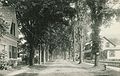
Main Street in 1909
-
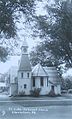
St. Luke's c. 1920
-
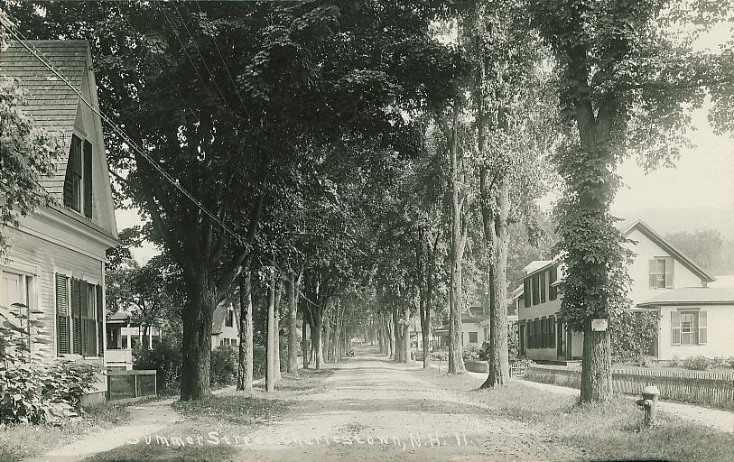
Summer Street in 1914
Geography
According to the United States Census Bureau, the town has a total area of 38.0 square miles (98 km2), of which 35.8 sq mi (93 km2) is land and 2.2 sq mi (5.7 km2) is water, comprising 5.66% of the town. Charlestown is drained by Clay Brook. The highest point in town is Sams Hill, at 1,683 feet (513 m) above sea level). Charlestown lies fully within the Connecticut River watershed.[4]
The town center, defined as a census-designated place (CDP), covers an area of 0.9 sq mi (2.3 km2), about 2.4% of the area of the town. 0.8 sq mi (2.1 km2) of the CDP is land and 0.0 square miles (0.1 km²) of it (4.55%) is water.
Charlestown is served by state routes 11, 12 and 12A.
Demographics
As of the census of 2000, there were 4,749 people, 1,920 households, and 1,332 families residing in the town. The population density was 132.6 people per square mile (51.2/km²). There were 2,067 housing units at an average density of 22.3 persons/km² (57.7 persons/sq mi). The racial makeup of the town was 98.53% White, 0.32% African American, 0.25% Native American, 0.15% Asian, 0.06% from other races, and 0.69% from two or more races. 0.59% of the population were Hispanic or Latino of any race.
There were 1,920 households out of which 30.5% had children under the age of 18 living with them, 55.6% were married couples living together, 9.3% have a woman whose husband does not live with her, and 30.6% were non-families. 23.9% of all households were made up of individuals and 9.9% had someone living alone who was 65 years of age or older. The average household size was 2.46 and the average family size was 2.90.
In the town the population was spread out with 24.7% under the age of 18, 6.5% from 18 to 24, 27.4% from 25 to 44, 27.1% from 45 to 64, and 14.3% who were 65 years of age or older. The median age was 40 years. For every 100 females there were 95.0 males. For every 100 females age 18 and over, there were 93.0 males.
The median income for a household in the town was $38,024, and the median income for a family was $45,172. Males had a median income of $31,010 versus $22,986 for females. The per capita income for the town was $18,654. 6.5% of the population and 3.5% of families were below the poverty line. Out of the total people living in poverty, 5.7% are under the age of 18 and 10.3% are 65 or older.
Town center
As of the census of 2000, there were 1,145 people, 468 households, and 301 families residing in the CDP (census-designated place) occupying the town center. The population density was 1,357.6 people per square mile (526.3/km²). There were 503 housing units at an average density of 231.2 persons/km² (596.4 persons/sq mi). The racial makeup of the town was 98.95% White, 0.26% Native American, 0.26% Asian, and 0.52% from two or more races. 0.79% of the population were Hispanic or Latino of any race.
There were 468 households out of which 31.2% had children under the age of 18 living with them, 48.1% were married couples living together, 12.0% have a woman whose husband does not live with her, and 35.5% were non-families. 28.4% of all households were made up of individuals and 11.3% had someone living alone who was 65 years of age or older. The average household size was 2.42 and the average family size was 2.87.
In the CDP the population was spread out with 24.5% under the age of 18, 7.2% from 18 to 24, 26.8% from 25 to 44, 26.4% from 45 to 64, and 15.1% who were 65 years of age or older. The median age was 39 years. For every 100 females there were 91.8 males. For every 100 females age 18 and over, there were 88.5 males.
The median income for a household is $38,083, and the median income for a family was $40,938. Males had a median income of $29,688 versus $21,344 for females. The per capita income for the town was $16,565. 9.9% of the population and 5.6% of families were below the poverty line. Out of the total people living in poverty, 10.9% are under the age of 18 and 14.6% are 65 or older.
Sites of interest
Notable inhabitants
- James Broderick (1927–1982), actor[5]
- Carlton "Pudge" Fisk (b. 1947), Major League Baseball and member of the Baseball Hall of Fame[6]
- Joseph Glidden (1813–1906), inventor of barbed wire[7][8]
- Charles Hale Hoyt (1859–1900), playwright and theatrical producer[9]
- Henry Hubbard (1784–1857), governor of New Hampshire[10]
- Samuel Hunt (1765–1807), United States congressman[11]
- Susannah Willard Johnson (1729–1810), author of a notable captivity narrative
- Benjamin Labaree, minister, professor and college president
- Ralph Metcalf (1798–1858), governor of New Hampshire[12]
- Simeon Olcott (1735–1815), U.S. senator[13]
- DeForest Richards (1846–1903), fifth governor of Wyoming[14]
- Richard H. Sylvester, journalist
- James Tufts (1829-1884), acting governor of Montana Territory[15]
- Alexander Hamilton Willard (1777–1865), member of the Lewis and Clark Expedition[16][17]
References
- ^ a b United States Census Bureau, American FactFinder, 2010 Census figures. Retrieved March 23, 2011.
- ^ "Charlestown, NH". Economic & Labor Market Information Bureau of New Hampshire. http://www.nh.gov/nhes/elmi/htmlprofiles/charlestown.html. Retrieved May 22, 2009.
- ^ Coolidge, Austin J.; John B. Mansfield (1859). A History and Description of New England. Boston, Massachusetts. pp. 438–441. http://books.google.com/books?id=OcoMAAAAYAAJ&lpg=PA9&ots=cUndZkVSIF&dq=coolidge%20mansfield%20history%20description%20new%20england%201859&pg=PA438#v=onepage&q&f=false.
- ^ Foster, Debra H.; Batorfalvy, Tatianna N.; and Medalie, Laura (1995). Water Use in New Hampshire: An Activities Guide for Teachers. U.S. Department of the Interior and U.S. Geological Survey. http://nh.water.usgs.gov/Publications/nh.intro.html.
- ^ "James Broderick". The Internet Movie Database. http://www.imdb.com/name/nm0110814/bio. Retrieved 7 December 2009.
- ^ "Biography". Carltonfisk.com. http://www.carltonfisk.com/biography.html. Retrieved 7 December 2009.
- ^ Roberts, Gary Boyd, and David Curtis Dearborn (1998). Notable Kin: An Anthology of Columns First Published in the NEHGS Nexus, 1986-1995. Boston, Massachusetts: New England Historic Genealogical Society. p. 107. ISBN 978-0936124209.
- ^ Van Dulken, Stephen (2001). Inventing the 19th century: 100 inventions that shaped the Victorian Age from Aspirin to the Zeppelin. New York City: New York University Press. p. 28. ISBN 978-0814788103.
- ^ Hoyt, Cliff and Linda (March 2, 2009). "Charles Hoyt, Popular Playwright of the Gay Nineties". The Advertising Collections of Cliff & Linda Hoyt. http://choyt48.home.comcast.net/~choyt48/chhoyt_run.htm. Retrieved 7 December 2009.
- ^ "Hubbard, Henry, (1784 - 1857)". Biographical Directory of the United States Congress. http://bioguide.congress.gov/scripts/biodisplay.pl?index=H000883. Retrieved 7 December 2009.
- ^ "Hunt, Samuel, (1765 - 1807)". Biographical Directory of the United States Congress. http://bioguide.congress.gov/scripts/biodisplay.pl?index=H000976. Retrieved 7 December 2009.
- ^ Bastedo, Russell. "A Guide to Likenesses of New Hampshire Officials and Governors on Public Display at the Legislative Office Building and the State House Concord, New Hampshire, to 1998". New Hampshire Division of Historical Records. http://www.nh.gov/nhdhr/publications/glikeness/metcralp.html. Retrieved 7 December 2009.
- ^ "Olcott, Simeon, (1735 - 1815)". Biographical Directory of the United States Congress. http://bioguide.congress.gov/scripts/biodisplay.pl?index=O000060. Retrieved 7 December 2009.
- ^ "Wyoming Governor De Forest Richards". Governor's Information. National Governors Association. http://www.nga.org/portal/site/nga/menuitem.29fab9fb4add37305ddcbeeb501010a0/?vgnextoid=ea0b6d14a47c3010VgnVCM1000001a01010aRCRD. Retrieved 7 December 2009.
- ^ "Catalogue of Officers and Students of Middlebury College in Middlebury, Vermont," 1901, pg. 146
- ^ Gass, Patrick, and James Kendall Hosmer (1904). Gass's Journal of the Lewis and Clark Expedition. A. C. McClurg & Co.. p. xxi.
- ^ Clarke, Charles G., and Dayton Duncan (2002). The Men of the Lewis and Clark Expedition. Lincoln, Nebraska: University of Nebraska Press. p. xii. ISBN 978-0803264199.
External links
- Town website
- Silsby Free Public Library
- Fort at Number Four
- Old Number Four Rod, Gun & Snowmobile Club
- New Hampshire Economic and Labor Market Information Bureau Profile
Municipalities and communities of Sullivan County, New Hampshire City 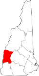
Towns Acworth | Charlestown | Cornish | Croydon | Goshen | Grantham | Langdon | Lempster | Newport | Plainfield | Springfield | Sunapee | Unity | Washington
Villages Balloch | Cornish Flat | East Lempster | Georges Mills | Guild | Meriden
Categories:- Towns in Sullivan County, New Hampshire
- Populated places on the Connecticut River
- Charlestown, New Hampshire
-


Wikimedia Foundation. 2010.