- Lempster, New Hampshire
Infobox Settlement
official_name = Lempster, New Hampshire
nickname =
motto =
image_
imagesize =
image_caption =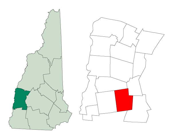
mapsize = 250px
map_caption = Location in Sullivan County,New Hampshire
settlement_type = Town
mapsize1 =
map_caption1 =
subdivision_type = Country
subdivision_name =United States
subdivision_type1 = State
subdivision_name1 =New Hampshire
subdivision_type2 = County
subdivision_name2 = Sullivan
government_type =
leader_title =Board of Selectmen
leader_name = Everett Thurber, Chair
Harold Whiting
William Murgatroy
established_title = Incorporated
named_for = Leominster,Massachusetts , but became Lempster due topronunciation spelling
established_date = 1772
area_magnitude = 1 E8
area_total_km2 = 84.9
area_total_sq_mi = 32.8
area_land_km2 = 83.8
area_land_sq_mi = 32.3
area_water_km2 = 1.1
area_water_sq_mi = 0.4
area_water_percent = 1.31
population_as_of = 2000
population_note =
population_total = 971
population_density_km2 = 11.6
population_density_sq_mi = 30.0
timezone = Eastern
utc_offset = -5
timezone_DST = Eastern
utc_offset_DST = -4
latd = 43 |latm = 14 |lats = 18 |latNS = N
longd = 72 |longm = 12 |longs = 38 |longEW = W
elevation_m = 426
elevation_ft = 1398
website = [http://www.lempsternh.org/ www.lempsternh.org]
postal_code_type =ZIP code
postal_code = 03605
area_code = 603
blank_name = FIPS code
blank_info = 33-41700
blank1_name = GNIS feature ID
blank1_info = 0873645
footnotes =Lempster is a town in Sullivan County,
New Hampshire ,United States . The population was 971 at the 2000 census.History
First granted by colonial
governor Jonathan Belcher in 1735 as Number 9 (ninth in a line of forts to guard against Indian attacks), it was regranted in 1753 as Dupplin, after Sir Thomas Hay,Viscount Dupplin , by GovernorBenning Wentworth . The town was re-granted one final time as Lempster, and incorporated in 1772.Geography
According to the
United States Census Bureau , the town has a total area of convert|32.8|sqmi|km2, of which convert|32.3|sqmi|km2|abbr=on is land and convert|0.4|sqmi|km2|abbr=on is water, comprising 1.31% of the town. The highest point in Lempster is the summit of Bean Mountain, at convert|2326|ft|m abovesea level . Lempster lies mostly within theConnecticut River watershed, with the southeastern corner of town lying in theAshuelot River watershed.cite book |title=Water Use in New Hampshire: An Activities Guide for Teachers |url=http://nh.water.usgs.gov/Publications/nh.intro.html |last=Foster |first=Debra H. |coauthors=Batorfalvy, Tatianna N.; and Medalie, Laura |publisher=U.S. Department of the Interior and U.S. Geological Survey |year=1995]Demographics
As of the
census GR|2 of 2000, there were 971 people, 387 households, and 275 families residing in the town. The 2003 census estimate for the town was 1,044 residents. Thepopulation density was 30.0 people per square mile (11.6/km²). There were 577 housing units at an average density of 17.8/sq mi (6.9/km²). The racial makeup of the town was 97.22% White, 0.10% Native American, 0.10% Asian, 0.10% Pacific Islander, and 2.47% from two or more races. Hispanic or Latino of any race were 0.21% of the population.There were 387 households out of which 30.5% had children under the age of 18 living with them, 59.9% were married couples living together, 7.2% had a female householder with no husband present, and 28.7% were non-families. 22.0% of all households were made up of individuals and 9.6% had someone living alone who was 65 years of age or older. The average household size was 2.51 and the average family size was 2.90.
In the town the population was spread out with 24.3% under the age of 18, 5.3% from 18 to 24, 28.4% from 25 to 44, 27.9% from 45 to 64, and 14.1% who were 65 years of age or older. The median age was 41 years. For every 100 females there were 103.6 males. For every 100 females age 18 and over, there were 105.9 males.
The median income for a household in the town was $40,458, and the median income for a family was $45,385. Males had a median income of $31,484 versus $22,566 for females. The
per capita income for the town was $19,172. About 3.2% of families and 7.3% of the population were below thepoverty line , including 8.0% of those under age 18 and 5.3% of those age 65 or over.Lempster wind farm
Lempster is home to New Hampshire's first
wind farm , providing a total of 24 MW from the 12 turbines, scheduled to be operational by the end of 2008. The turbines are located on Bean Mountain, a knob on the north-south ridge of Lempster Mountain (coord|43|14|N|72|09|W|type:mountain). [ [http://www.unionleader.com/article.aspx?headline=State's+lone+wind+farm+taking+shape State's lone wind farm taking shape] ] A second wind farm for the state has been proposed for Coos County. [ [http://www.concordmonitor.com/article/20080917/FRONTPAGE/809170304 33 turbines would dot Coos ridges] ]References
External links
* [http://www.lempsternh.org Town website]
* [http://www.nh.gov/nhes/elmi/htmlprofiles/lempster.html New Hampshire Economic and Labor Market Information Bureau Profile]
Wikimedia Foundation. 2010.