- Pelham, New Hampshire
-
Pelham, New Hampshire — Town — 
SealLocation in Hillsborough County, New Hampshire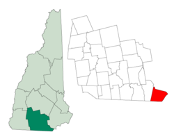
Coordinates: 42°44′04″N 71°19′28″W / 42.73444°N 71.32444°WCoordinates: 42°44′04″N 71°19′28″W / 42.73444°N 71.32444°W Country United States State New Hampshire County Hillsborough Incorporated 1746 Government – Board of Selectmen Douglas Viger, Chairman
Edmund Gleason, Vice Chairman
Robert Haverty
Harold Lynde
William McDevittArea – Total 27.0 sq mi (69.8 km2) – Land 26.4 sq mi (68.5 km2) – Water 0.5 sq mi (1.3 km2) 1.93% Elevation 154 ft (47 m) Population (2010) – Total 12,897 – Density 477.7/sq mi (184.4/km2) Time zone Eastern (UTC-5) – Summer (DST) Eastern (UTC-4) ZIP code 03076 Area code(s) 603 FIPS code 33-59940 GNIS feature ID 0873695 Website www.pelhamweb.com Pelham (
 /ˈpɛləm/) is a town in Hillsborough County, New Hampshire, United States. The population was 12,897 at the 2010 census.[1]
Contents
History
Pelham was split from Old Dunstable in 1741, when the border between Massachusetts and New Hampshire was settled. It was incorporated in 1746. The town is named after Thomas Pelham-Holles, 1st Duke of Newcastle.[2]
Geography
According to the United States Census Bureau, the town has a total area of 27.0 square miles (69.9 km2), of which 26.4 sq mi (68.4 km2) is land and 0.5 sq mi (1.3 km2) is water, comprising 1.93% of the town. The highest point in Pelham is Jeremy Hill, at 577 feet (176 m) above sea level. The town contains the southernmost point in the state of New Hampshire, at 42°41′49″N 71°17′40″W / 42.69694°N 71.29444°W, as the northern boundary of Massachusetts runs slightly northwest from Pelham.[3]
Demographics
Historical populations Census Pop. %± 1790 791 — 1800 918 16.1% 1810 998 8.7% 1820 1,040 4.2% 1830 1,070 2.9% 1840 1,003 −6.3% 1850 1,071 6.8% 1860 944 −11.9% 1870 861 −8.8% 1880 848 −1.5% 1890 791 −6.7% 1900 875 10.6% 1910 826 −5.6% 1920 974 17.9% 1930 814 −16.4% 1940 979 20.3% 1950 1,317 34.5% 1960 2,605 97.8% 1970 5,408 107.6% 1980 8,090 49.6% 1990 9,408 16.3% 2000 10,914 16.0% 2010 12,897 18.2% The earliest census data shows the town of Pelham having a population of 543 residents in 1767.[4]
As of the census[5] of 2000, there were 10,914 people, 3,606 households, and 2,982 families residing in the town. The population density was 412.9 people per square mile (159.4/km²). There were 3,740 housing units at an average density of 141.5 per square mile (54.6/km²). The racial makeup of the town was:
- 97.34% White (U.S. average: 75.1%)
- 0.44% African American (U.S. average: 12.3%)
- 0.22% Native American (U.S. average: 0.1%)
- 1.04% Asian (U.S. average: 3.6%)
- 0.25% from other races (U.S. average: 5.5%)
- 0.71% from two or more races (U.S. average: 2.4%)
Hispanic or Latino of any race were 0.96% of the population. (U.S. average: 12.5%)
In 2000, there were 3,606 households, with an average household size of 3.03 and an average family size of 3.33.
- 43.6% of households had children under the age of 18 living with them. (U.S. average: 32.8%)
- 71.8% were married couples living together. (U.S. average: 51.7%)
- 7.5% had a female householder with no husband present. (U.S. average: 12.2%)
- 17.3% were non-families. (U.S. average: 31.9%)
- 12.9% of all households were made up of individuals. (U.S. average: 25.8%)
- 5.7% had someone living alone who was 65 years of age or older. (U.S. average: 9.2%)
In 2000, the town's population had a median age of 36 years (U.S. average: 35.3).
- 28.9% under the age of 18
- 6.1% from 18 to 24
- 34.0% from 25 to 44
- 23.2% from 45 to 64
- 7.8% who were 65 years of age or older
For every 100 females there were 98.8 males. For every 100 females age 18 and over, there were 99.3 males.
The median income for a household in the town was $68,608. (U.S. average: $41,994). The median income for a family was $73,365. (U.S. average: $50,046). Males had a median income of $47,685 versus $33,375 for females. The per capita income for the town was $25,158. About 1.6% of families (U.S. average: 9.2%) and 3.0% of the population (U.S. average: 12.4%) were below the poverty line, including 3.1% of those under age 18 and 4.7% of those age 65 or over.
School system
- Pelham Elementary School
- Pelham Memorial School
- Pelham High School
- St. Patrick School (private)
- E. G. Sherburne School (former elementary school)
Parks
Muldoon Park
The park is located northwest of the center of Pelham at 304 Mammoth Road (NH 128), just north of Nashua Road. The park's land area is surrounded by NH 128, two roads that branch off it, and a minor road which intersects NH 111A.
Muldoon Park offers many short walking trails, four variously sized baseball fields (ranging from t-ball to official), a soccer field, and a play area. Most of the trails lead to the park's two ponds, local roads and houses or to Beaver Brook, a small river. The town of Pelham completed an 18-hole disc golf course here, stretching over a quarter-mile, in September 2007.[6]
The Pelham Parks and Recreation department has recently added two non-official sized baseball fields to the southwest corner of the park. Construction is complete on one field with the exception of dugouts, and the other field is still under construction, as of June 2008.
Notable residents
- Josiah Butler (1779–1854), U.S. Congressman in the 15th, 16th and 17th congresses[7]
- Sean Caisse (1986-), stock car driver
- Ray Fox, NASCAR crew chief and owner
- Daniel Gage (1828–1901), the "Ice King of Lowell", family for whom Gage Hill is named
- Richard M. Linnehan, NASA astronaut, a 1975 graduate of Pelham High School
See also
References
- ^ United States Census Bureau, American FactFinder, 2010 Census figures. Retrieved March 23, 2011.
- ^ "Profile for Pelham, New Hampshire". ePodunk. http://www.epodunk.com/cgi-bin/genInfo.php?locIndex=18975. Retrieved 2010-04-25.
- ^ U.S. Geological Survey. "Lowell, Massachusetts—New Hampshire" 7.5 x 15 minute quadrangle. 1987.
- ^ http://www.nh.gov/oep/programs/DataCenter/Population/1767-820.htm#hillsborough
- ^ "American FactFinder". United States Census Bureau. http://factfinder.census.gov. Retrieved 2008-01-31.
- ^ The Eagle-Tribune, October 15, 2007
- ^ The twentieth century biographical dictionary of notable Americans ... edited by Rossiter Johnson, John Ho
External links
- Town website
- New Hampshire Economic and Labor Market Information Bureau Profile
- Pelham, NH Police website
Municipalities and communities of Hillsborough County, New Hampshire Cities 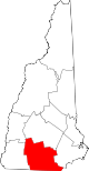
Towns Amherst | Antrim | Bedford | Bennington | Brookline | Deering | Francestown | Goffstown | Greenfield | Greenville | Hancock | Hillsborough | Hollis | Hudson | Litchfield | Lyndeborough | Mason | Merrimack | Milford | Mont Vernon | New Boston | New Ipswich | Pelham | Peterborough | Sharon | Temple | Weare | Wilton | Windsor
Villages East Merrimack | Grasmere | Pinardville
Categories:- Towns in Hillsborough County, New Hampshire


Wikimedia Foundation. 2010.