- Hancock, New Hampshire
Infobox Settlement
official_name = Hancock, New Hampshire
nickname =
motto =
image_
imagesize =
image_caption =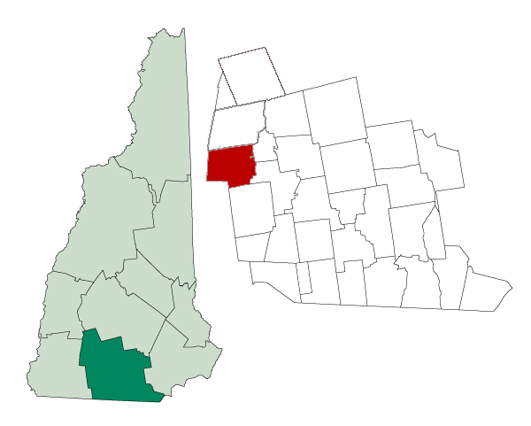
mapsize = 250px
map_caption = Location in Hillsborough County,New Hampshire
settlement_type = Town
mapsize1 =
map_caption1 =
subdivision_type = Country
subdivision_name =United States
subdivision_type1 = State
subdivision_name1 =New Hampshire
subdivision_type2 = County
subdivision_name2 = Hillsborough
government_type =
leader_title =Board of Selectmen
leader_name = Laurie Bryan
John Hayes
Lawrence Schwartz
established_title = Incorporated
established_date = 1779
area_magnitude = 1 E8
area_total_km2 = 80.9
area_total_sq_mi = 31.2
area_land_km2 = 77.6
area_land_sq_mi = 30.0
area_water_km2 = 3.2
area_water_sq_mi = 1.2
area_water_percent = 4.00
population_as_of = 2000
population_note =
population_total = 1739
population_density_km2 = 22.4
population_density_sq_mi = 58.0
timezone = Eastern
utc_offset = -5
timezone_DST = Eastern
utc_offset_DST = -4
latd = 42 |latm = 58 |lats = 22 |latNS = N
longd = 71 |longm = 58 |longs = 47 |longEW = W
elevation_m = 267
elevation_ft = 876
website = [http://www.hancocknh.org/ www.hancocknh.org]
postal_code_type =ZIP code
postal_code = 03449
area_code = 603
blank_name = FIPS code
blank_info = 33-33700
blank1_name = GNIS feature ID
blank1_info = 0873618
footnotes =Hancock is a town in Hillsborough County,
New Hampshire ,United States . The population was 1,739 at the 2000 census. Hancock is home to the Welch Family Farm Forest.History
Hancock started as an unidentified settlement on the
Contoocook River , in lands known as Society Land or Cumberland, which had been reserved for the proprietors of the lands which becameNew Hampshire . First settled in 1764, the town was set off from Peterborough and incorporated in 1779, named Hancock in honor ofJohn Hancock . A landowner of convert|1875|acre|km2|0 in the community, Hancock was the first governor of thestate ofMassachusetts , president of theContinental Congress , and signer of theDeclaration of Independence .Almost every building on Main Street in downtown Hancock is listed on the
National Register of Historic Places . Hancock's Meetinghouse is home to Paul Revere's #236 bell, which chimes on the hour, day and night. The town does not have traditional sidewalks, but gravel paths leading from home to home.Notable inhabitants
*
Oren B. Cheney , abolitionist, Free Baptist preacher, founder ofBates College
*Person C. Cheney ,U.S. Senator from New Hampshire
*Joseph Grew ,United States Ambassador to Japan
*Howard Mansfield , author
*Jay Pierrepont Moffat ,United States Ambassador to Canada
*Sy Montgomery , author, adventurer
*Lilla Cabot Perry , artist
*Elizabeth Yates , author and historianGeography
According to the
United States Census Bureau , the town has a total area of convert|31.2|sqmi|km2, of which convert|30.0|sqmi|km2|abbr=on is land and convert|1.2|sqmi|km2|abbr=on is water, comprising 4.00% of the town. Hancock is drained by the Contoocook River.Powder Mill Pond is in the east, andNubanusit Lake is on the western border.Skatutakee Mountain , the highest point in Hancock, has an elevation of convert|2002|ft|m abovesea level . Hancock lies fully within theMerrimack River watershed.cite book |title=Water Use in New Hampshire: An Activities Guide for Teachers |url=http://nh.water.usgs.gov/Publications/nh.intro.html |last=Foster |first=Debra H. |coauthors=Batorfalvy, Tatianna N.; and Medalie, Laura |publisher=U.S. Department of the Interior and U.S. Geological Survey |year=1995]Demographics
As of the
census GR|2 of 2000, there were 1,739 people, 706 households, and 494 families residing in the town. Thepopulation density was 58.0 people per square mile (22.4/km²). There were 814 housing units at an average density of 27.2/sq mi (10.5/km²). The racial makeup of the town was 98.39% White, 0.23% African American, 0.29% Native American, 0.40% Asian, 0.06% from other races, and 0.63% from two or more races. Hispanic or Latino of any race were 0.40% of the population.There were 706 households out of which 31.2% had children under the age of 18 living with them, 62.6% were married couples living together, 5.1% had a female householder with no husband present, and 29.9% were non-families. 25.1% of all households were made up of individuals and 10.3% had someone living alone who was 65 years of age or older. The average household size was 2.46 and the average family size was 2.94.
In the town the population was spread out with 25.0% under the age of 18, 3.9% from 18 to 24, 26.0% from 25 to 44, 28.3% from 45 to 64, and 16.8% who were 65 years of age or older. The median age was 43 years. For every 100 females there were 92.2 males. For every 100 females age 18 and over, there were 90.2 males.
The median income for a household in the town was $55,000, and the median income for a family was $64,423. Males had a median income of $40,000 versus $31,200 for females. The
per capita income for the town was $29,445. About 2.7% of families and 3.8% of the population were below thepoverty line , including 2.6% of those under age 18 and 4.1% of those age 65 or over.ites of interest
* Hancock Historical Society Museum
*Very Long Baseline Array References
External links
* [http://www.hancocknh.org Town website]
* [http://www.mv.com/ipusers/hancocknh/hhs/home.htm Hancock Historical Society]
* [http://members.aol.com/ilovet8r/wizzc.html History of Hancock, New Hampshire]
* [http://www.footnote.com/browse.php#22680955 Various town records 1749-1883] online atFootnote.com
* [http://www.nh.gov/nhes/elmi/htmlprofiles/hancock.html New Hampshire Economic and Labor Market Information Bureau Profile]
Wikimedia Foundation. 2010.