- Hillsborough, New Hampshire
Infobox Settlement
official_name = Hillsborough, New Hampshire
nickname =
motto =
image_
imagesize =
image_caption =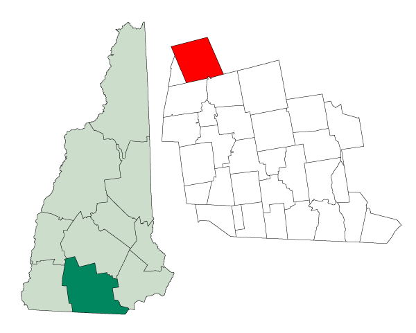
mapsize = 250px
map_caption = Location in Hillsborough County,New Hampshire
settlement_type = Town
mapsize1 =
map_caption1 =
subdivision_type = Country
subdivision_name =United States
subdivision_type1 = State
subdivision_name1 =New Hampshire
subdivision_type2 = County
subdivision_name2 = Hillsborough
government_type =
leader_title =Board of Selectmen
leader_name = Gary Snair, Chairman
Laura D. Simoes
Robert I. Buker
established_title = Incorporated
established_date = 1772
area_magnitude = 1 E8
area_total_km2 = 115.6
area_total_sq_mi = 44.6
area_land_km2 = 113.0
area_land_sq_mi = 43.6
area_water_km2 = 2.6
area_water_sq_mi = 1.0
area_water_percent = 2.24
population_as_of = 2000
population_note =
population_total = 4828
population_density_km2 = 43.6
population_density_sq_mi = 112.9
timezone = Eastern
utc_offset = -5
timezone_DST = Eastern
utc_offset_DST = -4
latd = 43 |latm = 06 |lats = 53 |latNS = N
longd = 71 |longm = 53 |longs = 42 |longEW = W
elevation_m = 194
elevation_ft = 636
website = [http://www.town.hillsborough.nh.us/ www.town.hillsborough.nh.us]
postal_code_type =ZIP code
postal_code = 03244
area_code = 603
blank_name = FIPS code
blank_info = 33-36180
blank1_name = GNIS feature ID
blank1_info = 0873625
footnotes =Hillsborough, frequently spelled Hillsboro, is a town in Hillsborough County,
New Hampshire ,United States . The population was 4,928 at the 2000 census. It includes Hillsborough Center; Hillsborough Upper Village; Hillsborough Lower Village; Emerald Lake Village; and the primary settlement in town, known either as "Bridge Village" or simply "Hillsborough". The town is home to Fox State Forest and part of Low State Forest.The Hillsborough CDP is a
census-designated place that roughly encompasses the central urban area of the town, located at the junction ofU.S. Route 202 and New Hampshire Routes 9 and 149. Over 37% of the town's population resides in the CDP.History
The town was first granted in 1735 by Colonial Governor
Jonathan Belcher as "Number Seven," one in a line of nine towns set up as defense barriers against Indian attacks. The towns were renamed following the 1741 establishment ofNew Hampshire as a separate province. Settled in 1741, the town was granted in 1748 by GovernorBenning Wentworth as "Hillsborough," named for Sir Wills Hill,Earl of Hillsborough . It would be incorporated in 1772 by Governor John Wentworth.Hillsborough is the birthplace in 1804 of
Franklin Pierce , 14th president of theUnited States , and the only president from New Hampshire. The Pierce Homestead was built in 1804 by his father, Benjamin Pierce, a general in the Revolutionary War, and twice governor of New Hampshire. Restored in 1925, the home was designated aNational Historic Landmark in 1961. Listed on theNational Register of Historic Places , the house is today a museum owned by the state, and operated by the Hillsborough Historical Society.Notable Inhabitants
*
Franklin Pierce , 14thPresident of United States
*Benjamin Pierce Cheney , a founder ofAmerican Express
*Benjamin Franklin Keith , theatrical impressario
*John Butler Smith , governor and manufacturerGeography
According to the
United States Census Bureau , the town has a total area of convert|44.6|sqmi|km2, of which convert|43.6|sqmi|km2|abbr=on is land and convert|1.0|sqmi|km2|abbr=on is water, comprising 2.24% of the town.According to theUnited States Census Bureau , the town center, orcensus-designated place , has a total area of convert|1.6|sqmi|km2|abbr=on.The highest point in Hillsborough is Thompson Hill, at convert|1768|ft|m above
sea level , in the northern part of town. Hillsborough is drained by theContoocook River , in addition to Beard's and Sand brooks. Part ofFranklin Pierce Lake is in the southwest. The town lies fully within theMerrimack River watershed.cite book |title=Water Use in New Hampshire: An Activities Guide for Teachers |url=http://nh.water.usgs.gov/Publications/nh.intro.html |last=Foster |first=Debra H. |coauthors=Batorfalvy, Tatianna N.; and Medalie, Laura |publisher=U.S. Department of the Interior and U.S. Geological Survey |year=1995]Demographics
As of the
census GR|2 of 2000, there were 4,928 people, 1,922 households, and 1,312 families residing in the town. Thepopulation density was 112.9 people per square mile (43.6/km²). There were 2,326 housing units at an average density of 53.3/sq mi (20.6/km²). The racial makeup of the town was 97.46% White, 0.18% Black or African American, 0.45% Native American, 0.93% Asian, 0.12% from other races, and 0.85% from two or more races. Hispanic or Latino of any race were 0.53% of the population.There were 1,922 households out of which 33.7% had children under the age of 18 living with them, 53.9% were married couples living together, 10.0% had a female householder with no husband present, and 31.7% were non-families. 23.8% of all households were made up of individuals and 8.0% had someone living alone who was 65 years of age or older. The average household size was 2.55 and the average family size was 3.02.
In the town the population was spread out with 26.5% under the age of 18, 6.7% from 18 to 24, 30.3% from 25 to 44, 23.7% from 45 to 64, and 12.7% who were 65 years of age or older. The median age was 38 years. For every 100 females there were 95.6 males. For every 100 females age 18 and over, there were 94.4 males.
The median income for a household in the town was $44,500, and the median income for a family was $50,445. Males had a median income of $37,016 versus $24,795 for females. The
per capita income for the town was $20,122. About 6.7% of families and 9.8% of the population were below thepoverty line , including 12.7% of those under age 18 and 10.1% of those age 65 or over.Town center
As of the
census GR|2 of 2000, there were 1,842 people, 760 households, and 455 families residing in the primary settlement, orcensus-designated place (CDP). Thepopulation density was 1,130.5 people per square mile (436.3/km²). There were 809 housing units at an average density of 496.5/sq mi (191.6/km²). The racial makeup of the CDP was 97.29% White, 0.11% Black or African American, 0.16% Native American, 1.47% Asian, 0.16% from other races, and 0.81% from two or more races. Hispanic or Latino of any race were 0.33% of the population.There were 760 households out of which 30.9% had children under the age of 18 living with them, 41.1% were married couples living together, 14.9% had a female householder with no husband present, and 40.1% were non-families. 31.8% of all households were made up of individuals and 11.3% had someone living alone who was 65 years of age or older. The average household size was 2.38 and the average family size was 3.01.
In the CDP the population was spread out with 26.3% under the age of 18, 8.2% from 18 to 24, 29.6% from 25 to 44, 21.6% from 45 to 64, and 14.4% who were 65 years of age or older. The median age was 36 years. For every 100 females there were 88.3 males. For every 100 females age 18 and over, there were 87.6 males.
The median income for a household in the CDP was $31,855, and the median income for a family was $47,438. Males had a median income of $38,077 versus $22,813 for females. The
per capita income for the CDP was $19,125. About 10.6% of families and 14.1% of the population were below thepoverty line , including 21.0% of those under age 18 and 9.5% of those age 65 or over.Education
Hillsborough is part of School Administrative Unit (SAU) 34. Public schools serving the community of Hillsboro include:
* [http://www.publicschoolreview.com/school_ov/school_id/50805 Hillsboro-Deering Elementary School]
* [http://www.publicschoolreview.com/school_ov/school_id/50807 Hillsboro-Deering Middle School]
* [http://www.publicschoolreview.com/school_ov/school_id/50806 Hillsboro-Deering High School]Sites of Interest
* D.A.R. Museum Room, in the "Community Building"
* [http://www.nhstateparks.org/ParksPages/FranklinPierce/FranklinPierce.html Franklin Pierce Homestead] (1804)
* [http://www.oddnewengland.com/state_nh/truck/truck.htm Kemp's Truck Museum]
* [http://www.conknet.com/~fullerlibrary/index.html Fuller Public Library]References
External links
* [http://www.town.hillsborough.nh.us Town website]
* [http://www.hillsboroughnhchamber.com/points.html Hillsborough Chamber of Commerce]
* [http://www.nh.gov/nhes/elmi/htmlprofiles/hillsborough.html New Hampshire Economic and Labor Market Information Bureau Profile]
Wikimedia Foundation. 2010.