- Lee, New Hampshire
Infobox Settlement
official_name = Lee, New Hampshire
nickname =
motto =
image_
imagesize =
image_caption =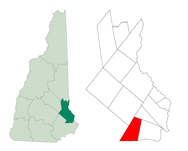
mapsize = 250px
map_caption = Location withinStrafford County ,New Hampshire
settlement_type = Town
mapsize1 =
map_caption1 =
subdivision_type = Country
subdivision_name =United States
subdivision_type1 = State
subdivision_name1 =New Hampshire
subdivision_type2 = County
subdivision_name2 = Strafford
government_type =
leader_title =Board of Selectmen
leader_name = Richard H. Wellington, Chairman
Joseph P. Ford
Frank W. Reinhold, Jr.
established_title = Settled
established_title2 = Incorporated
established_date = 1657
established_date2 =
area_magnitude = 1 E8
area_total_sq_mi = 20.2
area_total_km2 = 52.2
area_land_sq_mi = 20.0
area_land_km2 = 51.7
area_water_sq_mi = 0.2
area_water_km2 = 0.5
area_urban_sq_mi =
area_urban_km2 =
area_metro_sq_mi =
area_metro_km2 =
population_as_of = 2007
population_note =
population_total = 4,447
population_metro =
population_urban =
population_density_km2 = 86.0
population_density_sq_mi = 222.4
timezone = EST
utc_offset = -5
timezone_DST = EDT
utc_offset_DST = -4
latd = 43 |latm = 07 |lats = 23 |latNS = N
longd = 71 |longm = 00 |longs = 41 |longEW = W
elevation_m = 58
elevation_ft = 190
website = [http://www.leenh.org/ www.leenh.org/]
postal_code_type =ZIP code
postal_code = 03861
area_code = 603
blank_name = FIPS code
blank_info = 33-41460
blank1_name = GNIS feature ID
blank1_info = 0873644
footnotes = Lee is a town in Strafford County,New Hampshire ,United States . The population was 4,145 at the 2000 census. The town is a rural farm andbedroom community .History
Settled in 1657, Lee was originally part of the extensive early Dover township. It includes Wheelwright Pond, named for the founder of Exeter, the Reverend
John Wheelwright , and site of a noted early battle duringKing William's War . Indians, incited by the government ofNew France , attacked Exeter onJuly 4 ,1690 . They were pursued by 2 companies of scouts raised for the purpose, who overtook them at Wheelwright Pond onJuly 6 ,1690 . Fierce fighting would leave 3 officers and 12 soldiers dead, together with a large number of Indians.In 1735, Durham, which included Lee, separated from Dover. Then Lee, in turn, would separate from Durham on
January 16 ,1766 when it was established by Colonial GovernorBenning Wentworth . It was among the last of 129 towns to receive a charter during his administration, and named for British General Charles Lee, who later joined the American Revolution.Lee is hometown for numerous faculty of the
University of New Hampshire in Durham. On2007-06-11 , theUS Post Office announced that the town of Lee would have its own zip code – 03861.cite web |url=http://gregg.senate.gov/public/index.cfm?FuseAction=PressRoom.PressReleases&ContentRecord_id=1bc1b7f9-802a-23ad-4ba0-8b687bcacc6a&Region_id=&Issue_id= |title=New Zip Code for Lee, New Hampshire |date=2007-06-11 |accessdate=2007-07-09 |work=Senator Gregg website]Notable inhabitants
*
Tom Bergeron [cite web|url=http://www.newhampshire.com/nh-people/tom-Bergeron-biography.aspx|title="New Hampshire People"|publisher=NewHampshire.com|accessdate=2008-03-26] , television personality
*Daniel Meserve Durell , congressmanGeography
According to the
United States Census Bureau , the town has a total area of convert|20.2|sqmi|km2|sigfig=3, of which convert|20.0|sqmi|km2|abbr=on|sigfig=3 is land and convert|0.2|sqmi|km2|abbr=on|sigfig=1 is water, comprising 1.04% of the town. The town is drained by theLamprey River , North River and Oyster River. Lee lies fully within thePiscataqua River (Coastal) watershed.cite book |title=Water Use in New Hampshire: An Activities Guide for Teachers |url=http://nh.water.usgs.gov/Publications/nh.intro.html |last=Foster |first=Debra H. |coauthors=Batorfalvy, Tatianna N.; and Medalie, Laura |publisher=U.S. Department of the Interior and U.S. Geological Survey |year=1995] The highest point in Lee is convert|272|ft|m abovesea level , atop an unnamed hill southwest of the town center.Demographics
As of the
census GR|2 of 2000, there were 4,145 people, 1,466 households, and 1,092 families residing in the town. Thepopulation density was 207.8 people per square mile (80.2/km²). There were 1,534 housing units at an average density of 76.9/sq mi (29.7/km²). The racial makeup of the town was 96.02% White, 0.55% African American, 0.22% Native American, 1.57% Asian, 0.19% Pacific Islander, 0.39% from other races, and 1.06% from two or more races. Hispanic or Latino of any race were 1.18% of the population.There were 1,466 households out of which 45.2% had children under the age of 18 living with them, 61.4% were married couples living together, 8.6% had a female householder with no husband present, and 25.5% were non-families. 17.7% of all households were made up of individuals and 4.4% had someone living alone who was 65 years of age or older. The average household size was 2.81 and the average family size was 3.20.
In the town the population was spread out with 30.9% under the age of 18, 7.3% from 18 to 24, 31.7% from 25 to 44, 23.0% from 45 to 64, and 7.1% who were 65 years of age or older. The median age was 35 years. For every 100 females there were 100.4 males. For every 100 females age 18 and over, there were 98.5 males.
The median income for a household in the town was $57,993, and the median income for a family was $62,330. Males had a median income of $41,354 versus $29,651 for females. The
per capita income for the town was $23,905. About 4.3% of families and 5.1% of the population were below thepoverty line , including 5.8% of those under age 18 and 5.8% of those age 65 or over.ites of interest
* [http://www.museumsusa.org/museums/info/1163533 Lee Historical Society & Museum]
*Lee USA Speedway [http://www.leeusaspeedway.com/] , aNASCAR track where several scenes of "Days of Thunder " (starringTom Cruise ) were filmedFact|date=May 2008References
External links
* [http://www.leenh.org Town website]
* [http://www.lee.lib.nh.us/ Lee Public library]
* [http://www.nh.gov/nhes/elmi/htmlprofiles/lee.html New Hampshire Economic and Labor Market Information Bureau Profile]
* [http://history.rays-place.com/nh/lee-nh.htm History of Lee, New Hampshire (1882)]
Wikimedia Foundation. 2010.