- Milton, New Hampshire
-
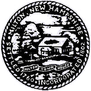
Milton, New Hampshire — Town — 
SealLocation in Strafford County, New Hampshire
Coordinates: 43°24′35″N 70°59′18″W / 43.40972°N 70.98833°WCoordinates: 43°24′35″N 70°59′18″W / 43.40972°N 70.98833°W Country United States State New Hampshire County Strafford Incorporated 1802 Government - Board of Selectmen Bob Srnec, Chair
Stan Nadeau
Tom GrayArea - Total 34.3 sq mi (88.8 km2) - Land 33.1 sq mi (85.8 km2) - Water 1.2 sq mi (3.0 km2) 3.41% Elevation 459 ft (140 m) Population (2010) - Total 4,598 - Density 134.1/sq mi (51.8/km2) Time zone Eastern (UTC-5) - Summer (DST) Eastern (UTC-4) ZIP code 03851 Area code(s) 603 FIPS code 33-48660 GNIS feature ID 0873668 Website www.miltonnh-us.com Milton is a town in Strafford County, New Hampshire, United States. The population was 4,598 at the 2010 census.[1] A manufacturing, resort and residential town, Milton includes the village of Milton Mills. The primary village in town, where 575 people resided at the 2010 census,[1] is defined as the Milton census-designated place (CDP), and is located along New Hampshire Route 125 and the Salmon Falls River, just north of Route 75.
Contents
History
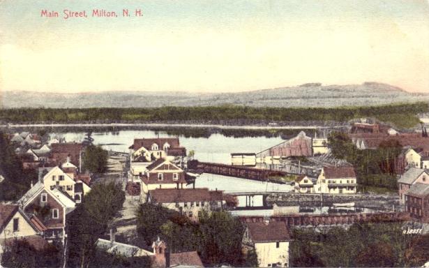
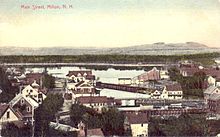 Main Street c. 1910
Originally a part of Rochester variously called the "Northeast Parish", "Three Ponds" or "Milton Mills", the town was settled in 1760. It would be set off and incorporated in 1802 as "Milton", the name either a contraction of "mill town", or else derived from a relative of the Wentworth colonial governors -- William Fitzwilliam, Earl Fitzwilliam and Viscount Milton. The town of Fitzwilliam also bears his name.
 Kennebunk Manufacturing Company Fibre Lunch Box Catalog Cover
Located along the Maine border, Milton was the location of early industry which used water power from the Salmon Falls River. Six miles north of Milton, the village of Milton Mills was once called "Shapleigh Mills" and during the 19th century had 4 shoe factories, 2 woolen mills, 1 felt mill, 1 carriage shop and many sawmills. In 1872, Henry H. Townsend established The Miltonia Mills, which manufactured fine wool blankets used by Admiral Robert E. Peary on his expedition to the North Pole, and Admiral Richard E. Byrd at the Antarctic. The company went bankrupt in 1950. The building then became Greene Tanning, a leather tannery where the employees of the mill made raw leather into leather known throughout the world as being some of the highest in quality.[citation needed]
In 1893 Jonas Spaulding opened a leatherboard mill in Milton, organizing the business as J. Spaulding and Sons. His sons were Leon C., Huntley N. and Rolland H., of whom Huntley and Rolland would serve as governors of New Hampshire. Jonas and his sons would undertake the construction of another leatherboard mill in North Rochester, NH around 1900. Jonas died before the North Rochester mill became operational. The brothers continued to run the business successfully and brought the Spaulding Brothers leatherboard mill in Townsend Harbor, Massachusetts, under the J. Spaulding and Sons banner in 1902. They were successful with a machine to manufacture shoe counters and with experiments to make vulcanized fibre. In 1912 they opened a purpose-built facility to make vulcanized fibre in Tonawanda, New York. In 1913 J. Spaulding and Sons opened a second leatherboard mill in Milton. They also acquired the Kennebunk Manufacturing Company (KEMACO), which made lunch boxes and violin cases using leatherboard and vulcanized fibre and at one time had facilities in Milton as well.
 Free Public Library c. 1910
The town contains some distinctive architecture, particularly the Milton Town House, built in 1808, and the Milton Free Public Library, a Second Empire former schoolhouse built at Milton Mills in 1875.
Notable inhabitants
- Louise Bogan, poet & critic
- Alonzo Nute, United States Representative from New Hampshire
-

Lake View House c. 1915
-

Street Scene c. 1910
-

Nute High School in 1907
Geography
According to the United States Census Bureau, the town has a total area of 34.3 square miles (89 km2), of which 33.1 sq mi (86 km2) is land and 1.2 sq mi (3.1 km2) is water, comprising 3.41% of the town. Milton is drained by the Salmon Falls River. Teneriffe Mountain is the highest point in Milton, with the summit reaching 1,090 feet (330 m) above sea level.
Demographics
 "The Camps" in 1910
As of the census[2] of 2000, there were 3,910 people, 1,456 households, and 1,084 families residing in the town. The population density was 118.1 people per square mile (45.6/km²). There were 1,815 housing units at an average density of 54.8 per square mile (21.2/km²). The racial makeup of the town was 97.85% White, 0.20% African American, 0.31% Native American, 0.26% Asian, 0.08% from other races, and 1.30% from two or more races. Hispanic or Latino of any race were 0.41% of the population.
There were 1,456 households out of which 37.0% had children under the age of 18 living with them, 58.9% were married couples living together, 9.5% had a female householder with no husband present, and 25.5% were non-families. 18.7% of all households were made up of individuals and 5.8% had someone living alone who was 65 years of age or older. The average household size was 2.69 and the average family size was 3.03.
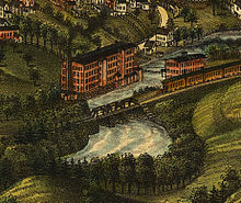 Mill & Train in 1888
In the town the population was spread out with 27.0% under the age of 18, 6.6% from 18 to 24, 31.7% from 25 to 44, 24.5% from 45 to 64, and 10.2% who were 65 years of age or older. The median age was 37 years. For every 100 females there were 98.8 males. For every 100 females age 18 and over, there were 99.5 males.
The median income for a household in the town was $44,194, and the median income for a family was $48,033. Males had a median income of $31,776 versus $26,134 for females. The per capita income for the town was $18,092. About 6.1% of families and 7.9% of the population were below the poverty line, including 15.6% of those under age 18 and 4.5% of those age 65 or over.
Sites of interest
References
- ^ a b United States Census Bureau, American FactFinder, 2010 Census figures. Retrieved March 23, 2011.
- ^ "American FactFinder". United States Census Bureau. http://factfinder.census.gov. Retrieved 2008-01-31.
External links
- Town website
- Milton Free Public Library
- Nute Library
- New Hampshire Economic and Labor Market Information Bureau Profile
Municipalities and communities of Strafford County, New Hampshire Cities 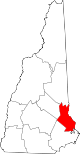
Towns Barrington | Durham | Farmington | Lee | Madbury | Middleton | Milton | New Durham | Rollinsford | Strafford
Villages Bow Lake Village | Center Strafford | East Rochester | Milton Mills
Categories:- Towns in Strafford County, New Hampshire
- 1802 establishments in the United States
- Populated places established in 1760


Wikimedia Foundation. 2010.