- Portal:New York Roads
-
- Wikipedia portals:
- Culture
- Geography
- Health
- History
- Mathematics
- Natural sciences
- People
- Philosophy
- Religion
- Society
- Technology
The New York Roads Portal
The highway system of the U.S. state of New York is a network of roads owned and maintained by several jurisdictions: the state of New York through the New York State Department of Transportation (NYSDOT) and its counties, towns, villages, and cities. The most prominent of these roads are part of one of four numbered route systems in New York, each assigned at a different level of government.


Interstate Highways and U.S. Routes are assigned at the national level. Interstate Highways are numbered in a grid—even-numbered routes are east–west routes (but the lowest numbers are along Mexico and the Gulf of Mexico), and odd-numbered routes are north–south routes (with the lowest numbers along the Pacific Ocean). U.S. Routes are also numbered in a grid—even numbered for east–west routes (with the lowest numbers along Canada) and odd numbered for north–south routes (with the lowest numbers along the Atlantic Ocean). For this reason, mainline (two-digit) Interstate Highways in New York all have numbers above 78 and mainline U.S. Routes (with the exception of US 44 and US 62) all have numbers below 20. Three-digit Interstate and U.S. Highways, also known as "child routes," are branches off their main one- or two-digit "parents". The majority of Interstate and U.S. Highways are maintained by NYSDOT.


New York State Routes are assigned by NYSDOT. Most routes are completely owned and maintained by the state; however, parts of some routes are maintained by local governments, such as a county or a city. Other routes, such as New York State Route 148 in Niagara County, are completely locally owned and maintained. The shield used for state routes is a simplified version of the Seal of New York. Roads that are maintained by the state but not assigned a state route designation carry a reference route designation, which is usually posted only on small, green reference markers alongside the highway.
Two-digit routes are typically long-distance highways while three-digit routes are typically connectors between two highways of greater importance. The first two-digit routes were assigned in 1924 while the first three-digit routes were assigned as part of the 1930 state highway renumbering. At that time, three-digit routes were generally assigned in "clusters", with the Rochester area playing home to Routes 250 through 261, the North Country having Routes 177 through 195, and so on. This system was used only in the renumbering and no longer exists on a large scale due to the removal and reassignment of designations in the years since.


County routes in New York are assigned individually by each county. The numbering and signing practices vary from county to county, as does the size of each county's system. Numerical designations typically do not carry over from one county to the next; exceptions include County Route 106 in Orange and Rockland Counties, both formerly part of New York State Route 210, and County Route 60 in Chemung and Tioga Counties, both formerly part of New York State Route 17.
A brief history of the New York Roads Portal is available here.
Selected article

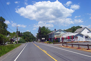
New York State Route 146 (NY 146) is a state highway in the Capital District of New York in the United States. It extends for 43 miles (69 km) from Gallupville at NY 443 to near Mechanicville at U.S. Route 4 (US 4) and NY 32. NY 146 is a major thoroughfare in the city of Schenectady, just outside of Albany. Most of the route follows an east–west alignment; however, the middle third of the route between Guilderland and Clifton Park runs in a more north–south manner in order to serve Schenectady. At one time, NY 146 had three spur routes; only one—NY 146A—still exists.
NY 146 was assigned as part of the 1930 renumbering of state highways in New York. At the time, NY 146 began at modern NY 443 in Berne and followed what is now NY 156 northeast to Altamont while modern NY 146 west of Altamont was part of NY 156. The alignments of the two routes were flipped in the late 1930s. Other minor realignments have occurred since, most notably near Mechanicville.
Selected picture
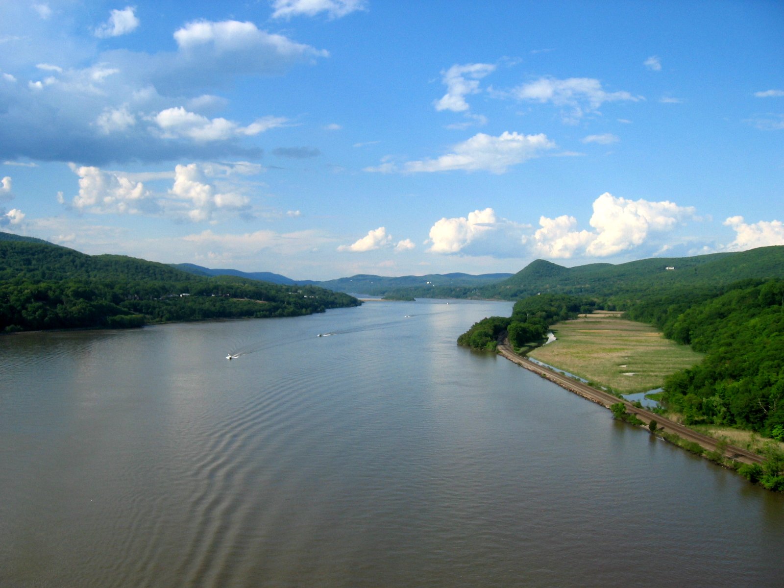
NY 32 is a north–south state highway that extends for 176.73 miles (284.42 km) through the Hudson Valley and Capital District regions of the U.S. state of New York. Here, the highway is concurrent with NY 213. Did you know?
- ... that the stub of NY 220 east of Oxford was originally part of an unsigned legislative route from 1916 to 1921?
- ... that NY 3 initially extended as far west as Niagara County?
- ... that NY 17M is the original surface routing of NY 17 from Middletown to Harriman?
In the news
- November 7: The new Lake Champlain Bridge between New York and Vermont, replacing the Champlain Bridge demolished in 2009, opens to traffic.[1]
- November 19: A 4-mile (6 km) extension of the Southern Expressway (U.S. Route 219) opens to traffic, moving the highway's southern terminus from NY 39 in Springville to Peters Road in Ashford.[2]
- August 24: The New York State Department of Transportation (NYSDOT) will assume maintenance of Interstate 84 in New York on October 11. This section of I-84 had been maintained by the New York State Thruway Authority for the last 20 years.[3]
- August 19: The gas stations at the Chittenango and Oneida travel plazas on the New York State Thruway will be closed until the first week of November for renovations.[4]
- August 17: Local officials are calling on those at the state and federal levels to allocate more funding to the construction of the last segment of the U.S. Route 15 freeway in Steuben County. The construction of bridges along the new road is not expected to start until 2012 due to a lack of funds, pushing the total completion date as far back as 2015.[5]
- August 4: Ground is officially broken on Interstate 781 (I-781), a proposed connector between I-81 and Fort Drum north of Watertown.[6]
Selected anniversaries – November
- 19th
- 2010: A 4-mile (6 km) extension of the Southern Expressway opens to traffic, connecting NY 39 near Springville, Erie County, to Peters Road in northern Cattaraugus County. The extension is the first new segment of the incomplete freeway to open in almost 30 years.
- 20th
- 2001: Ground is broken on NY 825, a new highway connecting the Utica–Rome Expressway to the former Griffiss Air Force Base.
Categories
Related WikiProjects

WikiProjects are organized groups of editors working towards improving articles on a particular topic.
General: WikiProject New York • WikiProject New York State Routes • Region-specific: Capital District • Hudson Valley • Long Island • New York City • SyracuseQuality content
 Featured content
List of highways in Essex County, New York • List of highways in Hamilton County, New York • List of highways in Warren County, New York • New York State Route 22 • New York State Route 28 • New York State Route 28N • New York State Route 32 • New York State Route 174 • New York State Route 175 • New York State Route 308 • New York State Route 311 • New York State Route 343 • New York State Route 373 • State Route 74 (New York – Vermont)
 Good articles
Things you can do
- Top priority:
- Improve all articles on active routes to B-Class or better.
- Improve all Start- and C-Class articles on active signed state highways to B-Class.
- Improve all New York Interstate Highway articles and parkway articles to B-Class.
- Get all past NYSR selected articles to at least B-Class status.
- 2006: NY 208, NY 52
- 2007: NY 55, US 9 in NY, NY 747
- Other tasks:
- Get all past and current NYSR selected articles to at least Good Article status.
- 2006: NY 208, NY 52
- 2007: NY 17K, NY 55, US 9 in NY, NY 747, NY 15
- 2011: NY 417
- Improve the project's former Good Articles/GANs back to GA status.
- Former GAs: US 9 in NY
- Failed GANs: NY 52, NY 100
- Work on all articles listed in Category:New York road articles needing attention.
- Expand these New York state highway stubs.
- Improve all articles on all numbered routes (including former routes) to B-Class or better.
Nominations and votes for selected articles and selected pictures are always needed. Anyone can nominate an article, and anyone can vote for an article. You can also recommend items for Did you know?. If you have news related to New York roads, you can add it to the "In the news" section above.
Related portals


U.S. Roads New York Hudson Valley New York City Finger Lakes "In the news" references
- ^ Waldman, Scott (November 6, 2011). "Lake Champlain Bridge set to open". The Albany Times-Union (Albany, New York). http://www.timesunion.com/local/article/Lake-Champlain-Bridge-set-to-open-2251370.php. Retrieved November 7, 2011.
- ^ "Extension of western NY's Rte. 219 opens". The Buffalo News. Associated Press. November 19, 2010. http://www.buffalonews.com/wire-feeds/state/article258406.ece. Retrieved November 21, 2010.
- ^ Rife, Judy (August 24, 2010). "DOT prepares to resume Interstate 84 care". Times Herald-Record (Middletown, Orange County, New York). http://www.recordonline.com/apps/pbcs.dll/article?AID=/20100824/BIZ/8240323/-1/SITEMAP. Retrieved August 30, 2010.
- ^ Powers, Matt (August 19, 2010). "2 Thruway gas stations closed until November". Oneida Daily Dispatch. http://www.oneidadispatch.com/articles/2010/08/19/news/doc4c6de9d35cb8e461662604.txt. Retrieved August 23, 2010.
- ^ Finger, Ray (August 17, 2010). "Politicians trying to speed up Route 15 construction project". Star-Gazette (Elmira, New York). http://www.stargazette.com/article/20100817/NEWS01/8170367/1113/Politicians-trying-to-speed-up-Route-15-construction-project. Retrieved August 23, 2010.
- ^ Rusho, Kris (August 4, 2010). "Ground Broken for Fort Drum Connector Road". WWNY-TV (Watertown, New York). http://www.wwnytv.com/news/local/Ground-Broken-for-Fort-Drum-Connector-Road-99983119.html. Retrieved August 4, 2010.
Categories:- Transport portals
- U.S. Roads portal


Wikimedia Foundation. 2010.