- New York State Route 448
-
NYS Route 448
Bedford Road 
Map of Rockland and Westchester Counties with NY 448 highlighted in redRoute information Maintained by NYSDOT Length: 3.90 mi[2] (6.28 km) Existed: 1971[1] – present Major junctions South end:  US 9 in Sleepy Hollow
North end:  NY 117 in Mount Pleasant
Location Counties: Westchester Highway system Numbered highways in New York
Interstate • U.S. • N.Y. (former) • Reference • County←  NY 446
NY 454  →
→New York State Route 448 (NY 448) is a 3.90-mile (6.28 km) long state highway in western Westchester County, New York in the United States. The route begins in the village of Sleepy Hollow at U.S. Route 9 (US 9) and goes in a northeast direction through the Pocantico Hills community in Mount Pleasant. It ends at NY 117 in Mount Pleasant, near the junction of NY 117 with Saw Mill River Road (NY 9A and NY 100) and the Taconic State Parkway. From 1930 to 1971, NY 448 was part of NY 117.
Contents
Route description
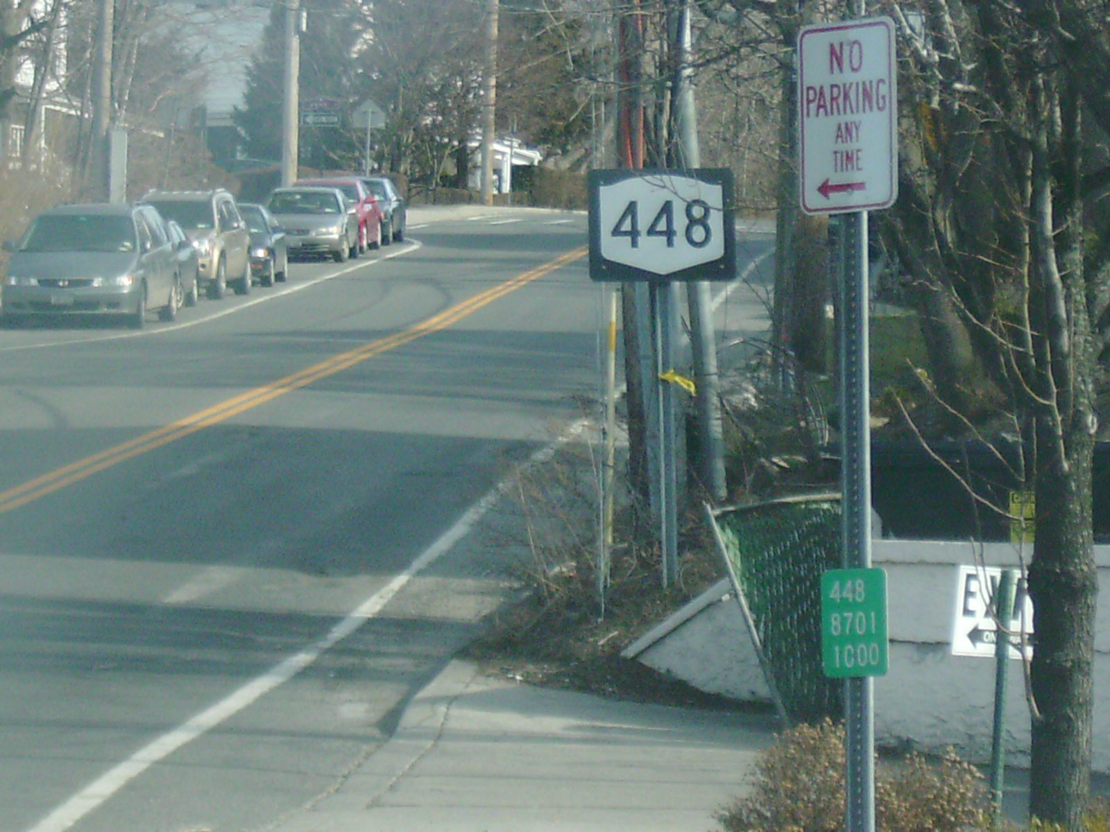
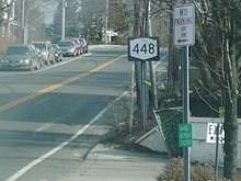 The first reassurance shield and reference marker heading northbound on NY 448 (Bedford Road)
NY 448 begins at an intersection with New Broadway and US 9 (North Broadway) in Sleepy Hollow, then heads through a residential area as Bedford Road. After the Webber Avenue intersection, Route 448 turns to the northeast, where it passes the athletic fields of Sleepy Hollow High School. Route 448 intersects with Sleepy Hollow Road, which leads into a residential development and parallels Route 448 northeastward for a short distance.[3]
Near the southern edge of Rockefeller State Park Preserve, Route 448 turns east and enters Kykuit, the estate of the Rockefeller family. At the hamlet of Pocantico Hills, the highway intersects with Lake Road and turns to the northeast, passing through more residential areas as it leaves the estate. Route 448 passes the Pocantico Hills Central School on its way, continuing northeast towards Phelps Way (NY 117). The road continues through a vacant area and heads northward into Mount Pleasant, where Route 448 terminates at an intersection with NY 117. Bedford Road continues east of this point as Route 117.[3]
History
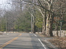 NY 448 near the intersection with Stillman Lane
The entirety of NY 448 was originally designated as part of NY 117 in the 1930 renumbering of state highways in New York.[4] This portion of NY 117 and Bedford Road was routed through the Rockefeller estate (Kykuit) and was designed to carry 1,900 cars per day. However, traffic on the roadway was much higher than expected, with the average annual daily traffic reaching upwards of 5,000 vehicles per day. As a result, the Rockefeller family looked into having the route realigned as early as 1932. The family suggested that a new highway be built at the northern end of the estate.[1]
Over some time, the Rockefellers had secured zoning permits to build developments on the northern edge of the estate. The movement to construct a new highway along this land began to gain steam when Nelson Rockefeller became Governor of New York. In 1965, Rockefeller unveiled plans for the Potantico Expressway, a connector from the to-be-constructed Hudson River Expressway (Interstate 487) to the Taconic State Parkway. People opposed the idea saying that it would quadruple the value of the estate land used by the highway. Nonetheless, construction began on the Potantico Expressway (now known as Phelps Way) in 1969. When the highway was completed in 1971, it became part of a rerouted NY 117. Route 117's former alignment along Bedford Road then became Route 448.[1]
Major intersections
The entire route is in Westchester County.
Location Mile[2] Destinations Notes Sleepy Hollow 0.00 US 9Tarrytown 3.90 NY 1171.000 mi = 1.609 km; 1.000 km = 0.621 mi References
- ^ a b c Anderson, Steve. "Phelps Way (NY 117)". NYCRoads. http://www.nycroads.com/roads/NY-117/. Retrieved March 12, 2008.
- ^ a b "2008 Traffic Data Report for New York State" (PDF). New York State Department of Transportation. June 16, 2009. p. 316. https://www.nysdot.gov/divisions/engineering/technical-services/hds-respository/NYSDOT_Traffic_Data_Report_2008.pdf. Retrieved December 9, 2009.
- ^ a b Google, Inc. Google Maps – overview map of NY 448 (Map). Cartography by Google, Inc. http://maps.google.com/maps?sourceid=navclient&ie=UTF-8&rlz=1T4ADBF_enUS232US232&q=from:+RT-448+%4041.085689,+-73.858528+to:+Beech+Hill+Rd+%4041.121853,+-73.815704&um=1&sa=N&tab=wl. Retrieved March 12, 2008.
- ^ Automobile Legal Association (ALA) Automobile Green Book, 1930/31 and 1931/32 editions, (Scarborough Motor Guide Co., Boston, 1930 and 1931). The 1930/31 edition shows New York state routes before to the 1930 renumbering
External links
Categories:- State highways in New York
- Transportation in Westchester County, New York


Wikimedia Foundation. 2010.