- New York State Route 446
-
NYS Route 446
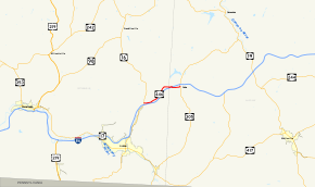
Map of Allegany and Cattaraugus Counties with NY 446 highlighted in redRoute information Maintained by NYSDOT Length: 6.76 mi[3] (10.88 km) Existed: ca. 1975[1][2] – present Major junctions West end:  NY 16 in Hinsdale
East end:  NY 305 in Cuba
Location Counties: Cattaraugus, Allegany Highway system Numbered highways in New York
Interstate • U.S. • N.Y. (former) • Reference • County←  NY 444
NY 448  →
→New York State Route 446 (NY 446) is a state highway in the Southern Tier of New York in the United States. It parallels the Southern Tier Expressway (NY 17 and Interstate 86, or I-86) very closely between Hinsdale and Cuba. The western terminus of the route is at an intersection with NY 16 north of the hamlet of Hinsdale. The eastern terminus is at a junction with NY 305 in Cuba. NY 446 was originally designated as part of NY 17 in 1924. It was renumbered twice, becoming part of NY 63 in 1930 and part of NY 408 in the early 1940s. It gained its current designation ca. 1975 after NY 408 was truncated to its current southern terminus in Nunda.
Contents
Route description
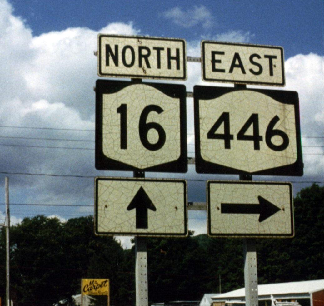
 NY 446 at NY 16 in Maplehurst
NY 446 begins at an intersection with NY 16 in the Hinsdale hamlet of Maplehurst, located a quarter-mile (0.40 km) north of exit 27 on the Southern Tier Expressway (I-86 and NY 17) and roughly 1 mile (1.6 km) north of the larger community of Hinsdale. The route heads northeast through the town of Hinsdale along the base of a valley surrounding Oil Creek. While NY 446 follows the north bank of the creek, the Southern Tier Expressway (and the Western New York and Pennsylvania Railroad [WNYP] just south of the expressway) run along the northern bank.[4]
Near the Cattaraugus-Allegany county line, Route 446, Oil Creek, and the WNYP all turn east toward Cuba; however, the expressway continues on a northeasterly alignment to bypass the village to the north. Upon entering Allegany County, NY 446 passes under the Southern Tier Expressway and becomes known as Water Street as it enters Cuba from the west upon traversing Oil Creek. The route continues eastward for three blocks to NY 305 (Genesee Street), where both Water Street and NY 446 terminate approximately a quarter-mile (0.40 km) south of exit 28 on the Southern Tier Expressway.[4]
History
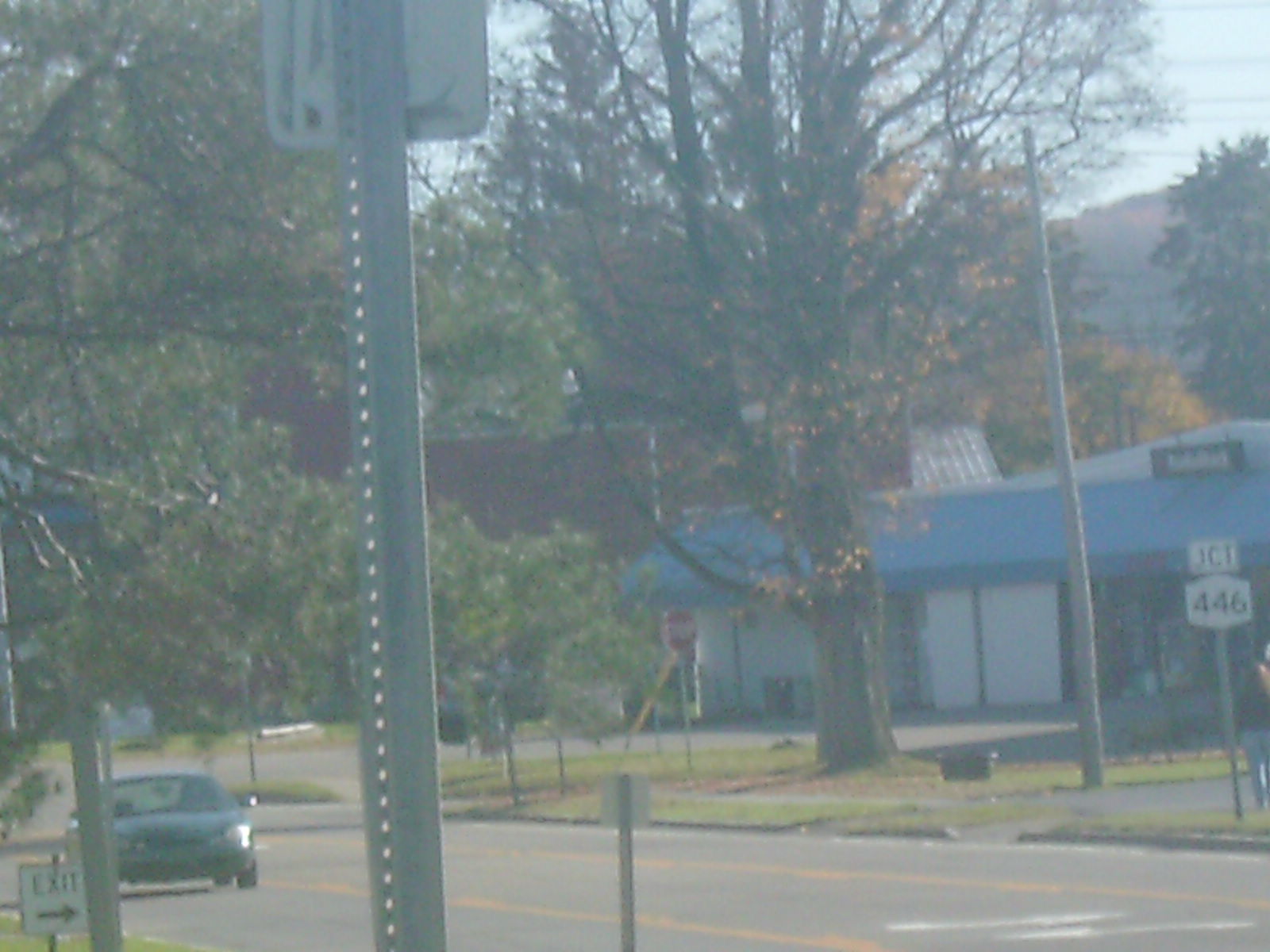
 Junction of NY 446 from NY 305, its eastern terminus
All of modern NY 446 was originally designated as part of NY 17 in 1924.[5][6] In the 1930 renumbering of state highways in New York, NY 17 was realigned onto what is now NY 417 between Olean and Wellsville while the former routing of NY 17 between Hinsdale and the Amity hamlet of Belvidere was incorporated into the new NY 63.[7] In the early 1940s, NY 63 was rerouted south of Mount Morris to follow its current alignment to Wayland. The former alignment of NY 63 from Hinsdale to Mount Morris was redesignated as NY 408.[8][9]
Construction began in the early 1970s on the portion of the Southern Tier Expressway between Olean and Corning. By 1974, the highway was open from Olean to Hinsdale and from Almond to Corning.[10][11] The segment between Hinsdale and NY 19 in Belvidere was completed by January 1975. On January 30, 1975, the section between Belvidere and Almond opened to traffic, completing the Olean–Corning portion of the expressway.[12] NY 408 was truncated to its current southern terminus in Nunda as a result. The portion of NY 408's former routing between Hinsdale and Cuba was renumbered to NY 446.[1][2]
Major intersections
County Location Mile[3] Destinations Notes Cattaraugus Hinsdale 0.00 NY 16Allegany Village of Cuba 6.76 NY 3051.000 mi = 1.609 km; 1.000 km = 0.621 mi References
- ^ a b Gulf (1974). New York and New Jersey Tourgide Map (Map). Cartography by Rand McNally and Company.
- ^ a b New York State Department of Transportation (1975). Hinsdale Digital Raster Quadrangle (Map). 1:24,000. http://www.nysgis.state.ny.us/gisdata/quads/drg24/dotpreview/index.cfm?code=w11. Retrieved December 31, 2009.
- ^ a b "2008 Traffic Data Report for New York State" (PDF). New York State Department of Transportation. June 16, 2009. p. 316. https://www.nysdot.gov/divisions/engineering/technical-services/hds-respository/NYSDOT_Traffic_Data_Report_2008.pdf. Retrieved December 9, 2009.
- ^ a b Yahoo! Inc. Yahoo! Maps – overview map of NY 446 (Map). Cartography by NAVTEQ. http://maps.yahoo.com/#mvt=m&lat=42.224341&lon=-78.300209&zoom=13&q1=42.17958%2C-78.381577&q2=42.219002%2C-78.27755. Retrieved November 7, 2008.
- ^ "New York's Main Highways Designated by Numbers". The New York Times: p. XX9. December 21, 1924.
- ^ Rand McNally and Company (1926). Rand McNally Auto Road Atlas (western New York) (Map). http://www.broermapsonline.org/members/NorthAmerica/UnitedStates/Midatlantic/NewYork/unitedstates1926ra_008.html. Retrieved December 31, 2009.
- ^ Dickinson, Leon A. (January 12, 1930). "New Signs for State Highways". The New York Times: p. 136.
- ^ Gulf Oil Company (1940). New York Info-Map (Map). Cartography by Rand McNally and Company.
- ^ Esso (1942). New York with Pictorial Guide (Map). Cartography by General Drafting.
- ^ New York State Thruway Authority (1971). New York Thruway (Map). Cartography by Rand McNally and Company.
- ^ Gulf (1974). New York and New Jersey Tourgide Map (Map). Cartography by Rand McNally and Company.
- ^ "Southern Tier Road Opening Set Thursday". Schenectady Gazette: p. 34. January 28, 1975. http://news.google.com/newspapers?id=IAohAAAAIBAJ&sjid=eXIFAAAAIBAJ&dq=southern%20tier%20expressway&pg=4636%2C2506685. Retrieved December 31, 2009.
External links
Categories:- State highways in New York
- Transportation in Allegany County, New York
- Transportation in Cattaraugus County, New York


Wikimedia Foundation. 2010.