- New York State Route 360
-
NYS Route 360
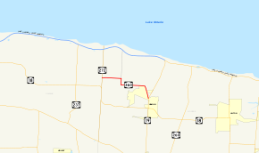
Map of Monroe and Orleans Counties with NY 360 highlighted in redRoute information Maintained by Monroe County Length: 4.87 mi[3] (7.84 km) Existed: ca. 1931[1][2] – present Major junctions West end:  NY 272 in Hamlin
East end:  NY 19 in Hamlin
Location Counties: Monroe Highway system Numbered highways in New York
Interstate • U.S. • N.Y. (former) • Reference • County←  NY 359
NY 361  →
→New York State Route 360 (NY 360) is an east–west state highway located in northwestern Monroe County, New York, in the United States. It extends for 4.87 miles (7.84 km) through the town of Hamlin from an intersection with NY 272 at the Monroe–Orleans county line to a junction with NY 19 north of the hamlet of Hamlin. NY 360 intersects the former southern terminus of NY 215 1.50 miles (2.41 km) east of the county line at its northern junction with Redman Road. Most of NY 360 passes through rural areas; however, the easternmost portion of the route is located in a residential neighborhood that comprises the northernmost portion of the hamlet of Hamlin.
The highways that NY 360 follows were originally improved to state highway standards in the 1900s and 1910s and first designated as part of NY 18 as part of the 1930 renumbering of state highways in New York. By the following year, the NY 360 designation was assigned to what is now NY 18 between NY 272 and NY 19. The alignments of NY 18 and NY 360 between those two routes were flipped ca. 1933. Ownership and maintenance of NY 360 was transferred from the state of New York to Monroe County on November 26, 2007, as part of a highway maintenance swap between the two levels of government. NY 360 now overlaps four different county routes at various points along its routing.
Contents
Route description
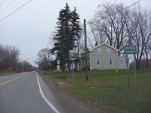 First reassurance marker on NY 360 eastbound, located just east of NY 272 and the county line
NY 360 begins at an intersection with NY 272 at the Monroe–Orleans county line in the town of Hamlin. The route heads east on Morton Road, passing through a lightly populated area and crossing a pair of tributaries that feed into Yanty Creek.[4] After 1.50 miles (2.41 km),[3] Morton Road ends at an intersection with Redman Road.[4] This junction was once the southern terminus of NY 215;[5] however, it is now merely a junction between two county-maintained routes.[6] NY 360 turns south here to follow Redman Road for 0.5 miles (0.8 km) before resuming its eastward progression on Church Road.[4]
Like on Morton Road before it, the portion of Church Road that is part of NY 360 is sparsely populated, save for a portion of the road near its junction with Lake Road West Fork. Roughly halfway between Redman Road and Lake Road West Fork, NY 360 passes over Sandy Creek. At Lake Road West Fork, NY 360 veers southeast. As NY 360 continues along the roadway, the amount of development increases as the route approaches of the hamlet of Hamlin. North of the hamlet's center, NY 360 meets NY 19 (Lake Road East Fork) at a Y-shaped intersection. NY 360 ends here, and NY 19 continues southward into Hamlin as Lake Road.[4]
History
Origins and designation
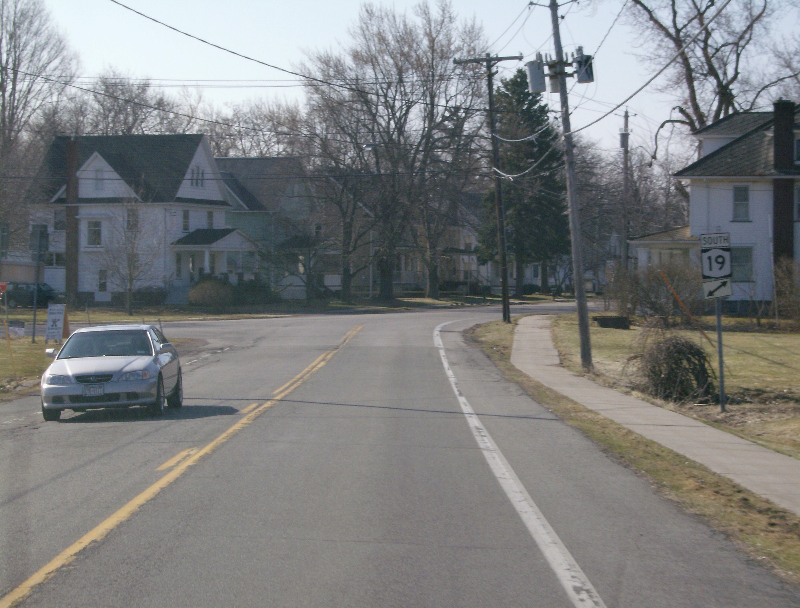
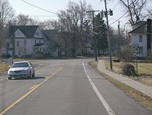 Eastern terminus of NY 360 at NY 19
On September 20, 1907, the state of New York let a contract for a project to improve Church Road, the section of Redman Road north of Church Road, and the portion of Lake Road West Fork between Church Road and Lake Road to state highway standards. The project was completed by mid-1909, and the highways, collectively inventoried as State Highway 286 (SH 286), were added to the state highway system on July 20, 1909. On June 8, 1915, the state awarded another contract to bring Morton Road up to state highway standards. Work on the road, internally designated as SH 1282, was completed that year, allowing for the highway to be added to the state highway system on December 8, 1915.[7][8] The first set of posted state routes in New York were assigned in 1924; however, no designations were assigned to either of the aforementioned highways at this time.[9]
In the 1930 renumbering of state highways in New York, several of the routes assigned during the 1920s were renumbered or modified. At the same time, hundreds of state-maintained highways that did not yet have a route number were assigned one. This included both SH 1282 and the section of SH 286 south of Morton Road as both became part of NY 18, a highway that was extended eastward from Buffalo to Rochester as part of the renumbering. At the time, NY 18 entered the hamlet of Morton on Kenmore Road and followed Morton, Redman, and Church Roads and Lake Road West Fork into Hamlin, where it overlapped with NY 63 (modern NY 19) south along Lake Road to rejoin its modern alignment at Hamlin Center Road.[10] By the following year, NY 360 was assigned to what is now NY 18 between NY 272 and Lake Road (then-NY 63) in Hamlin.[1][2] The alignments of NY 18 and NY 360 between Morton and Hamlin were flipped ca. 1933, placing both highways on their modern routings.[11][12]
Transfer of maintenance
In 2007, ownership and maintenance of NY 360 was transferred from the state of New York to Monroe County as part of a highway maintenance swap between the two levels of government. A bill (S4856, 2007) to enact the swap was introduced in the New York State Senate on April 23 and passed by both the Senate and the New York State Assembly on June 20. The act was signed into law by Governor Eliot Spitzer on August 28. Under the terms of the act, it took effect 90 days after it was signed into law; thus, the maintenance swap officially took place on November 26, 2007.[13]
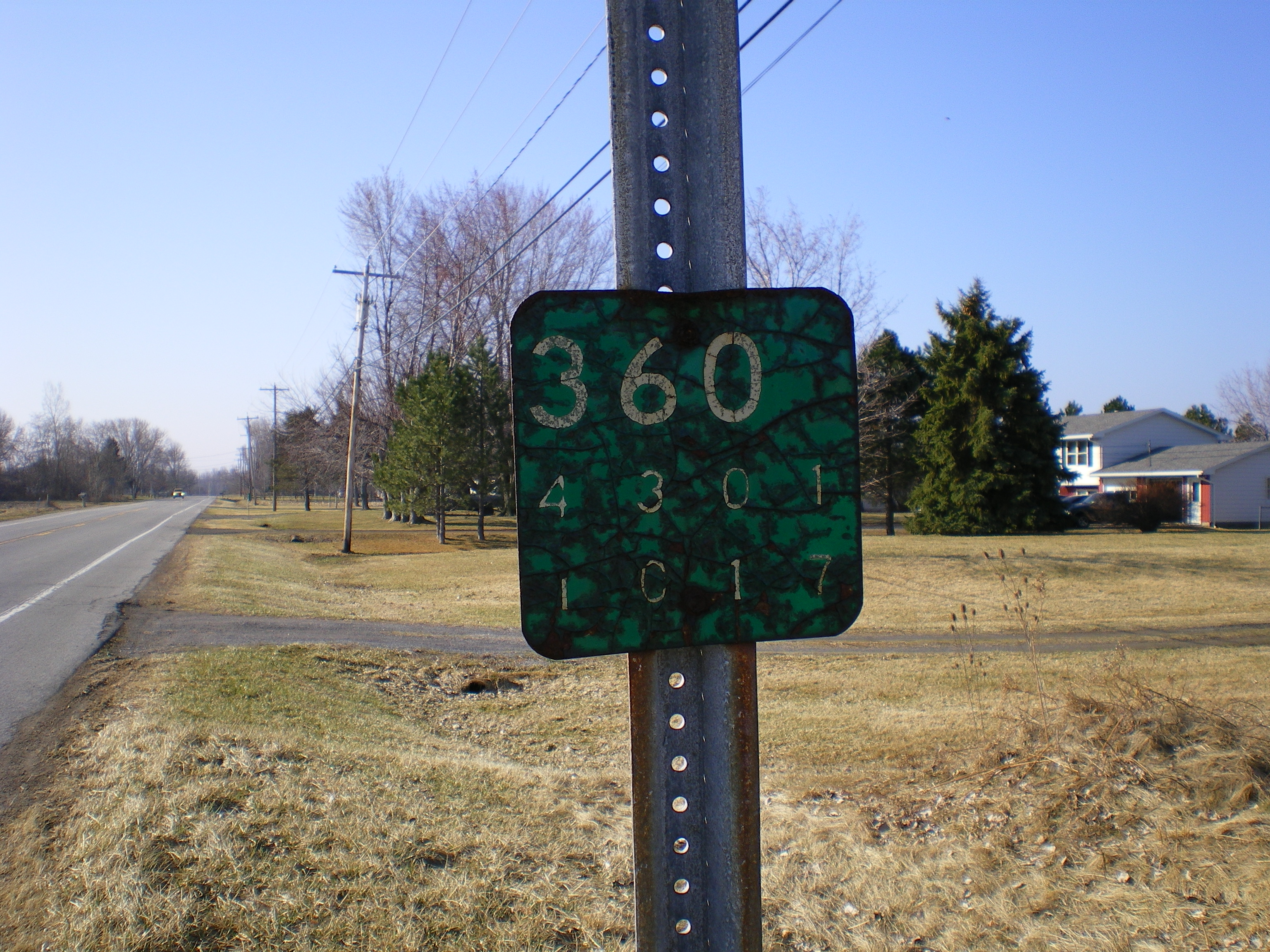
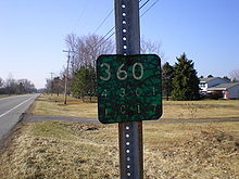 Old reference marker on the Redman Road portion of NY 360
As a result of the change in maintenance, NY 360 is now part of four unsigned county routes. On Morton Road, NY 360 is co-designated as County Route 279 (CR 279). The portion on Redman Road is part of CR 236, which extends from NY 31 west of Brockport to Cook Road near the Lake Ontario State Parkway. The section of NY 360 on Church Road overlaps with CR 277. Finally, the part of NY 360 on Lake Road West Fork is concurrent with CR 234, which extends north past NY 360 to Moscow Road (CR 211).[6]
Major intersections
The entire route is in Hamlin, Monroe County.
Mile[3] Destinations Notes 0.00 NY 2721.50 Redman Road (CR 236) Former southern terminus of NY 215 4.87 NY 19Hamlet of Hamlin 1.000 mi = 1.609 km; 1.000 km = 0.621 mi References
- ^ a b Standard Oil Company of New York (1930). Road Map of New York (Map). Cartography by General Drafting.
- ^ a b Kendall Refining Company (1931). New York (Map). Cartography by H.M. Gousha Company.
- ^ a b c "2006 Traffic Volume Report for New York State" (PDF). New York State Department of Transportation. July 16, 2007. p. 217. https://www.nysdot.gov/divisions/engineering/technical-services/hds-respository/NYSDOT%20TVR%202006%20by%20Route.pdf. Retrieved February 5, 2010.
- ^ a b c d Yahoo! Inc. Yahoo! Maps – overview map of NY 360 (Map). Cartography by NAVTEQ. http://maps.yahoo.com/#mvt=h&lat=43.317865&lon=-77.958235&zoom=15&q1=43.328099%2C-77.995189&q2=43.307241%2C-77.921246. Retrieved February 5, 2010.
- ^ Esso (1968). New York (Map). Cartography by General Drafting (1969–70 ed.).
- ^ a b Monroe County, New York. "Monroe County Map Builder". http://www.mappingmonroe.org/mmb/. Retrieved March 23, 2009. The designations were obtained by using the Identify tool.
- ^ New York State Department of Highways (1920). Report of the State Commissioner of Highways. Albany, New York: J. B. Lyon Company. pp. 220, 264. http://books.google.com/books?id=Sj4CAAAAYAAJ&pg=PA220. Retrieved February 5, 2010.
- ^ New York State Department of Transportation (1997). Hamlin Digital Raster Quadrangle (Map). 1:24,000. http://www.nysgis.state.ny.us/gisdata/quads/drg24/dotpreview/index.cfm?code=n15. Retrieved February 5, 2010.
- ^ "New York's Main Highways Designated by Numbers". The New York Times: p. XX9. December 21, 1924.
- ^ Dickinson, Leon A. (January 12, 1930). "New Signs for State Highways". The New York Times: p. 136.
- ^ Texas Oil Company (1932). Texaco Road Map – New York (Map). Cartography by Rand McNally and Company.
- ^ Texas Oil Company (1933). Texaco Road Map – New York (Map). Cartography by Rand McNally and Company.
- ^ New York State Legislature. "Bills of New York State – bill number-based search". http://public.leginfo.state.ny.us/menugetf.cgi. Retrieved February 5, 2010.
External links
Categories:- State highways in New York
- Transportation in Monroe County, New York


Wikimedia Foundation. 2010.