- New York State Route 273
-
NYS Route 273
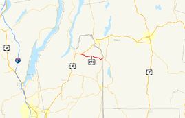
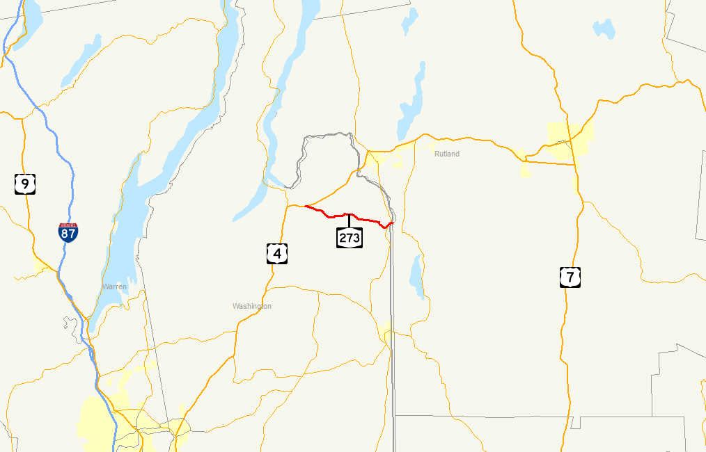
Map of eastern New York and western Vermont with NY 273 highlighted in redRoute information Maintained by NYSDOT Length: 7.16 mi[4] (11.52 km) Existed: ca. 1948[1][2] – March 24, 1980[3] Major junctions West end:  US 4 near Whitehall village
East end:  NY 22A in Hampton
Location Counties: Washington Highway system Numbered highways in New York
Interstate • U.S. • N.Y. (former) • Reference • County←  NY 272
NY 274  →
→New York State Route 273 (NY 273) was a state highway in northern Washington County, New York, United States. It began at an intersection with U.S. Route 4 (US 4) east of the village of Whitehall and ended at a junction with NY 22A in the town of Hampton, just west of the Vermont state line. The route passed through largely rural areas and entered only one community, the small hamlet of East Whitehall.
NY 273 followed part of the former routing of the Hampton and Whitehall Turnpike, a privately-maintained highway that linked the village of Whitehall to a bridge over the Poultney River near the hamlet of Hampton, where it continued to Poultney, Vermont, in the 19th century. The portion of the turnpike west of East Whitehall became part of US 4 in 1927; however, US 4 was realigned in the mid-1940s to follow a new, more direct highway between Whitehall and the Vermont state line at Fair Haven, Vermont.
NY 273 was assigned ca. 1948 to the portion of the old turnpike between US 4 east of Whitehall and NY 22A in Hampton. In 1980, NY 273 was removed from the state highway system as part of a highway maintenance swap between the state of New York and Washington County. The former routing of NY 273 became County Route 18 (CR 18).
Contents
Route description
NY 273 began at an intersection with US 4 east of the village of Whitehall in the town of Whitehall. After the intersection, the route passed the Our Lady of Angels Cemetery, where it turned to the southeast. NY 273 ran along the base of Ore Red Hill, outside of Whitehall. Near Ore Red Hill, the highway intersected with a local road, which connected to US 4. The route progressed to the southeast, entering the hamlet of East Whitehall, where it intersected with another local road.[5]
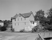 NY 273 in Hampton with the historic Campbell Hotel in view
NY 273 passed Bartholomew Hill and entered the town of Hampton, where it passed two mountains, Morris Hill, and the larger Thorn Hill. The highway then passed north of Crystal Lake, and entered the hamlet of Hampton. NY 273 ended here at an intersection with NY 22A just west of the Poultney River and the Vermont state line.[5]
History
Origins
On April 11, 1820, the New York State Legislature created the Hampton and Whitehall Turnpike Road Company, a privately-owned tasked with building the Hampton and Whitehall Turnpike. According to the act incorporating the company, the highway would begin at a bridge in the town of Hampton (at the Poultney River) and follow "the most convenient route" to the community of Whitehall Landing on Wood Creek[6] (the modern village of Whitehall[7]) in the town of Whitehall.[6]
The Hampton and Whitehall Turnpike Road Company was initially financed through 800 shares of stock valued at $20 each. Under the text of the act establishing the entity, only one toll gate was permitted on the turnpike. The toll charged at the gate varied by person; the exact amount was based on the vehicle used and the number of livestock and horses that were brought onto the roadway.[6]
By 1920, the turnpike company ceased to exist and the state of New York had plans in place to improve the portion of the turnpike west of the hamlet of East Whitehall. The improved road would be part of a state highway extending from the village of Whitehall to the Vermont state line at Fair Haven, Vermont.[8] The contract for the project was awarded on April 5, 1921,[9] and the highway was completed by 1926.[10]
Designations
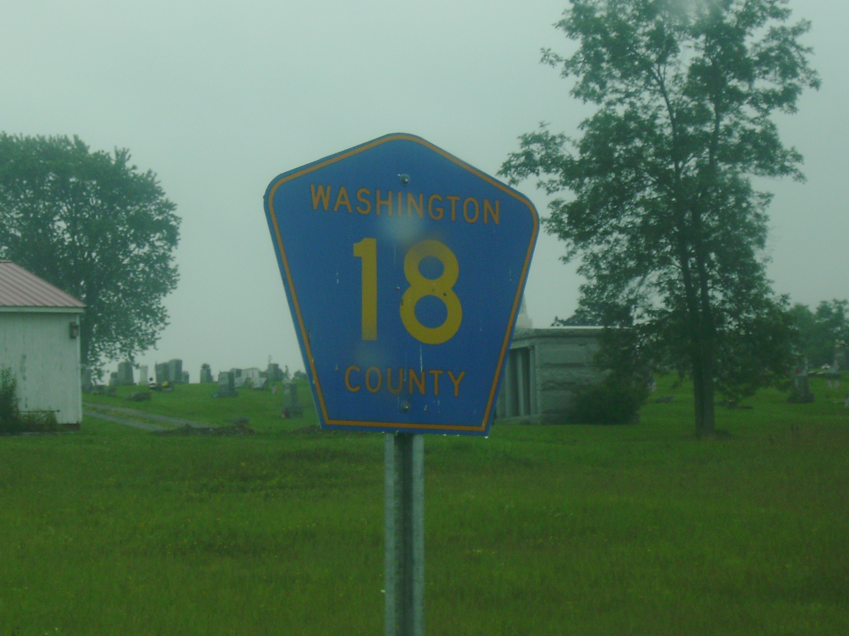
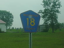 CR 18 reassurance shield in Whitehall
When the Whitehall – Fair Haven highway first opened, it did not have a designation. However, the road was part of the proposed routing of US 4, a route in the new U.S. Highway System.[10] It officially became part of US 4 when the system was officially approved in November of that year.[11] In the early 1940s, construction began on a new highway between Whitehall and Fair Haven that bypassed East Whitehall to the northwest.[12][13] It was completed by 1946, at which time it became a realignment of US 4.[14]
Ca. 1948, the portion of the old Hampton and Whitehall Turnpike between US 4 east of Whitehall and NY 22A in Hampton was designated as NY 273.[1][2] Although the short continuation of the turnpike past NY 22A to the Vermont state line was state-maintained,[15] it was not considered to be part of NY 273.[16][17]
In 1980, NY 273 was removed from the state highway system as part of a highway maintenance swap between the state of New York and Washington County. On April 1, 1980, ownership and maintenance of NY 273 and the short continuation to the Vermont state line was transferred from the state of New York to Washington County;[15] however, the NY 273 designation had officially ceased to exist one week earlier on March 24, 1980.[3] Following the swap, the former routing of NY 273 was redesignated as CR 18 while the short connector to Vermont became part of CR 18A, then a loop route off NY 22A.[18] CR 18A has since been reconfigured to follow a new highway leading directly from NY 22A to the Poultney River bridge.[4]
Major intersections
The entire route was in Washington County.
Location Mile[4] Destinations Notes Town of Whitehall 0.00 US 4Hampton 7.16 NY 22AHamlet of Hampton 1.000 mi = 1.609 km; 1.000 km = 0.621 mi References
- ^ a b Sinclair Oil Corporation (1947). New York Road Map and Pictorial Sight-Seeing Guide (Map). Cartography by Rand McNally and Company.
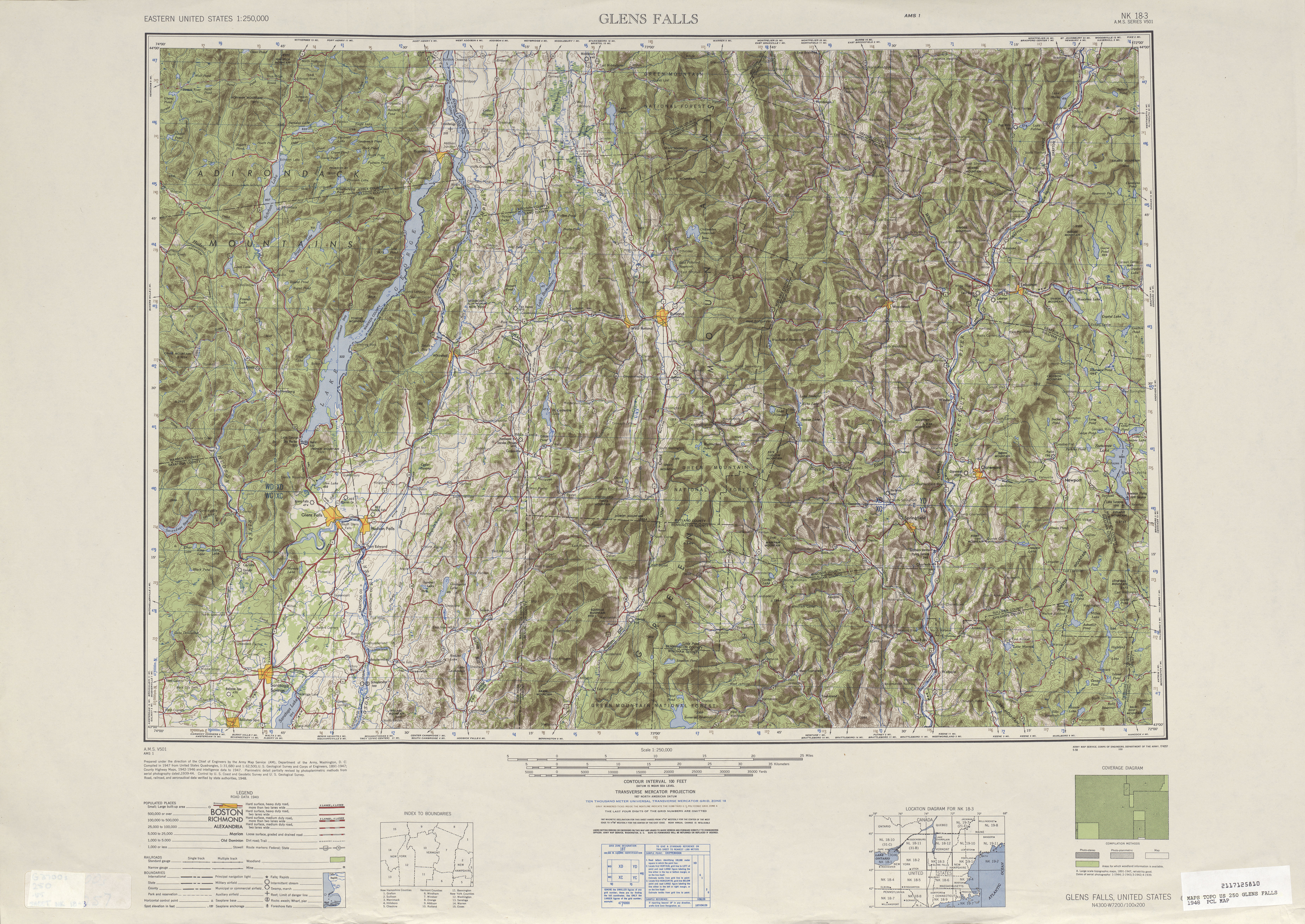
- ^ a b Army Map Service (1948). Glens Falls, United States Quadrangle (Map). 1:250,000. Eastern United States 1:250,000. http://www.lib.utexas.edu/maps/topo/250k/txu-pclmaps-topo-us-glens_falls-1948.jpg. Retrieved July 27, 2009.
- ^ a b New York State Department of Transportation (January 2009) (PDF). Official Description of Highway Touring Routes, Bicycling Touring Routes, Scenic Byways, & Commemorative/Memorial Designations in New York State. https://www.nysdot.gov/divisions/operating/oom/transportation-systems/repository/2009%20tour-bk.pdf. Retrieved July 27, 2009.
- ^ a b c Yahoo! Inc. Yahoo! Maps – overview map of former NY 273 (Map). Cartography by NAVTEQ. http://maps.yahoo.com/#mvt=m&lat=43.526468&lon=-73.244446&zoom=16&q1=43.548121%2C-73.376454&q2=43.524336%2C-73.252428. Retrieved July 12, 2008.
- ^ a b United States Geological Survey (1972). Thorn Hill Quadrangle – New York – Vermont (Map). 1:24,000. 7.5 Minute Series (Topographic). http://www.nysgis.state.ny.us/gisdata/quads/drg24/usgspreview/index.cfm?code=o43073e3. Retrieved July 27, 2009.
- ^ a b c Laws of the State of New York. New York State Legislature. 1821. pp. 162–163. http://books.google.com/books?id=SVc4AAAAIAAJ&dq=Whitehall%20and%20Hampton%20Turnpike&pg=RA1-PA162. Retrieved July 27, 2009.
- ^ Gazetteer of the State of New York. 1824. p. 578. http://books.google.com/books?id=zCkWAAAAYAAJ&lpg=PA578&ots=cv_XJ05HLM&dq=%22whitehall%20landing%22%20new%20york&pg=PA578. Retrieved July 27, 2009. "... to the head of L. Champlain, at Whitehall Landing, formerly Skenesborough." The original name of Whitehall village was Skenesborough.
- ^ New York State Department of Highways (1920). Report of the State Commissioner of Highways. Albany, New York: J. B. Lyon Company. p. 477. http://books.google.com/books?id=Sj4CAAAAYAAJ&pg=PA477. Retrieved July 27, 2009.
- ^ New York State Highway Commission (1921). Report of the State Commissioner of Highways. Albany, New York: J. B. Lyon Company. p. 110. http://books.google.com/books?id=X-0NAAAAYAAJ&dq=report%20commissioner%20highways%20new%20york&lr=&as_drrb_is=b&as_minm_is=0&as_miny_is=1920&as_maxm_is=0&as_maxy_is=1930&as_brr=1&pg=RA1-PA110. Retrieved July 27, 2009.
- ^ a b Rand McNally and Company (1926). Rand McNally Auto Road Atlas (eastern New York) (Map). http://www.broermapsonline.org/members/NorthAmerica/UnitedStates/Midatlantic/NewYork/unitedstates1926ra_009.html. Retrieved July 27, 2009.
- ^ United States Department of Agriculture (November 11, 1926). United States System of Highways (Map).
- ^ Esso (1940). New York (Map). Cartography by General Drafting.
- ^ Esso (1942). New York with Pictorial Guide (Map). Cartography by General Drafting.
- ^ Texaco (1946). New York with Pennsylvania (Map). Cartography by Rand McNally and Company.
- ^ a b New York State Legislature. "New York State Highway Law § 341". http://public.leginfo.state.ny.us/menugetf.cgi?COMMONQUERY=LAWS. Retrieved July 27, 2009.
- ^ Esso (1968). New York (Map). Cartography by General Drafting (1969–70 ed.).
- ^ United States Geological Survey (1972). Poultney Quadrangle – New York – Vermont (Map). 1:24,000. 7.5 Minute Series (Topographic).
- ^ New York State Department of Transportation (1992). Thorn Hill Digital Raster Quadrangle (Map). 1:24,000. http://www.nysgis.state.ny.us/gisdata/quads/drg24/dotpreview/index.cfm?code=l52. Retrieved July 27, 2009.
External links
Categories:- Former state highways in New York
- Transportation in Washington County, New York


Wikimedia Foundation. 2010.