- New York State Route 22A
-
NYS Route 22A
Route information Auxiliary route of NY 22 Maintained by NYSDOT Length: 10.61 mi[3] (17.08 km) Existed: early 1940s[1][2] – present Major junctions South end:  NY 22 in Granville
North end:  VT 22A at Hampton
Location Counties: Washington Highway system Numbered highways in New York
Interstate • U.S. • N.Y. (former) • Reference • County← NY 22NY 23  →
→New York State Route 22A (NY 22A) is a short north–south New York State Route located within Washington County. Its northern terminus is located in the town of Hampton at the Vermont state line, where it becomes Vermont Route 22A. Its southern terminus is located at a junction with NY 22 in the town of Granville.
Contents
Route description
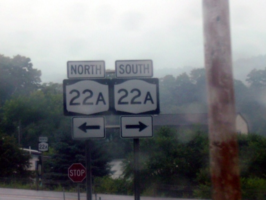
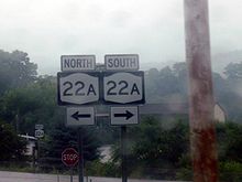 Signage for NY 22A at former NY 273 in Hampton
Route 22A begins at an intersection with NY 22 in the town of Granville. The route heads to the north, passing through downtown Granville, which is full of residential homes and the high school. After the intersection with Washington County Route 24, Route 22A begins a stretch of 9 miles (14 km) through the farmlands and forests of rural New York. At the intersection with County Route 21, Route 22A curves to the northeast and enters Raceville. Raceville is small, as Route 22A leaves uneventfully. The highway heads to the northest, edging closer to the Vermont state line.[4]
Route 22A makes a curve to the northwest after an intersection with a county road. The road then passes through a dense forest, entering the town of Hampton. There it intersects with two county roads before leaving the town. A few miles later, Route 22A passes the state line and continues into Vermont.[4]
History
What is now NY 22A was first designated as NY 286 as part of the 1930 renumbering of state highways in New York. It began at NY 22 in Middle Granville and went north to the Vermont state line, where it continued as Vermont Route 30A.[5] Ca. 1938, an alternate route of NY 286 along modern County Route 20 and Greenfield Lane in Hampton and Granville, College, and York Streets in Poultney, Vermont, was designated as NY 286A in New York and Vermont Route 286A in that state.[6][7] The New York half of the designation was short-lived as it was eliminated by the following year;[8] however, VT 286A remained in place until the early 1940s.[1][9] NY 286 was renumbered to NY 22A at some point between 1942 and 1944;[1][2] Vermont followed suit by renumbering VT 30A to VT 22A by 1946.[10]
Major intersections
The entire route is in Washington County.
Location Mile[3] Destinations Notes Town of Granville 0.00 NY 22Hampton 7.52  CR 18
CR 18Former eastern terminus of NY 273 10.61 VT 22AContinuation into Vermont 1.000 mi = 1.609 km; 1.000 km = 0.621 mi References
- ^ a b c Esso (1942). New York with Pictorial Guide (Map). Cartography by General Drafting.
- ^ a b United States Department of the Army Corps of Engineers (1944). New York – Vermont – Granville Quadrangle (Map). 1:24,000. 7.5 Minute Series. Cartography by United States Geological Survey. http://www.nysgis.state.ny.us/gisdata/quads/drg24/usgspreview/index.cfm?code=o43073d3. Retrieved May 3, 2009.
- ^ a b "2008 Traffic Data Report for New York State" (PDF). New York State Department of Transportation. June 16, 2009. p. 150. https://www.nysdot.gov/divisions/engineering/technical-services/hds-respository/NYSDOT_Traffic_Data_Report_2008.pdf. Retrieved January 12, 2010.
- ^ a b Google, Inc. Google Maps – overview map of NY 22A (Map). Cartography by Google, Inc. http://maps.google.com/maps?sourceid=navclient&ie=UTF-8&rlz=1T4ADBF_enUS232US232&q=from:+RT-22A+N+%4043.427797,+-73.285403+to:+RT-22A+%4043.567330,+-73.263210&um=1&sa=N&tab=wl. Retrieved March 24, 2008.
- ^ Standard Oil Company of New York (1930). Road Map of New York (Map). Cartography by General Drafting.
- ^ Standard Oil Company (1937). New York (Map). Cartography by General Drafting.
- ^ Esso (1938). New York Road Map for 1938 (Map). Cartography by General Drafting.
- ^ Standard Oil Company (1939). New York (Map). Cartography by General Drafting.
- ^ Esso (1940). New York (Map). Cartography by General Drafting.
- ^ Texaco (1946). New York with Pennsylvania (Map). Cartography by Rand McNally and Company.
External links
Categories:- State highways in New York
- Transportation in Washington County, New York

Wikimedia Foundation. 2010.