- New York State Route 825
-
NYS Route 825
Griffiss Veterans' Memorial Parkway Route information Maintained by the city of Rome Length: 2.59 mi[2] (4.17 km) Existed: 2002[1] – present Major junctions South end:  NY 49 in Rome
North end:  NY 46 in Rome
Location Counties: Oneida Highway system Numbered highways in New York
Interstate • U.S. • N.Y. (former) • Reference • County←  NY 812
NY 840  →
→New York State Route 825 (NY 825) is a state highway in Oneida County, New York, in the United States. It connects the former Griffiss Air Force Base to the Utica–Rome Expressway (NY 49) and downtown Rome. The southern terminus is at an interchange with NY 49 east of downtown Rome. Its northern terminus is at an intersection with NY 46 just north of downtown. NY 825 was assigned in 2002 and is ceremoniously named the Griffiss Veterans' Memorial Parkway.
Contents
Route description
NY 825 begins at a trumpet interchange with the Utica–Rome Expressway (NY 49) east of downtown Rome. The route heads northward, crossing over NY 365 about 150 yards (137 m) from NY 49. No direct connection exists between NY 365 and NY 825; however, Shady Grove Trail, a local street located just south of the Griffiss Business and Technology Park limits, provides access between the two roads. The highway continues north into the park, where it serves as the primary north–south roadway through the area. Roughly 1 mile (1.6 km) north of NY 49, NY 825 meets Geiger and Ellsworth Roads at a roundabout. At this point, NY 825 narrows from four to two lanes as it proceeds northward toward Griffiss International Airport.[3]
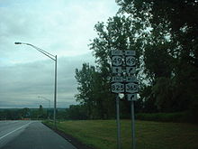 Southern terminus of NY 825
At Hangar Road, a local street providing direct access to the airport, NY 825 turns to the northwest, following Mohawk Drive toward the western extent of the former Griffiss Air Force Base grounds. The road reverts to a four-lane highway ahead of a junction with Bell Road, the last street that NY 825 meets within the business park. Past Bell Road, the route curves the northwest and exits the park as it crosses over the Mohawk River and enters a more densely developed area of Rome. NY 825, now named East Chestnut Street, continues onward for three blocks into a commercialized area north of downtown Rome, where it ends at a junction with Black River Boulevard (NY 46).[3] All of NY 825 is maintained by the city of Rome.[4]
History
Construction on the four-lane roadway that became NY 825 began on November 20, 2001, with a groundbreaking ceremony. The southernmost 1 mile (1.6 km) of the $8.5 million highway was completed by the following October, at which time the roadway was signed as NY 825.[1] By 2004, the route was extended northward along two-lane surface streets to intersect NY 46 north of downtown Rome.[5] Long-term plans for the route called for the two-lane segments of NY 825 to be widened to four lanes.[1] The section of NY 825 from Bell Road to NY 46 was widened by February 2009, leaving just the 1-mile (1.6 km) of the route from the roundabout with Geiger and Ellsworth Roads northwest to Bell Road to be expanded.[6]
On July 3, 2007, all of NY 825 was officially designated the Griffiss Veterans' Memorial Parkway after legislation proposing the name was signed into law by Governor Eliot Spitzer.[7] Signage displaying the ceremonial name was unveiled as part of a dedication ceremony held on November 14, 2007.[8]
In February 2009, the Griffiss Local Development Corporation (GLDC) looked into the possibility of hiring an engineering firm to complete the design work needed to begin work on widening the final two-lane section of NY 825 to four lanes. The company hoped that completing the project's design would make the project eligible for federal stimulus funding. The New York State Department of Transportation had completed 40% of the necessary design work; however, it lacked the funds needed to complete the plans and build the highway. As a result, GLDC saw hiring an outside firm to finish the project layout and receive federal stimulus funding as the most feasible way to make the project a reality. The remaining design work was estimated to cost between $400,000 and $500,000 while the actual construction cost was set at approximately $7 million.[6]
Major intersections
The entire route is in Rome, Oneida County.
Mile[2] Destinations Notes 0.00 NY 49Interchange  NY 365 via Shady Grove Trail
2.59 NY 461.000 mi = 1.609 km; 1.000 km = 0.621 mi References
- ^ a b c "History of development at Griffiss Business and Technology Park" (PDF). Archived from the original on March 3, 2006. http://web.archive.org/web/20060303044318/http://griffiss.mvedge.org/documents/Griffiss_History_2001-2004.pdf. Retrieved July 12, 2010.
- ^ a b "2008 Traffic Data Report for New York State" (PDF). New York State Department of Transportation. June 16, 2009. p. 326. https://www.nysdot.gov/divisions/engineering/technical-services/hds-respository/NYSDOT_Traffic_Data_Report_2008.pdf. Retrieved January 10, 2010.
- ^ a b Google, Inc. Google Maps – overview map of NY 825 (Map). Cartography by Google, Inc. http://maps.google.com/maps?f=d&source=s_d&saddr=43.203377,-75.408751&daddr=E+Chestnut+St%2FRT-825+%4043.230326,+-75.439456&hl=en&geocode=%3BFXakkwIdoOKA-w&mra=dme&mrcr=0&mrsp=0&sz=17&sll=43.20344,-75.405596&sspn=0.00549,0.013915&ie=UTF8&t=h&z=17. Retrieved July 12, 2010.
- ^ "Oneida County Inventory Listing" (CSV). New York State Department of Transportation. March 2, 2010. https://www.nysdot.gov/divisions/engineering/technical-services/hds-repository2/INV_2010-03-02_oneida.csv. Retrieved December 16, 2010.
- ^ New York State Department of Transportation (October 2004) (PDF). Official Description of Highway Touring Routes, Scenic Byways, & Bicycle Routes in New York State. https://www.nysdot.gov/divisions/operating/oom/transportation-systems/repository/tour_route_0.pdf. Retrieved July 13, 2010.
- ^ a b Guzewich, Dan (February 27, 2009). "Plans for Griffiss parkway accelerated with hope of fuel from stimulus funds". Rome Sentinel. http://romesentinel.com/news?newsid=20090227-141529. Retrieved July 12, 2010.
- ^ "New York State Assembly – Bill A01823". http://assembly.state.ny.us/leg/?bn=A01823&sh=t. Retrieved September 9, 2007.
- ^ Dellecese, Dave (November 14, 2007). "Route 825 in Rome renamed "Veterans' Memorial Parkway"". WKTV (Utica, New York). http://www.wktv.com/news/local/11308516.html. Retrieved July 12, 2010.
External links
Categories:- State highways in New York
- Transportation in Oneida County, New York


Wikimedia Foundation. 2010.