- New York State Route 426
-
NYS Route 426
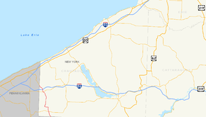
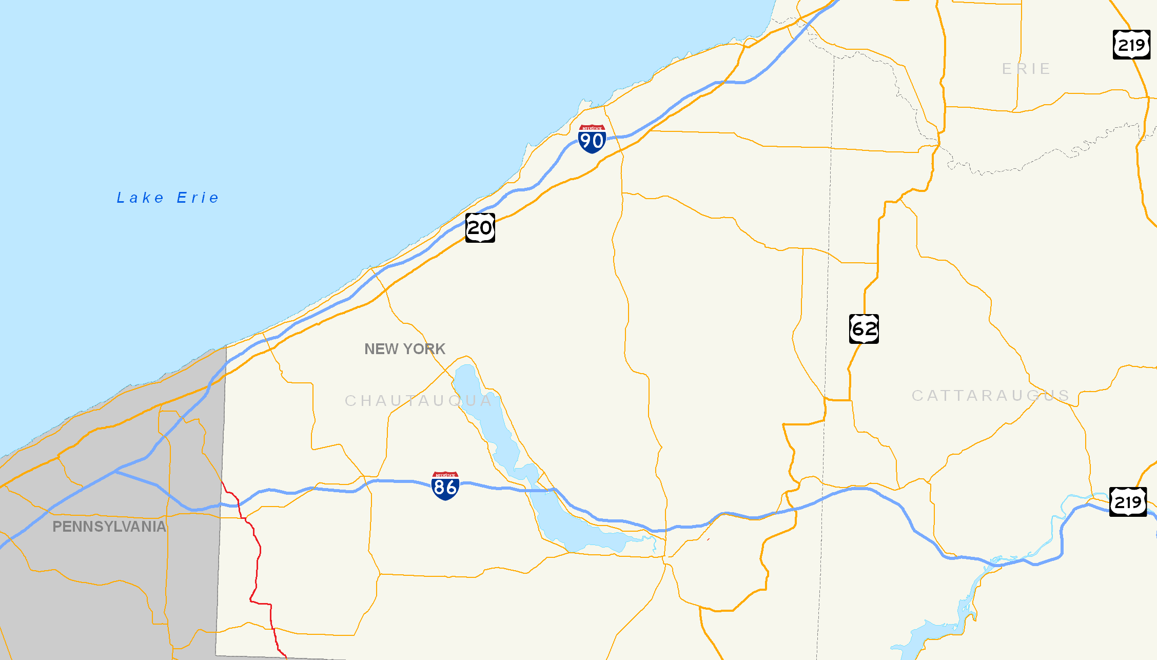
Map of southwestern New York with NY 426 highlighted in redRoute information Maintained by NYSDOT Length: 13.32 mi[2] (21.44 km) Existed: 1930[1] – present Major junctions South end:  PA 426 at French Creek
 I-86 / NY 17 in Mina
North end: PA 426 at MinaLocation Counties: Chautauqua Highway system Numbered highways in New York
Interstate • U.S. • N.Y. (former) • Reference • County←  NY 425
NY 427  →
→New York State Route 426 (NY 426) is a state highway located entirely within Chautauqua County, New York, United States. It runs just over 13 miles (21 km) from one section of the Pennsylvania state line to another, passing through two small hamlets and providing the Southern Tier Expressway (NY 17 and Interstate 86 or I-86) with its westernmost exit in New York. NY 426 is the westernmost north–south state highway in New York.
At both crossings of the state line it continues as Pennsylvania Route 426. It is the only other state highway besides NY 440 that can claim the distinction of being a middle segment of another state's similarly-numbered highway. The New York alignment has remained virtually unchanged since it was assigned as part of the 1930 renumbering of state highways in New York, while the designations of the roads it connects to in Pennsylvania have varied over the years. The two segments of PA 426 were established at different times in the 1940s.
Contents
Route description
NY 426 begins where the southern segment of Pennsylvania Route 426 leaves off at the Pennsylvania state line in French Creek 6 miles (10 km) north of Corry, Pennsylvania. The route heads north through rural southwestern Chautauqua County to the small community known as Cutting, where it overlaps NY 474 for a tenth of a mile (0.16 km) westward before resuming its trek northward.[3] Roughly 1.5 miles (2.4 km) north of Cutting, NY 426 veers to the west to avoid a large ridge situated near Beaver Meadow Brook, a small stream leading to French Creek. The route follows the brook to where it converges with the creek, then parallels French Creek northward toward the waterside hamlet of French Creek. The creek and NY 426 split south of the community, with the creek continuing along French Creek – Mina Road to the hamlet while NY 426 bypasses French Creek to the west. The route enters the town of Mina upon intersecting Harrington Hill Road a mile (1.6 km) to the north.[4]
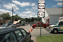
 NY 426 at NY 17 in Findley Lake
A half mile (0.8 km) into Mina, NY 426 comes within view of Findley Lake, a body of water 2 miles (3.2 km) long from south to north and as wide as one-half mile (0.8 km) at points. The route follows the eastern edge of the lake north to the hamlet of Findley Lake, situated at the northern tip of the lake. Here, NY 426 overlaps NY 430 westward for three blocks through the community prior to connecting to the Southern Tier Expressway (I-86 and NY 17) by way of an interchange 1 mile (1.6 km) north of Findley Lake. The exit is the westernmost exit on NY 17; however, the expressway itself continues west to I-90 near Erie, Pennsylvania, as I-86. Past the expressway, NY 426 continues northwest for another 2 miles (3.2 km) through nondescript terrain to the Pennsylvania state line, where it becomes the northern segment of PA 426.[3]
History
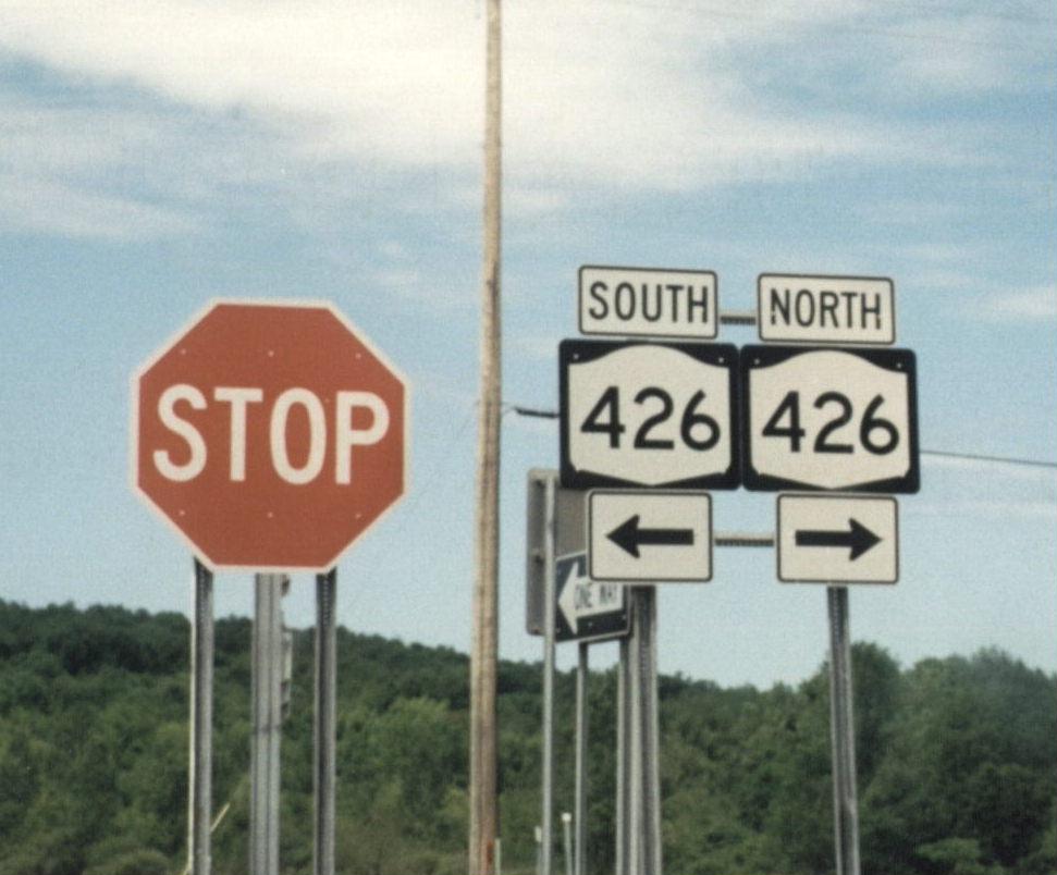
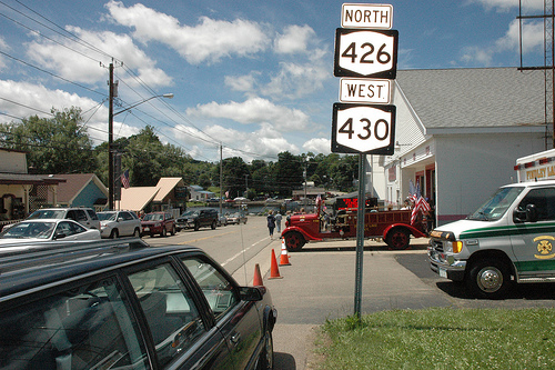
 NY 426 runs concurrently with NY 430 in the hamlet of Findley Lake in the town of Mina.
The entirety of NY 426 was assigned as part of the 1930 renumbering of state highways in New York as a northward extension of Pennsylvania Route 189, a short route leading south to Corry, Pennsylvania. Originally, NY 426 broke from its modern alignment at French Creek – Mina Road to serve the hamlet of French Creek via French Creek – Mina and King Roads before rejoining its current route west of the hamlet.[1] The route was realigned onto its present alignment west of French Creek ca. 1936.[5][6] In the early 1940s, the 426 designation was extended southward into Pennsylvania as Pennsylvania Route 426.[7][8] It was also extended northwestward into Pennsylvania in the mid-1940s, effectively making NY 426 the missing segment of an otherwise discontinuous PA 426.[8][9]
Major intersections
The entire route is in Chautauqua County.
Location Mile[2] Destinations Notes French Creek 0.00 PA 426Continuation into Pennsylvania 2.08  NY 474 east
Eastern terminus of NY 426 / NY 474 overlap 2.19 NY 474 westHamlet of Cutting; western terminus of NY 426 / NY 474 overlap Mina 10.36  NY 430 east
Hamlet of Findley Lake; eastern terminus of NY 426 / NY 430 overlap 10.62 NY 430 westWestern terminus of NY 426 / NY 430 overlap 11.46 I-86 / NY 17Exit 4 (I-86 / NY 17) 13.32 PA 426Continuation into Pennsylvania 1.000 mi = 1.609 km; 1.000 km = 0.621 mi References
- ^ a b Pennsylvania Department of Highways (1930) (PDF). Tourist Map of Pennsylvania (Map). ftp://ftp.dot.state.pa.us/public/pdf/BPR_pdf_files/Maps/Statewide/Historic_OTMs/1930fr.pdf. Retrieved March 25, 2008.
- ^ a b "2008 Traffic Data Report for New York State" (PDF). New York State Department of Transportation. June 16, 2009. p. 313. https://www.nysdot.gov/divisions/engineering/technical-services/hds-respository/NYSDOT_Traffic_Data_Report_2008.pdf. Retrieved December 6, 2009.
- ^ a b Google, Inc. Google Maps – New York State Route 426 (Map). Cartography by Google, Inc. http://maps.google.com/maps?ie=UTF8&ll=42.079878,-79.681091&spn=0.18194,0.458679&z=12. Retrieved March 25, 2008.
- ^ United States Geological Survey (1954). Clymer Quadrangle - New York - Chautauqua Co. (Map). 1 : 24,000. 7.5 Minute Series (Topographic). http://www.nysgis.state.ny.us/gisdata/quads/drg24/usgspreview/index.cfm?code=o42079a6. Retrieved March 25, 2008.
- ^ Sun Oil Company (1935). Road Map & Historical Guide - New York (Map). Cartography by Rand McNally and Company.
- ^ Standard Oil Company (1936). New York (Map). Cartography by General Drafting.
- ^ Gulf Oil Company (1940). New York Info-Map (Map). Cartography by Rand McNally and Company.
- ^ a b Esso (1942). New York with Pictorial Guide (Map). Cartography by General Drafting.
- ^ Texas Oil Company (1946). New York with Pennsylvania (Map). Cartography by Rand McNally and Company.
External links
Categories:- State highways in New York
- Transportation in Chautauqua County, New York

Wikimedia Foundation. 2010.