- State highways in Chautauqua County, New York
-
 Map locating where Chautauqua County is in New York
Chautauqua County, New York has eighteen currently state-maintained highways[1] which comprise a combined 386.7 miles (622.3 km) of the touring route total mileage in New York.[2] The eighteen state highways include eleven state touring routes and seven reference routes.[1] U.S. Route 20 and U.S. Route 62 also go through the county, as do Interstate 86 and Interstate 90.[1]
Contents
NY 5
 NY 5 intersects Reference Route 950D (Shortman Road) in Ripley, providing the first eastbound access to the New York State Thruway.Main article: New York State Route 5
NY 5 is a major east–west highway in upstate New York that passes through fourteen counties before ending in the state capital of Albany. It extends for a total of 370.87 miles (596.86 km), 41.23 miles (66.35 km) of which is in Chautauqua County.[1]NY 5 begins in Chautauqua County at the Pennsylvania state line (into Pennsylvania, the road becomes Pennsylvania Route 5). NY 5 follows the shore of Lake Erie through the county, passing through Ripley, Westfield, Portland, Dunkirk, Sheridan, Silver Creek and Irving before crossing into Erie County.
Lake Erie State Park in Portland is accessible from NY 5.
NY 17
 Main article: New York State Route 17
NY 17 is concurrent with I-86 through Chautauqua County, as it is throughout most of the Southern Tier. It extends for a total of 396.84 miles (638.65 km) through twelve counties. 37.86 miles (60.93 km) of its path is within Chautauqua County.[1] In Chautauqua County, NY 17 passes through Mina, Sherman, North Harmony, Bemus Point, Jamestown, Falconer and Kennedy.NY 39
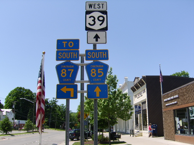
 NY 39 in Forestville.Main article: New York State Route 39
NY 39 begins at U.S. Route 20 in Sheridan. It is an east–west highway that extends for a total of 98.89 miles (159.15 km) through five Western New York counties. 11.13 miles (17.91 km) of its path goes through Chautauqua County.[1] In Chautauqua County, NY 39 passes through Sheridan, Hanover and Forestville.NY 60
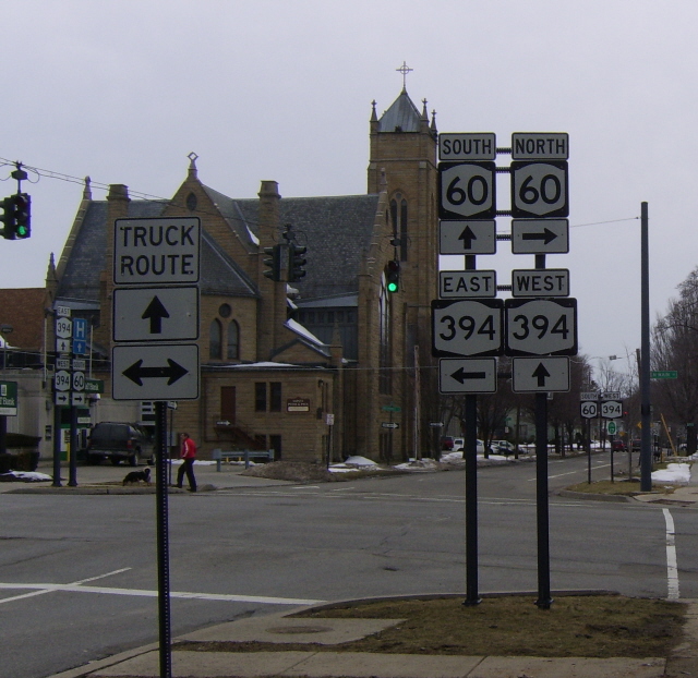
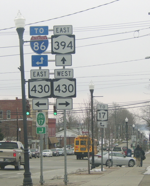
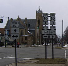 NY 60 intersecting with NY 394 in Jamestown.Main article: New York State Route 60
NY 60 begins at U.S. Route 62 in Kiantone. It is a north–south highway with a length of 33.16 miles (53.37 km), all of which is in Chautauqua County.[1] NY 60 passes through Kiantone, Jamestown, Gerry, Charlotte, Cassadaga, Fredonia and Dunkirk.NY 76
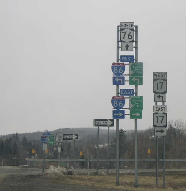
Main article: New York State Route 76
NY 76 begins at an intersection with New York State Route 474 in Clymer. It is a north–south highway with a length of 19.35 miles (31.14 km), all of which is in Chautauqua County.[1] NY 76 passes through Clymer, Sherman and Ripley.NY 83
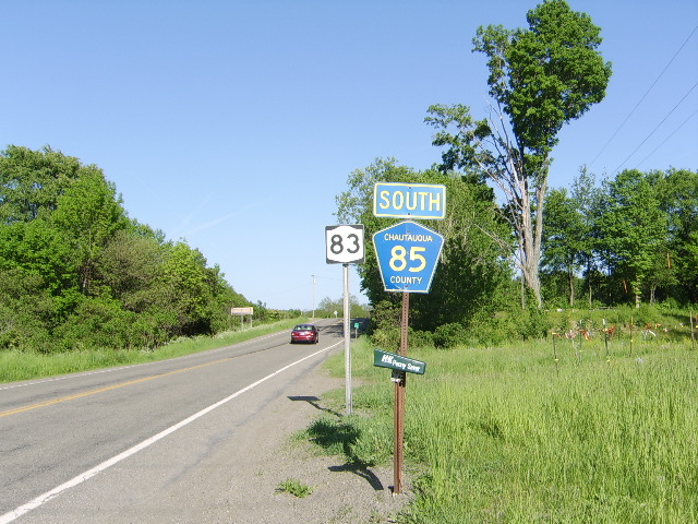
 Main article: New York State Route 83
NY 83 begins at U.S. Route 62 at the Cattaraugus County line. It is a north–south highway with a length of 21.82 miles (35.12 km), all of which is in Chautauqua County.[1] NY 83 passes through Cherry Creek, Villenova and Arkwright.NY 322
Main article: New York State Route 322
NY 322 begins at New York State Route 83 in Villenova. It is an east–west highway with a total length of 4.70 miles (7.56 km), 1.55 miles (2.49 km) of which is in Chautauqua County before it crosses into Cattaraugus County.[1]NY 394
 Main article: New York State Route 394
NY 394 begins at New York State Route 5 in Westfield. It is an east–west highway with a total length of 52.32 miles (84.20 km), 40.13 miles (64.58 km) of which is in Chautauqua County before it crosses into Cattaraugus County.[1] In Chautauqua County, NY 394 passes through Westfield, Mayville, Chautauqua, Lakewood, Jamestown, Falconer and Kennedy.
NY 426
Main article: New York State Route 426NY 426 begins at the Pennsylvania state line near Clymer, looping through the southwestern corner of the county and re-entering Pennsylvania near Findley Lake, becoming Pennsylvania Route 426 at both ends. It is a north–south highway with a length of 13.32 miles (21.44 km), all of which is in Chautauqua County.[1] NY 426 passes through French Creek and Findley Lake.
NY 430
Main article: New York State Route 430NY 430 begins at the Pennsylvania state line near Findley Lake. It is an east–west highway with a length of 38.49 miles (61.94 km), all of which is in Chautauqua County.[1] NY 430, also known as the Sen. Jess J. Present Memorial Highway, passes through Findley Lake, Sherman, Mayville, Bemus Point and Jamestown.
NY 474
Main article: New York State Route 474NY 474 begins at the Pennsylvania state line in French Creek. It is a north–south highway with a length of 24.58 miles (39.56 km), all of which is in Chautauqua County.[1] NY 474 passes through French Creek, Clymer, Panama, Ashville and Lakewood.
NY 950D
New York State Route 950D, also known as Shortman Road, is a reference route in Ripley. It is 1.22 miles (1.96 km) in length, running between New York State Route 5 and U.S. Route 20 and providing access from those routes to Interstate 90.[1]
NY 951C
New York State Route 951C, also known as Washington Street, is a reference route in Jamestown. It is 1.08 miles (1.74 km) in length, running between the NY 60/NY 394 concurrency near downtown and New York State Route 430 on the city's north side.[1]
NY 952H
New York State Route 952H, also known as Center Street, is a reference route in Silver Creek. It is just 0.04 miles (0.06 km) in length, providing a connection between New York State Route 5 and U.S. Route 20.[1]
NY 952P
New York State Route 952P, also known as Forest Avenue Extension, is a reference route in Busti. It is 7.61 miles (12.25 km) in length, connecting Jamestown with the Pennsylvania state line.[1]
NY 953B
New York State Route 953B, also known as Strunk Road, is a reference route in Ellicott. It is 0.44 miles (0.71 km) in length, providing access to I-86 from New York State Route 430.[1]
NY 954J
New York State Route 954J is a reference route that serves as an I-86 access road near Bemus Point. It is 1.62 miles (2.61 km) in length and provides a connection between New York State Route 430 and the interstate.[1]
NY 954K
New York State Route 954K, also known as McDaniel Avenue, is a reference route in Jamestown. It is 1.09 miles (1.75 km) in length, connecting New York State Route 394 with Fairmount Avenue.[1]
See also
References
- ^ a b c d e f g h i j k l m n o p q r s t u "List of state routes in Chautauqua County" (PDF). New York State Department of Transportation. 2003. https://www.nysdot.gov/divisions/engineering/technical-services/hds-respository/chautauquatvbk.pdf. Retrieved September 27, 2008.
- ^ "Overview of mileage in Chautauqua County, New York" (PDF). New York State Department of Transportation. 2006. https://www.nysdot.gov/divisions/engineering/technical-services/hds-respository/essex.pdf. Retrieved September 27, 2008.
Categories:- Lists of roads in the United States
- State highways in New York
- New York transport-related lists
- Transportation in Chautauqua County, New York


Wikimedia Foundation. 2010.