- Cherry Creek (village), New York
-
Cherry Creek — Village — Location within the state of New York
 Cherry Creek
Coordinates: 42°17′41″N 79°5′50″W / 42.29472°N 79.09722°WCoordinates: 42°17′41″N 79°5′50″W / 42.29472°N 79.09722°W Country United States State New York County Chautauqua Area - Total 1.4 sq mi (3.5 km2) - Land 1.4 sq mi (3.5 km2) - Water 0.0 sq mi (0.0 km2) Elevation 1,302 ft (397 m) Population (2000) - Total 551 - Density 404.8/sq mi (156.3/km2) Time zone Eastern (EST) (UTC-5) - Summer (DST) EDT (UTC-4) ZIP code 14723 Area code(s) 716 FIPS code 36-15187 GNIS feature ID 0946509 Cherry Creek is a village in Chautauqua County, New York, United States. The population was 551 at the 2000 census.
The Village of Cherry Creek is within the Town of Cherry Creek near the east border of the county. The village is located on Route 83 and a stream called Cherry Creek.
Contents
History
The village is the site of the earliest settlement of the town, around 1815.
The Village of Cherry Creek incorporated in 1893.
Geography
Cherry Creek is located at 42°17′40″N 79°5′50″W / 42.29444°N 79.09722°W (42.294654, -79.097353)[1].
According to the United States Census Bureau, the village has a total area of 1.4 square miles (3.5 km²).None of the area is covered with water.
Demographics
As of the census[2] of 2000, there were 551 people, 198 households, and 156 families residing in the village. The population density was 404.8 people per square mile (156.4/km²). There were 222 housing units at an average density of 163.1 per square mile (63.0/km²). The racial makeup of the village was 96.91% White, 0.18% Black or African American, 0.36% Native American, 0.36% Asian, 0.18% Pacific Islander, 0.91% from other races, and 1.09% from two or more races. Hispanic or Latino of any race were 1.27% of the population.
There were 198 households out of which 40.4% had children under the age of 18 living with them, 52.5% were married couples living together, 16.2% had a female householder with no husband present, and 21.2% were non-families. 15.7% of all households were made up of individuals and 7.6% had someone living alone who was 65 years of age or older. The average household size was 2.78 and the average family size was 3.03.
In the village the population was spread out with 31.2% under the age of 18, 6.5% from 18 to 24, 29.9% from 25 to 44, 22.1% from 45 to 64, and 10.2% who were 65 years of age or older. The median age was 36 years. For every 100 females there were 94.0 males. For every 100 females age 18 and over, there were 96.4 males.
The median income for a household in the village was $31,528, and the median income for a family was $32,500. Males had a median income of $31,406 versus $24,038 for females. The per capita income for the village was $15,358. About 15.9% of families and 18.3% of the population were below the poverty line, including 34.9% of those under age 18 and none of those age 65 or over.
References
- ^ "US Gazetteer files: 2010, 2000, and 1990". United States Census Bureau. 2011-02-12. http://www.census.gov/geo/www/gazetteer/gazette.html. Retrieved 2011-04-23.
- ^ "American FactFinder". United States Census Bureau. http://factfinder.census.gov. Retrieved 2008-01-31.
External links
Municipalities and communities of Chautauqua County, New York County seat: Mayville Cities 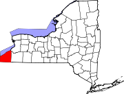
Towns Villages Bemus Point | Brocton | Cassadaga | Celoron | Cherry Creek | Falconer | Forestville | Fredonia | Lakewood | Mayville | Panama | Sherman | Silver Creek | Sinclairville | Westfield
CDPs Other
hamletsIndian
reservationCategories:- Villages in New York
- Populated places in Chautauqua County, New York


Wikimedia Foundation. 2010.