- Cherry Valley (town), New York
-
Cherry Valley, New York — Town — Cherry Valley, Otsego County, New York
Coordinates: 42°48′32″N 74°44′14″W / 42.80889°N 74.73722°WCoordinates: 42°48′32″N 74°44′14″W / 42.80889°N 74.73722°W Country United States State New York County Otsego Settled 1739 Established 1791 Government - Supervisor Tom Garretson Area - Total 40.1 sq mi (103.8 km2) - Land 40.1 sq mi (103.8 km2) - Water 0 sq mi (0 km2) Elevation 1,437 ft (438 m) Population (2000) - Total 1,266 - Density 31.6/sq mi (12.2/km2) Time zone Eastern (EST) (UTC-5) - Summer (DST) EDT (UTC-4) ZIP code 13320 Area code(s) 607 FIPS code 36-15253 GNIS feature ID 0978821 Website Official Cherry Valley website Cherry Valley is a town in Otsego County, New York, USA. The population was 1,266 at the 2000 census.
Within the Town of Cherry Valley is a village, also called Cherry Valley. The town is in the northeast corner of the county and is northeast of the City of Oneonta.
Contents
History
The modern history of Cherry Valley begins with John Lindsey receiving a land grant from George II of England; he moved there in 1739, and seven Anglo-Scottish families from New Hampshire moved into the area the following year. Due to high snow, the community almost failed but was saved by provisions from local natives.
During the Revolutionary War, Joseph Brant, a Mohawk Native American, led a mixed force of Indians and tories to the area, resulting in the Cherry Valley Massacre, during which 47 people were killed by tomahawk. The earlier massacre of 1778 was followed by a second raid in 1780, leading to the temporary abandonment of the village.
The town was established in 1791 from Canajoharie (in Montgomery County) as one of the original towns in the county. It was subsequently divided, giving rise to several new towns: Middlefield, Springfield, and Worcester (all in 1797) and Roseboom in 1854.
In 1812, the community of Cherry Valley set itself apart by incorporating as a village.
Geography
According to the United States Census Bureau, the town has a total area of 40.1 square miles (103.8 km²), all of it land.
The north town line is the border of Montgomery County and Herkimer County. The eastern town line is the border of Schoharie County, New York.
New York State Route 166 intersects US Route 20 in the town.
The Cherry Valley Creek flows southward through the center of the town.
Demographics
As of the census[1] of 2000, there were 1,266 people, 482 households, and 350 families residing in the town. The population density was 31.6 people per square mile (12.2/km²). There were 629 housing units at an average density of 15.7 per square mile (6.1/km²). The racial makeup of the town was 98.82% White, 0.08% Black or African American, 0.08% Native American, 0.39% Asian, 0.08% from other races, and 0.55% from two or more races. Hispanic or Latino of any race were 0.24% of the population.
There were 482 households out of which 31.7% had children under the age of 18 living with them, 58.3% were married couples living together, 10.6% had a female householder with no husband present, and 27.2% were non-families. 23.4% of all households were made up of individuals and 10.2% had someone living alone who was 65 years of age or older. The average household size was 2.63 and the average family size was 3.10.
In the town the population was spread out with 27.1% under the age of 18, 5.7% from 18 to 24, 27.2% from 25 to 44, 24.6% from 45 to 64, and 15.4% who were 65 years of age or older. The median age was 40 years. For every 100 females there were 94.2 males. For every 100 females age 18 and over, there were 90.3 males.
The median income for a household in the town was $39,107, and the median income for a family was $44,559. Males had a median income of $28,810 versus $22,417 for females. The per capita income for the town was $16,792. About 7.9% of families and 11.3% of the population were below the poverty line, including 15.8% of those under age 18 and 7.1% of those age 65 or over.
Communities and locations in the Town of Cherry Valley
- Center Valley – A hamlet in the southeast corner of the town, located on County Road 50.
- Cherry Valley – The Village of Cherry Valley is located on NY-166 and Cherry Valley Creek.
- Mount Independence – One of the highest elevations in the county.
- Salt Springville – A hamlet straddling the north town line.
- Shankley Mountain – An elevation in the northwest corner of the town.
References
- ^ "American FactFinder". United States Census Bureau. http://factfinder.census.gov. Retrieved 2008-01-31.
External links
- Cherry Valley information
- Cherry Valley Museum
- Cherry Valley History
- Official page by the Chamber of Commerce
- Official Cherry Valley website
- Early map and brief history of Cherry Valley
Municipalities and communities of Otsego County, New York County seat: Cooperstown City 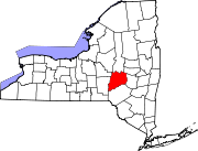
Towns Burlington | Butternuts | Cherry Valley | Decatur | Edmeston | Exeter | Hartwick | Laurens | Maryland | Middlefield | Milford | Morris | New Lisbon | Oneonta | Otego | Otsego | Pittsfield | Plainfield | Richfield | Roseboom | Springfield | Unadilla | Westford | Worcester
Villages Cherry Valley | Cooperstown | Gilbertsville | Laurens | Milford | Morris | Otego | Richfield Springs | Unadilla
CDP Other
hamletsBurlington Flats | Schenevus | Schuyler Lake | Silver Lake | South Edmeston | West Burlington | West Edmeston‡
Footnotes ‡This populated place also has portions in an adjacent county or counties
Categories:- Towns in New York
- American Revolutionary War sites
- Populated places in Otsego County, New York

Wikimedia Foundation. 2010.