- Exeter, New York
Infobox Settlement
official_name = Exeter, New York
settlement_type =Town
nickname =
motto =
imagesize =
image_caption =
image_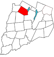
mapsize = 250x200px
map_caption = Otsego County map with the Town of Exeter in Red
mapsize1 =
map_caption1 =subdivision_type = Country
subdivision_name =United States
subdivision_type1 = State
subdivision_name1 =New York
subdivision_type2 = County
subdivision_name2 = Otsego
government_footnotes =
government_type =
leader_title =
leader_name =
leader_title1 =
leader_name1 =
established_title =
established_date =unit_pref = Imperial
area_footnotes =
area_magnitude =
area_total_km2 = 84.6
area_land_km2 = 83.1
area_water_km2 = 1.5
area_total_sq_mi = 32.7
area_land_sq_mi = 32.1
area_water_sq_mi = 0.6population_as_of = 2000
population_footnotes =
population_total = 954
population_density_km2 = 11.5
population_density_sq_mi = 29.7timezone = Eastern (EST)
utc_offset = -5
timezone_DST = EDT
utc_offset_DST = -4
elevation_footnotes =
elevation_m = 531
elevation_ft = 1742
latd = 42 |latm = 47 |lats = 4 |latNS = N
longd = 75 |longm = 5 |longs = 20 |longEW = Wpostal_code_type =
ZIP code
postal_code = 13315
area_code = 607
blank_name = FIPS code
blank_info = 36-24845
blank1_name = GNIS feature ID
blank1_info = 0978948
website =
footnotes =Exeter is a town in Otsego County,
New York ,United States . The population was 954 at the 2000 census. It is named after the county townExeter in England.The Town of Exeter is located in the norther part of the county.
History
The name Exeter derives from the town of
Exeter inDevon ,England .John Tunnicliff purchased convert|12000|acre|km2 of a patent that included the town from David Schuyler and others in 1756, but had to abandon attempts to settle the town until after the
French and Indian War .The first settlements were made around 1769 near Angel Hill. The town was formed from the Town of Richfield in 1799.
Geography
According to the
United States Census Bureau , the town has a total area of 32.7 square miles (84.6 km²), of which, 32.1 square miles (83.1 km²) of it is land and 0.6 square miles (1.5 km²) of it (1.75%) is water.The east town line borders, in part,
Canadarago Lake .Wharton Creek flows down the west side of the town. Angel Hill is an elevation near the south town line.New York State Route 28 is a north-south highway near the east town line, andNew York State Route 51 is a north-south highway near the west town line.Demographics
As of the
census GR|2 of 2000, there were 954 people, 373 households, and 280 families residing in the town. Thepopulation density was 29.7 people per square mile (11.5/km²). There were 542 housing units at an average density of 16.9/sq mi (6.5/km²). The racial makeup of the town was 96.44% White, 1.57% African American, 0.73% Native American, 0.42% Asian, 0.42% from other races, and 0.42% from two or more races. Hispanic or Latino of any race were 1.15% of the population.There were 373 households out of which 31.4% had children under the age of 18 living with them, 62.7% were married couples living together, 9.9% had a female householder with no husband present, and 24.9% were non-families. 20.4% of all households were made up of individuals and 11.0% had someone living alone who was 65 years of age or older. The average household size was 2.56 and the average family size was 2.94.
In the town the population was spread out with 22.9% under the age of 18, 8.3% from 18 to 24, 24.9% from 25 to 44, 29.4% from 45 to 64, and 14.6% who were 65 years of age or older. The median age was 41 years. For every 100 females there were 100.8 males. For every 100 females age 18 and over, there were 104.4 males.
The median income for a household in the town was $36,607, and the median income for a family was $41,184. Males had a median income of $27,083 versus $20,855 for females. The
per capita income for the town was $15,599. About 8.4% of families and 12.3% of the population were below thepoverty line , including 20.7% of those under age 18 and 9.9% of those age 65 or over.Communities and locations in Exeter
*Angel Hill -- An elevation near the south town line.
*Brainard Corners -- A hamlet west of Exeter village on County Road 22 at the junction of County Road 19.
*Exeter (or Exeter Center) -- hamlet located near the center of the town on County Road 22.
*Exeter Corner -- A location south of Exeter village.
*Lidell Corners -- A hamlet in the southeast corner of Exeter on NY-28 at County Road 19.
*Schuyler Lake -- A hamlet near the east town line on NY-28 at County Road 22. Its name is derived from the former name of Canadarago Lake.
*West Exeter -- A hamlet located near the west town line on NY-51.References
External links
* [http://www.rootsweb.com/~nyotsego/exe.htm Early map and brief history of Exeter]
Wikimedia Foundation. 2010.